|
Abergele
Abergele (; ; ) is a market town and community, situated on the north coast of Wales between the holiday resorts of Colwyn Bay and Rhyl, in Conwy County Borough and in the historic county of Denbighshire. Its northern suburb of Pensarn lies on the Irish Sea coast. Abergele and Pensarn railway station serves both resorts. Abergele is often overlooked due to the popularity of towns in nearby Rhyl, Prestatyn, Colwyn Bay, Llandudno and Conwy. Only 46.5% of the population was born in Wales as of the 2011 census. Etymology The meaning of the name can be deduced by being the Welsh word for estuary, river mouth or confluence and the name of the river which flows through the town. is a dialectal form of , which means spear, describing the action of the river cutting through the land. It has also been suggested this river is named because its waters flash brightly. Abergele is often mispronounced as ah-bear-geh-lee by non-native Welsh speakers. Geography The town itself l ... [...More Info...] [...Related Items...] OR: [Wikipedia] [Google] [Baidu] |
Abergele And Pensarn Railway Station
, symbol_location = gb , symbol = rail , image = Abergele and Pensarn Railway Station Booking Hall (geograph 4445552).jpg , borough = Abergele, Conwy , country = Wales , coordinates = , grid_name = Grid reference , grid_position = , manager = Transport for Wales , platforms = 2 , code = AGL , classification = DfT category F1 , original = Chester and Holyhead Railway , pregroup = London and North Western Railway , years = 1 May 1848 , events = Opened as Abergele , years1 = ? , events1 = Renamed , mpassengers = , footnotes = Passenger statistics from the Office of Rail and Road , embedded = Abergele & Pensarn railway station is a railway station on the North Wales Coast Line which serves both the town of Abergele and suburb of Pensarn in Conwy Cou ... [...More Info...] [...Related Items...] OR: [Wikipedia] [Google] [Baidu] |
Gwrych Castle
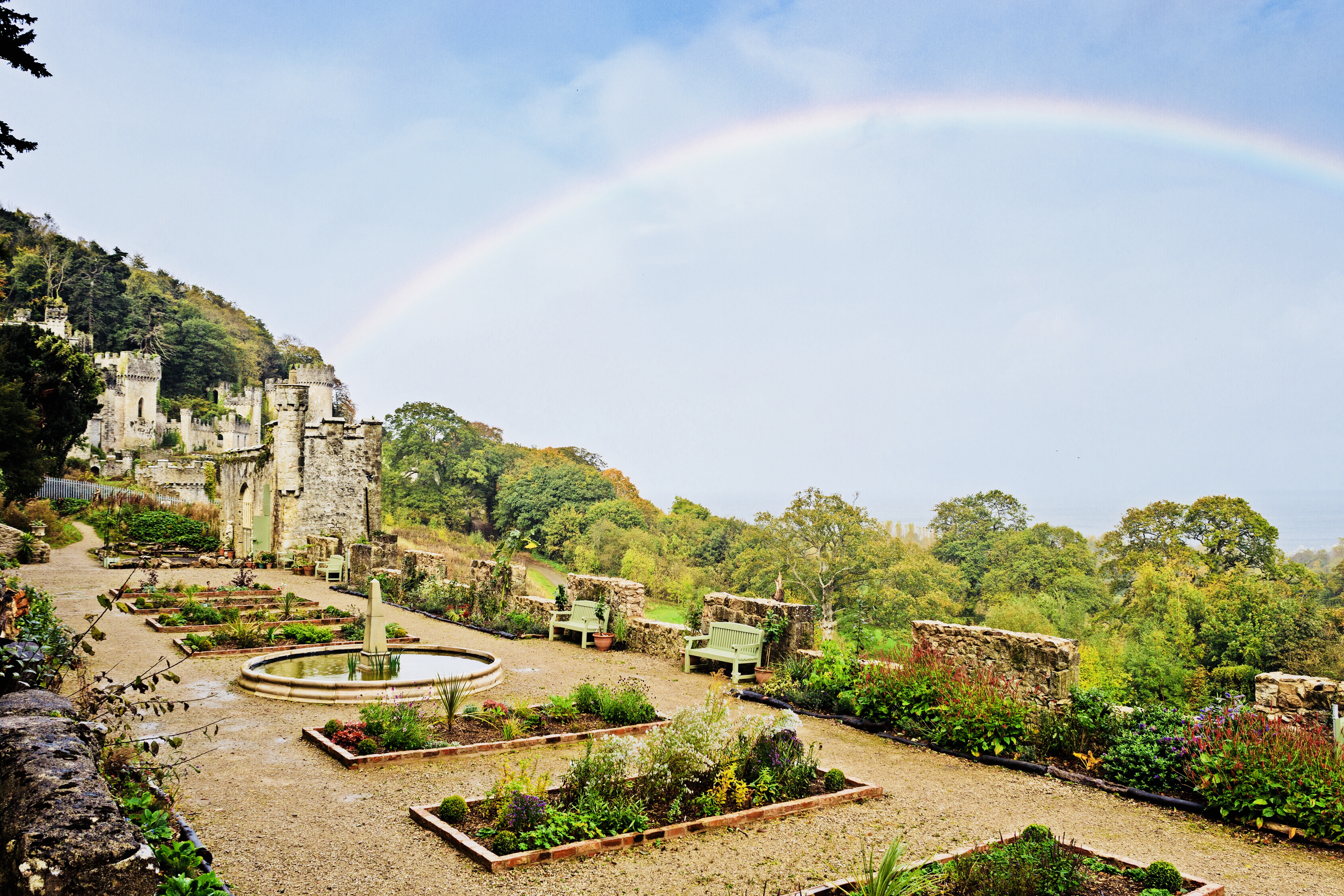
Gwrych Castle ( cy, Castell Gwrych meaning "hedged castle") (Originally spelt as 'Gwrŷch') is a Grade I listed 19th-century country house near Abergele in Conwy County Borough, Wales. The castle and 236 acre estate are owned by a charity, and a portion of the land is leased to Natural Resources Wales for a 999-year term. Foundation of the castle Gwrych Castle was built between 1810 and 1825 by Lloyd Hesketh Bamford-Hesketh (1787–1861), in memory of his mother Frances Lloyd and her ancestors. It incorporated an earlier house that had been in the ownership of the Lloyds since the late-medieval period. From 1894 until 1924, Winifred, Countess of Dundonald, the Hesketh heiress, owned the estate and it became the residence of the Earls of Dundonald (family name of Cochrane). The countess left the castle in her will to King George V and the then Prince of Wales (who later became Edward VIII). However, the gift was refused and the castle passed to the Venerable Order of Sa ... [...More Info...] [...Related Items...] OR: [Wikipedia] [Google] [Baidu] |
Pensarn
Pensarn is a suburb of Abergele in Conwy County Borough, Wales, the name Pensarn means 'end of the causeway' in English. The crossing of Morfa Rhuddlan was facilitated by a causeway near the sea, located at this point. This causeway was later developed by holiday developments along the coast between Rhyl and Abergele. Pensarn is served by Abergele and Pensarn railway station , symbol_location = gb , symbol = rail , image = Abergele and Pensarn Railway Station Booking Hall (geograph 4445552).jpg , borough = Abergele, Conwy , country = Wales , coordinates ..., the A55 and National Cycle Route 5 External links BBC Wales website Abergele Villages in Conwy County Borough {{Conwy-geo-stub ... [...More Info...] [...Related Items...] OR: [Wikipedia] [Google] [Baidu] |
Denbighshire (historic)
, HQ= Denbigh and Ruthin , Arms= , Map= , Code= DEN , CodeName= Chapman code , Government= Denbighshire County Council (1889-1974) , PopulationFirst= 83,629Vision of Britain 1831 Census/ref> , PopulationFirstYear= 1831 , AreaFirst= , AreaFirstYear= 1831 , DensityFirst= 0.2/acre , DensityFirstYear= 1831 , PopulationSecond= 144,783Vision of Britain Denbighshire population an density , PopulationSecondYear= 1911 , AreaSecond= ... [...More Info...] [...Related Items...] OR: [Wikipedia] [Google] [Baidu] |
A55 Road
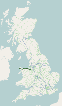
The A55, also known as the North Wales Expressway ( cy, Gwibffordd Gogledd Cymru) is a major road in Wales and England, connecting Cheshire and north Wales. The vast majority of its length from Chester to Holyhead is a dual carriageway primary route, with the exception of the Britannia Bridge over the Menai Strait and several short sections where there are gaps in between the two carriageways. All junctions are grade separated apart from a roundabout east of Penmaenmawr and another nearby in Llanfairfechan. Initially, the road ran from Chester to Bangor. In 2001, it was extended across Anglesey to the ferry port of Holyhead parallel to the A5. The road improvements have been part funded with European money, under the Trans-European Networks programme, as the route is designated part of Euroroute E22 (Holyhead – Leeds – Amsterdam – Hamburg – Malmö – Riga – Moscow – Perm – Ekaterinburg – Ishim). Route The Chester southerly bypass The A55 begins at ... [...More Info...] [...Related Items...] OR: [Wikipedia] [Google] [Baidu] |
River Gele
River Gele near Towyn. Looking east from the road bridge. The River Gele (''Welsh:'' Afon Gele) is a river in the North Wales and a tributary of the River Clwyd. The town of Abergele Abergele (; ; ) is a market town and community, situated on the north coast of Wales between the holiday resorts of Colwyn Bay and Rhyl, in Conwy County Borough and in the historic county of Denbighshire. Its northern suburb of Pensarn lies ... takes its name from the river. The spelling is a dialectal spelling of the Welsh word ' (spear or blade). The river gives its name to an electoral ward, called Gele, which includes the southern half of Abergele town. The river used to empty into the sea direct through the town of Abergele, but the Rhuddlan Marsh embankment act of 1794, diverted the river from the south of the town in an eastwards direction across the south of Rhuddlan Marsh and into the River Clwyd at Towyn. A short distance of the rivermouth is tidal. In 2010 and 2011 there were ... [...More Info...] [...Related Items...] OR: [Wikipedia] [Google] [Baidu] |
Clwyd
Clwyd () is a preserved county of Wales, situated in the north-east corner of the country; it is named after the River Clwyd, which runs through the area. To the north lies the Irish Sea, with the English ceremonial counties of Cheshire to the east and Shropshire to the south-east. Powys and Gwynedd lie to the south and west respectively. Clwyd also shares a maritime boundary with Merseyside along the River Dee. Between 1974 and 1996, a slightly different area had a county council, with local government functions shared with six district councils. In 1996, Clwyd was abolished, and the new principal areas of Conwy County Borough, Denbighshire, Flintshire and Wrexham County Borough were created; under this reorganisation, "Clwyd" became a preserved county, with the name being retained for certain ceremonial functions. This area of north-eastern Wales has been settled since prehistoric times; the Romans built a fort beside a ford on the River Conwy, and the Normans and Wel ... [...More Info...] [...Related Items...] OR: [Wikipedia] [Google] [Baidu] |
Rhyl
Rhyl (; cy, Y Rhyl, ) is a seaside town and community in Denbighshire, Wales. The town lies within the historic boundaries of Flintshire, on the north-east coast of Wales at the mouth of the River Clwyd ( Welsh: ''Afon Clwyd''). To the west is Kinmel Bay and Towyn, to the east Prestatyn, and to the southeast Rhuddlan and St Asaph. At the 2011 Census, Rhyl had a population of 25,149, with Rhyl–Kinmel Bay having 31,229. Rhyl forms a conurbation with Prestatyn and its two outlying villages, the Rhyl/Prestatyn Built-up area, whose 2011 population of 46,267 makes it north Wales's most populous non-city (the city of Wrexham's being greater). Rhyl was once an elegant Victorian resort town but suffered rapid decline around the 1990s and 2000s but has since been improved by major regeneration around and in the town. Etymology Early documents refer to a dwelling in the area named ''Ty'n Rhyl'' ("Rhyl croft"), and a manor house with that name still exists in the oldest part o ... [...More Info...] [...Related Items...] OR: [Wikipedia] [Google] [Baidu] |
Moelfre Isaf
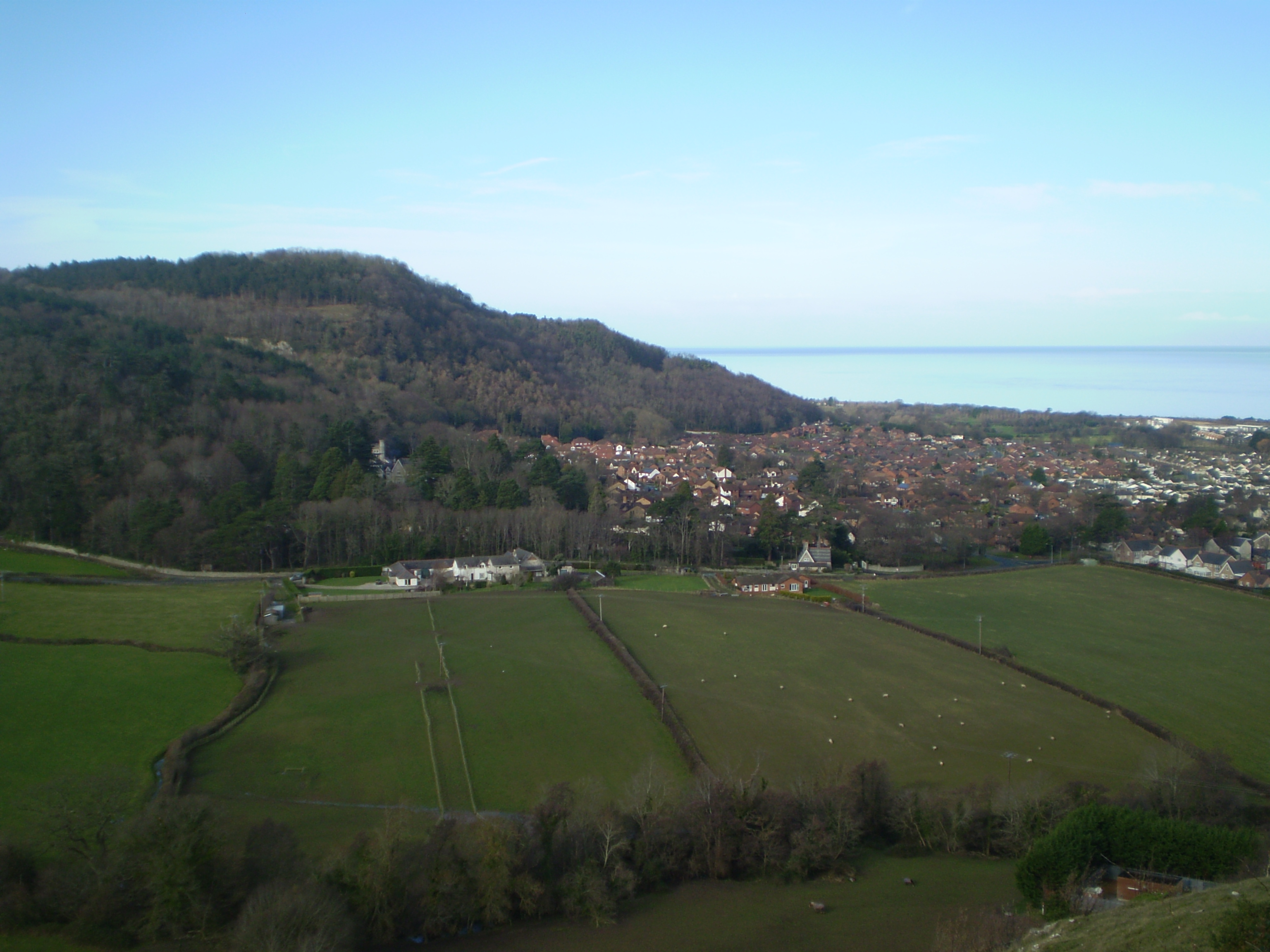
Moelfre Isaf is a 317 m (1,040 ft) hill located to the south of the town of Abergele. There are views towards the Clwydian Range, Snowdonia, and the Isle of Man and the Cumbrian Mountains can be seen on a clear day. Nearby is the small settlement of Moelfre, Conwy. Almost opposite is the higher hill of Moelfre Uchaf Moelfre Uchaf is a hill in the borough of Conwy, North Wales, 5 miles (8 km) south-east of Colwyn Bay and 1.5 mi (2 km) south-west of Betws-yn-Rhos. It is 396 m (1,299 ft) above sea level. A trigpoint A trian .... External links www.geograph.co.uk : photos of Moelfre Isaf and surrounding area Mountains and hills of Conwy County Borough {{Conwy-geo-stub ... [...More Info...] [...Related Items...] OR: [Wikipedia] [Google] [Baidu] |
Castell Cawr
Castell Cawr, or Tan-y-Gopa as it is known locally, is a heavily forested hill above the town of Abergele in Conwy county borough, Wales. On it is found the Iron Age hillfort of Castell Cawr, which overlooks the River Clwyd. Rare lesser horseshoe bats inhabit caves on the hill. The woods are owned by the Woodland Trust. The hill rises to 189 m (620 ft) above sea level, with extensive views to Snowdonia and the Clwydian Range. Thomas Pennant visited the area in the 18th century, and noted the existence of the hillfort. In 1860, James Halliwell-Phillipps wrote that the outline of the hillfort was obscured by vegetation, and identified the workings of a Roman lead mine on the hillside. The Welsh knew these excavations by the name "Ffos-y-bleiddiaid" ("Ditch of the Wolves") See also *List of hillforts in Wales This is a list of hillforts in Wales. Anglesey * Din Sylwy (Bwrdd Arthur) (), contour fort * Caer Idris Hillfort (), promontory fort * Caer y Twr (), par ... [...More Info...] [...Related Items...] OR: [Wikipedia] [Google] [Baidu] |
Tan-y-Gopa
Castell Cawr, or Tan-y-Gopa as it is known locally, is a heavily forested hill above the town of Abergele in Conwy county borough, Wales. On it is found the Iron Age hillfort of Castell Cawr, which overlooks the River Clwyd. Rare lesser horseshoe bats inhabit caves on the hill. The woods are owned by the Woodland Trust. The hill rises to 189 m (620 ft) above sea level, with extensive views to Snowdonia and the Clwydian Range. Thomas Pennant visited the area in the 18th century, and noted the existence of the hillfort. In 1860, James Halliwell-Phillipps wrote that the outline of the hillfort was obscured by vegetation, and identified the workings of a Roman lead mine on the hillside. The Welsh knew these excavations by the name "Ffos-y-bleiddiaid" ("Ditch of the Wolves") See also *List of hillforts in Wales This is a list of hillforts in Wales. Anglesey * Din Sylwy (Bwrdd Arthur) (), contour fort * Caer Idris Hillfort (), promontory fort * Caer y Twr (), par ... [...More Info...] [...Related Items...] OR: [Wikipedia] [Google] [Baidu] |
Conwy (county Borough)
Conwy County Borough ( cy, Bwrdeistref Sirol Conwy) is a county borough in Wales. It borders Gwynedd to the west and south, and Denbighshire to the east. Other settlements in the county borough include Abergele, Betws-y-Coed, Colwyn Bay, Conwy, Llandudno, Llandudno Junction, Llanfairfechan, Llanrwst, and Penmaenmawr. Geography The River Conwy, after which the county borough is named, lies wholly within the area: rising in Snowdonia and flowing through Llanrwst and Trefriw en route to the Irish Sea by Conwy. The river here marks the border between the historic counties of Caernarfonshire and Denbighshire. One third of the land area of the county borough lies in the Snowdonia National Park, and the council appoint three of the 18 members of the Snowdonia National Park Authority. Its total area is , making it slightly larger than Hong Kong. The eastern part includes the larger section of Denbigh Moors. The vast majority of the population live on the coast; the only settlement ... [...More Info...] [...Related Items...] OR: [Wikipedia] [Google] [Baidu] |


