Tritle Peak on:
[Wikipedia]
[Google]
[Amazon]
Tritle Peak is an prominence adjacent Roosevelt Point, on the East Rim of the Walhalla Plateau (East
 In the region adjacent to the East Rim of the Walhalla Plateau (
Tritle Peak closeup
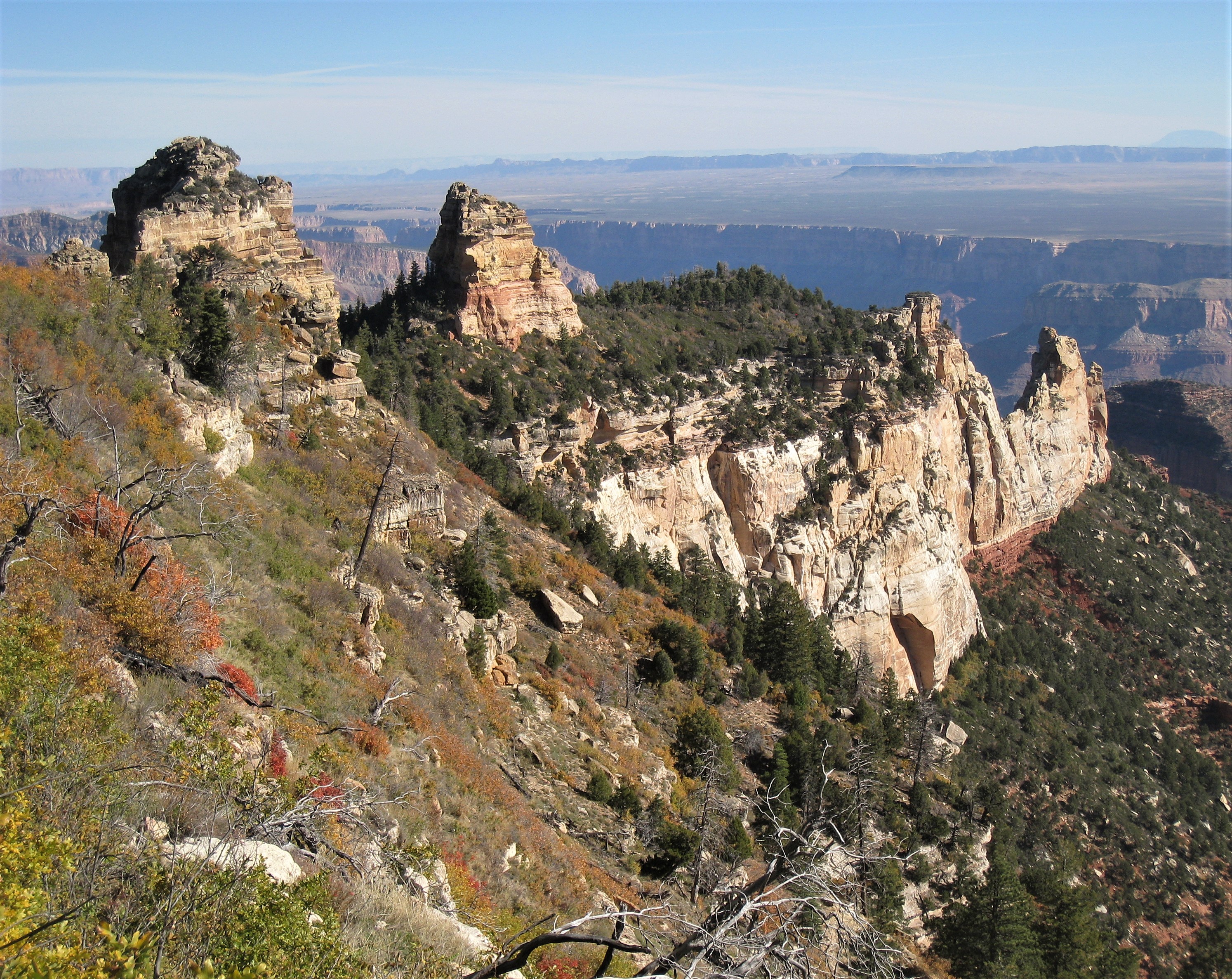
View of Roosevelt (and 2 Kaibab Limestone Rim prominences), and view of Tritle Peak below Rim. (Click on photo)
Grand Canyon Landforms of Coconino County, Arizona
Kaibab Plateau
The Kaibab Plateau is a plateau almost entirely in Coconino County, Arizona (but extending slightly north into Kane County, Utah) in the Southwestern United States. The high plain is also known as the Buckskin Mountain, Buckskin Plateau, and Ka ...
). It is located in far eastern Grand Canyon
The Grand Canyon is a steep-sided canyon carved by the Colorado River in Arizona, United States. The Grand Canyon is long, up to wide and attains a depth of over a mile ().
The canyon and adjacent rim are contained within Grand Canyon Nati ...
, of Northern Arizona. The peak is only about northeast of Roosevelt Point on an eroded ridgeline, and it is a very short caprock Caprock or cap rock is a hard, resistant, and impermeable layer of rock that overlies and protects a reservoir of softer organic material, similar to the crust on a pie where the crust (caprock) prevents leakage of the soft filling (softer materia ...
remainder of Coconino Sandstone
The Coconino Sandstone is a geologic formation (geology), formation composed of light-colored quartz arenite of Aeolian processes, eolian origin. It erodes to form conspicuous, sheer cliffs in the upper walls of Grand Canyon, as part of the Mog ...
cliffs upon Hermit Shale slopes. The entire ridge is a bright dark-burnt-red from the Hermit Shale, and sits on a ridgeline-platform of Supai Group
The Supai Group is a slope-forming sequence of mixed red beds and limestones that outcrop in the Colorado Plateau. The group was laid down during the Pennsylvanian to Lower Permian. Cliff-forming interbeds of sandstone are noticeable througho ...
unit 4, the Esplanade Sandstone
The Lower Permian Esplanade Sandstone is a cliff-forming, resistant sandstone, dark red, geologic unit found in the Grand Canyon. The rock unit forms a resistant shelf in the west Grand Canyon, south side of the Colorado River, at the east of th ...
.
Tritle Peak is at the headwaters of two major drainages east to the south-flowing Colorado River
The Colorado River () is one of the principal rivers (along with the Rio Grande) in the Southwestern United States and in northern Mexico. The river, the List of longest rivers of the United States (by main stem), 5th longest in the United St ...
, next to the East Rim, Grand Canyon – Upper Nankoweap Creek drainage (north), and Upper Kwagunt Creek drainage (south).
Geology (ridgeline of
Esplanade Sandstone
The Lower Permian Esplanade Sandstone is a cliff-forming, resistant sandstone, dark red, geologic unit found in the Grand Canyon. The rock unit forms a resistant shelf in the west Grand Canyon, south side of the Colorado River, at the east of th ...
)
 In the region adjacent to the East Rim of the Walhalla Plateau (
Kaibab Plateau
The Kaibab Plateau is a plateau almost entirely in Coconino County, Arizona (but extending slightly north into Kane County, Utah) in the Southwestern United States. The high plain is also known as the Buckskin Mountain, Buckskin Plateau, and Ka ...
), at rock units of the upper Supai Group, the platforms of the Esplanade Sandstone
The Lower Permian Esplanade Sandstone is a cliff-forming, resistant sandstone, dark red, geologic unit found in the Grand Canyon. The rock unit forms a resistant shelf in the west Grand Canyon, south side of the Colorado River, at the east of th ...
support various landforms. They are namely - Mount Hayden
Mount Hayden is a mountain located in the Catskill Mountains of New York northeast of Windham. Mount Nebo is located north-northwest, and Ginseng Mountain is located southeast of Mount Hayden.
References
Hayden
Hayden Hayden may refer to: ...
, Brady Peak
Brady Peak is an -elevation summit located in the Grand Canyon, in Coconino County, Arizona, Coconino County of northern Arizona, Southwestern United States, United States. It is situated northeast of the Vista Encantada viewpoint on the canyon ...
, and Tritle Peak. The peaks are composed of eroded Coconino Sandstone
The Coconino Sandstone is a geologic formation (geology), formation composed of light-colored quartz arenite of Aeolian processes, eolian origin. It erodes to form conspicuous, sheer cliffs in the upper walls of Grand Canyon, as part of the Mog ...
, upon Hermit Shale, ( slope-formed) slopes, debris-filled or vegetated. Ridgelines with no remaining Coconino Sandstone peaks, will be dk-reddish, or red from the Supai Group
The Supai Group is a slope-forming sequence of mixed red beds and limestones that outcrop in the Colorado Plateau. The group was laid down during the Pennsylvanian to Lower Permian. Cliff-forming interbeds of sandstone are noticeable througho ...
(with 2 cliff-layers & 2 slope-layers). Numerous ridgelines along the Walhalla Plateau East Rim have shed this Coconino Sandstone.

References
External links
{{commons category, Tritle PeakTritle Peak closeup
View of Roosevelt (and 2 Kaibab Limestone Rim prominences), and view of Tritle Peak below Rim. (Click on photo)
Grand Canyon Landforms of Coconino County, Arizona