Straight Point on:
[Wikipedia]
[Google]
[Amazon]
 Straight Point is a coastal region, forming a
 Straight Point is a coastal region, forming a
 headland
A headland, also known as a head, is a coastal landform, a point of land usually high and often with a sheer drop, that extends into a body of water. It is a type of promontory. A headland of considerable size often is called a cape.Whittow, Jo ...
, between Exmouth
Exmouth is a harbor, port town, civil parishes in England, civil parish and seaside resort situated on the east bank of the mouth of the River Exe, southeast of Exeter.
In 2011 it had a population of 34,432, making Exmouth the List of settl ...
and Budleigh Salterton
Budleigh Salterton is a seaside town on the coast in East Devon, England, south-east of Exeter. It lies within the East Devon Area of Outstanding Natural Beauty, and forms much of the electoral ward of Budleigh, whose ward population at the ...
in Devon
Devon ( ; historically also known as Devonshire , ) is a ceremonial county in South West England. It is bordered by the Bristol Channel to the north, Somerset and Dorset to the east, the English Channel to the south, and Cornwall to the west ...
on the south coast of England
England is a Countries of the United Kingdom, country that is part of the United Kingdom. It is located on the island of Great Britain, of which it covers about 62%, and List of islands of England, more than 100 smaller adjacent islands. It ...
.
Location
Straight Point is about south of the city ofExeter
Exeter ( ) is a City status in the United Kingdom, cathedral city and the county town of Devon in South West England. It is situated on the River Exe, approximately northeast of Plymouth and southwest of Bristol.
In Roman Britain, Exeter w ...
, southeast of Exmouth and about southwest of Sidmouth
Sidmouth () is a town on the English Channel in Devon, South West England, southeast of Exeter. With a population of 13,258 in 2021, it is a tourist resort and a gateway to the Jurassic Coast World Heritage Site. A large part of the town has ...
.
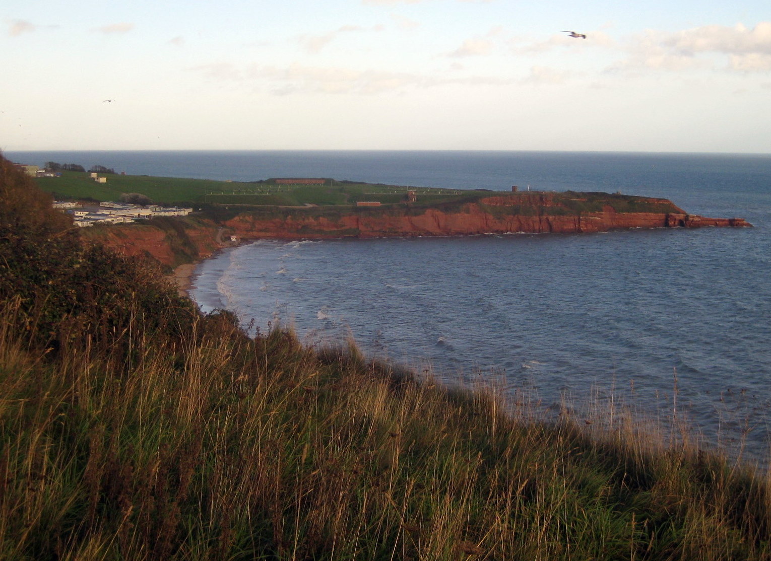
The top of the headland is used by the Royal Marines as a firing range, established using emergency powers during the second world war. To the west is Sandy Bay, a holiday beach, that can be reached either along the coastal path or through the large caravan park. To the east are Otter Cove and Littleton Cove. A navigational light for shipping was established on Straight Point in 1950 due the difficult conditions in the area for ships approaching the coast.
Geology
The redsandstone
Sandstone is a Clastic rock#Sedimentary clastic rocks, clastic sedimentary rock composed mainly of grain size, sand-sized (0.0625 to 2 mm) silicate mineral, silicate grains, Cementation (geology), cemented together by another mineral. Sand ...
cliffs at Straight Point show a sequence of sandstones in the Exmouth Formation. Predominantly the cliffs are composed of layers of Aylesbeare Mudstone, including some sandstone layers. They represent the earliest geology along the entire coast. They are from the Triassic period and date from 250 million years ago. Both sediments are markedly red, which indicates that they were formed in a desert.
At the east is an erosional platform, abraded by quartzite pebbles from the Budleigh Salterton pebble bed, seen at the neighbouring Littleham Cove.
At low tide most of the western section is accessible at low tide from Sandy Bay, but only a small part of the eastern side.
References
{{coord, 50.60660, -3.36177, display=title Bays of Devon Jurassic Coast Geology of Devon