Smith Inlet (Victoria Land) on:
[Wikipedia]
[Google]
[Amazon]
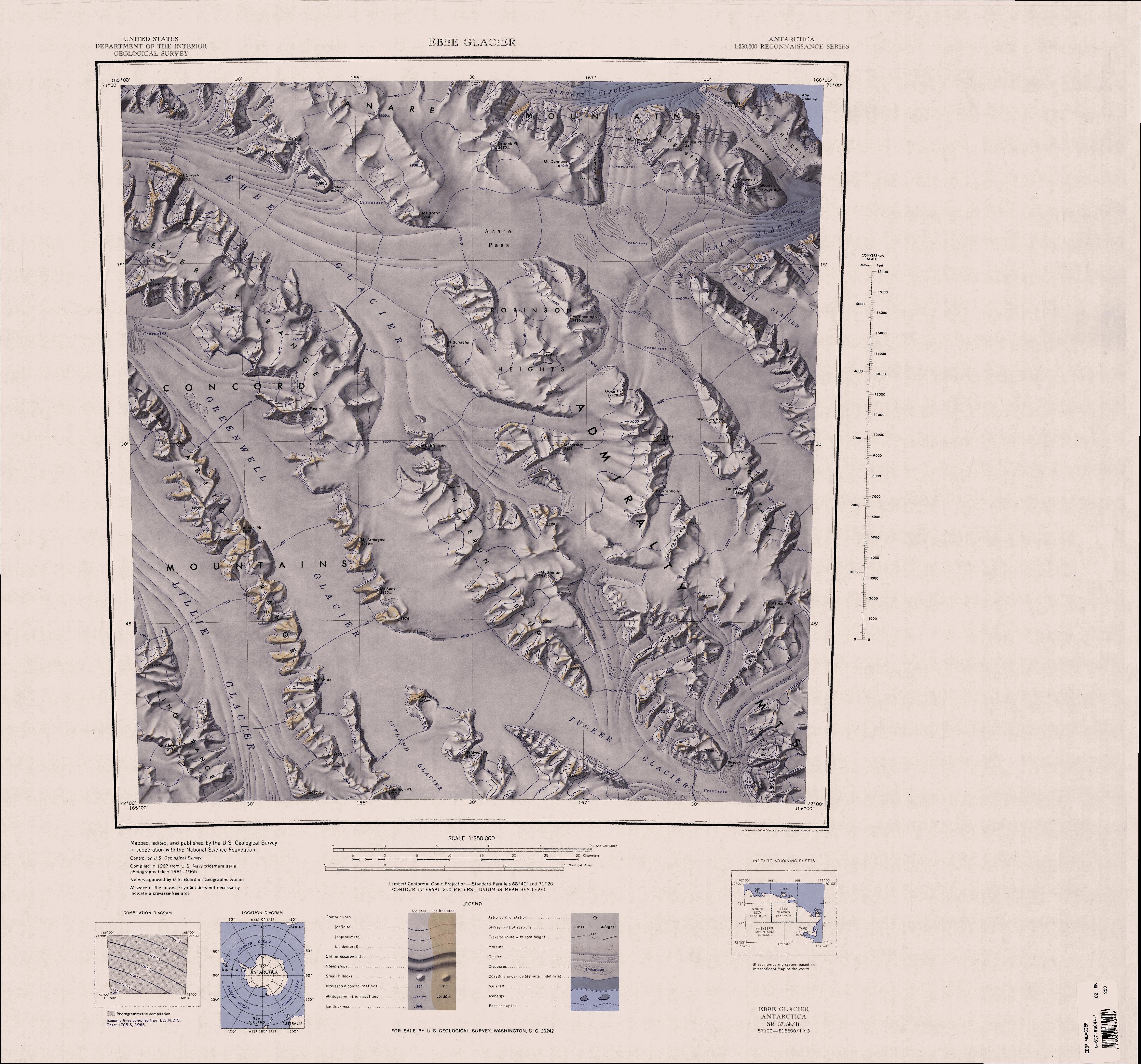
Barnett Glacier () is a large glacier in the

 Barnett Glacier rises in the
Anare Mountains
The Anare Mountains () are a large group of mainly snow-covered peaks and ridges along the northern coast of Victoria Land, Antarctica.
The group is bounded on the north and east by the Pacific Ocean, on the west by Lillie Glacier, and on the sou ...
that flows east along the south side of Tapsell Foreland
Tapsell Foreland () is a borad, mostly snow-covered foreland jutting into the sea between Yule Bay and Smith Inlet, northern Victoria Land.
Much of the central portion of this feature rises above .
Exploration and naming
The name Tapsell, app ...
into Smith Inlet, northern Victoria Land
Victoria Land is a region in eastern Antarctica which fronts the western side of the Ross Sea and the Ross Ice Shelf, extending southward from about 70°30'S to 78th parallel south, 78°00'S, and westward from the Ross Sea to the edge of the Ant ...
, Antarctica.
Exploration and naming
Barnett Glacier was mapped by theUnited States Geological Survey
The United States Geological Survey (USGS), founded as the Geological Survey, is an agency of the U.S. Department of the Interior whose work spans the disciplines of biology, geography, geology, and hydrology. The agency was founded on Mar ...
(USGS) from surveys and from United States Navy
The United States Navy (USN) is the naval warfare, maritime military branch, service branch of the United States Department of Defense. It is the world's most powerful navy with the largest Displacement (ship), displacement, at 4.5 millio ...
air photos, 1960–63.
It was named by the United States Advisory Committee on Antarctic Names
The Advisory Committee on Antarctic Names (ACAN or US-ACAN) is an advisory committee of the United States Board on Geographic Names responsible for recommending commemorative names for features in Antarctica.
History
The committee was established ...
(US-ACAN) after Donald C. Barnett, USGS topographic engineer, a member of USGS Topo East and West, 1962–63, in which the expedition extended geodetic control from the area of Cape Hallett
Cape Hallett is a snow-free area (Antarctic oasis) on the northern tip of the Hallett Peninsula on the Ross Sea coast of Victoria Land, East Antarctica. Cape Adare lies to the north.
History
In 1956, during Operation Deep Freeze II, was damag ...
to the Wilson Hills
Wilson Hills () is a group of scattered hills, nunataks and ridges that extend northwest–southeast about between Matusevich Glacier and Pryor Glacier in Antarctica.
Discovery and naming
The Wilson Hills were discovered by Lieutenant Harry ...
(Topo West) and from the foot of Beardmore Glacier
The Beardmore Glacier in Antarctica is one of the largest valley glaciers in the world, being long and having a width of .
It descends about from the Antarctic Plateau to the Ross Ice Shelf and is bordered by the Commonwealth Range of the Queen ...
through the Horlick Mountains
The Horlick Mountains () are a mountain group in the Transantarctic Mountains of Antarctica, lying eastward of Reedy Glacier and including the Wisconsin Range, Long Hills and Ohio Range.
Discovery and naming
The mountains were discovered in ...
(Topo East).
Location

 Barnett Glacier rises in the
 Anare Mountains
The Anare Mountains () are a large group of mainly snow-covered peaks and ridges along the northern coast of Victoria Land, Antarctica.
The group is bounded on the north and east by the Pacific Ocean, on the west by Lillie Glacier, and on the sou ...
to the northeast of Drabek Peak, and flows east.
It passes Mount Dalmeny, Hedgpeth Heights
The Hedgpeth Heights () are mainly snow-covered heights, long and with peaks rising to , located southwest of the Quam Heights in the Anare Mountains of Victoria Land, Antarctica.
Exploration and naming
The Hedgpeth Heights was mapped by the U ...
, the Douglas Gap and Quam Heights
Quam Heights () is a mostly snow-covered heights, long and wide, rising over and forming the coastline between the Barnett Glacier and Dennistoun Glacier in northern Victoria Land, Antarctica.
Exploration and naming
The Quam Heights were mappe ...
to the south.
It is fed by McElroy Glacier from Tapsell Foreland
Tapsell Foreland () is a borad, mostly snow-covered foreland jutting into the sea between Yule Bay and Smith Inlet, northern Victoria Land.
Much of the central portion of this feature rises above .
Exploration and naming
The name Tapsell, app ...
to the north, and flows past the south of the foreland to terminate in Smith Inlet to the south of Cape Moore.
Features
Douglas Gap
. A glacier-filled gap, wide, between Hedgpeth Heights and Quam Heights. Mapped by USGS from surveys and United States Navy air photos, 1960-63. Named by US-ACAN for Donald S. Douglas, United States ArmyRP biologist at Hallett Station, 1959-60 and 1960-61.McElroy Glacier
. A tributary glacier just west of Matthews Ridge on Tapsell Foreland. It drains south to join Barnett Glacier. It was mapped by USGS from surveys and United States Navy air photos, 1960-63. It was named by US-ACAN for Clifford T. McElroy, United States ArmyRP geologist at McMurdo Station, 1964-65 and 1966-67.Smith Inlet
. A bay, wide, partially filled with the ice tongue of Barnett Glacier. Located between Cape Moore and Cape Oakeley along the coast of north Victoria Land. Discovered by Captain James Clark Ross, 1841, who named it for Alexander J. Smith, mate on the Erebus.References
Sources
* * * {{Glaciers in the Antarctic Glaciers of Pennell Coast