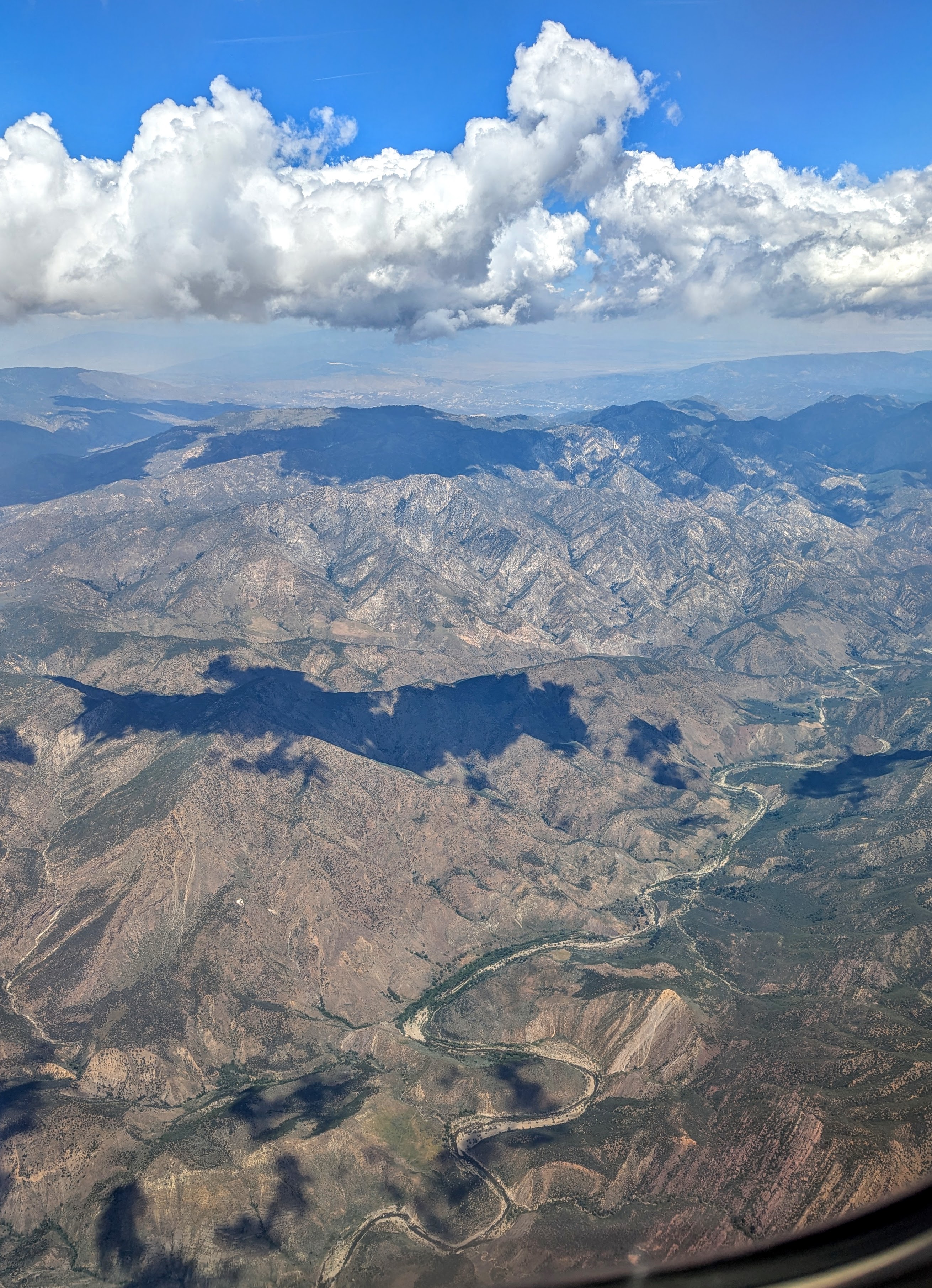
Sespe Wildlife Area on:
[Wikipedia]
[Google]
[Amazon]
The Sespe Wilderness is a 
wilderness area
Wilderness or wildlands (usually in the plural) are Earth's natural environments that have not been significantly modified by human activity, or any nonurbanized land not under extensive agricultural cultivation. The term has traditionally ...
in the eastern Topatopa Mountains
The Topatopa Mountains are a mountain range in Ventura County, California, north of Ojai, Santa Paula, and Fillmore. They are part of the Transverse Ranges of Southern California.
Etymology
A name for the mountains was first inscribed within t ...
and southern Sierra Pelona Mountains
The Sierra Pelona, also known as the Sierra Pelona Ridge or the Sierra Pelona Mountains and originally known as the Liebre Mountains, is a mountain ridge in the Transverse Ranges in Southern California. Located in northwest Los Angeles County, t ...
, within the Los Padres National Forest
Los Padres National Forest is a United States national forest in Southern California, southern and central California. Administered by the United States Forest Service, Los Padres includes most of the mountainous land along the California coast ...
(LPNF), in Ventura County
Ventura County () is a county located in the southern part of the U.S. state of California. As of the 2020 census, the population was 843,843. The largest city is Oxnard, and the county seat is the city of Ventura.
Ventura County comprises ...
, Southern California
California () is a U.S. state, state in the Western United States that lies on the West Coast of the United States, Pacific Coast. It borders Oregon to the north, Nevada and Arizona to the east, and shares Mexico–United States border, an ...
. The wilderness area is primarily located within the Ojai and Mt. Pinos ranger districts of the LPNF.
The wilderness was created by the U.S. Congress as part of the Los Padres Condor Range and River Protection Act of 1992 (Public Law 102-301). The same legislation also established the Chumash
Chumash may refer to:
*Chumash (Judaism), a Hebrew word for the Pentateuch, used in Judaism
*Chumash people, a Native American people of southern California
*Chumashan languages, Indigenous languages of California
See also
* Pentateuch (dis ...
, Garcia, Machesna Mountain, Matilija, and Silver Peak Wilderness areas. The Sespe Condor Sanctuary
The Sespe Condor Sanctuary is a wildlife refuge in the Topatopa Mountains, in northeastern Ventura County, California, Ventura County, California. It is within the Sespe Wilderness in the southern Los Padres National Forest.
History
The United ...
is within the Sespe Wilderness. It was established to promote the propagation and growth of the California condor
The California condor (''Gymnogyps californianus'') is a New World vulture and the largest North American land bird. It became extinct in the wild in 1987 when all remaining wild individuals were captured, but has since been reintroduced to n ...
, and is closed to the public.

Features
The Sespe Wilderness is primarilychaparral
Chaparral ( ) is a shrubland plant plant community, community found primarily in California, southern Oregon, and northern Baja California. It is shaped by a Mediterranean climate (mild wet winters and hot dry summers) and infrequent, high-intens ...
-covered terrain, with areas of California oak woodland
California oak woodland is a plant community found throughout the California chaparral and woodlands ecoregion of California in the United States and northwestern Baja California in Mexico. Oak woodland is widespread at lower elevations in coast ...
and riparian
A riparian zone or riparian area is the interface between land and a river or stream. In some regions, the terms riparian woodland, riparian forest, riparian buffer zone, riparian corridor, and riparian strip are used to characterize a ripar ...
habitats. A section of Sespe Creek
Sespe Creek (Chumashan languages, Chumash: S'eqp'e', "Kneecap") is a stream, some long,U.S. Geological Survey. National Hydrography Dataset high-resolution flowline dataThe National Map accessed March 16, 2011 in Ventura County, California, Ve ...
flows through it.
There are hiking trails, perennial and seasonal creeks, waterfalls, hot springs, rock formations, and designated campsites in the wilderness area.
Nearby wilderness areas of the southern Los Padres National Forest include the Matilija Wilderness (west) and Chumash Wilderness
The Chumash Wilderness is a wilderness area within the southern Los Padres National Forest. It is located in the Transverse Ranges, in northern Ventura County and southwestern Kern County in California.
The wilderness was created by the U.S. C ...
(northwest). The Dick Smith Wilderness
The Dick Smith Wilderness is a wilderness area in the mountains of eastern Santa Barbara County, California, United States, with a portion in Ventura County. It is completely contained within the Los Padres National Forest, and is northeast o ...
is further to the northwest.
See also
* *References
{{Authority control Wilderness areas of California Los Padres National Forest San Emigdio Mountains Topatopa Mountains Protected areas of Ventura County, California Protected areas established in 1992 1992 establishments in California