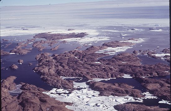
Rauer Islands on:
[Wikipedia]
[Google]
[Amazon]
 The Rauer Islands () are a group of rocky coastal
 The Rauer Islands () are a group of rocky coastal
 island
An island or isle is a piece of land, distinct from a continent, completely surrounded by water. There are continental islands, which were formed by being split from a continent by plate tectonics, and oceanic islands, which have never been ...
s which lie between Sorsdal Glacier Tongue and Ranvik Bay
Ranvik Bay () is an open bay 15 nautical miles (28 km) wide, lying southward of Rauer Islands in the southeast part of Prydz Bay. Discovered and charted in February 1935 by a Norwegian expedition led by Captain Klarius Mikkelsen in the Tho ...
, in the southeast part of Prydz Bay
Prydz Bay is a deep embayment of Antarctica between the Lars Christensen Coast and Ingrid Christensen Coast. The Bay is at the downstream end of a giant glacial drainage system that originates in the East Antarctic interior. The Lambert Glac ...
. Discovered and roughly charted in February 1935 by a Norwegian expedition under Captain Klarius Mikkelsen (see Caroline Mikkelsen). He named them ''Rauer'', probably after the island lying in Oslofjord
The Oslofjord (, ; ) is an inlet in southeastern Norway. The fjord begins at the small village of Bonn in Frogn, Frogn Municipality and stretching northwards to the city of Oslo, and then curving to the east and then south again. It then flows s ...
en opposite Tønsberg
Tønsberg (), historically Tunsberg, is a List of towns and cities in Norway, city in Tønsberg Municipality in Vestfold county, Norway. It is located about south-southwest of the capital city of Oslo on the western coast of the Oslofjord near ...
, Norway.
See also
*List of antarctic and sub-antarctic islands
This is a list of Antarctic and sub-Antarctic islands.
* Antarctic islands are, in the strict sense, the islands around mainland Antarctica, situated on the Antarctic Plate, and south of the Antarctic Convergence. According to the terms of the ...
Islands of Princess Elizabeth Land
{{PrincessElizabethLand-geo-stub