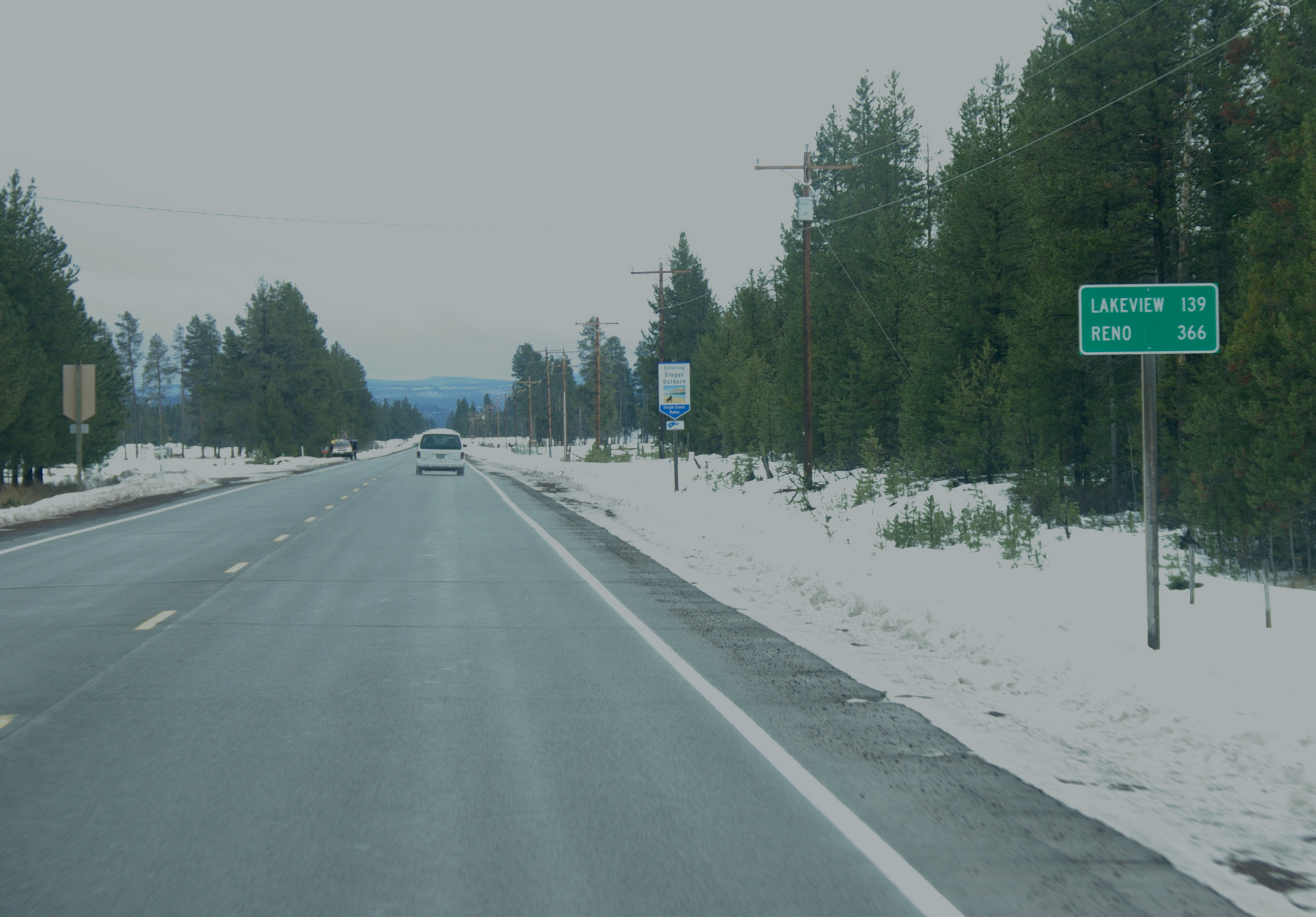
Oregon Route 31 on:
[Wikipedia]
[Google]
[Amazon]
Oregon Route 31 is a state highway in the
 Oregon 31 runs northwest-southeast, but is signed north–south. It is a two-lane rural road for its entire length. The northern terminus of the highway is at an intersection with U.S. Route 97 south of the city of La Pine. From there, the highway heads southeast, passing near the natural attractions of
Outback Scenic Byway
{{DEFAULTSORT:Oregon Route 031 031 Transportation in Deschutes County, Oregon Transportation in Klamath County, Oregon Transportation in Lake County, Oregon
U.S. state
In the United States, a state is a constituent political entity, of which there are 50. Bound together in a political union, each state holds governmental jurisdiction over a separate and defined geographic territory where it shares its sove ...
of Oregon
Oregon () is a state in the Pacific Northwest region of the Western United States. The Columbia River delineates much of Oregon's northern boundary with Washington, while the Snake River delineates much of its eastern boundary with Idaho. T ...
that runs between the Central Oregon
Central Oregon is a geographic region in the U.S. state of Oregon and is traditionally considered to be made up of Deschutes, Jefferson, and Crook counties. Other definitions include larger areas, often encompassing areas to the north towards ...
cities of La Pine and Lakeview. OR 31 traverses most of the Fremont Highway No. 19 of the Oregon state highway system, named after John C. Frémont. The entire length of OR 31 is part of the Outback Scenic Byway, though the byway extends further south beyond the end of OR 31, to the California
California is a state in the Western United States, located along the Pacific Coast. With nearly 39.2million residents across a total area of approximately , it is the most populous U.S. state and the 3rd largest by area. It is also the m ...
border.
Route description
 Oregon 31 runs northwest-southeast, but is signed north–south. It is a two-lane rural road for its entire length. The northern terminus of the highway is at an intersection with U.S. Route 97 south of the city of La Pine. From there, the highway heads southeast, passing near the natural attractions of
 Big Hole
The Kimberley Mine or Tim Kuilmine ( af, Groot Gat) is an open-pit and underground mine in Kimberley, South Africa, and claimed to be the deepest hole excavated by hand, although this claim is disputed.
History and size
The first diamonds he ...
, Hole-in-the-Ground, and Fort Rock State Natural Area. The route turns briefly east, passing by Paulina Marsh and Silver Lake
Silver is a chemical element with the Symbol (chemistry), symbol Ag (from the Latin ', derived from the Proto-Indo-European wikt:Reconstruction:Proto-Indo-European/h₂erǵ-, ''h₂erǵ'': "shiny" or "white") and atomic number 47. A soft, whi ...
and through the community of Silver Lake
Silver is a chemical element with the Symbol (chemistry), symbol Ag (from the Latin ', derived from the Proto-Indo-European wikt:Reconstruction:Proto-Indo-European/h₂erǵ-, ''h₂erǵ'': "shiny" or "white") and atomic number 47. A soft, whi ...
; it then turns south, goes over Picture Rock Pass, and passes by the Summer Lake Wildlife Area, then through the community of Summer Lake and by the lake of the same name. The road then runs east near the south shore of Summer Lake, then southeast through Paisley. Near the southern end of Abert Lake, and north of Lakeview, the highway ends at an intersection with U.S. Route 395
U.S. Route 395 (US 395) is a U.S. Route in the western United States. The southern terminus of the route is in the Mojave Desert at Interstate 15 near Hesperia. The northern terminus is at the Canada–US border near Laurier, where the road ...
.
A previous routing from a 1916 map shows the highway's northern terminus near Millican on U.S. 20, proceeding down Forest Road
Forest tracks or forest roads are roads or tracks intended to carry motorised vehicles or horse-drawn wagons being used mainly or exclusively for forestry purposes, such as conservation or logging. Forest tracks may be open to ramblers or mountain ...
25, then down Forest Road 18/Cabin Lake Road to the community of Fort Rock
Fort Rock is a tuff ring located on an ice age lake bed in north Lake County, Oregon, United States.
The ring is about in diameter and stands about high above the surrounding plain. Its name is derived from the tall, straight sides that resem ...
and continuing south on Pitcher Lane and Picture Lane to Silver Lake
Silver is a chemical element with the Symbol (chemistry), symbol Ag (from the Latin ', derived from the Proto-Indo-European wikt:Reconstruction:Proto-Indo-European/h₂erǵ-, ''h₂erǵ'': "shiny" or "white") and atomic number 47. A soft, whi ...
.
Major intersections
References
External links
Outback Scenic Byway
{{DEFAULTSORT:Oregon Route 031 031 Transportation in Deschutes County, Oregon Transportation in Klamath County, Oregon Transportation in Lake County, Oregon