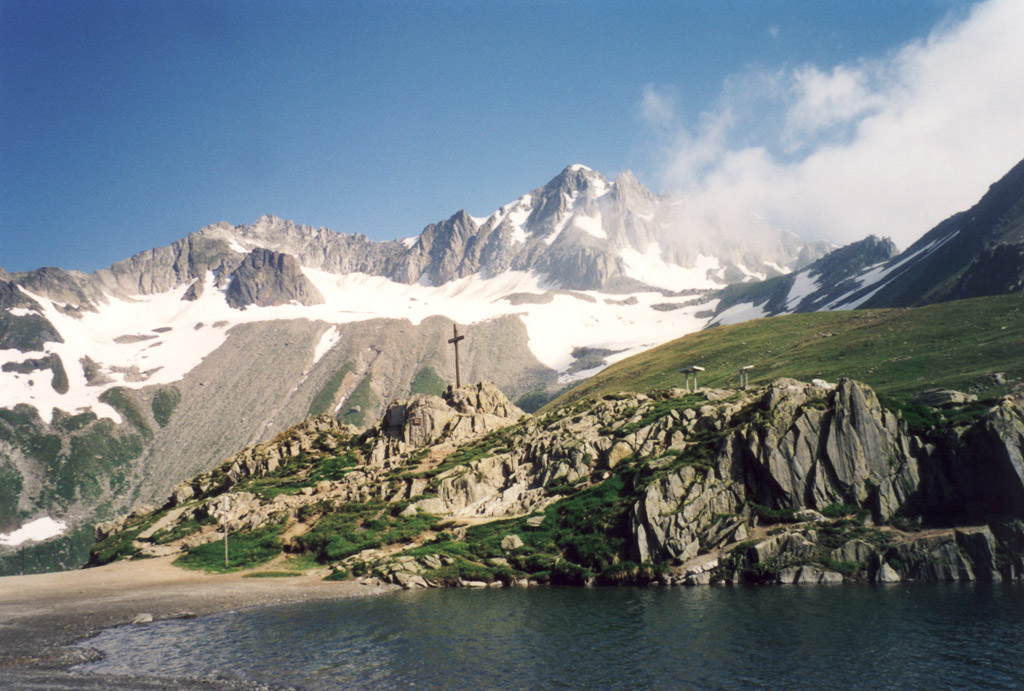
Nufenen Pass on:
[Wikipedia]
[Google]
[Amazon]
Nufenen Pass (Italian: ''Passo della Novena'', German: ''Nufenenpass'') (el. 2478 m.) is the highest mountain pass with a paved road within Switzerland. It lies between the summits of 


Cycling Map, Elevation Profile, and PhotosProfile on climbbybike.comCycling up to the Nufenenpass: data, profile, map, photos and description
Mountain passes of Ticino Mountain passes of the Alps Mountain passes of Valais Ticino–Valais border {{ticino-geo-stub
Pizzo Gallina
Pizzo Gallina is a mountain in the Lepontine Alps
, topo_map= Swiss Federal Office of Topography swisstopo
, photo=MonteLeone0001.jpg
, photo_caption=Monte Leone
, country_type= Countries
, country=
, subdivision1_type= Cantons, Regio ...
(north) and the Nufenenstock (south).
The pass road from Ulrichen
Ulrichen is a village in the municipality of Obergoms in the district of Goms in the canton of Valais in Switzerland. The population () was 219.
Ulrichen was an independent municipality until January 1, 2009, when it merged with Oberwald and O ...
in canton of Valais
Valais ( , , ; frp, Valês; german: Wallis ), more formally the Canton of Valais,; german: Kanton Wallis; in other official Swiss languages outside Valais: it, (Canton) Vallese ; rm, (Chantun) Vallais. is one of the 26 cantons forming the S ...
leads to the Bedretto valley in the canton of Ticino
Ticino (), sometimes Tessin (), officially the Republic and Canton of Ticino or less formally the Canton of Ticino,, informally ''Canton Ticino'' ; lmo, Canton Tesin ; german: Kanton Tessin ; french: Canton du Tessin ; rm, Chantun dal Tessin . ...
, linking Brig to Airolo. It is not the lowest pass between the two valleys, as it is located one kilometre north of an unnamed slightly lower pass at 2,440 metres (vs 2478 m.), which is traversed by a trail.
The road is of relatively recent construction, having been opened to motor vehicle traffic only since September 1969.
The source of the Ticino River
The river Ticino ( , ; lmo, Tesín; French and german: Tessin; la, Ticīnus) is the most important perennial left-bank tributary of the Po. It has given its name to the Swiss canton through which its upper portion flows.
It is one of the four ...
lies east of the top of the pass. Towards the north are views of the Bernese Alps
, topo_map= Swiss Federal Office of Topography swisstopo
, photo=BerneseAlps.jpg
, photo_caption=The Eiger, Mönch, and Jungfrau
, country= Switzerland
, subdivision1_type= Cantons
, subdivision1=
, parent= Western Alps
, borders_on=
, ...
, including the Finsteraarhorn
The Finsteraarhorn () is a mountain lying on the border between the cantons of Bern and Valais. It is the highest mountain of the Bernese Alps and the most prominent peak of Switzerland. The Finsteraarhorn is the ninth-highest mountain and thi ...
while there is a view over the Gries Glacier to the south.


See also
*List of highest paved roads in Europe
This is a list of the highest paved roads in Europe. It includes roads that are over long and whose culminating point is at least above sea level. This height approximately corresponds to that of the highest settlements in Europe and to the t ...
* List of mountain passes
This is a list of mountain passes.
Africa
Egypt
* Halfaya Pass (near Libya)
Lesotho
* Moteng Pass
* Mahlasela pass
* Sani Pass
Morocco
* Tizi n'Tichka
South Africa
* Eastern Cape Passes
* Western Cape Passes
* Northern Cape Passes
* ...
Bibliography
*Nicola Pfund
Nicola Pfund (born November 7, 1960 in Sorengo) is a Swiss Italian writer, blogger and journalist.
Biography
He is a native of Canton Schaffhausen, but he was born in Sorengo (Canton Ticino). After studying at a teacher-training college, Pfund ...
, ''Sui passi in bicicletta - Swiss Alpine passes by bicycle'', Fontana Edizioni, 2012, p. 54-61.
Sources and further reading
* This article incorporates information from the equivalent article in the German Wikipedia, consulted during April 2009.External links
Cycling Map, Elevation Profile, and Photos
Mountain passes of Ticino Mountain passes of the Alps Mountain passes of Valais Ticino–Valais border {{ticino-geo-stub