Mount Ōyama (Kanagawa) on:
[Wikipedia]
[Google]
[Amazon]
, also or Mount Kunimi (''Kunimi-yama''), is a mountain situated on the border of Isehara, Hadano and
 The mountain is made from non-alkali
File:Ooyama afurijinjya.jpg, Ōyama-Afuri Shrine
( 大山阿夫利神社) File:Ooyamadera (Isehara 200801).jpg, Ōyama-dera temple
( 大山寺)
 A bus connects Isehara Station on the
File:Hadano Basin from Shibusawa Hill Range 01.jpg, With Tanzawa Mountains
File:Mt.Oyama from Mt.Sannoto 01.jpg, From the west (from Mt. Sannoto, Tanzawa Mountains)
File:Mt.Oyama from yokohama.JPG, From the east (from Tsuzuki,
Atsugi
is a city located in Kanagawa Prefecture, Japan. , the city had an estimated population of 223,960 and a population density of 2400 persons per km². The total area of the city is .
While the name "Atsugi" is often associated with the United ...
in Kanagawa Prefecture
is a prefecture of Japan located in the Kantō region of Honshu. Kanagawa Prefecture is the second-most populous prefecture of Japan at 9,221,129 (1 April 2022) and third-densest at . Its geographic area of makes it fifth-smallest. Kanaga ...
, Japan. Together with Mount Tanzawa and other mountains in the Tanzawa Mountains
The are a mountain range in the Kantō region in Japan. The mountain range covers the northwestern part of Kanagawa Prefecture and touches the prefecture borders of Shizuoka Prefecture to the west and the Yamanashi Prefecture to the north.
Mou ...
it forms the Tanzawa-Ōyama Quasi-National Park. Mount Ōyama is a popular sightseeing spot in Kanagawa Prefecture.
Geology
 The mountain is made from non-alkali
 mafic
A mafic mineral or rock is a silicate mineral or igneous rock rich in magnesium and iron. Most mafic minerals are dark in color, and common rock-forming mafic minerals include olivine, pyroxene, amphibole, and biotite. Common mafic rocks incl ...
rock. The rock is 7-15 million years old. The rock was extruded on the sea floor during the Neogene
The Neogene ( ), informally Upper Tertiary or Late Tertiary, is a geologic period and system that spans 20.45 million years from the end of the Paleogene Period million years ago ( Mya) to the beginning of the present Quaternary Period Mya. ...
and then pushed up and onto the island of Honshu when the Izu–Bonin–Mariana Arc
The Izu–Bonin–Mariana (IBM) arc system is a plate tectonics, tectonic plate convergent boundary in Micronesia. The IBM arc system extends over 2800 km south from Tokyo, Japan, to beyond Guam, and includes the Izu Islands, the Bonin Island ...
collided with the rest of Japan.
Holy mountain
Mount Ōyama has long been regarded as a holy mountain and object of worship. Religiously motivated mountain climbing has been practiced since theHōreki
, also known as Horyaku, was a after '' Kan'en'' and before '' Meiwa''. The period spanned the years from October 1751 through June 1764. The reigning emperor and empress were and .Titsingh, Isaac. (1834 ''Annales des empereurs du japon'', p. 4 ...
era (1751–1764) and the various paths leading there were called . Today this name survives as the pseudonym of Route 246.
At the top of the mountain is the head office of the . Lower down the mountain is the lower shrine and the . ''Afuri'' refers to the high amount of rain and clouds associated with the mountain. Farmers pray at Ōyama-Afuri Shrine to Suijin, god of rain.
The mountain is also known as the Guardian of the Land (''Kunimi-yama'').
( 大山阿夫利神社) File:Ooyamadera (Isehara 200801).jpg, Ōyama-dera temple
( 大山寺)
Sightseeing
Odakyu Odawara Line
, commonly known as Odakyū, is a major railway company based in Tokyo, Japan, best known for its ''Romancecar'' series of limited express trains from Tokyo to Odawara, Enoshima, Tama New Town, and Hakone.
The Odakyu Electric Railway Company f ...
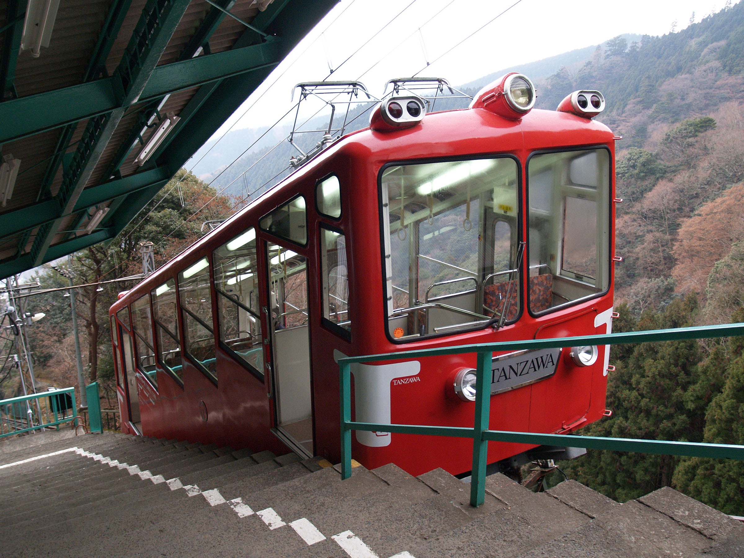
with the cable car station at the foot of the mountain. A narrow road runs directly between the town areas and the cable car station. The cable car starts from next to Ōyama-dera and climbs to the top station. The top station is not far from the lower Afuri Shrine. Hiking from there it takes about 1.5 hours to climb to the top of the mountain.
Tofu
Tofu (), also known as bean curd in English, is a food prepared by coagulating soy milk and then pressing the resulting curds into solid white blocks of varying softness; it can be ''silken'', ''soft'', ''firm'', ''extra firm'' or ''super f ...
and spinning tops are well-known local products. The Ōyama Tofu Festival takes place every March. The Ōyama Mountain Climbing Marathon also takes place in March between Isehara Station and the lower shrine. The course is over long and includes an altitude difference of over . Possible access points for an ascent are the cable car terminus, the temple in Isehara, and the in Hadano.
Photo gallery
Yokohama
is the second-largest city in Japan by population and the most populous municipality of Japan. It is the capital city and the most populous city in Kanagawa Prefecture, with a 2020 population of 3.8 million. It lies on Tokyo Bay, south of ...
)
File:Tomei-Expwy Atsugi.jpg, With Tomei Expressway
References
{{DEFAULTSORT:Mount Oyama, Kanagawa Oyama, Mount Isehara, Kanagawa Hadano, Kanagawa Atsugi, Kanagawa