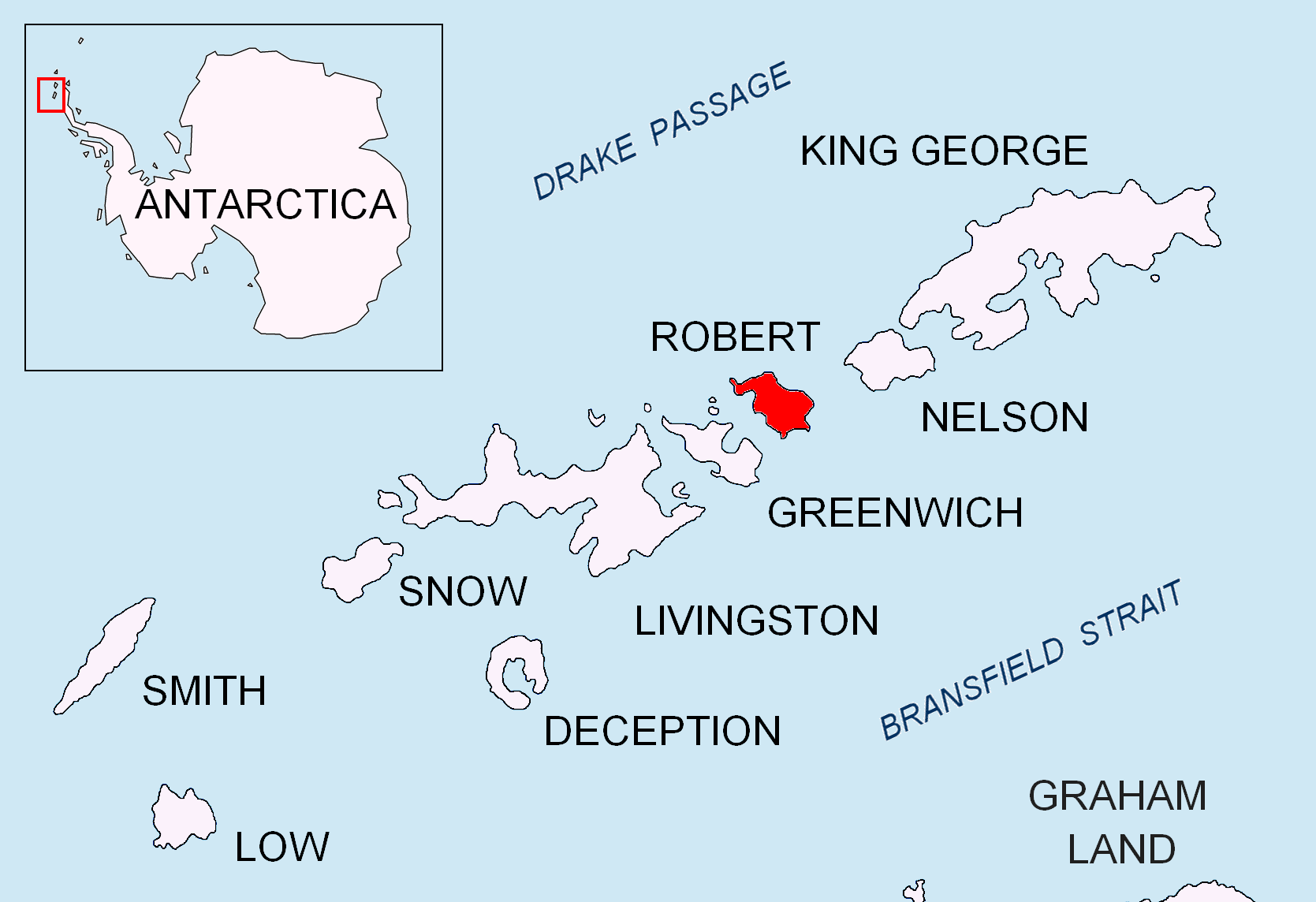
Kermen Peninsula on:
[Wikipedia]
[Google]
[Amazon]

 Kermen Peninsula (, ) is a 1.5-km long
Kermen Peninsula.
SCAR
Bulgarian Antarctic Gazetteer.
basic data
in English)
Kermen Peninsula.
Copernix satellite image Landforms of Robert Island Bulgaria and the Antarctic Peninsulas of the South Shetland Islands {{RobertIsland-geo-stub

 Kermen Peninsula (, ) is a 1.5-km long
 peninsula
A peninsula is a landform that extends from a mainland and is only connected to land on one side. Peninsulas exist on each continent. The largest peninsula in the world is the Arabian Peninsula.
Etymology
The word ''peninsula'' derives , . T ...
forming the south extremity of Robert Island
Robert Island or Mitchells Island or Polotsk Island or Roberts Island is an island
An island or isle is a piece of land, distinct from a continent, completely surrounded by water. There are continental islands, which were formed by being ...
, Antarctica
Antarctica () is Earth's southernmost and least-populated continent. Situated almost entirely south of the Antarctic Circle and surrounded by the Southern Ocean (also known as the Antarctic Ocean), it contains the geographic South Pole. ...
. Bounded by Micalvi Cove to the northwest, and Bransfield Strait
Bransfield Strait or Fleet Sea () is a body of water about wide extending for in a general northeast – southwest direction between the South Shetland Islands and the Antarctic Peninsula.
History
The strait was named in about 1825 by James W ...
to the southeast. Its extremity Edwards Point is forming the east side of the south entrance to English Strait
English Strait is the 10.5-mile (17-km) long and 1.2-mile (2-km) wide strait lying between Greenwich Island and Robert Island in the South Shetland Islands, Antarctica. Trending southeast-northwest, and entered between Santa Cruz Point and Edwa ...
and the southwest side of the entrance to Devesil Bight. The southwest half — ca. L.L. Ivanov. Antarctica: Livingston Island and Greenwich, Robert, Snow and Smith Islands. Scale 1:120000 topographic map. Troyan: Manfred Wörner Foundation, 2010. (First edition 2009. ) — is snow-free in summer. British
British may refer to:
Peoples, culture, and language
* British people, nationals or natives of the United Kingdom, British Overseas Territories and Crown Dependencies.
* British national identity, the characteristics of British people and culture ...
mapping in 1968, and Bulgaria
Bulgaria, officially the Republic of Bulgaria, is a country in Southeast Europe. It is situated on the eastern portion of the Balkans directly south of the Danube river and west of the Black Sea. Bulgaria is bordered by Greece and Turkey t ...
n in 2005 and 2009. Named after the town of Kermen in southeastern Bulgaria
Bulgaria, officially the Republic of Bulgaria, is a country in Southeast Europe. It is situated on the eastern portion of the Balkans directly south of the Danube river and west of the Black Sea. Bulgaria is bordered by Greece and Turkey t ...
.
Map
* L.L. Ivanov et al., Antarctica: Livingston Island and Greenwich Island, South Shetland Islands (from English Strait to Morton Strait, with illustrations and ice-cover distribution), Scale 1: 100000 map,Antarctic Place-names Commission
The Antarctic Place-names Commission was established by the Bulgarian Antarctic Institute in 1994, and since 2001 has been a body affiliated with the Ministry of Foreign Affairs (Bulgaria), Ministry of Foreign Affairs of Bulgaria.
The Commis ...
of Bulgaria, Ministry of Foreign Affairs, Sofia, 2005
Notes
References
Kermen Peninsula.
SCAR
Composite Gazetteer of Antarctica
The Composite Gazetteer of Antarctica (CGA) of the Scientific Committee on Antarctic Research (SCAR) is the authoritative international gazetteer containing all Antarctic toponyms published in national gazetteers, plus basic information about th ...
Bulgarian Antarctic Gazetteer.
Antarctic Place-names Commission
The Antarctic Place-names Commission was established by the Bulgarian Antarctic Institute in 1994, and since 2001 has been a body affiliated with the Ministry of Foreign Affairs (Bulgaria), Ministry of Foreign Affairs of Bulgaria.
The Commis ...
. (details in Bulgarianbasic data
in English)
External links
Kermen Peninsula.
Copernix satellite image Landforms of Robert Island Bulgaria and the Antarctic Peninsulas of the South Shetland Islands {{RobertIsland-geo-stub