Boothapandi on:
[Wikipedia]
[Google]
[Amazon]

 Boothapandi is a
had a population of 14,721. Males constitute 50% of the population and females 50%. Boothapandi has an average literacy rate of 82%, higher than the national average of 59.5%; with male literacy of 84% and female literacy of 79%. 9% of the population is under 6 years of age.

 Boothapandi is a
 panchayat town
A nagar panchayat () or town panchayat or Notified Area Council (NAC) in India is a settlement in transition from rural to urban and therefore a form of an urban political unit comparable to a municipality. An urban centre with more than 12,00 ...
in Kanyakumari district in the state of Tamil Nadu
Tamil Nadu (; , TN) is the southernmost States and union territories of India, state of India. The List of states and union territories of India by area, tenth largest Indian state by area and the List of states and union territories of Indi ...
, India.
The town spans an area of around 5 km2 with Thittuvilai, Thuvarancaud, Arasankuzhi, Andithoppu, Mannadi, Saattupudoor, Seethapal and Manathittai as its sub-villages. The places situated in the vicinity of the town include Azhakiyapadiapuram to the northwest, Easanthimangalam to the southwest, and Thalakudi to the southeast and Aralvaimozhi to the east.
It is the headquarters of Thovalai taluk, which is one among the four taluks
A tehsil (, also known as tahsil, taluk, or taluka () is a local unit of administrative division in India and Pakistan. It is a subdistrict of the area within a district including the designated populated place that serves as its administrative ce ...
of Kanyakumari district. The village has a sub-register office, taluk office, police station, higher secondary school and court.
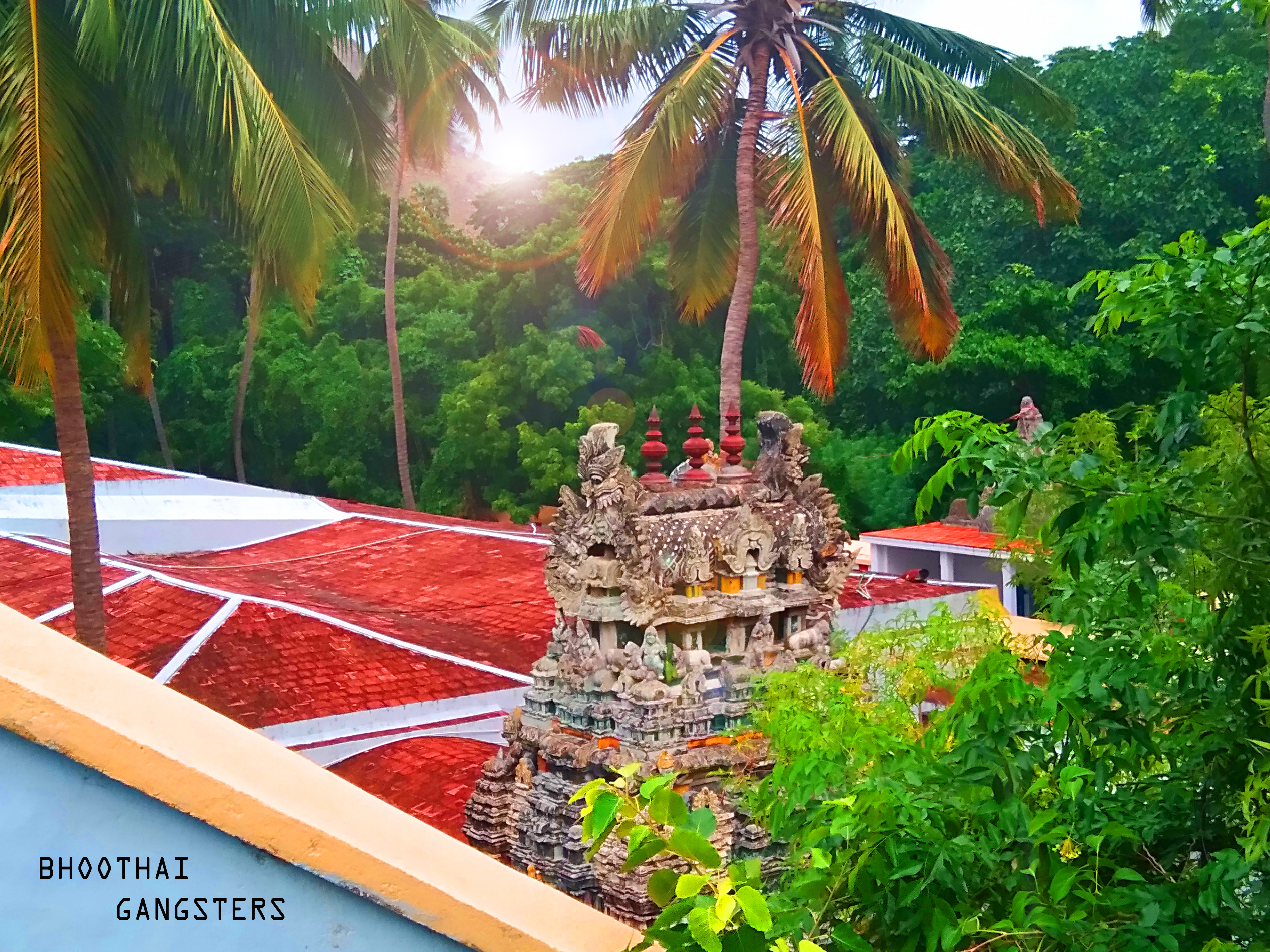
It was named after the presence of the Bhoothalingaswamy Temple (Bhoothapandi), which is famous for its sculptures and architecture. The surrounding area is green and fertile. The village is only 25 minutes from Nagercoil
Nagercoil, natively spelt as Nāgarkovil (, "Temple of the Nāgas", or Nagaraja-Temple), is a Municipal Corporation city and the administrative headquarters of Kanyakumari District in Tamil Nadu state, India. Situated close to the tip of the ...
and its views of the Western Ghats attract many tourists and photographers.
History
Boothapandi was a part of travancore kingdom before the independence of India. The Bhoothappandi panchayat was formed on 1936. It was one among the 4 Panchayats sanctioned by Sir C.P.Ramaswamy Iyer ( Diwan - Thiruvithancore). The others were Paravur,Nedumangadu
Nedumangad is a municipal town in the Thiruvananthapuram district in the Indian state of Kerala. It is the headquarters of Nedumangad Tehsil and Nedumangad Revenue Division. It is a suburb of the extended metropolitan region of Thiruvananthap ...
and Perumbavoor
Perumbavoor () is a municipality in the Ernakulam district of Kerala, India. It is located north of the district collectorate in Thrikkakara and about north of the state capital Thiruvananthapuram. Perumbavoor is part of the Kochi metrop ...
.
Demographics
Indiacensus
A census (from Latin ''censere'', 'to assess') is the procedure of systematically acquiring, recording, and calculating population information about the members of a given Statistical population, population, usually displayed in the form of stati ...
,Boothapandihad a population of 14,721. Males constitute 50% of the population and females 50%. Boothapandi has an average literacy rate of 82%, higher than the national average of 59.5%; with male literacy of 84% and female literacy of 79%. 9% of the population is under 6 years of age.
Notable natives
* P Jeevanandham, a socialist and Tamil social reformer. * B. A. Chidambaranath, a popular musician who was a music director ofMalayalam
Malayalam (; , ) is a Dravidian languages, Dravidian language spoken in the Indian state of Kerala and the union territories of Lakshadweep and Puducherry (union territory), Puducherry (Mahé district) by the Malayali people. It is one of ...
and Tamil
Tamil may refer to:
People, culture and language
* Tamils, an ethno-linguistic group native to India, Sri Lanka, and some other parts of Asia
**Sri Lankan Tamils, Tamil people native to Sri Lanka
** Myanmar or Burmese Tamils, Tamil people of Ind ...
films, was also a native of this town.
See also
* Bhoothalingaswamy Temple (Bhoothapandi) *South Paravoor
Paravur () is a municipality in the Kollam district of Kerala, India. It is located 11.6 km (7.2 mi) southeast of Kollam city center and is a part of the Kollam metropolitan area. Paravur railway station is the last station in Kollam district, ...
* Kollam
Kollam (;), is an ancient seaport and the List of cities and towns in Kerala, fourth largest city in the Indian state of Kerala. Located on the southern tip of the Malabar Coast of the Arabian Sea, the city is on the banks of Ashtamudi Lake ...
* Putheri
Putheri is a village panchayat located in Rajakkamangalam block of Kanyakumari district, Tamil Nadu, India. The panchayat has total of seven panchayat constituencies. Out of these seven panchayat members are elected.
Nainar Yogeeswaramudaiyar ...
References
Cities and towns in Kanyakumari district {{Kanniyakumari-geo-stub