|
Pileus (meteorology)
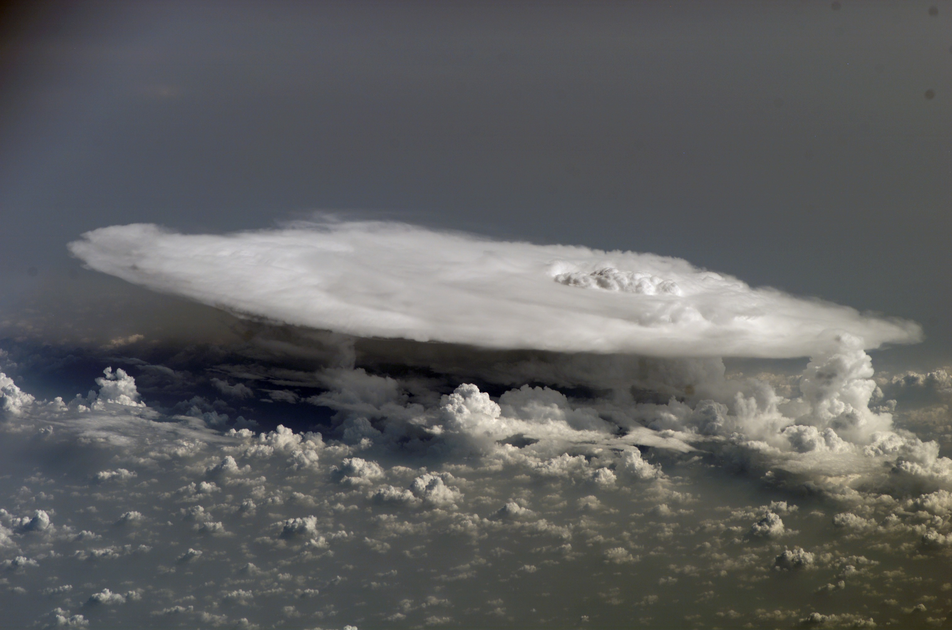
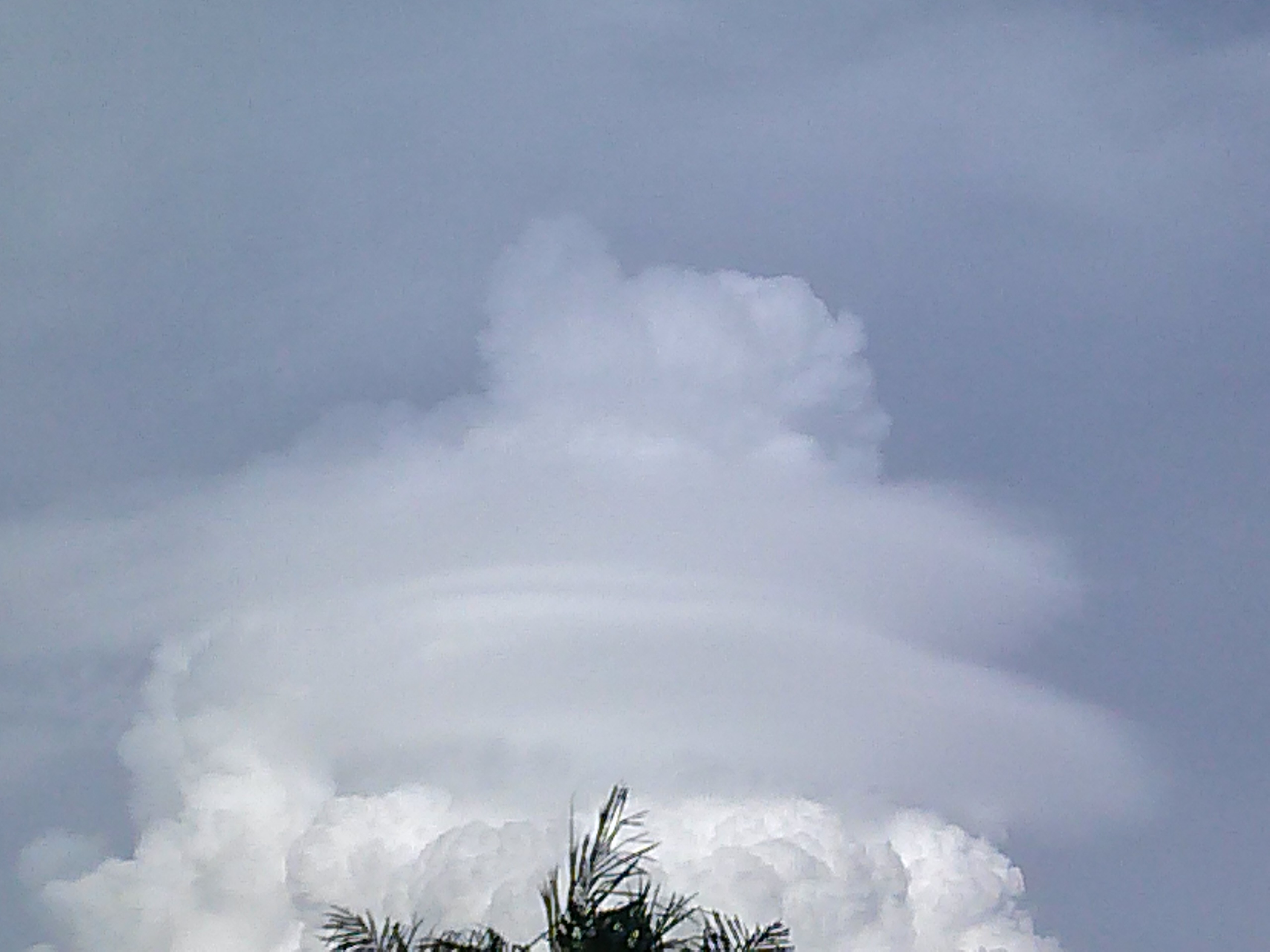
A pileus (; ), also called scarf cloud or cap cloud, is a small, horizontal, lenticular cloud appearing above a cumulus cloud, cumulus or cumulonimbus cloud. Pileus clouds are often short-lived, appearing for typically only a few minutes, with the main cloud beneath them rising through convection to absorb them. Furthermore, the clouds are typically formed by drier air with a higher Lifted condensation level, lifting condensation level, which often prevents vertical growth and leads to the smooth horizontal cap shape that the cloud is named for. They are formed by strong updraft at lower altitudes, acting upon moist air above, causing the air to adiabatic cooling, cool to its dew point as it rises. As such, they are usually indicators of severe weather, and a pileus found atop a cumulus cloud often foreshadows transformation into a cumulonimbus cloud, as it indicates a strong updraft within the cloud. Pilei can also form above mountains, ash clouds, and pyrocumulus clouds f ... [...More Info...] [...Related Items...] OR: [Wikipedia] [Google] [Baidu] |
Pyrocumulus Cloud
A flammagenitus cloud, also known as a flammagenitus, pyrocumulus cloud, or fire cloud, is a dense cumuliform cloud associated with fire or volcanic eruptions. A flammagenitus is similar dynamically in some ways to a firestorm, and the two phenomena may occur in conjunction with each other. However, either may occur without the other. Formation A flammagenitus cloud is produced by the intense heating of the air from the surface. The intense heat induces convection, which causes the air mass to rise to a point of stability, usually in the presence of moisture. Phenomena such as volcanic eruptions and forest fires can induce formation of this cloud, by mechanisms similar to those that form homogenitus clouds. The presence of a low-level jet stream can enhance its formation. Condensation of ambient moisture (moisture already present in the atmosphere), as well as moisture evaporated from burnt vegetation or volcanic outgassing (water vapour being a dominant component ... [...More Info...] [...Related Items...] OR: [Wikipedia] [Google] [Baidu] |
Lenticular Cloud
Lenticular clouds (, ) are stationary clouds that form mostly in the troposphere, typically in parallel alignment to the wind direction. They are often comparable in appearance to a lens or saucer. polar stratospheric cloud, Nacreous clouds that form in the lower stratosphere sometimes have lenticular shapes. There are three main types of lenticular clouds: altocumulus standing lenticular (ACSL), stratocumulus lenticularis, stratocumulus standing lenticular (SCSL), and cirrocumulus lenticularis, cirrocumulus standing lenticular (CCSL), varying in altitude above the ground. Formation and appearance As air travels along the surface of the Earth, obstructions are often encountered, including natural features, such as mountains or hills, and artificial structures, such as buildings and other constructions, which disrupt the flow of air into "eddies", or areas of turbulence. When moist, stable air flows over a larger eddy, such as those caused by mountains, a series of large-scal ... [...More Info...] [...Related Items...] OR: [Wikipedia] [Google] [Baidu] |
Atmospheric Convection
Atmospheric convection is the vertical transport of heat and moisture in the atmosphere. It occurs when warmer, less dense air rises, while cooler, denser air sinks. This process is driven by parcel-environment instability, meaning that a "parcel" of air is warmer and less dense than the surrounding environment at the same altitude. This difference in temperature and density (and sometimes humidity) causes the parcel to rise, a process known as buoyancy. This rising air, along with the compensating sinking air, leads to mixing, which in turn expands the height of the planetary boundary layer (PBL), the lowest part of the atmosphere directly influenced by the Earth's surface. This expansion contributes to increased winds, cumulus cloud development, and decreased surface dew points (the temperature below which condensation occurs). Convection plays a crucial role in weather patterns, influencing cloud formation, wind, and the development of thunderstorms, which can be associa ... [...More Info...] [...Related Items...] OR: [Wikipedia] [Google] [Baidu] |
Cloud Iridescence
Cloud iridescence or irisation is a colorful optical phenomenon that occurs in a cloud and appears in the general proximity of the Sun or Moon. The colors resemble those seen in soap bubbles and oil on a water surface. It is a type of photometeor. This fairly common phenomenon is most often observed in altocumulus, cirrocumulus, lenticular, and cirrus clouds. They sometimes appear as bands parallel to the edge of the clouds. Iridescence is also seen in the much rarer polar stratospheric clouds, also called nacreous clouds. The colors are usually pastel, but can be very vivid or mingled together, sometimes similar to mother-of-pearl. When appearing near the Sun, the effect can be difficult to spot as it is drowned in the Sun's glare. This may be overcome by shielding the sunlight with one's hand or hiding it behind a tree or building. Other aids are dark glasses, or observing the sky reflected in a convex mirror or in a pool of water. Etymology Irisations are name ... [...More Info...] [...Related Items...] OR: [Wikipedia] [Google] [Baidu] |
Cumulonimbus Incus
A cumulonimbus incus (), also called an anvil cloud, is a cumulonimbus cloud that has reached the level of stratospheric stability and has formed the characteristic flat, anvil-shaped top. It signifies a thunderstorm in its mature stage, succeeding the cumulonimbus calvus stage. Cumulonimbus incus is a subtype of cumulonimbus capillatus. These clouds are commonly associated with severe weather, including heavy rain, downbursts, and occasionally a tornado. Hazards A cumulonimbus incus is a mature thunderstorm cloud generating many dangerous elements. *Lightning: this storm cloud is capable of producing bursts of cloud-to-ground lightning. *Hail: hailstones may fall from this cloud if it is a highly unstable environment (which favours a more vigorous storm updraft). *Heavy rain: this cloud may drop several inches (centimetres) of rain in a short amount of time. This can cause flash flooding. *Strong wind Wind is the natural movement of atmosphere of Earth, air or ot ... [...More Info...] [...Related Items...] OR: [Wikipedia] [Google] [Baidu] |
American Meteorological Society
The American Meteorological Society (AMS) is a scientific and professional organization in the United States promoting and disseminating information about the atmospheric, oceanic, and hydrologic sciences. Its mission is to advance the atmospheric and related sciences, technologies, specifications, applications and services for the benefit of society. Background Founded on December 29, 1919, by Charles F. Brooks, at a meeting of the American Association for the Advancement of Science in St. Louis, and incorporated on January 21, 1920, the American Meteorological Society has a membership of more than 13,000 weather, water, and climate scientists, professionals, researchers, educators, students, and enthusiasts. AMS publishes 12 atmospheric and related oceanic and hydrologic journals (in print and online), sponsors as many as twelve conferences annually, and administers professional certification programs and awards. The AMS Policy and Education programs promote scientific kn ... [...More Info...] [...Related Items...] OR: [Wikipedia] [Google] [Baidu] |
Cumulonimbus Velum
Cumulonimbus velum (Cb vel) (from the Latin ''cumulonimbus'', "column-rain" + ''velum'', "veil") is a cumulonimbus cloud with an accessory cloud veil wrapped around its mid area, representing an area of humid stable air created as a result of the growth of the parent cumulonimbus. The altostratus velum cloud appears dark in comparison to its parent cloud, and can persist even after the cumulonimbus has disintegrated. The velum is very rare, as conditions necessary in development are infrequent. References Cumulus {{Cloud-stub ... [...More Info...] [...Related Items...] OR: [Wikipedia] [Google] [Baidu] |
Altostratus
Altostratus is a middle-altitude cloud genus made up of water droplets, ice crystals, or a mixture of the two. Altostratus clouds are formed when large masses of warm, moist air rise, causing water vapor to condense. Altostratus clouds are usually gray or blueish featureless sheets, although some variants have wavy or banded bases. The sun can be seen through thinner altostratus clouds, but thicker layers can be quite opaque. Altostratus clouds usually predict the arrival of warm fronts. Once altostratus clouds associated with a warm front arrive, continuous rain or snow will usually follow in the next 12 to 24 hours. Although altostratus clouds predict the arrival of warmer, wetter weather, they themselves do not produce significant precipitation. Thunderstorms can be embedded in altostratus clouds, however, bringing showers. Because altostratus clouds can contain ice crystals, they can produce some optical phenomena like iridescence and coronas. Description Altostratus ... [...More Info...] [...Related Items...] OR: [Wikipedia] [Google] [Baidu] |
Nuclear Detonation
A nuclear explosion is an explosion that occurs as a result of the rapid release of energy from a high-speed nuclear reaction. The driving reaction may be nuclear fission or nuclear fusion or a multi-stage cascading combination of the two, though to date all fusion-based weapons have used a fission device to initiate fusion, and a pure fusion weapon remains a hypothetical device. Nuclear explosions are used in nuclear weapons and nuclear testing. Nuclear explosions are extremely destructive compared to conventional (chemical) explosives, because of the vastly greater energy density of nuclear fuel compared to chemical explosives. They are often associated with mushroom clouds, since any large atmospheric explosion can create such a cloud. Nuclear explosions produce high levels of ionizing radiation and radioactive debris that is harmful to humans and can cause moderate to severe skin burns, eye damage, radiation sickness, radiation-induced cancer and possible death depending ... [...More Info...] [...Related Items...] OR: [Wikipedia] [Google] [Baidu] |
Nuclear Weapon Yield
The explosive yield of a nuclear weapon is the amount of energy released such as blast, thermal, and nuclear radiation, when that particular nuclear weapon is detonated. It is usually expressed as a ''TNT equivalent'', the standardized equivalent mass of trinitrotoluene (TNT) which would produce the same energy discharge if detonated, either in kilotonnes (symbol kt, thousands of tonnes of TNT), in megatonnes (Mt, millions of tonnes of TNT). It is also sometimes expressed in terajoules (TJ); an explosive yield of one terajoule is equal to . Because the accuracy of any measurement of the energy released by TNT has always been problematic, the conventional definition is that one kilotonne of TNT is held simply to be equivalent to 1012 calories. The yield-to-weight ratio is the amount of weapon yield compared to the mass of the weapon. The practical maximum yield-to-weight ratio for fusion weapons (thermonuclear weapons) has been estimated to six megatonnes of TNT per tonne of bomb ... [...More Info...] [...Related Items...] OR: [Wikipedia] [Google] [Baidu] |
Mushroom Cloud
A mushroom cloud is a distinctive mushroom-shaped flammagenitus cloud of debris, smoke, and usually condensed water vapour resulting from a large explosion. The effect is most commonly associated with a nuclear explosion, but any sufficiently energetic detonation or deflagration will produce a similar effect. They can be caused by powerful conventional weapons, including thermobaric weapons such as the Father of All Bombs, ATBIP and GBU-43/B MOAB. Some Eruption column, volcanic eruptions and impact events can produce natural mushroom clouds. Mushroom clouds result from the sudden formation of a large volume of lower-density gases at any altitude, causing a Rayleigh–Taylor instability. The buoyant mass of gas rises rapidly, resulting in turbulent vortices curling downward around its edges, forming a temporary vortex ring that draws up a central column, possibly with smoke, debris, condensed water vapor, or a combination of these, to form the "mushroom stem". The mass of gas plu ... [...More Info...] [...Related Items...] OR: [Wikipedia] [Google] [Baidu] |


