|
Ice Cap
In glaciology, an ice cap is a mass of ice that covers less than of land area (usually covering a highland area). Larger ice masses covering more than are termed ice sheets. Description Ice caps are not constrained by topographical features (i.e., they will lie over the top of mountains). By contrast, ice masses of similar size that ''are'' constrained by topographical features are known as ice fields. The ''dome'' of an ice cap is usually centred on the highest point of a massif. Ice flows away from this high point (the ice divide) towards the ice cap's periphery. Ice caps have significant effects on the geomorphology of the area that they occupy. Plastic moulding, gouging and other glacial erosional features become present upon the glacier's retreat. Many lakes, such as the Great Lakes in North America, as well as numerous valleys have been formed by glacial action over hundreds of thousands of years. On Earth, there are about of total ice mass. The average te ... [...More Info...] [...Related Items...] OR: [Wikipedia] [Google] [Baidu] |
Vatnajökull
Vatnajökull ( Icelandic pronunciation: , literally "Glacier of Lakes"; sometimes translated as Vatna Glacier in English) is the largest and most voluminous ice cap in Iceland, and the second largest in area in Europe after the Severny Island ice cap of Novaya Zemlya. It is in the south-east of the island, covering approximately 8% of the country. Size With an area of 7,900 km2, Vatnajökull is the second largest ice cap in Europe by volume (about 3,000 km3) and area (after the still larger Severny Island ice cap of Novaya Zemlya, Russia, which is in the extreme northeast of Europe). On 7 June 2008, it became a part of the Vatnajökull National Park. The average thickness of the ice is , with a maximum thickness of . Iceland's highest peak, Hvannadalshnúkur (), as part of the Öræfajökull, is in the southern periphery of Vatnajökull, near Skaftafell. Volcanoes Under the ice cap, as under many of the glaciers of Iceland, there are several volcanoes. Erup ... [...More Info...] [...Related Items...] OR: [Wikipedia] [Google] [Baidu] |
Iceland
Iceland ( is, Ísland; ) is a Nordic island country in the North Atlantic Ocean and in the Arctic Ocean. Iceland is the most sparsely populated country in Europe. Iceland's capital and largest city is Reykjavík, which (along with its surrounding areas) is home to over 65% of the population. Iceland is the biggest part of the Mid-Atlantic Ridge that rises above sea level, and its central volcanic plateau is erupting almost constantly. The interior consists of a plateau characterised by sand and lava fields, mountains, and glaciers, and many glacial rivers flow to the sea through the lowlands. Iceland is warmed by the Gulf Stream and has a temperate climate, despite a high latitude just outside the Arctic Circle. Its high latitude and marine influence keep summers chilly, and most of its islands have a polar climate. According to the ancient manuscript , the settlement of Iceland began in 874 AD when the Norwegian chieftain Ingólfr Arnarson became the fir ... [...More Info...] [...Related Items...] OR: [Wikipedia] [Google] [Baidu] |
List Of Glaciers In Russia
This is a list of glaciers in Russia. It includes glaciers, ice caps and ice domes located in the Russian Federation. List of glaciers and ice caps Ice caps * Academy of Sciences Glacier () – Severnaya Zemlya. Largest single ice formation in Russia * Albanov Glacier () – Severnaya Zemlya * Chernyshev Ice Cap () – Franz Josef Land * De Long East Glacier – Bennett Island. De Long Islands * De Long West Glacier – Bennett Island. De Long Islands * Henrietta Island ice cap – De Long Islands * Jeannette Island ice cap – De Long Islands * Karpinsky Glacier ()Maria Shahgedanova & Mikhail Kuznetsov, ''The Physical Geography of Northern Eurasia'', p. 202 – Severnaya Zemlya * Leningradsky ice cap () – Severnaya Zemlya * Malyy Glacier – Bennett Island. De Long Islands * Pioneer Glacier () – Severnaya Zemlya * Rusanov Glacier ()Mark Nuttall, ''Encyclopedia of the Arctic'', p. 1887 – Severnaya Zemlya * Schmidt Island ice cap – Severnaya Zemlya * Seve ... [...More Info...] [...Related Items...] OR: [Wikipedia] [Google] [Baidu] |
Ice Shelf
An ice shelf is a large floating platform of ice that forms where a glacier or ice sheet flows down to a coastline and onto the ocean surface. Ice shelves are only found in Antarctica, Greenland, Northern Canada, and the Russian Arctic. The boundary between the floating ice shelf and the anchor ice (resting on bedrock) that feeds it is the grounding line. The thickness of ice shelves can range from about to . In contrast, sea ice is formed on water, is much thinner (typically less than ), and forms throughout the Arctic Ocean. It is also found in the Southern Ocean around the continent of Antarctica. The movement of ice shelves is principally driven by gravity-induced pressure from the grounded ice. That flow continually moves ice from the grounding line to the seaward front of the shelf. In steady state, about half of Antarctica's ice shelf mass is lost to basal melt and half is lost to calving, but the relative importance of each process varies significantly between ic ... [...More Info...] [...Related Items...] OR: [Wikipedia] [Google] [Baidu] |
Ice Core
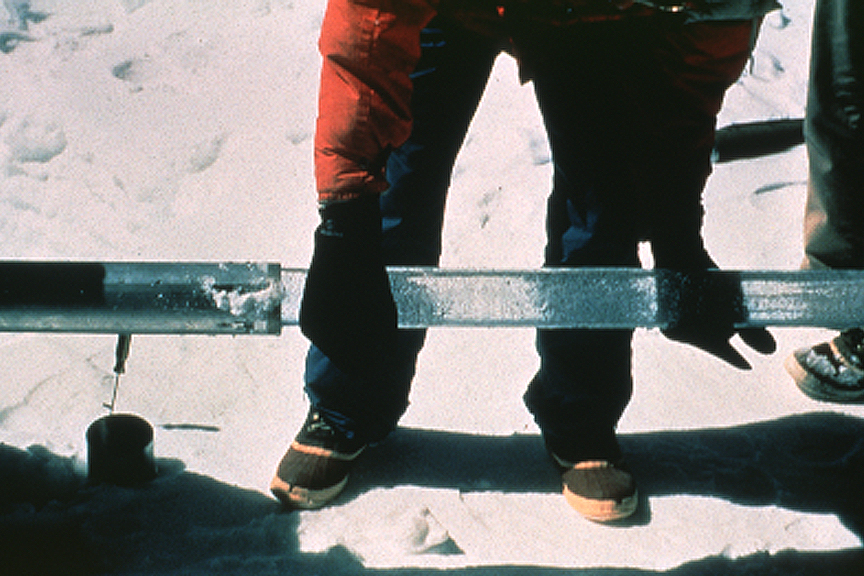
An ice core is a core sample that is typically removed from an ice sheet or a high mountain glacier. Since the ice forms from the incremental buildup of annual layers of snow, lower layers are older than upper ones, and an ice core contains ice formed over a range of years. Cores are drilled with hand augers (for shallow holes) or powered drills; they can reach depths of over two miles (3.2 km), and contain ice up to 800,000 years old. The physical properties of the ice and of material trapped in it can be used to reconstruct the climate over the age range of the core. The proportions of different oxygen and hydrogen isotopes provide information about ancient temperatures, and the air trapped in tiny bubbles can be analysed to determine the level of atmospheric gases such as carbon dioxide. Since heat flow in a large ice sheet is very slow, the borehole temperature is another indicator of temperature in the past. These data can be combined to find the climate m ... [...More Info...] [...Related Items...] OR: [Wikipedia] [Google] [Baidu] |
Ice Cap Climate
An ice cap climate is a polar climate where no mean monthly temperature exceeds . The climate covers areas in or near the high latitudes (65° latitude) to polar regions (70–90° north and south latitude), such as Antarctica, some of the northernmost islands of Canada and Russia, Greenland, along with some regions and islands of Norway's Svalbard Archipelago that have vast deserts of snow and ice. Areas with ice cap climates are normally covered by a permanent layer of ice and have no vegetation. There is limited animal life in most ice cap climates, usually found near the oceanic margins. Although ice cap climates are inhospitable to human life, there are some small research stations scattered in Antarctica and interior Greenland. Description Under the Köppen climate classification, the ice cap climate is denoted as ''EF''. Ice caps are defined as a climate with no months above . Such areas are found around the north and south pole, and on the top of many high mountains. Si ... [...More Info...] [...Related Items...] OR: [Wikipedia] [Google] [Baidu] |
Iceberg
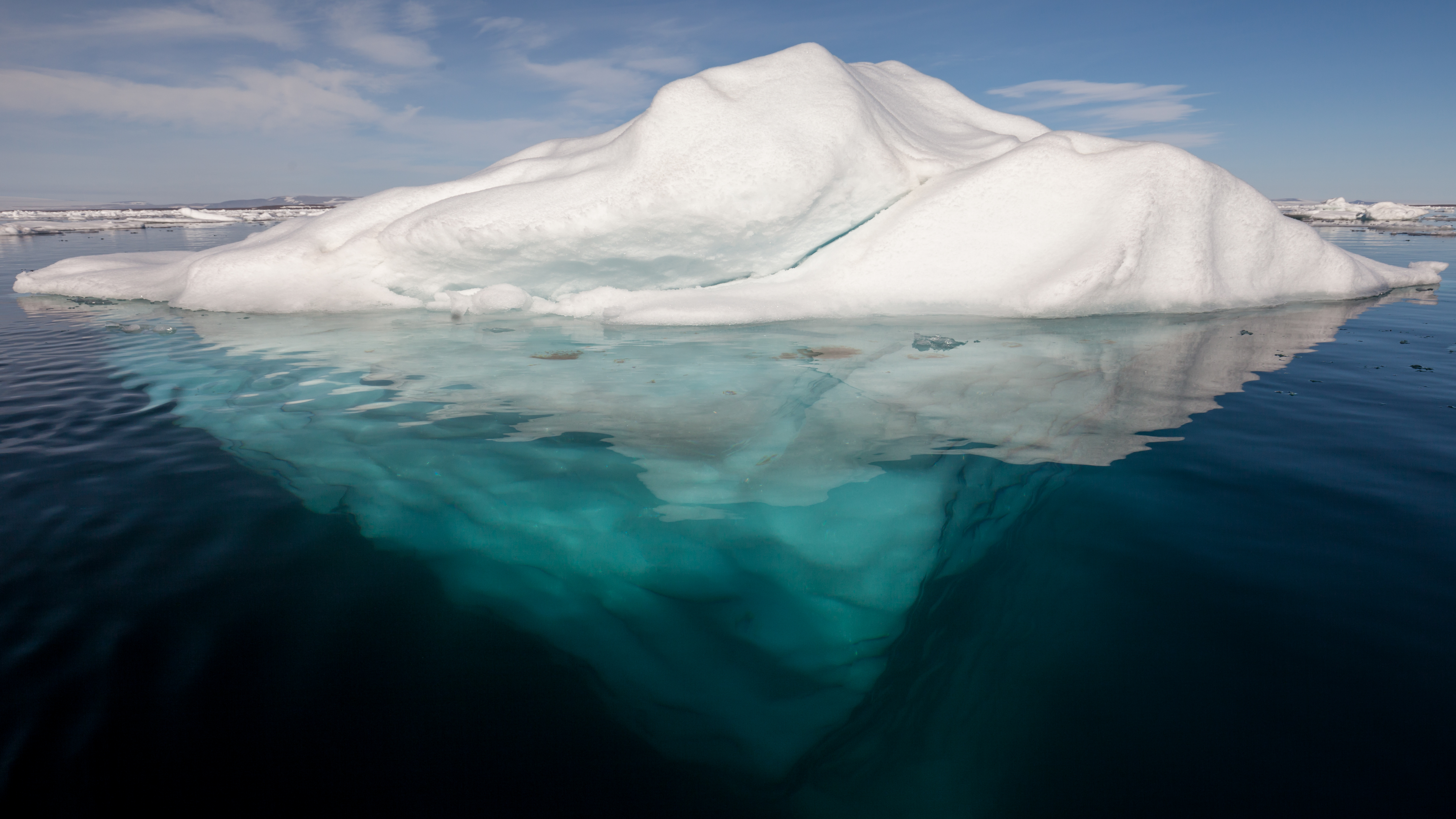
An iceberg is a piece of freshwater ice more than 15 m long that has broken off a glacier or an ice shelf and is floating freely in open (salt) water. Smaller chunks of floating glacially-derived ice are called "growlers" or "bergy bits". The sinking of the ''Titanic'' in 1912 led to the formation of the International Ice Patrol in 1914. Much of an iceberg is below the surface, which led to the expression " tip of the iceberg" to illustrate a small part of a larger unseen issue. Icebergs are considered a serious maritime hazard. Icebergs vary considerably in size and shape. Icebergs that calve from glaciers in Greenland are often irregularly shaped while Antarctic ice shelves often produce large tabular (table top) icebergs. The largest iceberg in recent history (2000), named B-15, measured nearly 300 km × 40 km. The largest iceberg on record was an Antarctic tabular iceberg of over [] sighted west of Scott Island, in the South Pacific Ocean, by the USS Glacie ... [...More Info...] [...Related Items...] OR: [Wikipedia] [Google] [Baidu] |
Glacier
A glacier (; ) is a persistent body of dense ice that is constantly moving under its own weight. A glacier forms where the accumulation of snow exceeds its ablation over many years, often centuries. It acquires distinguishing features, such as crevasses and seracs, as it slowly flows and deforms under stresses induced by its weight. As it moves, it abrades rock and debris from its substrate to create landforms such as cirques, moraines, or fjords. Although a glacier may flow into a body of water, it forms only on land and is distinct from the much thinner sea ice and lake ice that form on the surface of bodies of water. On Earth, 99% of glacial ice is contained within vast ice sheets (also known as "continental glaciers") in the polar regions, but glaciers may be found in mountain ranges on every continent other than the Australian mainland, including Oceania's high-latitude oceanic island countries such as New Zealand. Between latitudes 35°N and 35°S, glaciers occur ... [...More Info...] [...Related Items...] OR: [Wikipedia] [Google] [Baidu] |
Norwegian Polar Institute
The Norwegian Polar Institute (NPI; no, Norsk Polarinstitutt) is Norway's central governmental institution for scientific research, mapping and environmental monitoring in the Arctic and the Antarctic. The NPI is a directorate under Norway's Ministry of Climate and Environment. The institute advises Norwegian authorities on matters concerning polar environmental management and is the official environmental management body for Norwegian activities in Antarctica. Activities The institute's activities are focused on environmental research and management in the polar regions. The NPI's researchers investigate biodiversity, climate and environmental toxins in the Arctic and Antarctic, and in this context the institute equips and organizes large-scale expeditions to both polar regions. The institute contributes to national and international climate work, and is an active contact point for the international scientific community. The institute collects and analyses data on the environ ... [...More Info...] [...Related Items...] OR: [Wikipedia] [Google] [Baidu] |
Svalbard
Svalbard ( , ), also known as Spitsbergen, or Spitzbergen, is a Norwegian archipelago in the Arctic Ocean. North of mainland Europe, it is about midway between the northern coast of Norway and the North Pole. The islands of the group range from 74° to 81° north latitude, and from 10° to 35° east longitude. The largest island is Spitsbergen, followed by Nordaustlandet and . The largest settlement is Longyearbyen. The islands were first used as a base by the whalers who sailed far north in the 17th and 18th centuries, after which they were abandoned. Coal mining started at the beginning of the 20th century, and several permanent communities were established. The Svalbard Treaty of 1920 recognizes Norwegian sovereignty, and the 1925 Svalbard Act made Svalbard a full part of the Kingdom of Norway. They also established Svalbard as a free economic zone and a demilitarized zone. The Norwegian Store Norske and the Russian remain the only mining companies in plac ... [...More Info...] [...Related Items...] OR: [Wikipedia] [Google] [Baidu] |
Biscayarfonna
Biscayarfonna (''Biscay glacier'' in Nynorsk) is an ice cap in Spitsbergen, Svalbard. It has an elevation of , and is located on the Haakon VII Land peninsula between Raudfjorden in the west and Breibogen bay in the east. This ice cap is named after Biscay in honour of the Basque whalers who hunted at Spitsbergen in the 17th and 18th centuries. See also *List of glaciers in Svalbard This is a list of glaciers in Svalbard. It includes glaciers and ice caps in Svalbard, Norway. List of glaciers and ice caps Ice caps *Austfonna *Biscayarfonna * Glitnefonna * Lomonosovfonna * Løvenskioldfonna * Valhallfonna * Vegafonna *Vestf ... References External linksKayaking by Glaciers in Svalbard Glaciers of Spitsbergen {{Spitsbergen-glacier-stub ... [...More Info...] [...Related Items...] OR: [Wikipedia] [Google] [Baidu] |
Polar Ice Cap
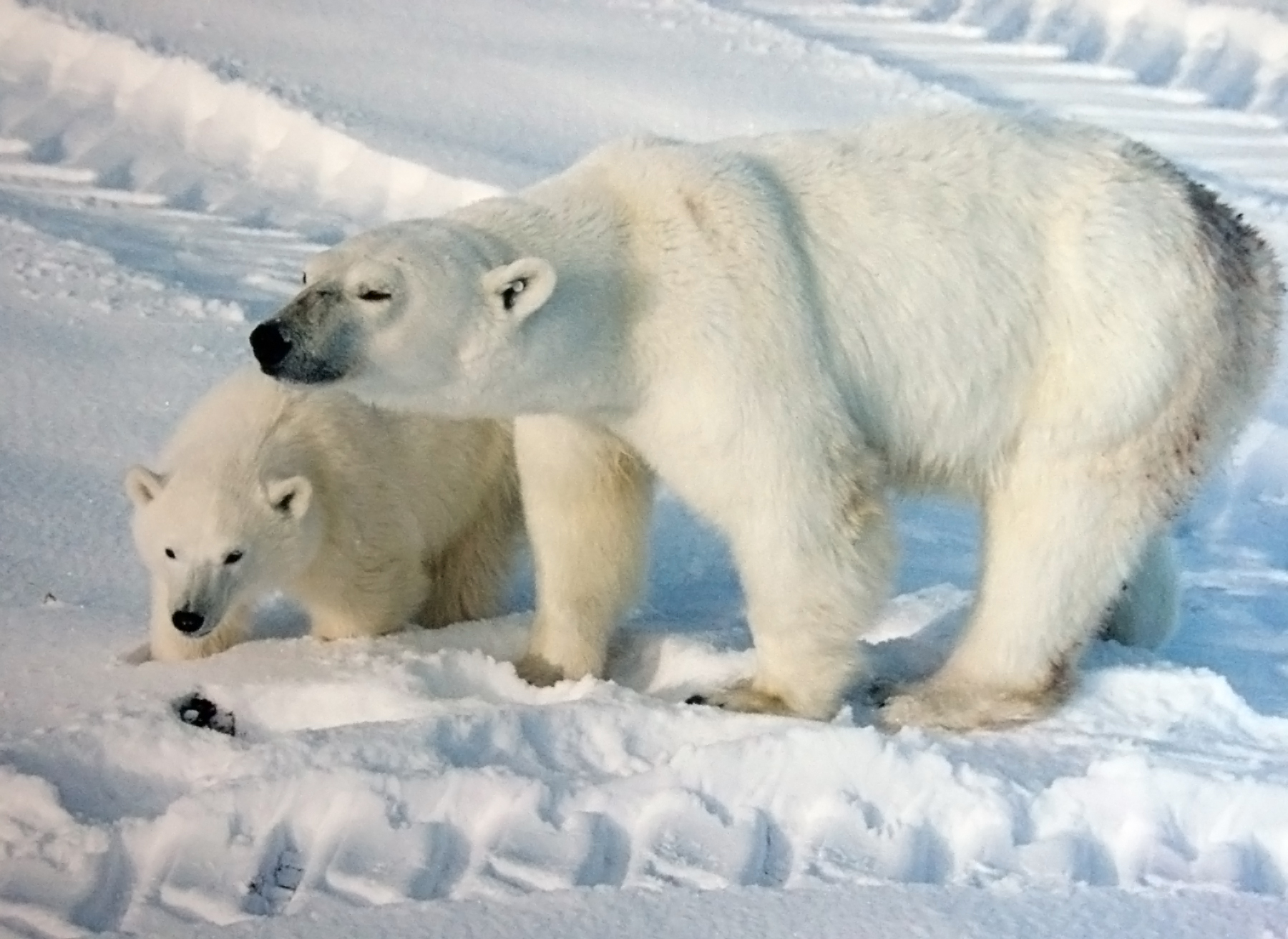
A polar ice cap or polar cap is a high-latitude region of a planet, dwarf planet, or natural satellite that is covered in ice. There are no requirements with respect to size or composition for a body of ice to be termed a polar ice cap, nor any geological requirement for it to be over land, but only that it must be a body of solid phase matter in the polar region. This causes the term "polar ice cap" to be something of a misnomer, as the term ice cap itself is applied more narrowly to bodies that are over land, and cover less than 50,000 km2: larger bodies are referred to as ice sheets. The composition of the ice will vary. For example, Earth's polar caps are mainly water ice, whereas Mars's polar ice caps are a mixture of solid carbon dioxide and water ice. Polar ice caps form because high-latitude regions receive less energy in the form of solar radiation from the Sun than equatorial regions, resulting in lower surface temperatures. Earth's polar caps have chan ... [...More Info...] [...Related Items...] OR: [Wikipedia] [Google] [Baidu] |


