|
Yazidism In Turkey
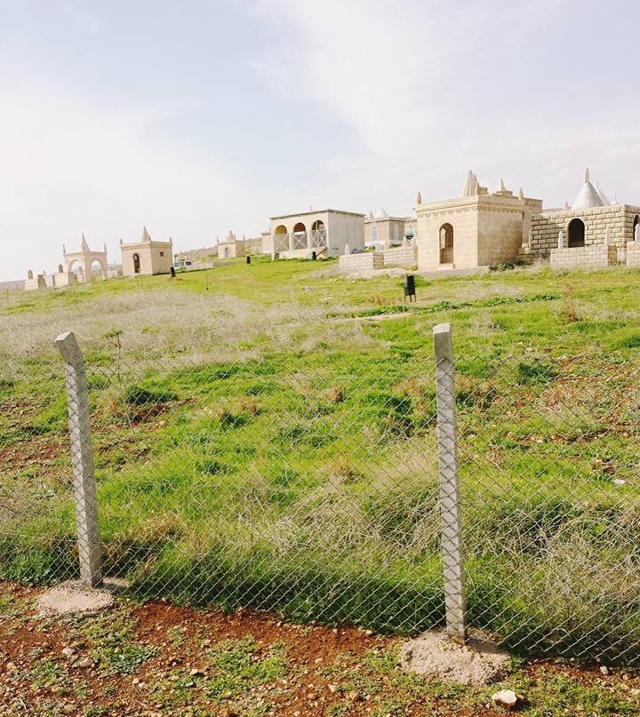
Yazidism in Turkey refers to adherents of Yazidism from Turkey, who remained in Turkey after the dissolution of the Ottoman Empire. The Yazidis living in Turkey during and after the second half of the 20th century gradually left for European countries. In the 1980s, there were 60,000 Yazidis situated in Beşiri, Kurtalan, Bismil, Midyat, İdil, Idil, Cizre, Nusaybin, Viranşehir, Suruç and Bozova. Today, these places are almost empty due to exodus to Europe which was provoked by political, religious and economic difficulties. Today only small number remain in villages around Midyat, Viranşehir, Çınar, Diyarbakır, Çınar and Beşiri. According to the census of 2000, only 423 individuals adhering to Yazidism remained in the country. Demography According to the Society for Threatened Peoples, 300,000 Yazidis originally lived in Turkey. In the 1980s, the number of Yazidis in Turkey was around 60,000. In 1993, the number was estimated to be 24,309. In 2003, the United States ... [...More Info...] [...Related Items...] OR: [Wikipedia] [Google] [Baidu] |
United States Department Of State
The United States Department of State (DOS), or simply the State Department, is an United States federal executive departments, executive department of the U.S. federal government responsible for the country's foreign policy of the United States, foreign policy and foreign relations of the United States, relations. Equivalent to the ministry of foreign affairs of other nations, its primary duties are advising the U.S. president on international relations, administering List of diplomatic missions of the United States, diplomatic missions, negotiating international treaties and agreements, protecting citizens abroad and representing the U.S. at the United Nations. The department is headquartered in the Harry S Truman Building, a few blocks from the White House, in the Foggy Bottom, Washington, D.C., Foggy Bottom neighborhood of Washington, D.C.; "Foggy Bottom" is thus sometimes used as a metonym. Established in 1789 as the first administrative arm of the U.S. executive branch, th ... [...More Info...] [...Related Items...] OR: [Wikipedia] [Google] [Baidu] |
Şanlıurfa Province
Şanlıurfa Province (; ), also known as Urfa Province, is a Provinces of Turkey, province and Metropolitan municipalities in Turkey, metropolitan municipality in southeastern Turkey. The city of Şanlıurfa is the capital of the province which bears its name. Its area is 19,242 km2, and its population is 2,170,110 (2022). The province is considered part of Turkish Kurdistan and has a Kurds, Kurdish majority with a significant Arabs, Arab and Turkish people, Turkish minority. Districts Şanlıurfa province is divided into 13 Districts of Turkey, districts, listed below with their populations as at 31 December 2022 according to the official government estimates: * Akçakale (123,721) * Birecik (93,613) * Bozova (52,680) * Ceylanpınar (90,440) * Eyyübiye (391,795) * Halfeti (41,662) * Haliliye (396,656) * Harran (96,072) * Hilvan (42,218) * Karaköprü (265,035) * Siverek (267,942) * Suruç (100,961) * Viranşehir (207,315) Geography With an area of , it is the larg ... [...More Info...] [...Related Items...] OR: [Wikipedia] [Google] [Baidu] |
Diyarbakır Province
Diyarbakır Province (; ; ) is a province and metropolitan municipality in southeastern Turkey. Its area is 15,101 km2, and its population is 1,804,880 (2022). The provincial capital is the city of Diyarbakır. The Kurdish majority province is part of Turkish Kurdistan. History It has been home to many civilisations and the surrounding area including itself is home to many Mesolithic era stone carvings and artifacts. The province has been ruled by the Akkadians, Hurrians, Mittani, Medes, Hittites, Armenians, Arameans, Neo-Babylonians, Achaemenids, Greeks, Romans, Parthians, Byzantium, Sassanids, Arabs, Seljuk Empire, Mongol Empire, Safavid dynasty, Marwanids, and Ayyubids. Administrative history In June 1927, the Law 1164 was passed allowing the creation of Inspectorates-General ( Turkish: ''Umumi Müffetişlik''). The Diyarbakır province was therefore included in the First Inspectorate General (), which was created on the 1 January 1928 and also included Ha ... [...More Info...] [...Related Items...] OR: [Wikipedia] [Google] [Baidu] |
Sur, Diyarbakır
Sur is a municipality and district of Diyarbakır Province, Turkey. Its area is 1,227 km2, and its population is 100,613 (2022). It covers the eastern part of the city of Diyarbakır and the adjacent countryside. The historical Diyarbakır Fortress lies in this district, which takes its name from the castle walls (). Background Sur district was created in 2008 from part of the central district (''Merkez'') of Diyarbakır. It is situated at the Tigris bank, on the felsic lava of the shield volcano Karaca Dağ at an elevation of above mean sea level. Many historic buildings and structures in the district are witness of several civilizations and rich cultures, which were hosted in the location in the history. The background of Sur goes back to 7500 BC. Archaeological excavations showed that world's oldest settlement was located in the region. Civilizations ruled here are Hurrians (Bronze Age), Mitanni (c. 1500 BC–c. 1300 BC), Hittites (c. 1600 BC–c. 1178 BC), Assur (earl ... [...More Info...] [...Related Items...] OR: [Wikipedia] [Google] [Baidu] |
Şırnak Province
Şırnak Province (, ) is a Provinces of Turkey, province in Turkey in the Southeastern Anatolia Region. Şırnak Province was created in 1990, with areas that were formerly part of the Siirt Province, Siirt, Hakkâri Province, Hakkâri and Mardin Provinces. It borders both Kurdistan Region of Iraq and Syria. The current Wāli, Governor of the province is Cevdet Atay. The province had a population of 570,745 in 2023. Its area is 7,078 km2. It encompasses 19 Belde, municipalities, 240 villages and 192 Hamlet (place), hamlets. Considered part of Turkish Kurdistan, the province has a Kurds, Kurdish majority. Geography Şırnak Province has some mountainous regions in the west and the south, but the majority of the province consists of plateaus, resulting from the many rivers that cross it. These include the Tigris (and its tributaries Hezil and Kızılsu) and Çağlayan (river), Çağlayan. The most important mountains are Mount Cudi (2089 m), Mount Gabar, Mount Namaz and Moun ... [...More Info...] [...Related Items...] OR: [Wikipedia] [Google] [Baidu] |
Batman Province
Batman Province (, ; ) is a province in Turkey. It was created in May 1990 with the Law No. 3647 taking some parts from the eastern Province of Siirt and some from the southern Province of Mardin. Its area is 4,477 km2, and its population is 634,491 (2022). Its current governor is Ekrem Canalp. The province is considered part of Turkish Kurdistan and has a Kurdish majority. History The Batman Province contains the strategic Tigris river with fertile lands by its sides, as well as rocky hills with numerous caves providing a natural shelter. Therefore, it was inhabited from prehistoric times, likely from the Neolithic (Paleolithic) period, according to archeological evidence. First documented evidence of settlements in the province dates back to 7th century BC. An artificial "island" was created in this marshy area. It was named ''Elekhan'', and had an independent status for 194 years from 546 BC till the invasion of Alexander the Great in 334 BC. The Batman Province was a ... [...More Info...] [...Related Items...] OR: [Wikipedia] [Google] [Baidu] |
Batman, Turkey
Batman (; ) is a city and capital of Batman District in Batman Province, Turkey. It lies on a plateau, above sea level, near the confluence of the Batman River and the Tigris and had a population of 452,157 in 2021. It is populated by Kurds. The Batı Raman oil field, which is the largest oil field in Turkey, is located just outside the city. Batman has a local airport and a military airbase, which was used for transit of aircraft and helicopters in some search and rescue operations during the Gulf War. Until the 1950s, Batman was a village, with a population of about 3,000. However, oil fields were discovered around it in the 1940s that resulted in a rapid development of the area and in the inflow of workforce from other parts of Turkey. In 1957, the village was renamed Batman, after the river namesake, received a city status and became a district center. Over the next 50 years, a significant amount of Batman's one-story buildings were rebuilt as multi-story buildings. As a r ... [...More Info...] [...Related Items...] OR: [Wikipedia] [Google] [Baidu] |
Mardin Province
Mardin Province (; ; ; ) is a province and metropolitan municipality in Turkey. Its area is 8,780 km2, and its population is 870,374 (2022). The largest city in the province is Kızıltepe, while the capital Mardin is the second largest city. Districts Mardin Province is divided into 10 districts: * Artuklu * Dargeçit * Derik * Kızıltepe * Mazıdağı * Midyat * Nusaybin * Ömerli * Savur * Yeşilli Demographics Mardin Province is a linguistically, ethnically and religiously diverse province. The dominant ethnic groups are Arabs, Assyrians, and Kurds, of which Kurds constitute a majority. Other minor groups include Armenians, Chechens and Turks, while Jews lived in the area before migrating to Israel around 1948. The Chechens settled in the region during the Russo-Turkish War in 1877/1878. The distinctive Mhallami community also reside in the district. The province is considered part of Turkish Kurdistan. In 1990, it was estimated that Kurds const ... [...More Info...] [...Related Items...] OR: [Wikipedia] [Google] [Baidu] |


