|
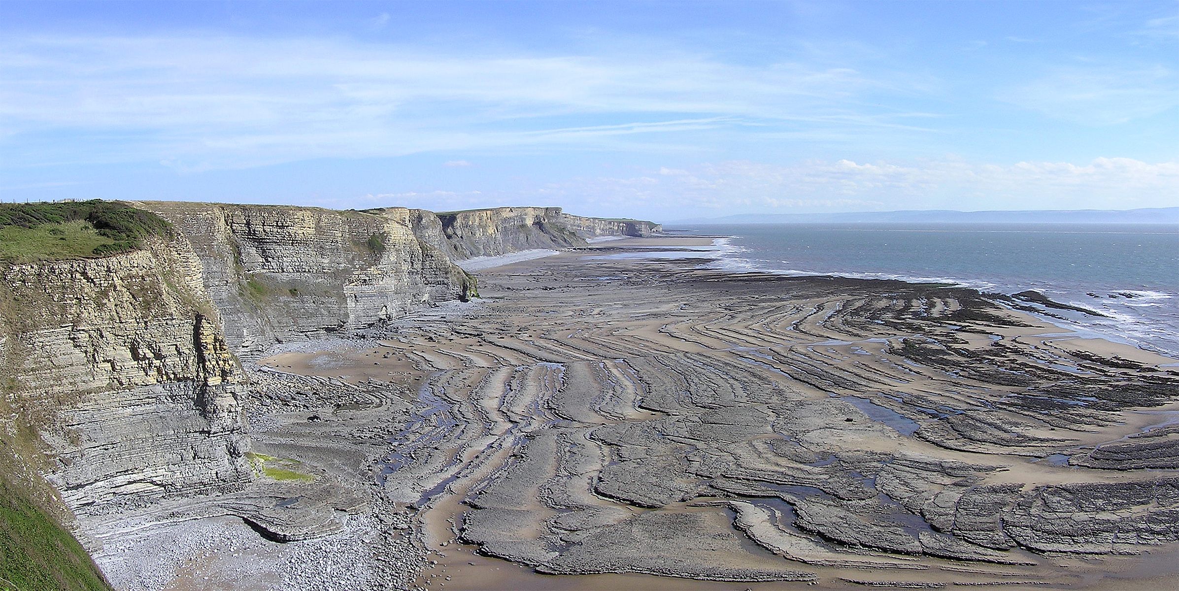
Wave-cut Platform
A wave-cut platform, shore platform, coastal bench, or wave-cut cliff is the narrow flat area often found at the base of a sea cliff or along the shoreline of a lake, bay, or sea that was created by erosion. Wave-cut platforms are often most obvious at low tide when they become visible as huge areas of flat rock. Sometimes the landward side of the platform is covered by sand, forming the beach, and then the platform can only be identified at low tides or when storms move the sand. __TOC__ Formation Wave-cut platforms form when destructive waves hit against the cliff face, causing an undercut between the high and low water marks, mainly as a result of abrasion, corrosion and hydraulic action, creating a wave-cut notch. This notch then enlarges into a cave. The waves undermine this portion until the roof of the cave cannot hold due to the pressure and freeze-thaw or biological weathering acting on it, and collapses, resulting in the cliff retreating landward. The base of the c ... [...More Info...] [...Related Items...] OR: [Wikipedia] [Google] [Baidu] |
Lake Bonneville
Lake Bonneville was the largest Late Pleistocene paleolake in the Great Basin of western North America. It was a pluvial lake that formed in response to an increase in precipitation and a decrease in evaporation as a result of cooler temperatures. The lake covered much of what is now western Utah and at its highest level extended into present-day Idaho and Nevada. Many other hydrographically closed basins in the Great Basin contained expanded lakes during the Late Pleistocene, including Lake Lahontan in northwestern Nevada. Geologic description Shorelines of Lake Bonneville are visible above Salt Lake City along the western front of the Wasatch Range, Wasatch Mountains and on other mountains throughout the Bonneville basin.Gilbert, G.K., 1890. Lake Bonneville. U.S. Geological Survey Monograph 1. 438 pp. These shorelines appear as shelves or benches that protrude from the mountainside above the valley floor, are visible on the ground from long distances and on satellite images, a ... [...More Info...] [...Related Items...] OR: [Wikipedia] [Google] [Baidu] |
Terrace (geology)
In geology, a terrace is a step-like landform. A terrace consists of a flat or gently sloping geomorphic surface, called a tread, that is typically bounded on one side by a steeper ascending slope, which is called a "riser" or "scarp". The tread and the steeper descending slope (riser or scarp) together constitute the terrace. Terraces can also consist of a tread bounded on all sides by a descending riser or scarp. A narrow terrace is often called a bench.Howard, A.D., R.W. Fairbridge, J.H. Quinn, 1968, "Terraces, Fluvial—Introduction", in R.W. Fairbridge, ed., ''The Encyclopedia of Geomorphology: Encyclopedia of Earth Science Series'', vol. 3. Reinhold Book Corporation. New York, New York.Jackson, J.A., 1997, ''Glossary of Geology''. American Geological Institute. Alexandria, Virginia. The sediments underlying the tread and riser of a terrace are also commonly, but incorrectly, called terraces, leading to confusion. Terraces are formed in various ways. Fluvial terraces ... [...More Info...] [...Related Items...] OR: [Wikipedia] [Google] [Baidu] |
Strandflat
Strandflat ( no , strandflate) is a landform typical of the Norwegian coast consisting of a flattish erosion surface on the coast and near-coast seabed. In Norway, strandflats provide room for settlements and agriculture, constituting important cultural landscapes. The shallow and protected waters of strandflats are valued fishing grounds that provide sustenance to traditional fishing settlements. Outside Norway proper, strandflats can be found in other high-latitude areas, such as Antarctica, Alaska, the Canadian Arctic, the Russian Far North, Greenland, Svalbard, Sweden and Scotland. The strandflats are usually bounded on the landward side by a sharp break in slope, leading to mountainous terrain or high plateaux. On the seaward side, strandflats end at submarine slopes. The bedrock surface of strandflats is uneven and tilts gently towards the sea. The concept of a strandflat was introduced in 1894 by Norwegian geologist Hans Reusch. Norwegian strandflat Characteristics ... [...More Info...] [...Related Items...] OR: [Wikipedia] [Google] [Baidu] |
Raised Shorelines
A raised shoreline is an ancient shoreline exposed above current water level. These landforms are formed by a relative change in sea level due to global sea level rise, isostatic rebound, and/or tectonic uplift. These surfaces are usually exposed above modern sea level when a heavily glaciated area experiences a glacial retreat, causing water levels to rise. This area will then experience post-glacial rebound, effectively raising the shoreline surface. Examples of raised shorelines can be found along the coasts of formerly glaciated areas in Ireland and Scotland, as well as in North America. Raised shorelines are exposed at various locations around the Puget Sound of Washington State. See also * Isostasy * Landform * Machair * Marine terrace * Parallel Roads of Glen Roy * Raised beach * Terrace (geology) * Wave-cut platform A wave-cut platform, shore platform, coastal bench, or wave-cut cliff is the narrow flat area often found at the base of a sea cliff or along the sho ... [...More Info...] [...Related Items...] OR: [Wikipedia] [Google] [Baidu] |
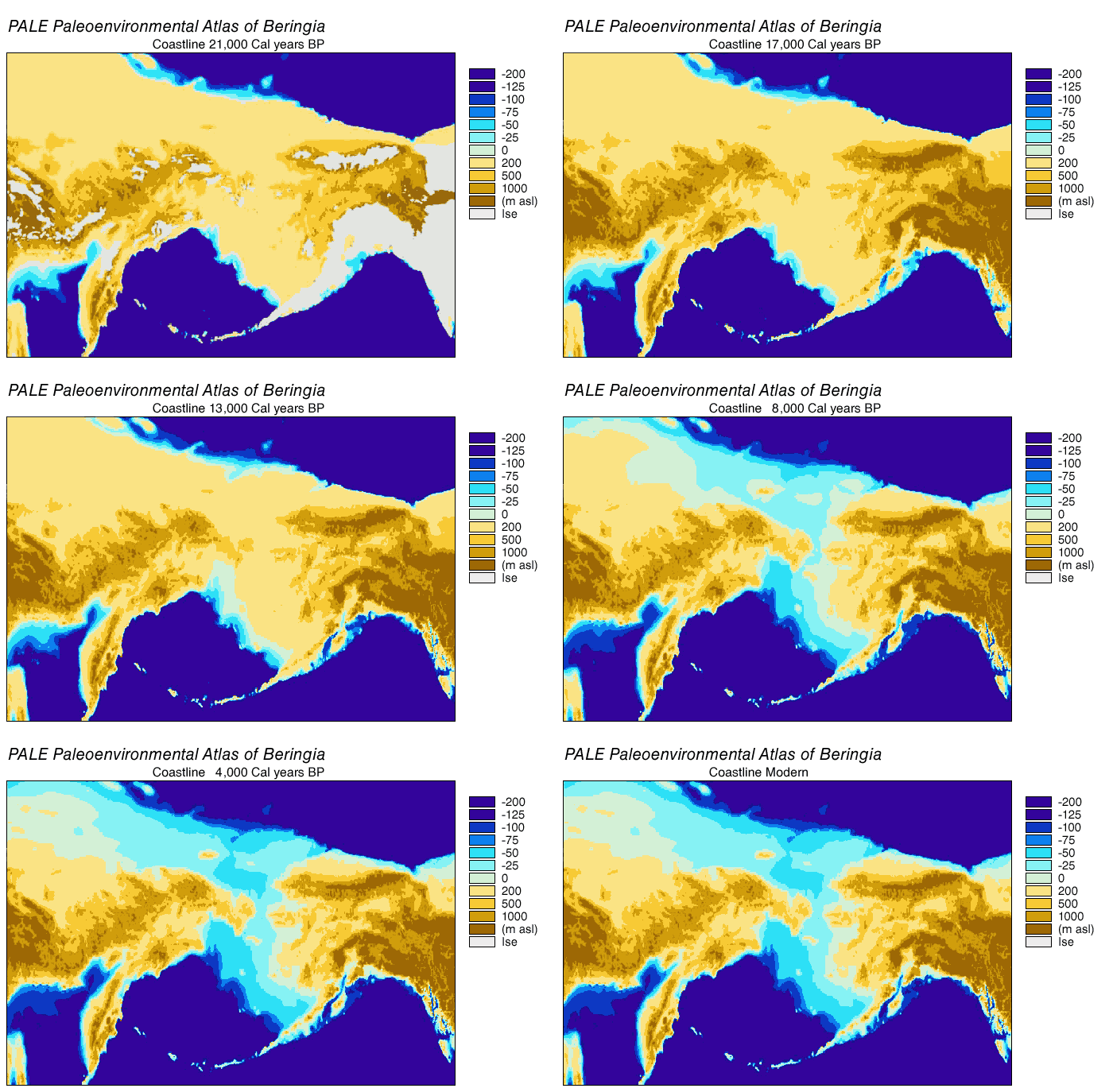
Paleoshoreline
A paleoshoreline (ancient shoreline) is a shoreline which existed in the geologic past. (''Paleo'' is from an ancient Greek word meaning "old" or "ancient".) A perched coastline is an ancient (fossil) shoreline positioned above the present shoreline. Tides cause the ocean to advance and recede in a very short time scale, in most places about twice per day; weather conditions can also cause short-term variations. Coastlines can also move due to coastal erosion, without a change in sea level. But "sea level" refers to the average level over a relatively long period (years). This average sea level can advance and recede over much longer periods (thousands or millions of years), causing paleoshorelines which may be difficult to identify. Just off the coast of parts of North America, in the last 15,000 years sea level has varied from over below, to as high as above its present level. That entire time, humans have lived in North America. A lake may also have a paleoshoreline. Pal ... [...More Info...] [...Related Items...] OR: [Wikipedia] [Google] [Baidu] |
Marine Terrace
A raised beach, coastal terrace,Pinter, N (2010): 'Coastal Terraces, Sealevel, and Active Tectonics' (educational exercise), from [02/04/2011] or perched coastline is a relatively flat, horizontal or gently inclined surface of marine origin,Pirazzoli, PA (2005a): 'Marine Terraces', in Schwartz, ML (ed) ''Encyclopedia of Coastal Science.'' Springer, Dordrecht, pp. 632–633 mostly an old abrasion platform which has been lifted out of the sphere of wave activity (sometimes called "tread"). Thus, it lies above or under the current sea level, depending on the time of its formation.Strahler AH; Strahler AN (2005): ''Physische Geographie.'' Ulmer, Stuttgart, 686 p.Leser, H (ed)(2005): ‚''Wörterbuch Allgemeine Geographie.'' Westermann&Deutscher Taschenbuch Verlag, Braunschweig, 1119 p. It is bounded by a steeper ascending slope on the landward side and a steeper descending slope on the seaward side (sometimes called "riser"). Due to its generally flat shape, it is often used for Anthr ... [...More Info...] [...Related Items...] OR: [Wikipedia] [Google] [Baidu] |
Machair (geography)
A machair (; sometimes machar in English) is a fertile low-lying grassy plain found on part of the northwest coastlines of Ireland and Scotland, in particular the Outer Hebrides. The best examples are found on North and South Uist, Harris and Lewis. Etymology ''Machair'' is a Gaelic word meaning "fertile plain", but the word is now also used in scientific literature to describe the dune grassland unique to Western Scotland and north-west Ireland. It had been used by naturalists since 1926, but the term was not adopted by scientists until the 1940s. The word is used in a number of placenames in Ireland and Scotland, even in areas where no machair has ever been supported. In Scotland, some Gaelic speakers use ''machair'' as a general term for the whole dune system, including the dune ridge, while others restrict its use to the extensive flat grasslands inland of the dune ridge. In Ireland, the word has been used only in place-names, and the habitat's existence there was only rec ... [...More Info...] [...Related Items...] OR: [Wikipedia] [Google] [Baidu] |
Bench (geology)
In geomorphology, geography and geology, a bench or benchland is a long, relatively narrow strip of relatively level or gently inclined land that is bounded by distinctly steeper slopes above and below it. Benches can be of different origins and created by very different geomorphic processes.Jackson, J.A., 1997, ''Glossary of Geology.'' American Geological Institute. Alexandria, Virginia. First, the differential erosion of rocks or sediments of varying hardness and resistance to erosion can create benches. Earth scientists called such benches "structural benches." Second, other benches are narrow fluvial terraces created by the abandonment of a floodplain by a river or stream and entrenchment of the river valley into it. Finally, a bench is also the name of a narrow flat area often seen at the base of a sea cliff that was created by waves or other physical or chemical erosion near the shoreline. These benches are typically referred to as either "coastal benches," "wave-cut benche ... [...More Info...] [...Related Items...] OR: [Wikipedia] [Google] [Baidu] |
Beach
A beach is a landform alongside a body of water which consists of loose particles. The particles composing a beach are typically made from rock, such as sand, gravel, shingle, pebbles, etc., or biological sources, such as mollusc shells or coralline algae. Sediments settle in different densities and structures, depending on the local wave action and weather, creating different textures, colors and gradients or layers of material. Though some beaches form on inland freshwater locations such as lakes and rivers, most beaches are in coastal areas where wave or current action deposits and reworks sediments. Erosion and changing of beach geologies happens through natural processes, like wave action and extreme weather events. Where wind conditions are correct, beaches can be backed by coastal dunes which offer protection and regeneration for the beach. However, these natural forces have become more extreme due to climate change, permanently altering beaches at very ... [...More Info...] [...Related Items...] OR: [Wikipedia] [Google] [Baidu] |
Tedbury Camp
Tedbury Camp is a multivallate Iron Age promontory hill fort defended by two parallel banks near Great Elm, Somerset, England. Background Hill forts developed in the Late Bronze and Early Iron Age, roughly the start of the first millennium BC. The reason for their emergence in Britain, and their purpose, has been a subject of debate. It has been argued that they could have been military sites constructed in response to invasion from continental Europe, sites built by invaders, or a military reaction to social tensions caused by an increasing population and consequent pressure on agriculture. The dominant view since the 1960s has been that the increasing use of iron led to social changes in Britain. Deposits of iron ore were located in different places to the tin and copper ore necessary to make bronze, and as a result trading patterns shifted and the old elites lost their economic and social status. Power passed into the hands of a new group of people. Archaeologist Barry ... [...More Info...] [...Related Items...] OR: [Wikipedia] [Google] [Baidu] |
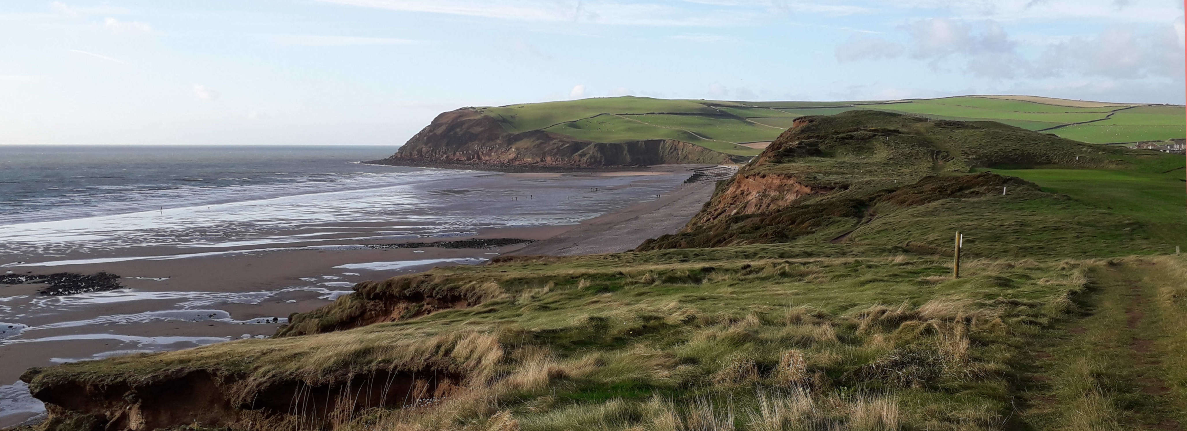
St Bees Head
St Bees Head is a headland on the North West coast of the English county of Cumbria and is named after the nearby village of St Bees. It is the only stretch of Heritage Coast on the English coastline between the Welsh and Scottish borders, and is a Site of Special Scientific Interest. The sea off the Head is protected as part of the Cumbria Coast, Cumbria Coast Marine Conservation Zone. It lies on two long-distance footpaths, the Cumbria Coastal Way and Alfred Wainwright's Coast to Coast Walk. Both long-distance footpaths follow the edge of the cliffs, which rise to 90 metres above sea level and have views of the Cumbrian mountains and coast. North Head The true geographical head is the North Head, which is the most westerly point of Northern England and is the site of St Bees Lighthouse. During WW2 a radar station was operated from here, and some of the buildings can still be seen adjacent to the lighthouse. The foghorn building is to the west of the lighthouse, but is now d ... [...More Info...] [...Related Items...] OR: [Wikipedia] [Google] [Baidu] |


