|
Warragul
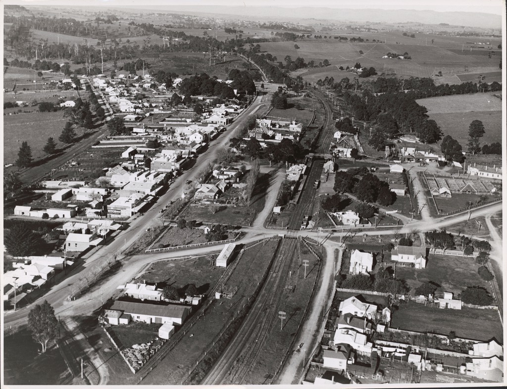
Warragul is a town in Victoria, Australia, south-east of Melbourne. Warragul lies between the Strzelecki Ranges to the south and the Mount Baw Baw Plateau of the Great Dividing Range to the north. As of the , the town had a population of 19,856 people. Warragul forms part of a larger urban area that includes nearby Drouin that had an estimated total population of 42,827 as of the . Warragul is the main population and service centre of the West Gippsland region and the Shire of Baw Baw. The surrounding area is noted for dairy farming and other niche agriculture and has long been producing gourmet foods. Naming Warragul (or warrigal, worrigle, warragal) is a New South Wales Indigenous word from the Darug language meaning ''wild dog'' or ''dingo''. The town name is accepted to mean ''wild dog'' and various businesses in the town use the words 'Wild Dog' in their name. However, the word was recorded as being used by settlers of Gippsland in the 1840s and 1850s to mean ''wild Abo ... [...More Info...] [...Related Items...] OR: [Wikipedia] [Google] [Baidu] |
Warragul Railway Station
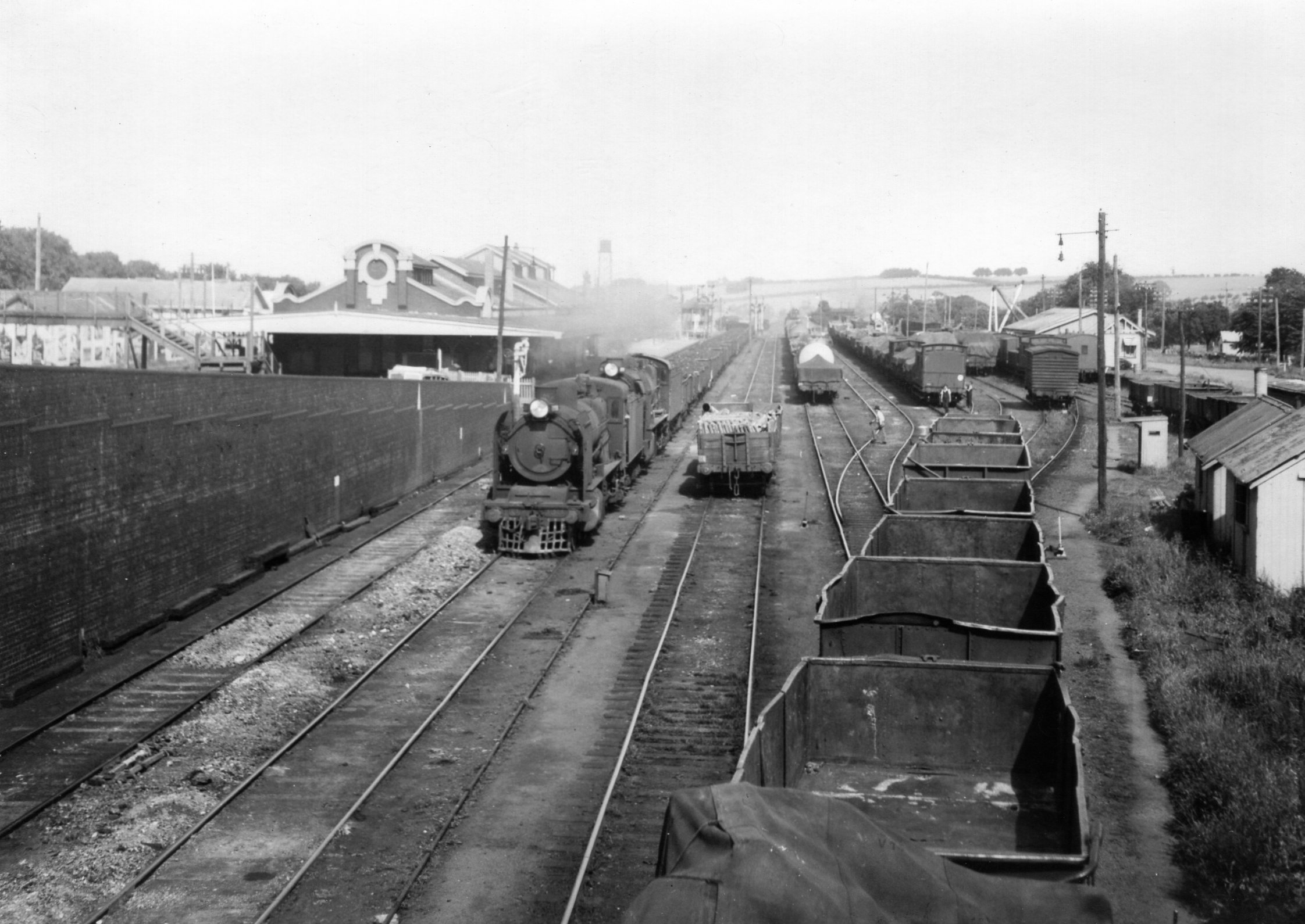
Warragul railway station is located on the Gippsland line in Victoria, Australia. It serves the town of Warragul, and it opened on 1 March 1878 as Warrigal. It was renamed Warragul on 1 May 1879. It was the junction station for the branch line to Neerim South and Noojee, which closed in 1958. The line between Pakenham and Warragul was duplicated in various stages between 1952 and 1956, and was electrified in 1954. Two years earlier, in 1952, the line to Yarragon was duplicated, and in 1955, electrification was extended to Moe. Starting from 15 February 1987, and lasting until December 1998, the station was the terminus of a number of The Met/ PTC electric passenger services from Flinders Street. The line was de-electrified beyond Warragul on 28 June 1987, and the overhead support structures were removed in 2005/2006, as part of the Regional Fast Rail project. The former "A" siding was abolished in 1988, along with alterations to the points, signals and levers. Also durin ... [...More Info...] [...Related Items...] OR: [Wikipedia] [Google] [Baidu] |
Drouin, Victoria
Drouin is a town in the West Gippsland region, east of Melbourne, in the Australian state of Victoria. Its local government area is the Shire of Baw Baw, and is home to the shire council’s headquarters despite being the second-largest town in the shire, behind neighbouring Warragul. The town’s name is believed to be an Aboriginal word meaning "north wind". New housing developments have accelerated the town's residential growth in recent years. As at the , Drouin had a population of people. History Settlement in this part of Gippsland was rather delayed due to the dense forest. Pastoral runs were taken up but little developed. In 1867, a coaching station was established on the track into Gippsland at Brandy Creek, about north-east of present Drouin. By the early 1870s, a small settlement had developed and land was being selected in the area. A post office opened on 5 April 1876, later renamed to Jindivick in 1878. Between 1877 and 1879, the Gippsland railway line was co ... [...More Info...] [...Related Items...] OR: [Wikipedia] [Google] [Baidu] |
Shire Of Baw Baw
The Shire of Baw Baw is a local government area in Victoria, Australia, in the eastern part of the state. It covers an area of and in June 2018 had a population of 52,015. It includes the towns of Drouin, Longwarry, Neerim South, Trafalgar, Warragul and Yarragon. It was formed in 1994 from the amalgamation of the Shire of Buln Buln, Shire of Narracan, Rural City of Warragul, and some parts of the Shire of Upper Yarra. The shire is governed and administered by the Baw Baw Shire Council; its seat of local government and administrative centre is located at the council headquarters in Drouin, and it has a service centre located in Warragul. The shire is named after the major geographical feature in the region, the Baw Baw Plateau with Mount Baw Baw being the second highest peak in the region. An unincorporated area, the Mount Baw Baw Alpine Resort, is enclaved within the shire. Location and geography The more densely populated southern half of the shire consists of low rolling h ... [...More Info...] [...Related Items...] OR: [Wikipedia] [Google] [Baidu] |
Gippsland Railway Line
The Gippsland line (also known as the Orbost railway line) is a railway line serving the Latrobe Valley and Gippsland regions of Victoria (Australia), Victoria, Australia. It runs east from the state capital Melbourne through the cities of Moe, Victoria, Moe, Morwell, Victoria, Morwell, Traralgon, Victoria, Traralgon, Sale, Victoria, Sale and terminating at Bairnsdale, Victoria, Bairnsdale. Prior to its dismantling in 1994, the line extended to Orbost, Victoria, Orbost. The dismantled section now comprises the East Gippsland Rail Trail, a shared bicycle, walking, and horseriding track. Services Metro Trains Melbourne operates suburban passenger services along the inner section of the line as the Pakenham railway line, Pakenham line, while V/Line services operate as the Traralgon V/Line rail service, Traralgon and the Bairnsdale V/Line rail service, Bairnsdale lines. Freight services also use the line, operated by Qube Holdings. History Rail lines were built to Gippsland ... [...More Info...] [...Related Items...] OR: [Wikipedia] [Google] [Baidu] |
Neerim South
Neerim South is a town in West Gippsland, Victoria, Australia, located in the Shire of Baw Baw, east of Melbourne and north of Warragul. At the 2016 census, Neerim South had a population of 1,305. The Post Office opened on 1 February 1883. The town was connected to the Victorian Railways network with the opening of a branch line from the main Gippsland line at Warragul on 18 March 1892, later connecting to Noojee in 1919. The line closed in 1958. The Neerim South Court of Petty Sessions closed in 1968. Elementary education is provided by Neerim South Primary School Secondary education is provided at Neerim District Secondary College The town's main industry is service to the local farming community. It contains art galleries, a working Alpaca farm with an Alpaca product shop, cafés, restaurants, a pub and bed and breakfasts. Until 2008, the bakery still cooked bread in the wood-fired oven built in 1880. The area has numerous wineries, and is known for its blue cheese. ... [...More Info...] [...Related Items...] OR: [Wikipedia] [Google] [Baidu] |
Nilma, Victoria
Nilma is a locality in the West Gippsland region of Victoria, Australia located between Warragul and Darnum. The Post Office opened on 1 May 1886 as Bloomfield Railway Station, was renamed Nilma in 1909 and closed in 1979. The locality in conjunction with neighbouring township Darnum has an Australian Rules football team competing in the Ellinbank & District Football League The Ellinbank and District Football League is an Australian rules football and Netball League, based in the West Gippsland region of Victoria for smaller towns and villages in the regions of Baw Baw, South Gippsland and Cardinia. There are 11 .... References Towns in Victoria (Australia) Shire of Baw Baw {{Gippsland-geo-stub ... [...More Info...] [...Related Items...] OR: [Wikipedia] [Google] [Baidu] |
Rokeby, Victoria
Rokeby is a town in West Gippsland, Victoria, Australia. It is near the towns of Warragul and Neerim South, east of the state capital, Melbourne Melbourne ( ; Boonwurrung/Woiwurrung: ''Narrm'' or ''Naarm'') is the capital and most populous city of the Australian state of Victoria, and the second-most populous city in both Australia and Oceania. Its name generally refers to a met .... Rokeby Post Office opened on 20 May 1892 and closed in 1981. References External links Towns in Victoria (Australia) Shire of Baw Baw {{Gippsland-geo-stub ... [...More Info...] [...Related Items...] OR: [Wikipedia] [Google] [Baidu] |
Moe, Victoria
Moe ( ) is a town in the Latrobe Valley in the Gippsland region of Victoria, Australia. It is approximately east of the central business district of Melbourne, due south of the peak of Mount Baw Baw in the Great Dividing Range and features views of the Baw Baw Ranges to the north and Strzelecki Ranges to the south. At June 2018, Moe had an estimated urban population of 16,812 Estimated resident population, 30 June 2018. (including Newborough). The population has been slowly shrinking with an average annual rate of -0.1% year-on-year for the five years to 2018. It is administered by the Latrobe City Council. Moe was originally known as ''The Mowie'', then ''Little Moi''. The town's name is believed to derive from a Kurnai (local Indigenous) word meaning "swamp land". Moe is a navigation point and stopover for tourists en route to Erica, the historic goldfields township of Walhalla, the Walhalla Goldfields Railway and Mount Baw Baw. Lake Narracan is nearby, and Moe is home t ... [...More Info...] [...Related Items...] OR: [Wikipedia] [Google] [Baidu] |
Strzelecki Ranges
The Strzelecki Ranges (pronounced STREHZ leckee) is a set of low mountain ridges located in the West Gippsland and South Gippsland regions of the Australian state of Victoria. The Ranges are named after Paweł Edmund Strzelecki, a Polish explorer, who with the assistance of Charley Tarra the small party's Aboriginal guide, led an expedition through this region in 1840. They also form a biogeographic subregion of the South Eastern Highlands. "Land of the Lyrebird" is also a common alternative name for the Strzelecki Ranges based on a popular 1920s book. Geography The Strzelecki Ranges generally run east-west and extend for roughly 100 km. They are composed of deeply dissected sandstone and mudstone, rising from 300 to 500 metres, with the highest point at Mount Tassie being 740 metres. The north is bounded by the Latrobe River and the south by the coast dominated by Wilsons Promontory, Corner Inlet and the Ninety-Mile beach. The Strzelecki Ranges presents a diverse ran ... [...More Info...] [...Related Items...] OR: [Wikipedia] [Google] [Baidu] |
West Gippsland
West Gippsland, a region of Gippsland in Victoria, Australia, extends from the southeastern limits of metropolitan Melbourne and Western Port Bay in the west to the Latrobe Valley in the east, and is bounded by the Strzelecki Ranges to the south and the Mount Baw Baw Plateau in the Great Dividing Range to the north. Geography The western part of the region around Western Port Bay and the Bunyip River is mostly flat (much of it having been reclaimed from the drained Koo Wee Rup Swamp), while the eastern part consists of low rolling hills. To the north these hills become steeper as they merge into the Great Dividing Range. In the mountainous north around Noojee logging remains an important industry, while a small winter resort is located to the northeast at Mount Baw Baw. Further to the east are the small township of Erica and the historic gold mining town of Walhalla. Nature reserves in the region include Bunyip State Park, Mount Worth State Park and Baw Baw National Park. ... [...More Info...] [...Related Items...] OR: [Wikipedia] [Google] [Baidu] |
Electoral District Of Narracan
The electoral district of Narracan is an electoral district of the Victorian Legislative Assembly in Australia. It was first proclaimed in 1967 and has usually been held by the Liberal Party. The electorate covers the provincial Warragul-Drouin urban area, as well as many smaller rural towns in north west Gippsland Gippsland is a rural region that makes up the southeastern part of Victoria, Australia, mostly comprising the coastal plains to the rainward (southern) side of the Victorian Alps (the southernmost section of the Great Dividing Range). It covers .... The electoral district of Narracan is named after Narracan, a rural locality located in the narrow Narracan Creek Valley, 14km south of Moe. The word "Narracan" is believed to be derived from an Aboriginal word describing a crow. Members for Narracan Election results References External links Electorate profile: Narracan District, Victorian Electoral Commission Electoral districts of Victoria (Australia) ... [...More Info...] [...Related Items...] OR: [Wikipedia] [Google] [Baidu] |
Mount Baw Baw
Mount Baw Baw is a mountain summit on the Baw-Baw Plateau of the Great Dividing Range, located in Victoria, Australia. The name is from the Woiwurrung language spoken by Eastern Kulin people. It is of uncertain meaning, but possibly signifies, ''echo'', or ''ghost''. The Mount Baw Baw Alpine Resort is an unincorporated area, that includes the Mt Baw Baw summit, which is under the direct administration of the government of Victoria, and is surrounded by the Baw Baw National Park, in the Shire of Baw Baw Location Mount Baw Baw is about east of Melbourne and north of the Latrobe Valley. Mount Baw Baw itself is one of a number of peaks on the Baw Baw Plateau, a long plateau tending about 20 km north-east and is about 10 km wide. Other peaks on the plateau include Mount Mueller, Mount Whitelaw, Talbot Peak, Mount St Phillack, Mount Tyers, Mount Kernot and Mount St Gwinear. The plateau itself is isolated from most of Victoria's high country by the deep valleys of the Tho ... [...More Info...] [...Related Items...] OR: [Wikipedia] [Google] [Baidu] |


