|
Valle Del Yaqui
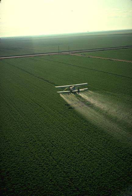
The Valle del Yaqui or Yaqui Valley is a highly productive agricultural area in Sonora. Durum wheat is a major crop. However, the crop is highly fertilized, and is a significant source of nitrous oxide, a powerful greenhouse gas. The natives, the Yaquis, since the Pre-Columbian era inhabited and farmed on the west bank of the Yaqui River. Much of the valley, to the east side of the river, was a semi-desert region covered with scrub, mesquites, and cacti. It was not until the end of the 19th century that the irrigation project conceived by Carlos Conant was developed, and a vast area began to be used for agriculture. After the Mexican Revolution, the federal government took control of Sonora's irrigation infrastructure and after World War II, began extensive dam and reservoir construction. From the 1940s to the 1970s, advanced agricultural techniques were pioneered by Norman Borlaug of the International Maize and Wheat Improvement Center (CIMMYT) based in Ciudad Obregón. This ... [...More Info...] [...Related Items...] OR: [Wikipedia] [Google] [Baidu] |
Sonora
Sonora (), officially Estado Libre y Soberano de Sonora ( en, Free and Sovereign State of Sonora), is one of the 31 states which, along with Mexico City, comprise the Federal Entities of Mexico. The state is divided into 72 municipalities; the capital (and largest) city of which being Hermosillo, located in the center of the state. Other large cities include Ciudad Obregón, Nogales (on the Mexico-United States border), San Luis Río Colorado, and Navojoa. Sonora is bordered by the states of Chihuahua to the east, Baja California to the northwest and Sinaloa to the south. To the north, it shares the U.S.–Mexico border primarily with the state of Arizona with a small length with New Mexico, and on the west has a significant share of the coastline of the Gulf of California. Sonora's natural geography is divided into three parts: the Sierra Madre Occidental in the east of the state; plains and rolling hills in the center; and the coast on the Gulf of California. It is pri ... [...More Info...] [...Related Items...] OR: [Wikipedia] [Google] [Baidu] |
World War II
World War II or the Second World War, often abbreviated as WWII or WW2, was a world war that lasted from 1939 to 1945. It involved the vast majority of the world's countries—including all of the great powers—forming two opposing military alliances: the Allies and the Axis powers. World War II was a total war that directly involved more than 100 million personnel from more than 30 countries. The major participants in the war threw their entire economic, industrial, and scientific capabilities behind the war effort, blurring the distinction between civilian and military resources. Aircraft played a major role in the conflict, enabling the strategic bombing of population centres and deploying the only two nuclear weapons ever used in war. World War II was by far the deadliest conflict in human history; it resulted in 70 to 85 million fatalities, mostly among civilians. Tens of millions died due to genocides (including the Holocaust), starvation, massa ... [...More Info...] [...Related Items...] OR: [Wikipedia] [Google] [Baidu] |
Mayo River (Mexico)
The Mayo River is located in the Mexican state of Sonora. The Adolfo Ruiz Cortines Dam generates electricity and irrigates agriculture in the Mayo Valley. It is 30 km east of the city of Navojoa, in the municipality of Álamos. Adolfo Ruiz Cortines was a president of Mexico The president of Mexico ( es, link=no, Presidente de México), officially the president of the United Mexican States ( es, link=no, Presidente de los Estados Unidos Mexicanos), is the head of state and head of government of Mexico. Under the .... See also * List of longest rivers of Mexico References Rivers of the Gulf of California Rivers of Sonora Rivers of the Sierra Madre Occidental {{Mexico-river-stub ... [...More Info...] [...Related Items...] OR: [Wikipedia] [Google] [Baidu] |
Navojoa
Navojoa is the fifth-largest city in the northern Mexican state of Sonora and is situated in the southern part of the state. The city is the administrative seat of Navojoa Municipality, located in the Mayo River Valley. History The city name derives from the native Mayo language meaning "Cactus House" or "Cactus Place" ("Navo"= Cactus, "Jova"= House). The valley has been continuously inhabited since pre-Hispanic times by the Mayo people. In September 1536, Diego de Guzmán, a Spaniard, became the first known European to reach the valley and the first Jesuit missionaries started settling in the region in 1614. Several geoglyphs from the Mayo tribe can be found along the Mayo River. Due to the city's distant location from Mexico City, the difficult times of Mexico's independence in the early 19th century were largely absent from the region. However, the city had some importance after the Mexican Revolution of 1910. The Mexican Revolutionary Álvaro Obregón was born in Hacie ... [...More Info...] [...Related Items...] OR: [Wikipedia] [Google] [Baidu] |
Huatabampo
Huatabampo () is a city in Huatabampo Municipality in the States of Mexico, state of Sonora, in northwestern Mexico. It is situated on the Gulf of California, near the mouth of the Mayo River, Mexico, Mayo River. It is located at latitude . Huatabampo is southwest of Navojoa via Sonora State Highway 56 and Sonora State Highway 149. Mexican Federal Highway 15 can be accessed via Sonora State Highway 176. It is notable as the home of revolutionary general Álvaro Obregón, a successful chickpea farmer before the Mexican Revolution, and now his burial site. Etymology The name Huatabampo is from the local Mayo language: "Huata" (Willow) + "Bampo" (Water), or "Willow in/near the Water". Huatabampo is also known as "Tierra de Generales" (Land of Generals) since during the Mexican Revolution (1910–1917) several high-ranking revolutionary generals emerged from the town. Among them is Álvaro Obregón (1880–1928), who was born in Navojoa, but lived for many years in Huatabampo, the o ... [...More Info...] [...Related Items...] OR: [Wikipedia] [Google] [Baidu] |
Guaymas
Guaymas () is a city in Guaymas Municipality, in the southwest part of the state of Sonora, in northwestern Mexico. The city is south of the state capital of Hermosillo, and from the U.S. border. The municipality is located on the Gulf of California and the western edge of the Sonoran Desert and has a hot, dry climate and of beaches. The municipality's formal name is Guaymas de Zaragoza and the city's formal name is the Heroica Ciudad de Guaymas. The city proper is mostly an industrial port and is the principal port for the state of Sonora. The city has a well-attended annual carnival, which has been held since 1888. Nearby, San Carlos and its beaches are major tourist attractions. History Before the arrival of the Europeans, the bay of Guaymas was dominated by the Guaymas, Seri and Yaqui tribes. In 1539, two Spanish ships, the ''Santa Águeda'' and the ''Trinidad'', arrived in Guaymas Bay. They were commanded by Francisco de Ulloa, who called the area "the port of ports." ... [...More Info...] [...Related Items...] OR: [Wikipedia] [Google] [Baidu] |
Empalme, Sonora
Empalme is a city surrounded by a municipality located on the south-central coast of the Mexican state of Sonora. According to the 2005 census the population of the city was 40,630 inhabitants, while the municipality, which has an area of 708.53 km² (273.56 sq mi), reported 50,663 inhabitants. Except for its coastline on the Gulf of California (Sea of Cortes), the municipality is entirely surrounded by the much larger municipality of Guaymas. In Spanish, the word ''empalme'' means "junction". At first, the community site was called ''Kilómetro Nueve'' because it was nine kilometers out of the port city of Guaymas. Then for a while it was called ''El Empalme'' meaning ''the junction''. The ''El'' was soon dropped. Unlike other towns or cities in Mexico, Empalme was built completely by foreigners, specifically the Utah Construction Company under contract to the Southern Pacific Railroad Company. Very few native materials were used in the construction. The founders owned ... [...More Info...] [...Related Items...] OR: [Wikipedia] [Google] [Baidu] |
Green Revolution
The Green Revolution, also known as the Third Agricultural Revolution, was a period of technology transfer initiatives that saw greatly increased crop yields and agricultural production. These changes in agriculture began in developed countries after World War II and spread globally till the late 1980s. In the late 1960s, farmers began incorporating new technologies such as high-yielding varieties of cereals, particularly dwarf wheat and rice, and the widespread use of chemical fertilizers, pesticides, and controlled irrigation. Agriculture also saw the adoption of newer methods of cultivation, including mechanization. These changes were often implemented as a package of practices meant to replace traditional agricultural technology. Both the Ford Foundation and the Rockefeller Foundation were heavily involved in its initial development in Mexico. One key leader was agricultural scientist Norman Borlaug, the "Father of the Green Revolution", who received the Nobel Peace P ... [...More Info...] [...Related Items...] OR: [Wikipedia] [Google] [Baidu] |
Ciudad Obregón
Ciudad Obregón is a city in southern Sonora. It is the state's second largest city after Hermosillo and serves as the municipal seat of Cajeme, as of 2020, the city has a population of 436,484. Ciudad Obregón is south of the state's northern border. History The city, previously named Cajeme, takes its name from Mexican Revolutionary Álvaro Obregón, a native of nearby Huatabampo, Sonora. Álvaro Obregón became president of Mexico after the Revolution and initiated an "agricultural revolution" in the Yaqui Valley, introducing modern agricultural techniques and making this valley one of the most prosperous agricultural regions in the country. Renowned US agronomist Dr. Norman Borlaug, the architect of the "Green Revolution" worked here after successful developments in increasing the resistance of wheat. For his efforts he was later awarded the Nobel Prize. The origins of this city date back to the year 1906 when the company's rail track South Pacific Railway reached this ... [...More Info...] [...Related Items...] OR: [Wikipedia] [Google] [Baidu] |
Norman Borlaug
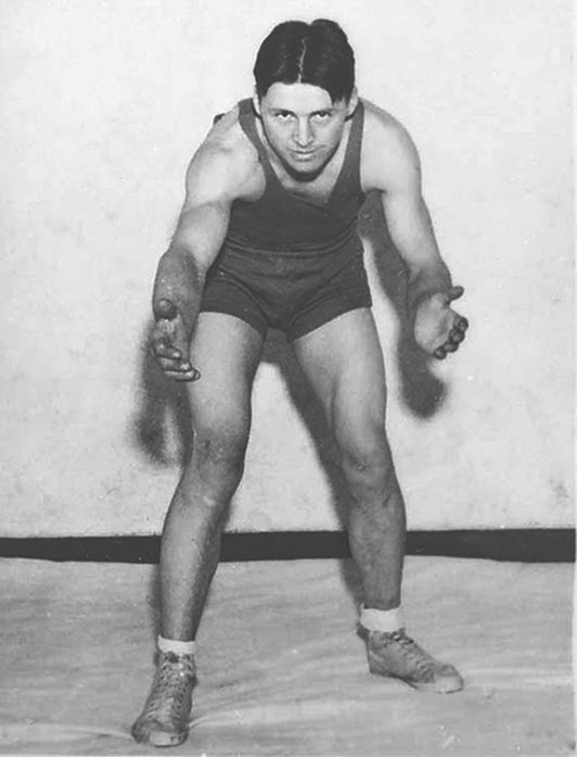
Norman Ernest Borlaug (; March 25, 1914September 12, 2009) was an American agronomist who led initiatives worldwide that contributed to the extensive increases in agricultural production termed the Green Revolution. Borlaug was awarded multiple honors for his work, including the Nobel Peace Prize, the Presidential Medal of Freedom and the Congressional Gold Medal. Borlaug received his B.S. in forestry in 1937 and Ph.D. in plant pathology and genetics from the University of Minnesota in 1942. He took up an agricultural research position with CIMMYT in Mexico, where he developed semi-dwarf, high- yield, disease-resistant wheat varieties. During the mid-20th century, Borlaug led the introduction of these high-yielding varieties combined with modern agricultural production techniques to Mexico, Pakistan, and India. As a result, Mexico became a net exporter of wheat by 1963. Between 1965 and 1970, wheat yields nearly doubled in Pakistan and India, greatly improving the food securi ... [...More Info...] [...Related Items...] OR: [Wikipedia] [Google] [Baidu] |
Mexican Revolution
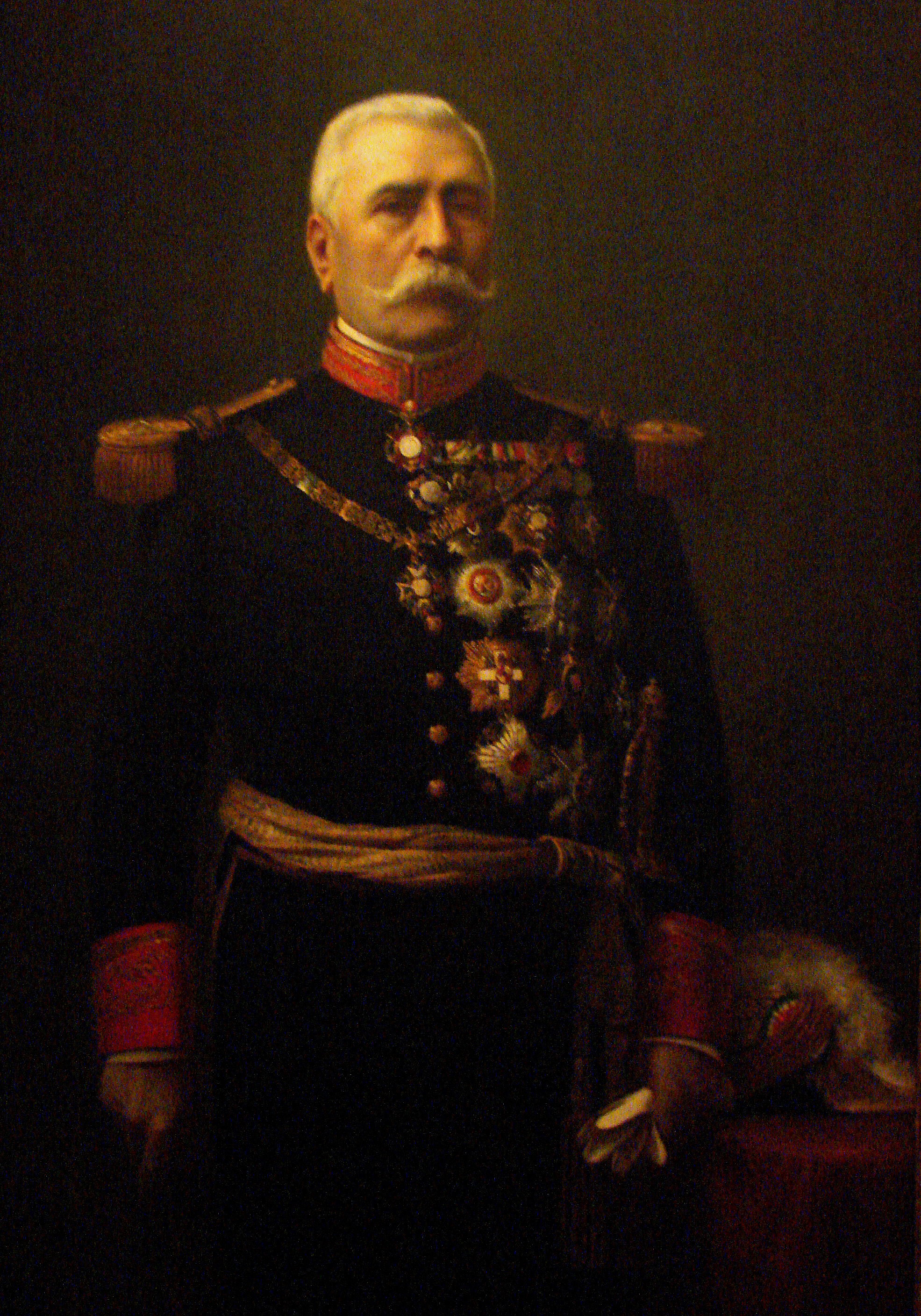
The Mexican Revolution ( es, Revolución Mexicana) was an extended sequence of armed regional conflicts in Mexico from approximately 1910 to 1920. It has been called "the defining event of modern Mexican history". It resulted in the destruction of the Federal Army and its replacement by a revolutionary army, and the transformation of Mexican culture and government. The northern Constitutionalist faction prevailed on the battlefield and drafted the present-day Constitution of Mexico, which aimed to create a strong central government. Revolutionary generals held power from 1920 to 1940. The revolutionary conflict was primarily a civil war, but foreign powers, having important economic and strategic interests in Mexico, figured in the outcome of Mexico's power struggles. The United States played an especially significant role. Although the decades-long regime of President Porfirio Díaz (1876–1911) was increasingly unpopular, there was no foreboding in 1910 that a revolutio ... [...More Info...] [...Related Items...] OR: [Wikipedia] [Google] [Baidu] |
Durum
Durum wheat (), also called pasta wheat or macaroni wheat (''Triticum durum'' or ''Triticum turgidum'' subsp. ''durum''), is a tetraploid species of wheat. It is the second most cultivated species of wheat after common wheat, although it represents only 5% to 8% of global wheat production. It was developed by artificial selection of the domesticated emmer wheat strains formerly grown in Central Europe and the Near East around 7000 BC, which developed a naked, free-threshing form. Like emmer, durum wheat is awned (with bristles). It is the predominant wheat that grows in the Middle East. ''Durum'' in Latin means "hard", and the species is the hardest of all wheats. This refers to the resistance of the grain to milling, in particular of the starchy endosperm, implying dough made from its flour is weak or "soft". This makes durum favorable for semolina and pasta and less practical for flour, which requires more work than with hexaploid wheats like common bread wheats. Des ... [...More Info...] [...Related Items...] OR: [Wikipedia] [Google] [Baidu] |


