|
Umatilla People
The Umatilla are a Sahaptin-speaking Native American tribe who traditionally inhabited the Columbia Plateau region of the northwestern United States, along the Umatilla and Columbia rivers."Umatilla," in Barbara A. Leitch, ''A Concise Dictionary of Indian Tribes of North America.'' Algonac, MI: Reference Publications, Inc., 1979; pp. 490-491. The Umatilla people are called Imatalamłáma, a Umatilla person is called Imatalamłá (with orthographic ł representing IPA /ɬ/). Some sources say that ''Umatilla'' is derived from ''imatilám-hlama'': ''hlama'' means 'those living at' or 'people of' and there is an ongoing debate about the meaning of ''imatilám'', but it is said to be an island in the Columbia River. B. Rigsby and N. Rude mention the village of ''ímatalam'' that was situated at the mouth of the Umatilla River and where the language was spoken. The Nez Perce refer to the Umatilla people as ''hiyówatalampoo'' (Aoki (1994:171)). History Early development The Umatill ... [...More Info...] [...Related Items...] OR: [Wikipedia] [Google] [Baidu] |
Eastern Washington
Eastern Washington is the region of the U.S. state of Washington located east of the Cascade Range. It contains the city of Spokane (the second largest city in the state), the Tri-Cities, the Columbia River and the Grand Coulee Dam, the Hanford Nuclear Reservation and the fertile farmlands of the Yakima Valley and the Palouse. Unlike in Western Washington, the climate is dry, including some desert environments. Climate A significant difference between Eastern Washington and the western half of the state is its climate. While the west half of the state is located in a rainy oceanic climate, the eastern half receives little rainfall due to the rainshadow created by the Cascade Mountains. Also, due to being farther from the sea, the east side has both hotter summers and colder winters than the west. Most communities in Eastern Washington, for example, have significant yearly snowfall, while in the west snowfall is minimal and not seen every year. The east and west do still ... [...More Info...] [...Related Items...] OR: [Wikipedia] [Google] [Baidu] |
Blue Mountains (Oregon)
The Blue Mountains are a mountain range in the northwestern United States, located largely in northeastern Oregon and stretching into extreme southeastern Washington. The range has an area of about , stretching east and southeast of Pendleton, Oregon, to the Snake River along the Oregon–Idaho border. The Blue Mountains cover ten counties across two states; they are Union, Umatilla, Grant, Baker, Wallowa and Harney counties in Oregon, and Walla Walla, Columbia, Garfield and Asotin counties in Washington. The mountains are unique as the home of the world's largest living organism, a subterranean colonial mycelial mat of the fungus ''Armillaria ostoyae''. The Blue Mountains were named after the color of the mountains when seen from a distance. Geology The Blues are uplift mountainscbgwma.orThe Columbia River Basalt Group , Continental flood basalt flows , cbgwma.org accessdate: February 8, 2017 and contain some of the oldest rocks in Oregon. Rocks as old as 400 millio ... [...More Info...] [...Related Items...] OR: [Wikipedia] [Google] [Baidu] |
Pendleton, Oregon
Pendleton is a city and the county seat of Umatilla County, Oregon. The population was 17,107 at the time of the 2020 census, which includes approximately 1,600 people who are incarcerated at Eastern Oregon Correctional Institution. Pendleton is the smaller of the two principal cities of the Hermiston–Pendleton Micropolitan Statistical Area. This micropolitan area covers Morrow and Umatilla counties and had a combined population of 92,261 at the 2020 census. History A European-American commercial center began to develop here in 1851, when Dr. William C. McKay established a trading post at the mouth of McKay Creek. A United States Post Office named Marshall (for the owner, and sometime gambler, of another local store) was established April 21, 1865, and later renamed Pendleton, after politician and diplomat George H. Pendleton (1825–1889), who served as a U.S. Representative and Senator from Ohio. The city was incorporated by the Oregon Legislative Assembly ... [...More Info...] [...Related Items...] OR: [Wikipedia] [Google] [Baidu] |
Umatilla Indian Reservation
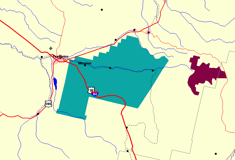
The Umatilla Indian Reservation is an Indian reservation in the Pacific Northwest of the United States. It was created by The Treaty of June 9, 1855 between the United States and members of the Walla, Cayuse, and Umatilla tribes. It lies in northeastern Oregon, east of Pendleton. The reservation is mostly in Umatilla County, with a very small part extending south into Union County. It is managed by the three Confederated Tribes of the Umatilla Indian Reservation. Located on the north side of the Blue Mountains, the reservation was established for two Sahaptin-speaking Native American tribes: the Umatilla and Walla Walla, and for the Cayuse, whose language, now extinct, was an isolate. All the tribes historically inhabited the Columbia Plateau region. The tribes share land and a governmental structure as part of their confederation. Geography, demographics and headquarters The reservation has a land area of and a tribal population of 2,927 as of the 2000 census. In a ... [...More Info...] [...Related Items...] OR: [Wikipedia] [Google] [Baidu] |
Confederated Tribes Of The Umatilla Indian Reservation
The Confederated Tribes of the Umatilla Indian Reservation are the federally recognized confederations of three Sahaptin-speaking Native American tribes who traditionally inhabited the Columbia River Plateau region: the Cayuse, Umatilla, and Walla Walla. When the leaders of the Walla Walla, Cayuse, and Umatilla peoples signed the Treaty of Walla Walla with the United States in 1855, they ceded of their homeland that is now northeastern Oregon and southeastern Washington. This was done in exchange for a reservation of and the promise of annuities in the form of goods and supplies. The tribes share the Reservation, which consists of in Umatilla County, in northeast Oregon state. The tribes have created a joint political structure as part of their confederation. The tribal offices are just east of Pendleton, Oregon. Almost half of the reservation land is owned by non-Native Americans; the reservation includes significant portions of the Umatilla River watershed. In 2013 th ... [...More Info...] [...Related Items...] OR: [Wikipedia] [Google] [Baidu] |
Indian Reservation
An Indian reservation is an area of land held and governed by a federally recognized Native American tribal nation whose government is accountable to the United States Bureau of Indian Affairs and not to the state government in which it is located. Some of the country's 574 federally recognized tribes govern more than one of the 326 Indian reservations in the United States, while some share reservations, and others have no reservation at all. Historical piecemeal land allocations under the Dawes Act facilitated sales to non–Native Americans, resulting in some reservations becoming severely fragmented, with pieces of tribal and privately held land being treated as separate enclaves. This jumble of private and public real estate creates significant administrative, political and legal difficulties. The total area of all reservations is , approximately 2.3% of the total area of the United States and about the size of the state of Idaho. While most reservations are small ... [...More Info...] [...Related Items...] OR: [Wikipedia] [Google] [Baidu] |
Walla Walla Council (1855)
The Walla Walla Council (1855) was a meeting in the Pacific Northwest between the United States and sovereign tribal nations of the Cayuse, Nez Perce, Umatilla, Walla Walla, and Yakama. The council occurred on May 29 – June 11; the treaties signed at this council on June 9 were ratified by the U.S. Senate four years later in 1859. These treaties codified the constitutional relationship between the people living on the Nez Perce, Umatilla, and Yakama reservations; it was one of the earliest treaties obtained in the Pacific Northwest. Washington Territory's first governor Isaac I. Stevens secured this treaty, allowing larger portions of the land to be given to the two largest and most powerful tribes: Yakama and Nez Perce; these reservations encompassed most of their traditional hunting grounds. The smaller tribes moved to the smaller of the three reservations. Stevens was able to acquire of land. See also *Yakima War (1855–58) * Palouse War (1858 ... [...More Info...] [...Related Items...] OR: [Wikipedia] [Google] [Baidu] |
Infectious
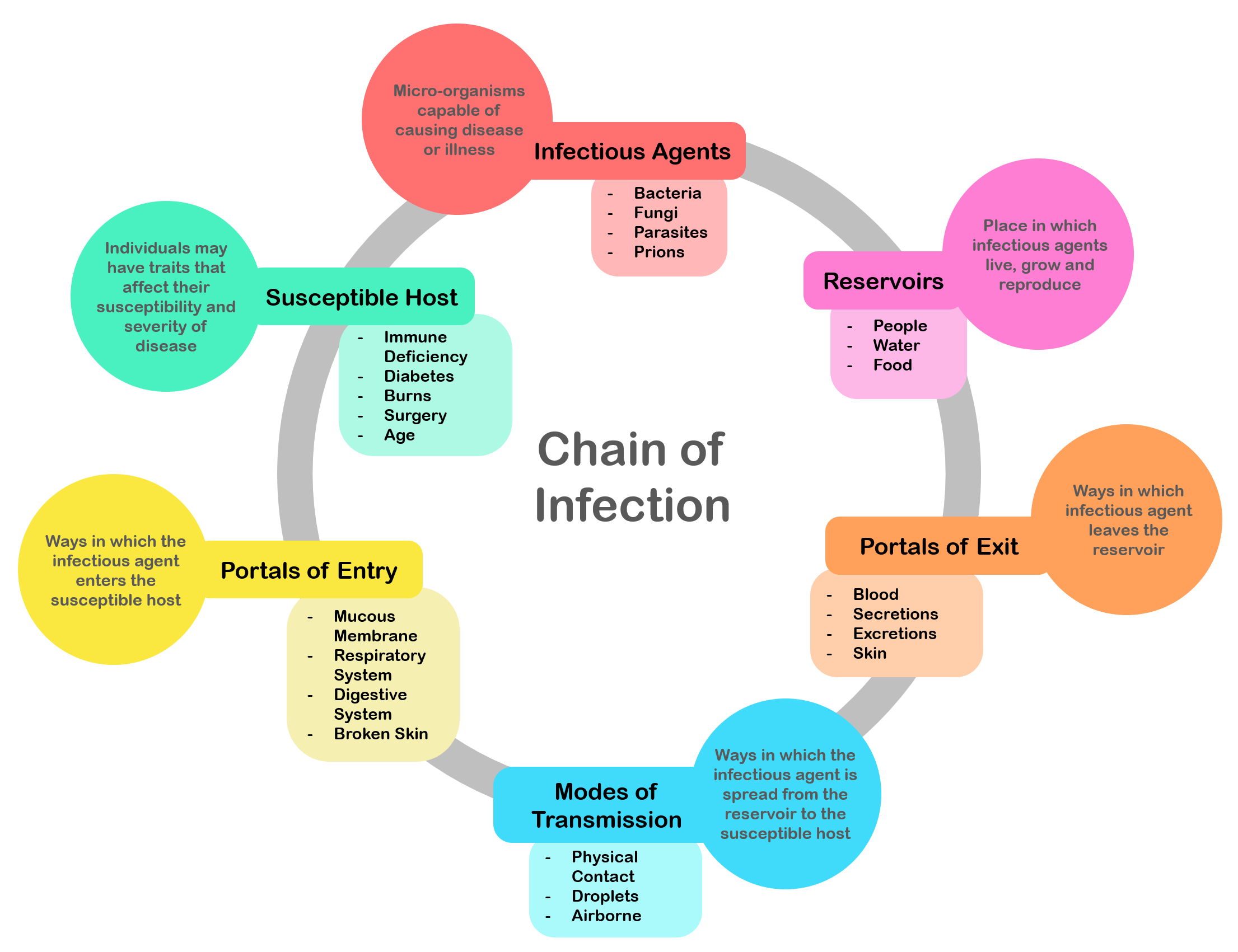
An infection is the invasion of tissues by pathogens, their multiplication, and the reaction of host tissues to the infectious agent and the toxins they produce. An infectious disease, also known as a transmissible disease or communicable disease, is an illness resulting from an infection. Infections can be caused by a wide range of pathogens, most prominently bacteria and viruses. Hosts can fight infections using their immune system. Mammalian hosts react to infections with an innate response, often involving inflammation, followed by an adaptive response. Specific medications used to treat infections include antibiotics, antivirals, antifungals, antiprotozoals, and antihelminthics. Infectious diseases resulted in 9.2 million deaths in 2013 (about 17% of all deaths). The branch of medicine that focuses on infections is referred to as infectious disease. Types Infections are caused by infectious agents (pathogens) including: * Bacteria (e.g. ''Mycobacterium tuberculosis'' ... [...More Info...] [...Related Items...] OR: [Wikipedia] [Google] [Baidu] |
Smallpox
Smallpox was an infectious disease caused by variola virus (often called smallpox virus) which belongs to the genus Orthopoxvirus. The last naturally occurring case was diagnosed in October 1977, and the World Health Organization (WHO) certified the global eradication of the disease in 1980, making it the only human disease to be eradicated. The initial symptoms of the disease included fever and vomiting. This was followed by formation of ulcers in the mouth and a skin rash. Over a number of days, the skin rash turned into the characteristic fluid-filled blisters with a dent in the center. The bumps then scabbed over and fell off, leaving scars. The disease was spread between people or via contaminated objects. Prevention was achieved mainly through the smallpox vaccine. Once the disease had developed, certain antiviral medication may have helped. The risk of death was about 30%, with higher rates among babies. Often, those who survived had extensive scarring of their ... [...More Info...] [...Related Items...] OR: [Wikipedia] [Google] [Baidu] |
Yakima People
The Yakama are a Native American tribe with nearly 10,851 members, based primarily in eastern Washington state. Yakama people today are enrolled in the federally recognized tribe, the Confederated Tribes and Bands of the Yakama Nation. Their Yakama Indian Reservation, along the Yakima River, covers an area of approximately 1.2 million acres (5,260 km²). Today the nation is governed by the Yakama Tribal Council, which consists of representatives of 14 tribes. Many Yakama people engage in ceremonial, subsistence, and commercial fishing for salmon, steelhead, and sturgeon in the Columbia River and its tributaries, including within land ceded by the tribe to the United States. Their right to fish in their former territory is protected by treaties and was re-affirmed in late 20th-century court cases such as ''United States v. Washington'' (known as the Boldt Decision, 1974) and ''United States v. Oregon'' (''Sohappy v. Smith'', 1969), though more than a century of U.S. indus ... [...More Info...] [...Related Items...] OR: [Wikipedia] [Google] [Baidu] |
Palouse People
The Palouse are a Sahaptin tribe recognized in the Treaty of 1855 with the United States along with the Yakama. It was negotiated at the 1855 Walla Walla Council. A variant spelling is Palus. Today they are enrolled in the federally recognized Confederated Tribes and Bands of the Yakama Nation and some are also represented by the Colville Confederated Tribes, the Confederated Tribes of the Umatilla Indian Reservation and Nez Perce Tribe. Ethnography The people are one of the Sahaptin-speaking groups of Native Americans living on the Columbia Plateau in eastern Washington, northeastern Oregon, and North Central Idaho: these included the Nez Percé, Cayuse, Walla Walla, Umatilla and the Yakama. The Palouse (Palus) territory extends from the confluence of the Snake and Clearwater Rivers in the east to the confluence of the Snake and Columbia Rivers in the west. It encompassed the Palouse River Valley up to Rock Lake in the north and stayed north of the Touchet River Valle ... [...More Info...] [...Related Items...] OR: [Wikipedia] [Google] [Baidu] |


_p704_PENDLETON.jpg)


