|
U.S. Route 87 In Texas
In the U.S. state of Texas, U.S. Highway 87 (US 87) is a north–south U.S. Highway that begins near the Gulf Coast in Port Lavaca, Texas and heads north through San Antonio, Lubbock, Amarillo, and Dalhart to the New Mexico border near Texline. Route description US 87 begins at an intersection with State Highway 238 in Port Lavaca. It takes a northwesterly route out of the town, and travels to Victoria, where it intersects US 59 and US 77. Its northwesterly path continues to Cuero, where it merges with (and is briefly co-signed with) US 77 Alternate and US 183 before turning back toward the north. US 87 follows a gentle northwesterly route until just before Smiley, where it takes a more westerly turn. At Nixon, US 87 merges with State Highway 97 and continues west as a co-signed route until just west of Stockdale, where SH 97 leaves the route and US 87 continues to the northwest to San Antonio. On the southeast side of the city, US 87 merges with Interstate 10 (I- ... [...More Info...] [...Related Items...] OR: [Wikipedia] [Google] [Baidu] |
Port Lavaca, Texas
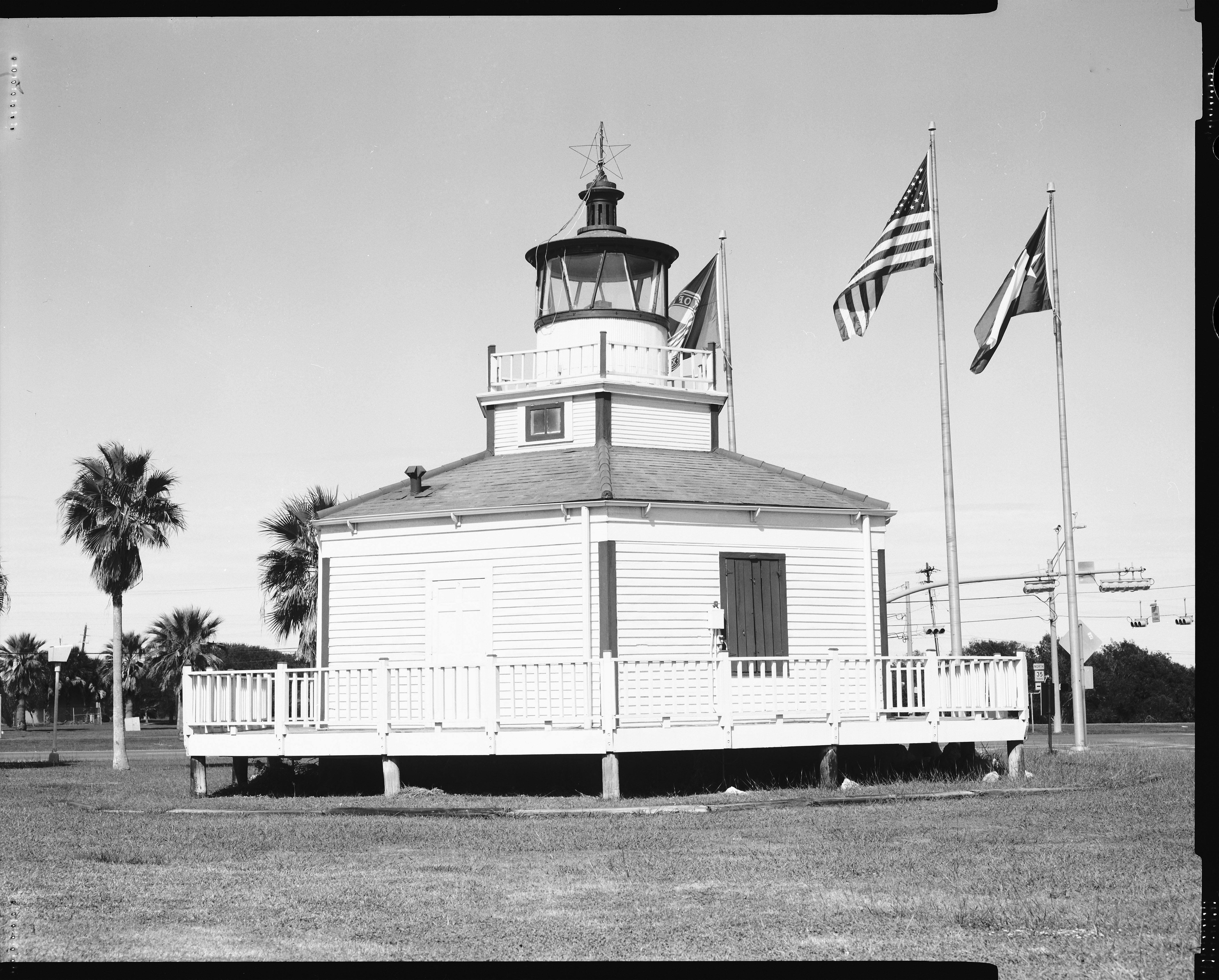
Port Lavaca () is a city in Calhoun County, Texas, Calhoun County, located in the U.S. state of Texas. The population was 12,248 at the 2010 census and 11,557 at the 2020 census. It is the county seat of Calhoun County and part of the Victoria, Texas Victoria metropolitan area, Metropolitan Statistical Area. Port Lavaca is southwest of Houston. Geography Port Lavaca is located in northern Calhoun County on the west side of Lavaca Bay, an arm of Matagorda Bay. According to the United States Census Bureau, the city has a total area of , of which is land and , or 28.04%, is water. Climate Port Lavaca holds the state record of the highest wind speed ever reached. During Hurricane Carla in September 1961, the winds were recorded to gust up to . In 2004, Port Lavaca, including the South Texas Area, recorded up to of snowfall. During Hurricane Harvey in August 2017, Port Lavaca was the location of the peak of the storm surge, which was measured at . Port Lavaca also suffered damage ... [...More Info...] [...Related Items...] OR: [Wikipedia] [Google] [Baidu] |
Kendall County, Texas
Kendall County is a county located on the Edwards Plateau in the U.S. state of Texas. In 2020 United States Census, 2020 census, its population was 44,279. Its county seat is Boerne, Texas, Boerne. The county is named for George Wilkins Kendall, a journalist and Mexican–American War correspondent. Kendall County is part of the San Antonio, Texas, San Antonio–New Braunfels, Texas, New Braunfels, TX San Antonio metropolitan area, metropolitan statistical area. ''Progressive Farmer'' rated Kendall County fifth in its list of the "Best Places to Live in Rural America" in 2006. Kendall, along with Hays County, Texas, Hays and Comal County, Texas, Comal Counties, was listed in 2017 of the nation's 10 fastest-growing large counties with a population of at least 10,000. From 2015 to 2016, Kendall County, the second-fastest-growing county in the nation, grew by 5.16%, gaining 2,088 people in a one-year period.Press Release Number: CB17-44Maricopa County Added Over 222 People Per Da ... [...More Info...] [...Related Items...] OR: [Wikipedia] [Google] [Baidu] |
Lynn County, Texas
Lynn County is a county in the U.S. state of Texas. As of the 2020 census, its population was 5,596. Its county seat is Tahoka. The county was created in 1876 and organized in 1903. Lynn County, along with Crosby and Lubbock Counties, is part of the Lubbock Metropolitan Statistical Area (MSA). The Lubbock MSA and Levelland Micropolitan Statistical Area (µSA), encompassing only Hockley County, form the larger Lubbock–Levelland Combined Statistical Area (CSA). Lynn County was one of 30 prohibition, or entirely dry, counties in Texas, but is now a moist county. The county has two historical museums, the O'Donnell Heritage Museum, with a Dan Blocker room in O'Donnell, and the Tahoka Pioneer Museum in Tahoka. The county is also home to thLynn County Hospital Districtthat provides medical care to the county and surrounding area History Native Americans Apache and Comanche peoples roamed the high plains until various military expeditions of the 19th century pus ... [...More Info...] [...Related Items...] OR: [Wikipedia] [Google] [Baidu] |
Dawson County, Texas
Dawson County is a county in the U.S. state of Texas. As of the 2020 census, its population was 12,456. The county seat is Lamesa. The county was created in 1876 and later organized in 1905. It is named for Nicholas Mosby Dawson, a soldier of the Texas Revolution. Dawson County comprises the Lamesa, TX Micropolitan Statistical Area (μSA), and it is the smallest Micropolitan Statistical Area in the United States. History A Dawson County was founded in 1856 from Kinney County, Maverick County and Uvalde County, but was divided in 1866 between Kinney County and Uvalde County. The current Dawson County was founded in 1876. In 1943, the discovery well for the Spraberry Trend, the third-largest oil field in the United States by remaining reserves, was drilled in Dawson County on land owned by farmer Abner Spraberry, for whom the geological formation and associated field were named. While most of the oil fields are in the counties to the south, a small portion of the Spraberry T ... [...More Info...] [...Related Items...] OR: [Wikipedia] [Google] [Baidu] |
Martin County, Texas
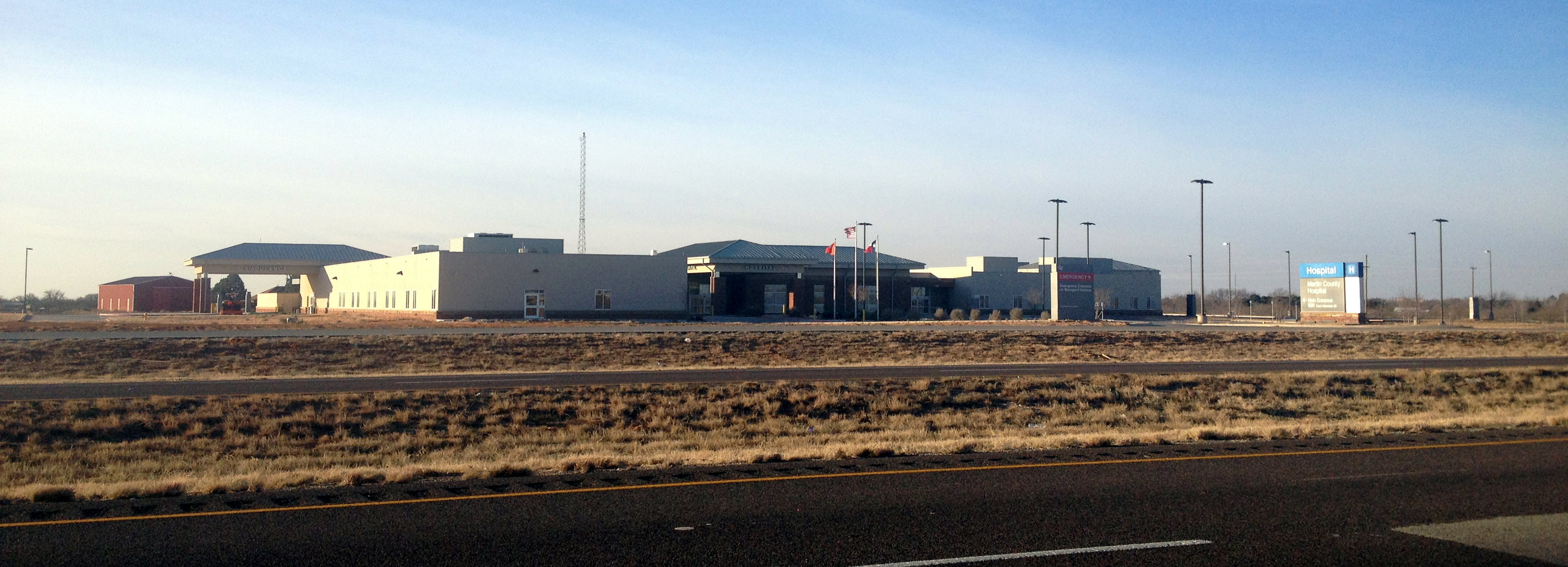
Martin County is a county in the U.S. state of Texas. As of the 2010 census, its population was 5,237. Its county seat is Stanton. The county was created in 1876 and organized in 1884. It is named for Wylie Martin, an early settler. Until November 2018, Martin County was one of six entirely dry counties in Texas. During that month, Martin County changed from a dry county to a partially wet county after Stanton residents voted to approve the sale of beer and wine within city limits. Five dry counties remain. Martin County is included in the Midland–Odessa combined statistical area. Geography According to the U.S. Census Bureau, the county has an area of , of which is land and (0.08%) is water. The northern portion of the Spraberry Trend, the second-largest oil field in the United States by 2013 estimated crude oil production, underlies much of the county. Major highways * * * * * * * Adjacent counties * Dawson County (north) * Howard County (east) * Glassc ... [...More Info...] [...Related Items...] OR: [Wikipedia] [Google] [Baidu] |
Howard County, Texas
Howard County is a county located in the U.S. state of Texas. At the 2020 census, its population was 34,860. Its county seat is Big Spring. The county was created in 1876 and organized in 1882. It is named for Volney E. Howard, a U.S. Congressman from Texas. Howard County is included in the Big Spring, Texas Micropolitan Statistical Area. Geography According to the U.S. Census Bureau, the county has a total area of , of which are land and (0.4%) are covered by water. Howard County is located at the boundary between the Llano Estacado to the north and the Edwards Plateau to the south. Beals Creek, a tributary of the Colorado River, flows through the center of Big Spring and divides these two major physiographic regions. Major highways * Interstate 20 * Interstate 20 Business * U.S. Highway 87 * State Highway 176 * State Highway 350 * Farm to Market Road 669 * Farm to Market Road 700 Adjacent counties * Borden County (north) * Mitchell County (east) ... [...More Info...] [...Related Items...] OR: [Wikipedia] [Google] [Baidu] |
Glasscock County, Texas
Glasscock County is a county located in the U.S. state of Texas. As of the 2020 census, its population was 1,116. Its county seat is Garden City. The county was created in 1887 and later organized in 1893. It is named for George Washington Glasscock, an early settler of the Austin, Texas area and the namesake of Georgetown, Texas. Glasscock County is included in the Big Spring, TX Micropolitan Statistical Area. Geography According to the U.S. Census Bureau, the county has a total area of , of which is land and (0.1%) is water. The Spraberry Trend, the third-largest oil field in the United States by remaining reserves, underlies much of the county. This pro-Republican trend is reflected in party membership. During the 2008 Presidential primary in Texas, 19 voters from Glasscock County cast ballots in the Democratic race, while over 400 cast ballots in the Republican race Communities * Garden City (county seat) * Saint Lawrence, Texas, St. Lawrence See also * Nati ... [...More Info...] [...Related Items...] OR: [Wikipedia] [Google] [Baidu] |
Sterling County, Texas
Sterling County is a county located on the Edwards Plateau in the U.S. state of Texas. As of the 2020 census, its population was 1,372, making it the ninth-least populous county in Texas. Its county seat is Sterling City. The county is named for W. S. Sterling, an early settler in the area. Sterling County was one of 30 prohibition, or entirely dry, counties in the state of Texas, but is now a moist county. History Native Americans Original native Plains Indians included Comanche, Lipan Apache, Kiowa, and Kickapoo. The region had a number of violent encounters between the Comanche, local ranchmen, and Texas Rangers. A deadly skirmish occurred in the 1870s between area ranchmen and the Comanche on the Lacy Creek on the present day Campstool Ranch. “The Fight at Live Oak Mott” is an account of the events as written by W.K. Kellis, in the Sterling City ''News-Record'', and later published in ''Frontier Times'' by J. Marvin Hunter. In 1879, the last significant battle b ... [...More Info...] [...Related Items...] OR: [Wikipedia] [Google] [Baidu] |
Coke County, Texas
Coke County is a county located on the Edwards Plateau in the U.S. state of Texas. As of the 2020 census, its population was 3,285. Its county seat is Robert Lee. The county was founded in 1889 and is named for Richard Coke, the 15th governor of Texas. Coke County was one of 46 prohibition, or entirely dry, counties in the state of Texas, but passed a law allowing the sale of beer and wine in 2005. History Native Americans From about 1700 to the 1870s, Comanche, Tonkawa, Lipan Apache, Kickapoo, and Kiowa roamed the county. These tribes settled in rock shelters in the river and creek valleys, leaving behind artifacts and caches of seeds, implements, burial sites, petroglyphs, river shells, turkey and deer bones, flint knives, scrapers, and points. Early years In 1851, United States Army post Fort Chadbourne was established to protect the frontier, and the fort was manned until the Civil War. The Butterfield Overland Mail ran through the area from 1858 to 1861. Betwe ... [...More Info...] [...Related Items...] OR: [Wikipedia] [Google] [Baidu] |
Tom Green County, Texas
Tom Green County is a county located on the Edwards Plateau in the U.S. state of Texas. As of the 2020 census, its population was 120,003. Its county seat is San Angelo. The county was created in 1874 and organized the following year. It is named for Thomas Green, who was a Confederate soldier and lawyer. Tom Green County is included in the San Angelo metropolitan statistical area; the county is home to Goodfellow Air Force Base, as well as Angelo State University, part of the Texas Tech University System. History The county was established by the state legislature on March 13, 1874, and named after Thomas Green, a Confederate brigadier general. It originally comprised an area over . The original county seat was the town of Ben Ficklin. In 1882, flood waters of the Concho River destroyed the town and drowned 65 people. The county seat was moved to Santa Angela. In 1883, the town's name was officially changed to San Angelo by the United States Post Office. Following com ... [...More Info...] [...Related Items...] OR: [Wikipedia] [Google] [Baidu] |
Concho County, Texas
Concho County is a county located on the Edwards Plateau in the U.S. state of Texas. As of the 2020 census, the population was 3,303. Its county seat is Paint Rock. The county was founded in 1858 and later organized in 1879. It is named for the Concho River. History Through the 1800s, Paleo-Indians lived in the county and left behind archaeological remains of a burned-rock midden. Athabascan-speaking Indians associated with the prehorse Plains culture live in this part of Texas. Later native inhabitants include Jumano, Tonkawa, Comanche and Lipan Apache. In 1847, John O. Meusebach sent surveyors into the area. In 1849, Robert Simpson Neighbors lead a small expedition through the area. The Texas Legislature formed Concho County from Bexar County in 1858. In 1874, Ranald S. Mackenzie led a campaign to drive out remaining native peoples and established the Mackenzie Trail. The county seat was formally established and named Paint Rock after the nearby pictographs. The ... [...More Info...] [...Related Items...] OR: [Wikipedia] [Google] [Baidu] |
McCulloch County, Texas
McCulloch County is a county located on the Edwards Plateau in the U.S. state of Texas. At the 2020 census, its population was 7,630. Its county seat is Brady. The county was created in 1856 and later organized in 1876. It is named for Benjamin McCulloch, a famous Texas Ranger and Confederate general. The geographical center of Texas lies within McCulloch County, near Brady. History From 5000 BC to 1500 AD, the early Native American inhabitants included Tonkawa, Lipan Apache, Comanche, and Tawakoni. The 1788 José Mares expedition passed through the area while travelling from San Antonio to Santa Fe. On November 21, 1831, in the Brady vicinity, James Bowie, Rezin P. Bowie, David Buchanan, Cephas D. Hamm, Matthew Doyle, Jesse Wallace, Thomas McCaslin, Robert Armstrong, and James Coryell with two servants, Charles and Gonzales, held at bay for a day and a night 164 Caddo and Lipans. After 80 warriors had been killed, the Indians withdrew. Camp San Saba was established i ... [...More Info...] [...Related Items...] OR: [Wikipedia] [Google] [Baidu] |


