|
Taketomi, Okinawa
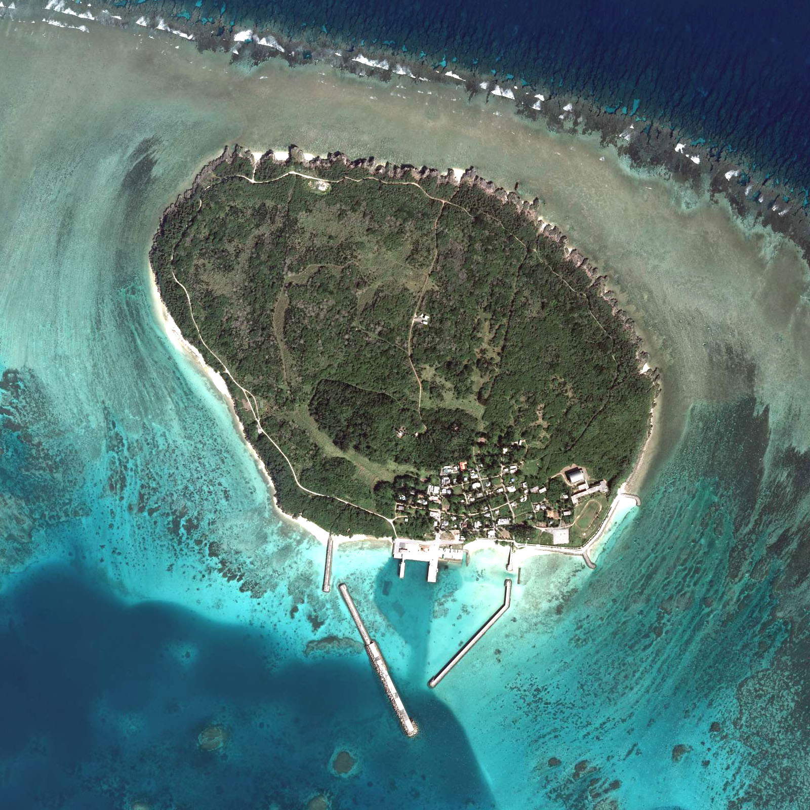
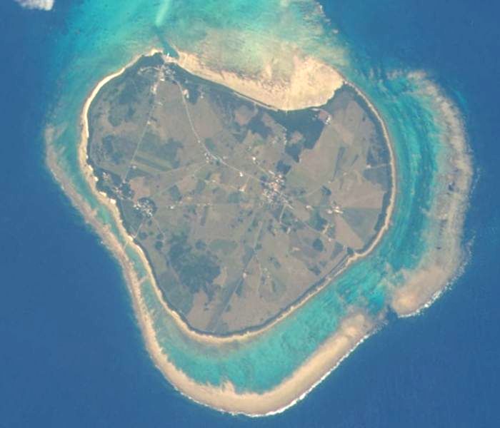
is a town located in Yaeyama District, Okinawa Prefecture, Japan. The town includes all of the islands in the Yaeyama Islands excluding Ishigaki, Yonaguni, and the Senkaku Islands. This includes the islands of Iriomote, Yubu, Taketomi, Kohama, Kuroshima, Hateruma, and Hatoma. Although Ishigaki is not part of the town of Taketomi, the town hall is located there. As of October 2016, the town has an estimated population of 4,050 and the density of 12 persons per km2 (31/sq mi). The total area is 334.02 km2 (128.97 sq mi). Transportation Hateruma Airport is located on Hateruma Island in Taketomi. Education Combined elementary and junior high schools include: * Funauki Elementary and Junior High School (竹富町立船浮小中学校) - Iriomote Island * Hateruma Elementary and Junior High School (竹富町立波照間小中学校) - Hateruma * Hatoma Elementary and Junior High School (竹富町立鳩間小中学校) - Hatoma * Iriomote Elementary and Junior High Sch ... [...More Info...] [...Related Items...] OR: [Wikipedia] [Google] [Baidu] |
Okinawa Prefecture
is a prefecture of Japan. Okinawa Prefecture is the southernmost and westernmost prefecture of Japan, has a population of 1,457,162 (as of 2 February 2020) and a geographic area of 2,281 km2 (880 sq mi). Naha is the capital and largest city of Okinawa Prefecture, with other major cities including Okinawa, Uruma, and Urasoe. Okinawa Prefecture encompasses two thirds of the Ryukyu Islands, including the Okinawa, Daitō and Sakishima groups, extending southwest from the Satsunan Islands of Kagoshima Prefecture to Taiwan ( Hualien and Yilan Counties). Okinawa Prefecture's largest island, Okinawa Island, is the home to a majority of Okinawa's population. Okinawa Prefecture's indigenous ethnic group are the Ryukyuan people, who also live in the Amami Islands of Kagoshima Prefecture. Okinawa Prefecture was ruled by the Ryukyu Kingdom from 1429 and unofficially annexed by Japan after the Invasion of Ryukyu in 1609. Okinawa Prefecture was officially founded in 1879 by the Empire ... [...More Info...] [...Related Items...] OR: [Wikipedia] [Google] [Baidu] |
Yaeyama Islands
The Yaeyama Islands (八重山列島 ''Yaeyama-rettō'', also 八重山諸島 ''Yaeyama-shotō'', Yaeyama: ''Yaima'', Yonaguni: ''Daama'', Okinawan: ''Yeema'', Northern Ryukyuan: ''Yapema'') are an archipelago in the southwest of Okinawa Prefecture, Japan, and cover . The islands are located southwest of the Miyako Islands, part of the Ryukyu Islands archipelago. The Yaeyama Islands are the remotest part of Japan from the main islands and contain Japan's most southern (Hateruma) and most western (Yonaguni) inhabited islands. The city of Ishigaki serves as the political, cultural, and economic center of the Yaeyama Islands. Natural history The Yaeyama Islands are home to numerous species of subtropical and tropical plants, and mangrove forests. The islands produce sugarcane and pineapples. Coral reefs around the islands are ideal habitats for dolphins, sea turtles, and larger fish such as manta rays and whale sharks. Before being wiped out by humans, whales and dugongs wer ... [...More Info...] [...Related Items...] OR: [Wikipedia] [Google] [Baidu] |
Population Density
Population density (in agriculture: standing stock or plant density) is a measurement of population per unit land area. It is mostly applied to humans, but sometimes to other living organisms too. It is a key geographical term.Matt RosenberPopulation Density Geography.about.com. March 2, 2011. Retrieved on December 10, 2011. In simple terms, population density refers to the number of people living in an area per square kilometre, or other unit of land area. Biological population densities Population density is population divided by total land area, sometimes including seas and oceans, as appropriate. Low densities may cause an extinction vortex and further reduce fertility. This is called the Allee effect after the scientist who identified it. Examples of the causes of reduced fertility in low population densities are * Increased problems with locating sexual mates * Increased inbreeding Human densities Population density is the number of people per unit of area, usuall ... [...More Info...] [...Related Items...] OR: [Wikipedia] [Google] [Baidu] |
Population
Population typically refers to the number of people in a single area, whether it be a city or town, region, country, continent, or the world. Governments typically quantify the size of the resident population within their jurisdiction using a census, a process of collecting, analysing, compiling, and publishing data regarding a population. Perspectives of various disciplines Social sciences In sociology and population geography, population refers to a group of human beings with some predefined criterion in common, such as location, race, ethnicity, nationality, or religion. Demography is a social science which entails the statistical study of populations. Ecology In ecology, a population is a group of organisms of the same species who inhabit the same particular geographical area and are capable of interbreeding. The area of a sexual population is the area where inter-breeding is possible between any pair within the area and more probable than cross-breeding with in ... [...More Info...] [...Related Items...] OR: [Wikipedia] [Google] [Baidu] |
Ishigaki, Okinawa
is a city in Okinawa Prefecture, Japan. It includes Ishigaki island and the Senkaku Islands territory. The city is the political, cultural, and economic center of the Yaeyama Islands. New Ishigaki Airport serves the city. As of December 2012, the city has an estimated population of 48,816 and a population density of 213 persons per km2. The total area is 229.00 km2. It is also the location of the disputed Senkaku Islands (see below in the Geography section). History The current city of Ishigaki was founded in 1908 as Yaeyama Village, an amalgamation of the Ishigaki, Ōhama, and Miyara magiri. In 1914 it was renamed to Ishigaki Village, and grew to become Ishigaki Town in 1926. Ishigaki was elevated to city status on July 10, 1947. Historical footnote: One of the first Frenchmen ever to visit Japan, Guillaume Courtet, came ashore at Ishigaki in 1636. Geography The city of Ishigaki covers the entirety of Ishigaki Island (). The island is surrounded by coral reefs. The high ... [...More Info...] [...Related Items...] OR: [Wikipedia] [Google] [Baidu] |
Hatoma
Hatoma (鳩間島, ''Hatoma-jima''; Yaeyama: ''Patuma''; Okinawan: ''Hatuma'') is a small island of the Yaeyama Islands, barely 1 kilometer in diameter. It is under the administration of Taketomi District, Okinawa Prefecture, Japan. In local language, the island's name is pronounced ''Patuma''. Geography Hatoma is located just north of Iriomote. It is a tiny island, with an area of just , a circumference of , and a population of about 48. History Hatoma has been continuously inhabited for at least several centuries, if not longer. Excavations on the island have shown that until recent times, Hatoma residents subsisted largely on shellfish gathered in the surrounding shallow waters, and vegetables. Unlike nearby Iriomote, Hatoma was not infested by malaria; hence its long-term settlement. In the early 1900s, Hatoma flourished as a skipjack tuna fishing port. At that time, the population of the island numbered in the hundreds. In 1968, because of the declining economic viab ... [...More Info...] [...Related Items...] OR: [Wikipedia] [Google] [Baidu] |
Hateruma
Hateruma (波照間島; ''Hateruma-jima''; Yaeyama: ''Patirooma'', Hateruma dialect: ''Besїma'' "our island", Okinawan: ''Hatiruma'', Northern Ryukyuan: ''Patara'') is an island in the Yaeyama District of Okinawa Prefecture, Japan. It is the southernmost inhabited island in Japan. It is one of the Yaeyama Islands, and is located south of Iriomote-jima, the largest of the island group. Hateruma, which is composed of corals, has 12.7 km2 of area and approximately 600 inhabitants. The primary products of the island include sugarcane, pineapple, refined sugar, and ''Awanami'', a highly prized type of the alcoholic beverage awamori. Its southern location makes it one of the few places in Japan where the Southern Cross can be observed. Tourism Hateruma is frequently visited by tourists from Ishigaki on day trips, as it boasts the southernmost tip of land of Japan. In addition, the southernmost school and the southernmost police station of Japan are tourist attractions. In ... [...More Info...] [...Related Items...] OR: [Wikipedia] [Google] [Baidu] |
Kuroshima, Taketomi, Okinawa
Kuroshima (黒島; Yaeyama: ''Ffusïma'', Okinawan: ''Kurushima''), also known as "Kuro Island", is an island in Taketomi Town, Okinawa, part of the Yaeyama archipelago. The island has the approximate shape of a heart symbol when viewed from the air, and is marketed as "Heart Island". The name means "Black Island". The island has an area of about and a population of approximately 210 . Kuroshima is a comparatively flat island, as the highest point is just above sea level. Cattle raising is a major economic activity and a yearly "cow festival" is held. Sometimes the island is marketed as "Island of Cows" as well, as there are more cows than inhabitants living on it. Tourist activities include diving and sunbathing. Sights Kuroshima has various sights to offer: *A lighthouse stands at the southern tip. *In the Visitors' Center in the west of the island various old photos, stuffed animals and traditional fishing and agricultural equipment are on display. *''Puzumari'' is an ol ... [...More Info...] [...Related Items...] OR: [Wikipedia] [Google] [Baidu] |
Kohamajima
( Yaeyama: ''Kumoo'', Okinawan: ''Kubama'') is an island in the Yaeyama Islands group at the southwestern end of the Ryukyu Islands chain, and part of Taketomi, Yaeyama District, Okinawa Prefecture, Japan. The island has an area of , with a surrounding area of . The island is located about 25 minutes by ferry from Ishigaki Island, which is the transportation and business center of the Yaeyama Islands. The 2001 NHK drama series '' Churasan'' was set on the island. Shinobu Miyara, former member of Da Pump, is from Kohama-jima. The octogenarian "idol" group, KBG84, has given Kohama much media coverage. Access Kohamajima is accessible via several ferries from Ishigaki Marina, Taketomi Island, and Iriomote Island. ;Yaeyama Kankō Ferry :Ishigaki Island Port (Ritō Terminal): About 25 minutes one way, 11 ferries daily from morning until evening. A "car ferry" runs about 3 times weekly. :Taketomi Island: About 20 minutes one way, once daily :Iriomote Island Ōhara Port: About 30 min ... [...More Info...] [...Related Items...] OR: [Wikipedia] [Google] [Baidu] |
Taketomi
is an island in the town of Taketomi, within Yaeyama District of Okinawa Prefecture, Japan. Taketomi is one of the Yaeyama Islands. The population of Taketomi Island was 323 as of January 2012. Geography Taketomi Island is located south of Ishigaki Island. The island has a village in the center. The island covers , and runs east to west and north to south. Taketomi is a raised coral atoll. The island is circular in shape, and is surrounded by coral reefs. Taketomi Island is part of Iriomote-Ishigaki National Park, established in 1972. Taketomi is known for its "traditional Okinawan" houses, stone walls, and sandy streets, making it popular with tourists. Various rules are in place to prevent the more aesthetically displeasing aspects of modern construction from ruining the beauty of the island, such as replacing hand-packed stone with concrete walls. Popular tourist activities include relaxing at the beach, snorkeling, taking an ox-cart ride through the village, and simply ... [...More Info...] [...Related Items...] OR: [Wikipedia] [Google] [Baidu] |
Yubu Island
''Yubu'', translated as Pace(s) of Yu or Step(s) of Yu, is the basic mystic dance step of religious Daoism. This ancient walking or dancing technique typically involves dragging one foot after another, and is explained in reference to the legendary Yu the Great, who became lame on one side of his body from exerting himself while establishing order in the world after the Great Flood. Daoist religions, especially during the Six Dynasties period (220–589), incorporated ''Yubu'' into rituals, such as the ''Bugang'' "pace the Big Dipper", in which a Taoist priest would symbolically walk the nine stars of the ''Beidou'' "Big Dipper" in order to acquire that constellation's supernatural energy. Terminology The term Yubu , defined as ''boxing'' "limp; walk lame" (''Hanyu Da Cidian'' 1993 1.664), compounds two Chinese words. Yu was the legendary founder of the Xia dynasty (c. 2070 BCE-c. 1600 BCE), and worked so long and hard fighting the mythical Great Flood that he became par ... [...More Info...] [...Related Items...] OR: [Wikipedia] [Google] [Baidu] |
Iriomote
is the largest of the Yaeyama Islands of Japan, and the second largest in Okinawa Prefecture after Okinawa Island itself. The island has an area of and a 2005 population of 2,347. The island does not have an airstrip, and most visitors — over 390,000 in 2006 — arrive from Ishigaki by ferry, a ride to on Iriomote's northeast coast or on the southeast coast. Administratively the island belongs to Taketomi Town, Okinawa Prefecture. Infrastructure is limited to a single coastal road connecting the hamlets on the northern and eastern shores. Wildlife The island is famed for the Iriomote cat, a '' Critically Endangered'' wild cat found only on Iriomote. the population size is estimated to be 100–109 individuals. The island has a venomous snake—''Trimeresurus elegans'', known locally as the ''habu'', a species of pitviper whose bite has a fatality rate of 3% and a permanent disability rate of 6–8%.U.S. Navy (1991). ''Poisonous Snakes of the World''. New York: Dover P ... [...More Info...] [...Related Items...] OR: [Wikipedia] [Google] [Baidu] |


