|
South Weymouth (MBTA Station)
South Weymouth is an MBTA Commuter Rail station in Weymouth, Massachusetts. It serves the Plymouth/Kingston Line, and is located on the west side of the former South Weymouth Naval Air Station in the South Weymouth village. History South Weymouth station opened along with on the Old Colony Railroad in 1845. The railroad built a small wood-frame depot, which served as the station facilities for the next 114 years. The line closed on June 30, 1959, after the completion of the Southeast Expressway. The building was used by a drywall company for two decades. It was bought in 2001; in 2005, the entire building was placed on jacks and rotated from its original location to face Pond Street. The building was initially used as a general store, then as a sports memorabilia shop beginning in 2010. The MBTA began restoring the Old Colony Lines for commuter service in the 1990s. The new South Weymouth station was located south of the town center and the old station on land formerly part ... [...More Info...] [...Related Items...] OR: [Wikipedia] [Google] [Baidu] |
Weymouth, Massachusetts
("To Work Is to Conquer") , image_map = Norfolk County Massachusetts incorporated and unincorporated areas Weymouth highlighted.svg , mapsize = 250px , map_caption = Location in Norfolk County in Massachusetts , pushpin_map = , pushpin_label_position = right , pushpin_label = , pushpin_map_caption = Location in Massachusetts , coordinates = , subdivision_type = Country , subdivision_name = , subdivision_type1 = State , subdivision_type2 = County , subdivision_name1 = , subdivision_name2 = Norfolk , established_title = Settled , established_date = 1622 , established_title2 = Incorporated , established_date2 = September 2, 1635 , government_type = Mayor-council , leader_title = Mayor , leader_name = Bob Hedlund ( R) , area_total_km2 = 55.88 , are ... [...More Info...] [...Related Items...] OR: [Wikipedia] [Google] [Baidu] |
Side Platform
A side platform (also known as a marginal platform or a single-face platform) is a platform positioned to the side of one or more railway tracks or guideways at a railway station, tram stop, or transitway. A station having dual side platforms, one for each direction of travel, is the basic design used for double-track railway lines (as opposed to, for instance, the island platform where a single platform lies between the tracks). Side platforms may result in a wider overall footprint for the station compared with an island platform where a single width of platform can be shared by riders using either track. In some stations, the two side platforms are connected by a footbridge running above and over the tracks. While a pair of side platforms is often provided on a dual-track line, a single side platform is usually sufficient for a single-track line. Layout Where the station is close to a level crossing (grade crossing) the platforms may either be on the same side of the cro ... [...More Info...] [...Related Items...] OR: [Wikipedia] [Google] [Baidu] |
Massachusetts Bay Transportation Authority
The Massachusetts Bay Transportation Authority (abbreviated MBTA and known colloquially as "the T") is the public agency responsible for operating most public transportation services in Greater Boston, Massachusetts. The MBTA transit network includes the MBTA subway with three metro lines (the Blue, Orange, and Red lines), two light rail lines (the Green and Ashmont–Mattapan lines), and a five-line bus rapid transit system (the Silver Line); MBTA bus local and express service; the twelve-line MBTA Commuter Rail system, and several ferry routes. In , the system had a ridership of , or about per weekday as of , of which the rapid transit lines averaged and the light rail lines , making it the fourth-busiest rapid transit system and the third-busiest light rail system in the United States. As of , average weekday ridership of the commuter rail system was , making it the sixth-busiest commuter rail system in the U.S. The MBTA is the successor of several previous publ ... [...More Info...] [...Related Items...] OR: [Wikipedia] [Google] [Baidu] |
MBTA Commuter Rail
The MBTA Commuter Rail system serves as the commuter rail arm of the Massachusetts Bay Transportation Authority's transportation coverage of Greater Boston in the United States. Trains run over of track to 141 different stations, with 58 stations on the north side and 83 stations on the south. It is operated under contract by Keolis, which took over operations on July 1, 2014, from the Massachusetts Bay Commuter Railroad Company (MBCR). In , the system had a ridership of , or about per weekday as of , making it the sixth-busiest commuter rail system in the U.S., behind the three New York-area systems, the Chicago-area system, and the Philadelphia-area system. The line's characteristic purple-trimmed coaches operate as far south as North Kingstown, Rhode Island, and as far north as Newburyport and as far west as Fitchburg, both in Massachusetts. Trains originate at two major terminals in Boston—South Station and North Station—with both transportation hubs offering c ... [...More Info...] [...Related Items...] OR: [Wikipedia] [Google] [Baidu] |
South Weymouth Naval Air Station
Naval Air Station South Weymouth was an operational United States Navy airfield from 1942 to 1997 in South Weymouth, Massachusetts. It was first established as a regular Navy blimp base during World War II. During the postwar era the base became part of the Naval Air Reserve Training Command, hosting a variety of Navy and Marine Corps reserve aircraft squadrons and other types of reserve units. Like most BRAC sites, environmental contamination was detected in 1986, and since 1993 numerous remedies and long term monitoring of ground water are in place. Since 2005, over 600 acres have been transferred to the affected towns for reuse, and in 2011 the Navy signed a $25 million contract to transfer its remaining land. World War II In 1938, the site was surveyed as a possible location for a municipal airport, which was never built. Construction work on the base began in September 1941 and the base was commissioned as the United States Naval Air Station South Weymouth on 1 March 1942 ... [...More Info...] [...Related Items...] OR: [Wikipedia] [Google] [Baidu] |
South Weymouth, Massachusetts
("To Work Is to Conquer") , image_map = Norfolk County Massachusetts incorporated and unincorporated areas Weymouth highlighted.svg , mapsize = 250px , map_caption = Location in Norfolk County in Massachusetts , pushpin_map = , pushpin_label_position = right , pushpin_label = , pushpin_map_caption = Location in Massachusetts , coordinates = , subdivision_type = Country , subdivision_name = , subdivision_type1 = State , subdivision_type2 = County , subdivision_name1 = , subdivision_name2 = Norfolk , established_title = Settled , established_date = 1622 , established_title2 = Incorporated , established_date2 = September 2, 1635 , government_type = Mayor-council , leader_title = Mayor , leader_name = Bob Hedlund ( R) , area_total_km2 = 55.88 , area ... [...More Info...] [...Related Items...] OR: [Wikipedia] [Google] [Baidu] |
Former South Weymouth Station Building, November 2016
A former is an object, such as a template, gauge or cutting die, which is used to form something such as a boat's hull. Typically, a former gives shape to a structure that may have complex curvature. A former may become an integral part of the finished structure, as in an aircraft fuselage, or it may be removable, being using in the construction process and then discarded or re-used. Aircraft formers Formers are used in the construction of aircraft fuselage, of which a typical fuselage has a series from the nose to the empennage, typically perpendicular to the longitudinal axis of the aircraft. The primary purpose of formers is to establish the shape of the fuselage and reduce the column length of stringers to prevent instability. Formers are typically attached to longerons, which support the skin of the aircraft. The "former-and-longeron" technique (also called stations and stringers) was adopted from boat construction, and was typical of light aircraft built until the ... [...More Info...] [...Related Items...] OR: [Wikipedia] [Google] [Baidu] |
Old Colony Railroad
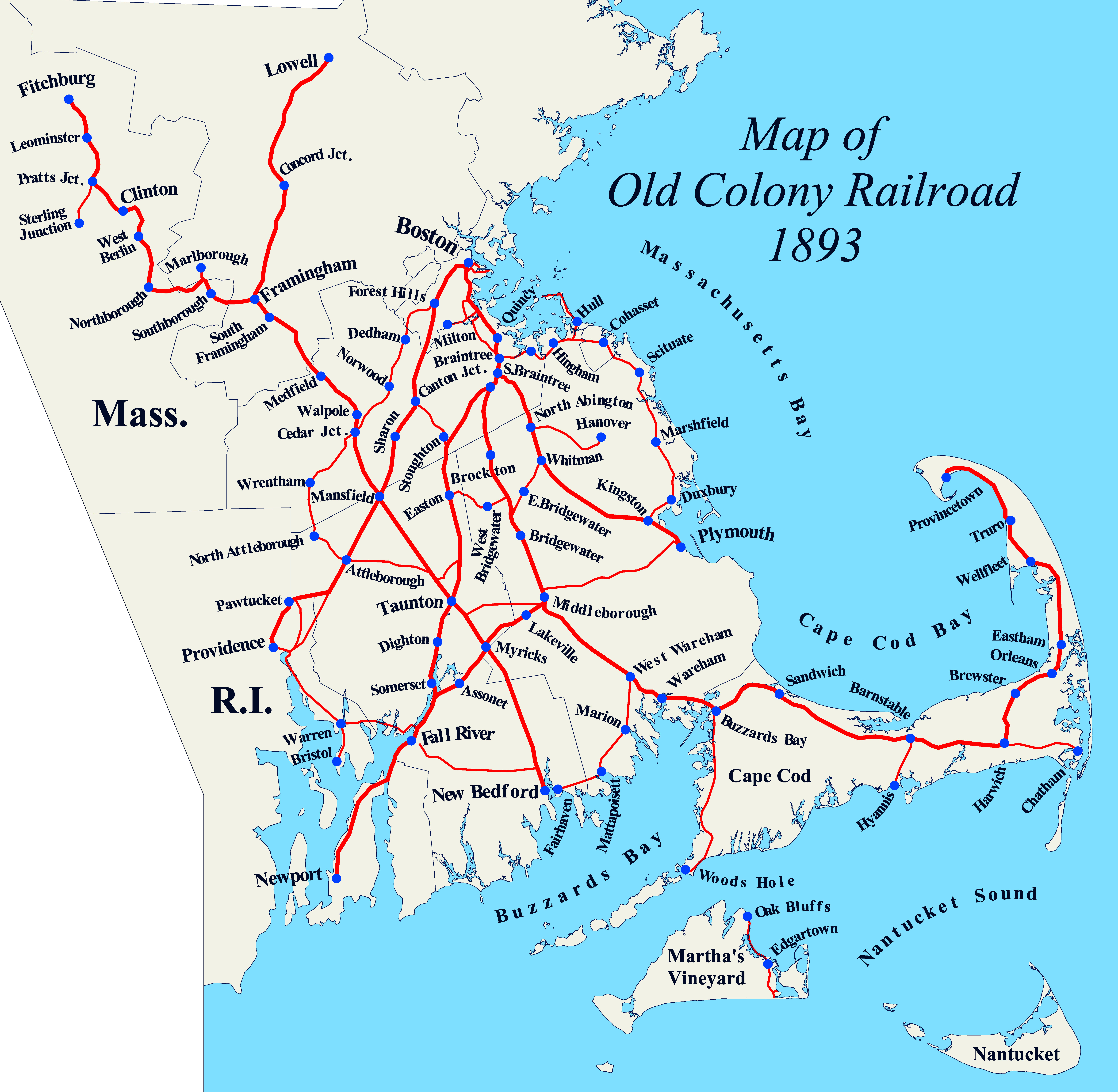
The Old Colony Railroad (OC) was a major railroad system, mainly covering southeastern Massachusetts and parts of Rhode Island, which operated from 1845 to 1893. Old Colony trains ran from Boston to points such as Plymouth, Fall River, New Bedford, Newport, Providence, Fitchburg, Lowell and Cape Cod. For many years the Old Colony Railroad Company also operated steamboat and ferry lines, including those of the Fall River Line with express train service from Boston to its wharf in Fall River where passengers boarded luxury liners to New York City. The company also briefly operated a railroad line on Martha's Vineyard, as well as the freight-only Union Freight Railroad in Boston. The OC was named after the "Old Colony", the nickname for the Plymouth Colony. From 1845 to 1893, the OC network grew extensively largely through a series of mergers and acquisitions with other established railroads, until it was itself acquired by the New York, New Haven and Hartfor ... [...More Info...] [...Related Items...] OR: [Wikipedia] [Google] [Baidu] |
Southeast Expressway (Massachusetts)
Interstate 93 (I-93) is an Interstate Highway in the New England states of Massachusetts, New Hampshire, and Vermont in the United States. Spanning approximately along a north–south axis, it is one of three primary Interstate Highways located entirely within New England; the other two are I-89 and I-91. The largest cities along the route are Boston, Massachusetts, and Manchester, New Hampshire; it also travels through the New Hampshire state capital of Concord. I-93 begins at an interchange with I-95, US Route 1 (US 1) and Route 128 in Canton, Massachusetts. It travels concurrently with US 1 beginning in Canton, and, with Route 3 beginning at the Braintree Split on the Braintree– Quincy city line, through the Central Artery in Downtown Boston before each route splits off beyond the Leonard P. Zakim Bunker Hill Memorial Bridge. The portion of highway between the Braintree Split and the Central Artery is named the "Southeast Express ... [...More Info...] [...Related Items...] OR: [Wikipedia] [Google] [Baidu] |
MBTA
The Massachusetts Bay Transportation Authority (abbreviated MBTA and known colloquially as "the T") is the public agency responsible for operating most public transportation services in Greater Boston, Massachusetts. The MBTA transit network includes the MBTA subway with three metro lines (the Blue, Orange, and Red lines), two light rail lines (the Green and Ashmont–Mattapan lines), and a five-line bus rapid transit system (the Silver Line); MBTA bus local and express service; the twelve-line MBTA Commuter Rail system, and several ferry routes. In , the system had a ridership of , or about per weekday as of , of which the rapid transit lines averaged and the light rail lines , making it the fourth-busiest rapid transit system and the third-busiest light rail system in the United States. As of , average weekday ridership of the commuter rail system was , making it the sixth-busiest commuter rail system in the U.S. The MBTA is the successor of several previous pu ... [...More Info...] [...Related Items...] OR: [Wikipedia] [Google] [Baidu] |
Kingston/Plymouth Line
The Old Colony Lines are a pair of branches of the MBTA Commuter Rail system, connecting downtown Boston, Massachusetts with the South Shore and cranberry-farming country to the south and southeast. The two branches operate concurrently for via the Old Colony Mainline from South Station to Braintree station. The Middleborough/Lakeville Line then winds south through Holbrook, Brockton, Bridgewater, Middleborough, and Lakeville via the Middleborough Main Line and Cape Main Line. The Kingston/Plymouth Line heads southeast to serve Weymouth, Abington, Whitman, Hanson, Halifax, Kingston, and Plymouth by way of the Plymouth branch. History The Old Colony under the New Haven Historically, train service extended beyond the current terminus of the three branches. Greenbush service continued on a now-abandoned right-of-way to Kingston, where it joined the Plymouth line. The Plymouth line extended into downtown Plymouth, and a branch connected to Middleborough through Carver ... [...More Info...] [...Related Items...] OR: [Wikipedia] [Google] [Baidu] |


