|
Quiriguá
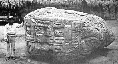
Quiriguá () is an ancient Maya archaeological site in the department of Izabal in south-eastern Guatemala. It is a medium-sized site covering approximately along the lower Motagua River, with the ceremonial center about from the north bank. During the Maya Classic Period (AD 200–900), Quiriguá was situated at the juncture of several important trade routes. The site was occupied by 200, construction on the acropolis had begun by about 550, and an explosion of grander construction started in the 8th century. All construction had halted by about 850, except for a brief period of reoccupation in the Early Postclassic (''c''. 900 – ''c''. 1200). Quiriguá shares its architectural and sculptural styles with the nearby Classic Period city of Copán, with whose history it is closely entwined. Quiriguá's rapid expansion in the 8th century was tied to king K'ak' Tiliw Chan Yopaat's military victory over Copán in 738. When the greatest king o ... [...More Info...] [...Related Items...] OR: [Wikipedia] [Google] [Baidu] |
Copán
Copán is an archaeological site of the Maya civilization in the Copán Department of western Honduras, not far from the border with Guatemala. This ancient Maya city mirrors the beauty of the physical landscape in which it flourished—a fertile, well-watered mountain valley in western Honduras at an elevation of 600 meters (1,970 feet) above mean sea level. It was the capital city of a major Classic period kingdom from the 5th to 9th centuries AD. The city was in the extreme southeast of the Mesoamerican cultural region, on the frontier with the Isthmo-Colombian cultural region, and was almost surrounded by non-Maya peoples.. Copán was occupied for more than two thousand years, from the Early Preclassic period to the Postclassic. The city developed a distinctive sculptural style within the tradition of the lowland Maya, perhaps to emphasize the Maya ethnicity of the city's rulers. The city has a historical record that spans the greater part of the Classic period an ... [...More Info...] [...Related Items...] OR: [Wikipedia] [Google] [Baidu] |
Los Amates
Los Amates is a municipality in the Izabal department of Guatemala. The population is about 61,000. The mayor is currently Marco Tulio Ramirez Estrada. Los Amates is located on the Motagua River, from the ruins of the ancient Maya city of Quiriguá. History Quiriguá Quiriguá is an ancient Maya archaeological site in Los Amates. It is a medium-sized site covering approximately along the lower Motagua River, with the ceremonial center about from the north bank. During the Maya Classic Period (AD 200–900), Quiriguá was situated at the juncture of several important trade routes. The site was occupied by 200, construction on the acropolis had begun by about 550, and an explosion of grander construction started in the 8th century. All construction had halted by about 850, except for a brief period of reoccupation in the Early Postclassic (''c''. 900 – ''c''. 1200). Quiriguá shares its architectural and sculptural styles with the nearby Class ... [...More Info...] [...Related Items...] OR: [Wikipedia] [Google] [Baidu] |
Maya Civilization
The Maya civilization () of the Mesoamerican people is known by its ancient temples and glyphs. Its Maya script is the most sophisticated and highly developed writing system in the pre-Columbian Americas. It is also noted for its art, architecture, mathematics, calendar, and astronomical system. The Maya civilization developed in the Maya Region, an area that today comprises southeastern Mexico, all of Guatemala and Belize, and the western portions of Honduras and El Salvador. It includes the northern lowlands of the Yucatán Peninsula and the highlands of the Sierra Madre, the Mexican state of Chiapas, southern Guatemala, El Salvador, and the southern lowlands of the Pacific littoral plain. Today, their descendants, known collectively as the Maya, number well over 6 million individuals, speak more than twenty-eight surviving Mayan languages, and reside in nearly the same area as their ancestors. The Archaic period, before 2000 BC, saw the first developme ... [...More Info...] [...Related Items...] OR: [Wikipedia] [Google] [Baidu] |
Mesoamerica
Mesoamerica is a historical region and cultural area in southern North America and most of Central America. It extends from approximately central Mexico through Belize, Guatemala, El Salvador, Honduras, Nicaragua, and northern Costa Rica. Within this region pre-Columbian societies flourished for more than 3,000 years before the Spanish colonization of the Americas. Mesoamerica was the site of two of the most profound historical transformations in world history: primary urban generation, and the formation of New World cultures out of the long encounters among indigenous, European, African and Asian cultures. In the 16th century, Eurasian diseases such as smallpox and measles, which were endemic among the colonists but new to North America, caused the deaths of upwards of 90% of the indigenous people, resulting in great losses to their societies and cultures. Mesoamerica is one of the five areas in the world where ancient civilization arose independently (see cradle of civiliza ... [...More Info...] [...Related Items...] OR: [Wikipedia] [Google] [Baidu] |
Mesoamerican Chronology
Mesoamerican chronology divides the history of prehispanic Mesoamerica into several periods: the Paleo-Indian (first human habitation until 3500 BCE); the Archaic (before 2600 BCE), the Preclassic or Formative (2500 BCE – 250 CE), the Classic (250–900 CE), and the Postclassic (); as well as the post European contact Colonial Period (1521–1821), and Postcolonial, or the period after independence from Spain (1821–present). The periodisation of Mesoamerica by researchers is based on archaeological, ethnohistorical, and modern cultural anthropology research dating to the early twentieth century. Archaeologists, ethnohistorians, historians, and cultural anthropologists continue to work to develop cultural histories of the region. Overview Paleo-Indian period 10,000–3500 BCE The Paleo-Indian (less frequently, '' Lithic'') period or era is that which spans from the first signs of human presence in the region, to the establishment of agricu ... [...More Info...] [...Related Items...] OR: [Wikipedia] [Google] [Baidu] |
Mesoamerican Architecture
Mesoamerican architecture is the set of architectural traditions produced by pre-Columbian cultures and civilizations of Mesoamerica, traditions which are best known in the form of public, ceremonial and urban monumental buildings and structures. The distinctive features of Mesoamerican architecture encompass a number of different regional and historical styles, which however are significantly interrelated. These styles developed throughout the different phases of Mesoamerican history as a result of the intensive cultural exchange between the different cultures of the Mesoamerican culture area through thousands of years. Mesoamerican architecture is mostly noted for its pyramids, which are the largest such structures outside of Ancient Egypt. One interesting and widely researched topic is the relation between cosmovision, religion, geography, and architecture in Mesoamerica. Much seems to suggest that many traits of Mesoamerican architecture were governed by religious and mytho ... [...More Info...] [...Related Items...] OR: [Wikipedia] [Google] [Baidu] |
Izabal Department
Izabal () is one of the 22 departments of Guatemala. Its coastal areas form part of the homeland of the Garifuna people. Izabal is bordered to the north by Belize, to the north east by the Gulf of Honduras, and to the east by Honduras, and by the Guatemalan departments of Petén to the north west, Alta Verapaz to the west, and Zacapa to the south. The Izabal Department surrounds Lake Izabal (or Lago de Izabal), Guatemala's largest lake (about 48 km long and 24 km wide, with an area of about 590 km²). The Spanish Colonial fort of San Felipe, now a Guatemalan national monument, overlooks the point where the lake flows into the Río Dulce. The small town of Izabal is on the south shore of the lake; before the construction of the ports of Livingston and Puerto Barrios in the 19th century this was Guatemala's main Caribbean Sea port and was the original seat of Izabal department; nowadays, however, Izabal town is a remote village that gets little traffic. From ... [...More Info...] [...Related Items...] OR: [Wikipedia] [Google] [Baidu] |
Maya Architecture
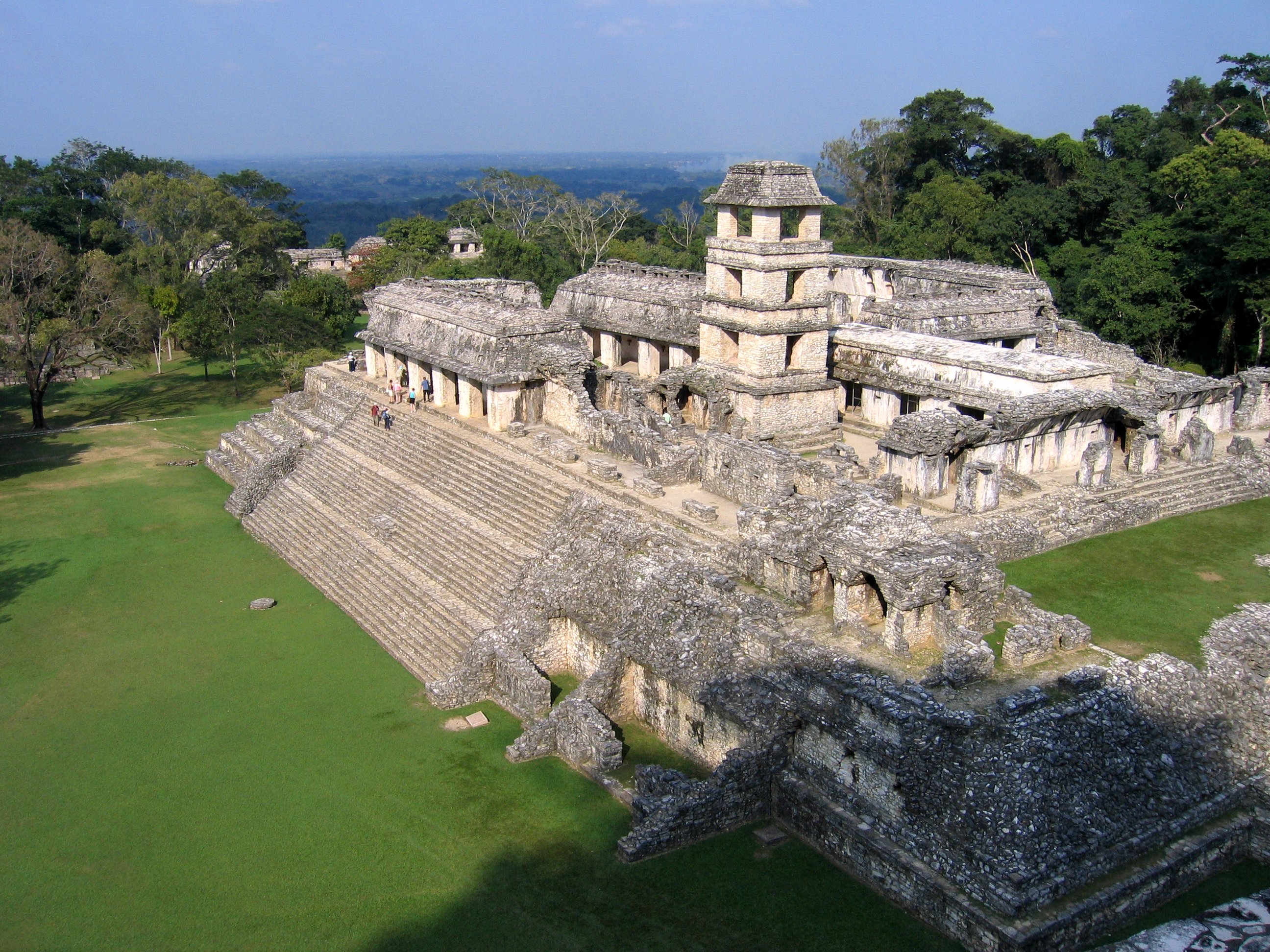
Maya architecture spans several thousands of years, several eras of political change, and architectural innovation before the Spanish colonization of the Americas. Often, the buildings most dramatic and easily recognizable as creations of the Maya peoples are the step pyramids of the Terminal Preclassic Maya period and beyond. Based in general Mesoamerican architectural traditions, the Maya utilized geometric proportions and intricate carving to build everything from simple houses to ornate temples. This article focuses on the more well-known pre-classic and classic examples of Maya architecture. The temples like the ones at Palenque, Tikal, and Uxmal represent a zenith of Maya art and architecture. Through the observation of numerous elements and stylistic distinctions, remnants of Maya architecture have become an important key to understanding their religious beliefs and culture as a whole. Urban design As Maya cities spread throughout the varied geography of Mesoamerica, t ... [...More Info...] [...Related Items...] OR: [Wikipedia] [Google] [Baidu] |
Guatemala
Guatemala ( ; ), officially the Republic of Guatemala ( es, República de Guatemala, links=no), is a country in Central America. It is bordered to the north and west by Mexico; to the northeast by Belize and the Caribbean; to the east by Honduras; to the southeast by El Salvador and to the south by the Pacific Ocean. With an estimated population of around million, Guatemala is the most populous country in Central America and the 11th most populous country in the Americas. It is a representative democracy with its capital and largest city being Nueva Guatemala de la Asunción, also known as Guatemala City, the most populous city in Central America. The territory of modern Guatemala hosted the core of the Maya civilization, which extended across Mesoamerica. In the 16th century, most of this area was conquered by the Spanish and claimed as part of the viceroyalty of New Spain. Guatemala attained independence in 1821 from Spain and Mexico. In 1823, it became part of the Fe ... [...More Info...] [...Related Items...] OR: [Wikipedia] [Google] [Baidu] |
Motagua River
The Motagua River () is a river in Guatemala. It rises in the western highlands of Guatemala where it is also called Río Grande, and runs in an easterly direction to the Gulf of Honduras. The final few kilometres of the river form part of the Guatemala–Honduras border. The Motagua River basin covers an area of and is the largest in Guatemala. The Motagua River is believed to be the number one most plastic-emitting river in the world, contributing around two per cent of global plastic pollution emissions into the world's oceans annually. Overview The river runs in a valley that has the only known source of jadeitite (jade) in Mesoamerica, and was an important commerce route during the Pre-Columbian era. The important Maya site of Quirigua is near the river's north bank, as are several smaller sites with jade quarries and workshops. The Motagua river valley also marks the Motagua Fault, the tectonic boundary between the North American and the Caribbean Plates. The M ... [...More Info...] [...Related Items...] OR: [Wikipedia] [Google] [Baidu] |
Sandstone
Sandstone is a clastic sedimentary rock composed mainly of sand-sized (0.0625 to 2 mm) silicate grains. Sandstones comprise about 20–25% of all sedimentary rocks. Most sandstone is composed of quartz or feldspar (both silicates) because they are the most resistant minerals to weathering processes at the Earth's surface. Like uncemented sand, sandstone may be any color due to impurities within the minerals, but the most common colors are tan, brown, yellow, red, grey, pink, white, and black. Since sandstone beds often form highly visible cliffs and other topographic features, certain colors of sandstone have been strongly identified with certain regions. Rock formations that are primarily composed of sandstone usually allow the percolation of water and other fluids and are porous enough to store large quantities, making them valuable aquifers and petroleum reservoirs. Quartz-bearing sandstone can be changed into quartzite through metamorphism, usually r ... [...More Info...] [...Related Items...] OR: [Wikipedia] [Google] [Baidu] |


.png)


Saunders_Quarry-1.jpg)