|
Philipstown, New York
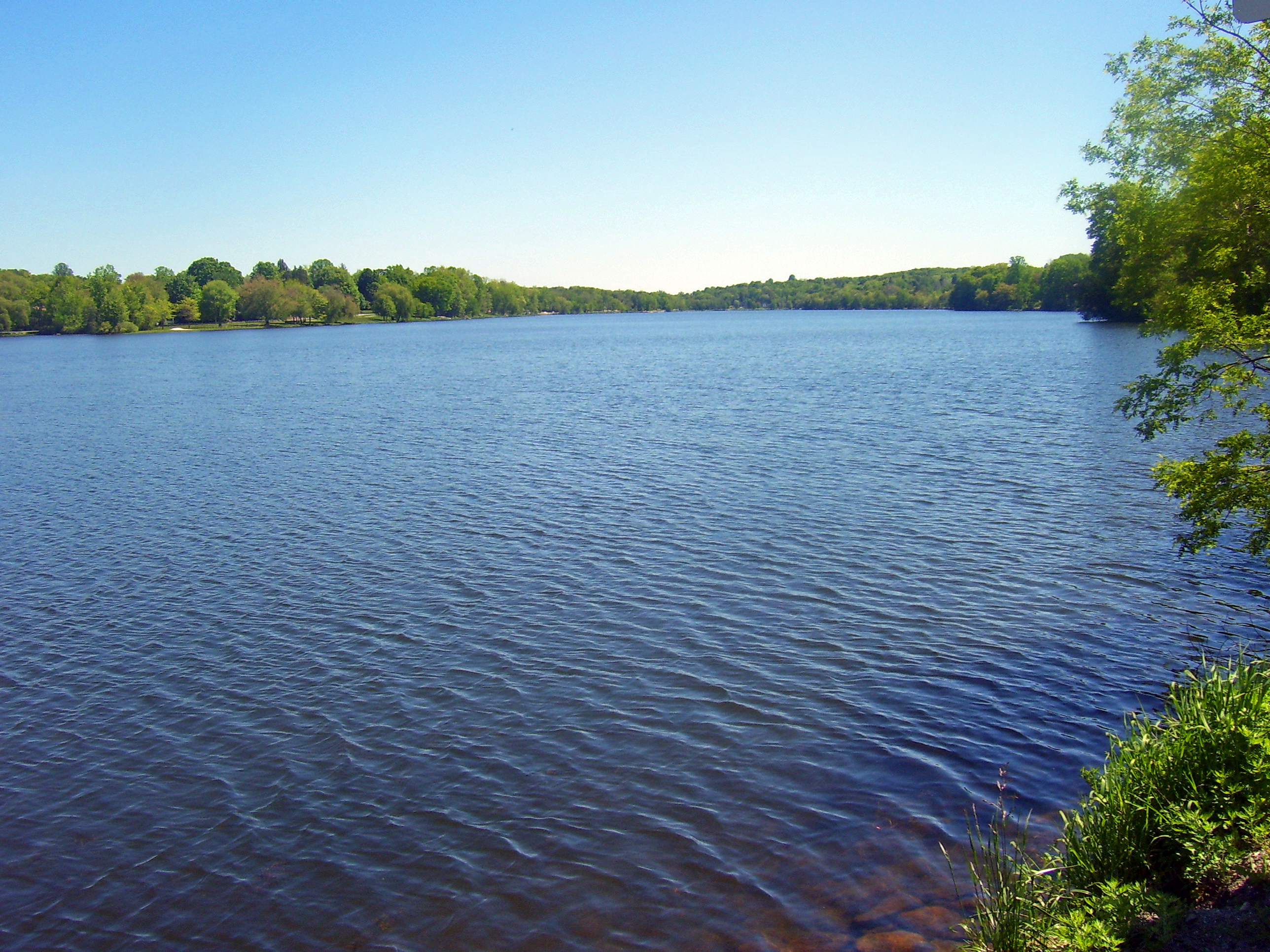
Philipstown is a town located in the western part of Putnam County, New York, United States. The population was 9,831 at the 2020 census. History In 1697 Adolphus Philipse, a wealthy Province of New York landowner and merchant, purchased a tract from Dutch traders which received British Royal sanction as the ''Highland Patent''. Comprising roughly 250 square miles, it extended approximately 13 miles along the eastern shore of the Hudson River, from Annsville Creek to the Fishkill Creek, and eastward some 20 or so miles to the border of the Colony of Connecticut.Smith, Philip Henry, ''General History of Putnam County: From 1609 to 1876, inclusive'', published by the author, Pawling, NY, 1877, p. 44 Philipstown was first settled in the westernmost of this parcel ''circa'' 1715. In 1754 the Highland Patent, subsequently known as the Philipse Patent, was divided among Philipse heirs into nine parcels.French's Gazetteer of the State of New York (1860): “The Philipses Patent… ... [...More Info...] [...Related Items...] OR: [Wikipedia] [Google] [Baidu] |
Administrative Divisions Of New York
The administrative divisions of New York are the various units of government that provide local services in the State of New York. The state is divided into boroughs, counties, cities, townships called "towns", and villages. (The only boroughs, the five boroughs of New York City, have the same boundaries as their respective counties.) They are municipal corporations, chartered (created) by the New York State Legislature, as under the New York Constitution the only body that can create governmental units is the state. All of them have their own governments, sometimes with no paid employees, that provide local services. Centers of population that are not incorporated and have no government or local services are designated hamlets. Whether a municipality is defined as a borough, city, town, or village is determined not by population or land area, but rather on the form of government selected by the residents and approved by the New York Legislature. Each type of local government ... [...More Info...] [...Related Items...] OR: [Wikipedia] [Google] [Baidu] |
Colony Of Connecticut
The ''Connecticut Colony'' or ''Colony of Connecticut'', originally known as the Connecticut River Colony or simply the River Colony, was an English colony in New England which later became Connecticut. It was organized on March 3, 1636 as a settlement for a Puritan congregation, and the English permanently gained control of the region in 1637 after struggles with the Dutch. The colony was later the scene of a bloody war between the colonists and Pequot Indians known as the Pequot War. Connecticut Colony played a significant role in the establishment of self-government in the New World with its refusal to surrender local authority to the Dominion of New England, an event known as the Charter Oak incident which occurred at Jeremy Adams' inn and tavern. Two other English settlements in the State of Connecticut were merged into the Colony of Connecticut: Saybrook Colony in 1644 and New Haven Colony in 1662. Leaders Thomas Hooker delivered a sermon to his congregation on May 31, ... [...More Info...] [...Related Items...] OR: [Wikipedia] [Google] [Baidu] |
Orange County, New York
Orange County is a county located in the U.S. state of New York. As of the 2020 census, the population was 401,310. The county seat is Goshen. This county was first created in 1683 and reorganized with its present boundaries in 1798. Orange County is part of the Poughkeepsie–Newburgh–Middletown metropolitan statistical area, which belongs to the larger New York–Newark–Bridgeport, NY–NJ–CT–PA Combined Statistical Area. It is in the state's Mid-Hudson Region of the Hudson Valley Area. As of the 2010 census the center of population of New York state was located in Orange County, approximately west of the hamlet of Westbrookville. History Orange County was officially established on November 1, 1683, when the Province of New York The Province of New York (1664–1776) was a British proprietary colony and later royal colony on the northeast coast of North America. As one of the Middle Colonies, New York achieved independence and worked with the others ... [...More Info...] [...Related Items...] OR: [Wikipedia] [Google] [Baidu] |
Hudson River
The Hudson River is a river that flows from north to south primarily through eastern New York. It originates in the Adirondack Mountains of Upstate New York and flows southward through the Hudson Valley to the New York Harbor between New York City and Jersey City, eventually draining into the Atlantic Ocean at Lower New York Bay. The river serves as a political boundary between the states of New Jersey and New York at its southern end. Farther north, it marks local boundaries between several New York counties. The lower half of the river is a tidal estuary, deeper than the body of water into which it flows, occupying the Hudson Fjord, an inlet which formed during the most recent period of North American glaciation, estimated at 26,000 to 13,300 years ago. Even as far north as the city of Troy, the flow of the river changes direction with the tides. The Hudson River runs through the Munsee, Lenape, Mohican, Mohawk, and Haudenosaunee homelands. Prior to European ... [...More Info...] [...Related Items...] OR: [Wikipedia] [Google] [Baidu] |
United States Census Bureau
The United States Census Bureau (USCB), officially the Bureau of the Census, is a principal agency of the U.S. Federal Statistical System, responsible for producing data about the American people and economy. The Census Bureau is part of the U.S. Department of Commerce and its director is appointed by the President of the United States. The Census Bureau's primary mission is conducting the U.S. census every ten years, which allocates the seats of the U.S. House of Representatives to the states based on their population. The bureau's various censuses and surveys help allocate over $675 billion in federal funds every year and it assists states, local communities, and businesses make informed decisions. The information provided by the census informs decisions on where to build and maintain schools, hospitals, transportation infrastructure, and police and fire departments. In addition to the decennial census, the Census Bureau continually conducts over 130 surveys and programs ... [...More Info...] [...Related Items...] OR: [Wikipedia] [Google] [Baidu] |
Kent, New York
Kent is a town in Putnam County, New York, United States. The population was 12,900 at the 2020 census. The name is that of an early settler family. The town is in the north-central part of the Putnam County. Many of the lakes are reservoirs for New York City. History Kent was part of the Philipse Patent of 1697, when it was still populated by the Wappinger tribe. Daniel Nimham (1724–1778) was the last chief of the Wappingers and was the most prominent Native American of his time in the Hudson Valley. The town was first settled by Europeans in the mid-18th century by Zachariah Merritt and others, from New England, Westchester County, or the Fishkill area. Elisha Cole and his wife Hannah Smalley built Coles Mills in 1748, having moved to that location the previous year from Cape Cod. Coles Mill operated until 1888 when it was submerged under West Branch Reservoir. Around this same time the northeastern part of the county was settled by the Kent, Townsend, and Ludington fam ... [...More Info...] [...Related Items...] OR: [Wikipedia] [Google] [Baidu] |
Putnam Valley, New York
Putnam Valley is a town in Putnam County, New York, United States. The population was 11,809 at the 2010 census. Its location is northeast of New York City, in the southwestern part of Putnam County.Putnam Valley calls itself the "Town of Lakes". History The retreating glaciers of the last ice age did much to shape the landscape of Putnam Valley, including the shearing of hills to expose springs (creating, for example Bryant Pond) and leaving the glacial deposits of stone and large boulders. The current area of Putnam Valley was occupied by paleo-Indians, followed by the historic Wappinger Indians who lived by the many lakes. Dutch and English farmers moved into the area toward the end of the 17th Century. In 1697, the Highland Patent was granted to Adolph Philipse. The first settlers arrived ''circa'' 1740. In 1745, the Smith property was sold to the Bryant family, who renamed their pond Bryant Pond and the nearby hill, Bryant Hill. The Smith family homestead is the oldest ho ... [...More Info...] [...Related Items...] OR: [Wikipedia] [Google] [Baidu] |
Nelsonville, New York
Nelsonville is a village located in the town of Philipstown in Putnam County, New York, United States. The population was 628 at the time of the 2010 census. Nelsonville Lies in the Hudson Highlands directly east of the village of Cold Spring. On Main Street, the border is roughly demarcated by the western property line of the Baptist Church at the height of land, and by the property line along the rear of the church lot, extending south toward the Cold Spring Cemetery. Along with its neighbor, Cold Spring, the village is known for being a small, picturesque enclave with a historic housing stock. It is a popular weekend and fall foliage destination for New York City residents, and the origin of several well-known hiking trails that traverse the Hudson Highlands. The village is served by the Cold Spring Metro-North commuter railroad stop on the Hudson Line. History Nelsonville is named after the Nelson family, early residents in the area. The West Point Foundry Association's op ... [...More Info...] [...Related Items...] OR: [Wikipedia] [Google] [Baidu] |
Garrison, New York
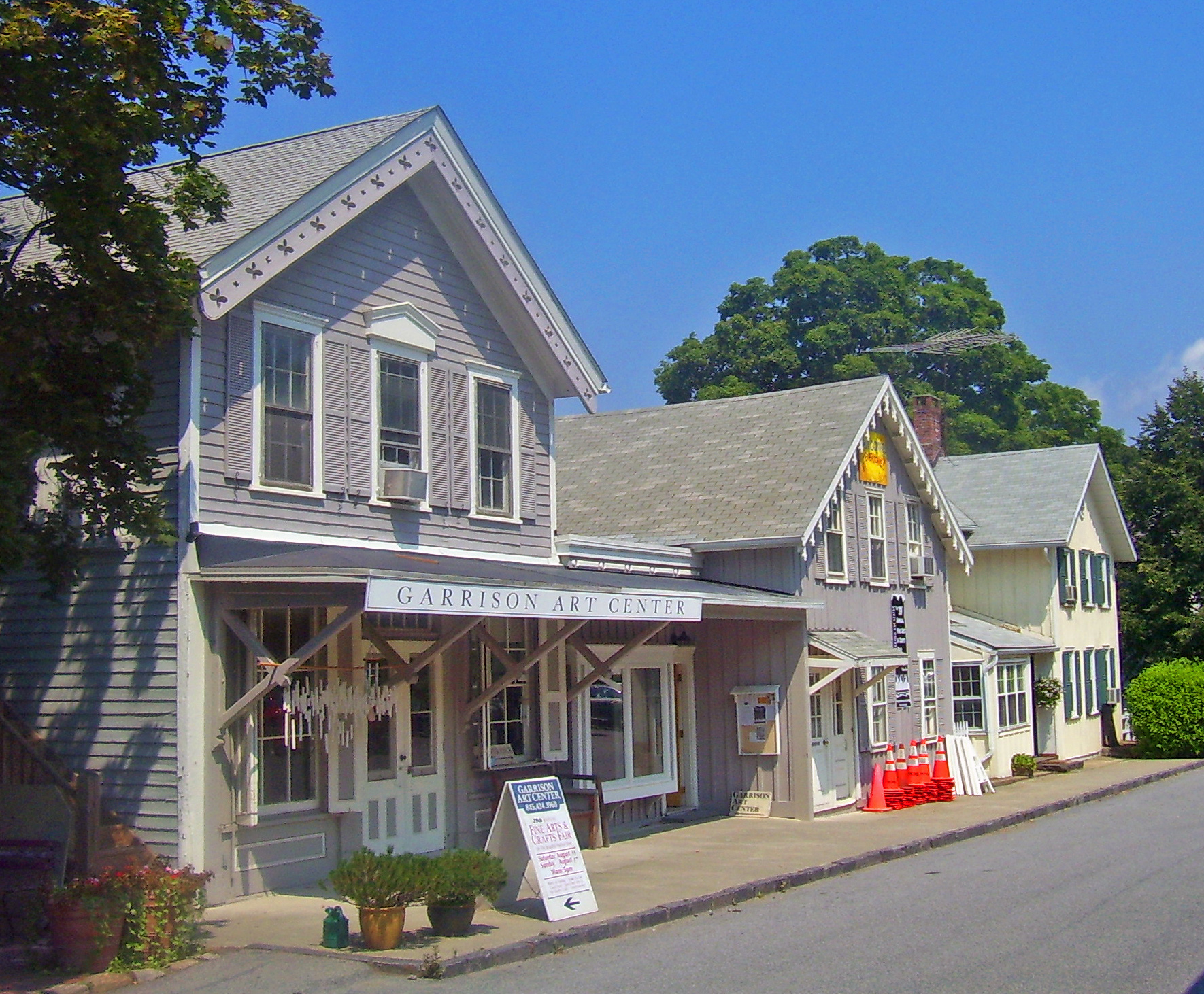
Garrison is a hamlet in Putnam County, New York, United States. It is part of the town of Philipstown, on the east side of the Hudson River, across from the United States Military Academy at West Point. The Garrison Metro-North Railroad station serves the town. Garrison (a.k.a. Garrison's Landing) was named after 2nd Lieutenant Isaac Garrison, who held a property lot on the Hudson River across from West Point and conducted a ferry service across the Hudson River between the two hamlets. Isaac and his son Beverly Garrison fought in the Battle of Fort Montgomery in 1777, were captured by the British and later set free. The Garrison train wreck took place near Garrison on the Great Hudson River Railway on October 24, 1897, killing 20 people. For the 1969 film '' Hello, Dolly!'' starring Barbra Streisand, Garrison was the filming location for the Yonkers scenes. The Saint Basil Academy in the town served as the finish line of ''The Amazing Race 10'' in 2006. Organization ... [...More Info...] [...Related Items...] OR: [Wikipedia] [Google] [Baidu] |
Cold Spring, New York
Cold Spring is a village in the town of Philipstown in Putnam County, New York, United States. The population was 1,986 at the 2020 census. It borders the smaller village of Nelsonville and the hamlets of Garrison and North Highlands. The central area of the village is on the National Register of Historic Places as the Cold Spring Historic District due to its many well- preserved 19th-century buildings, constructed to accommodate workers at the nearby West Point Foundry (itself a Registered Historic Place today). The town is the birthplace of General Gouverneur K. Warren, who was an important figure in the Union Army during the Civil War. The village, located in the Hudson Highlands, sits at the deepest point of the Hudson River, directly across from West Point. Cold Spring serves as a weekend getaway for many residents of New York City. Commuter service to New York City is available via the Cold Spring train station, served by Metro-North Railroad. The train journey is appro ... [...More Info...] [...Related Items...] OR: [Wikipedia] [Google] [Baidu] |
Fishkill (town), New York
Fishkill is a town in the southwestern part of Dutchess County, New York, United States. It lies approximately north of New York City. The population was 22,107 at the 2010 census. Fishkill surrounds the city of Beacon, and contains a village, which is also named Fishkill. The name Fishkill derives from the Dutch words ''vis kill'', meaning "fish creek". The location of Fishkill was known as ''Tioranda'' by the Native American peoples. The name means "The place where two waters meet". Fishkill is one of the nine original towns in Dutchess County, and is best known today for its rich history dating to the American Revolutionary War period and scenic views of the Hudson Highlands. History In 1683 New York City merchants Francis Rombouts and Gulian Verplanck purchased in Dutchess County from the Wappinger confederacy of Native Americans for a quantity of goods including rum, powder, and tobacco. In 1685 it was granted as the royal Rombout Patent. Neither ever lived on the land, i ... [...More Info...] [...Related Items...] OR: [Wikipedia] [Google] [Baidu] |
Hudson Highlands
The Hudson Highlands are mountains on both sides of the Hudson River in New York state lying primarily in Putnam County on its east bank and Orange County on its west. They continue somewhat to the south in Westchester County and Rockland County, respectively. North to south they fall between Newburgh Bay and Haverstraw Bay, the latter forming the northern region of the New York - New Jersey Highlands. The Hudson River enters this region in the south at Dunderberg Mountain near Stony Point, and from the north in the vicinity of Breakneck Ridge and Storm King Mountain near Cornwall, New York. These highlands have played a significant role in America's environmental, cultural, and military history. Geology The bedrock of the Highlands is part of the Reading Prong and more than a billion years old, formed during the Grenville Orogeny. It represents the very core of the Appalachian range, which has been formed by successive mountain-building events ( orogenies). The present mou ... [...More Info...] [...Related Items...] OR: [Wikipedia] [Google] [Baidu] |
.png)


.jpg)
