|
Partick Station
, symbol_location = gb , symbol = rail , symbol2 = glasgow , image = Partick station new facade.jpeg , caption = The new façade of ''Partick station'' after a lengthy renovation , borough = Partick, City of Glasgow , country = Scotland , coordinates = , grid_name = Grid reference , grid_position = , manager = ScotRail , platforms = 2 , disabled = , code = PTK , transit_authority = SPT , original = British Railways , opened = Butt (1995), page 181 , mpassengers = , footnotes = Passenger statistics from the Office of Rail and Road Partick station is an interchange station in the Partick area of Glasgow, Scotland. Along with an adjacent bus station, it forms one of the main transport hubs in Glasgow. The station is served by Glasgow Subway and National Rail service ... [...More Info...] [...Related Items...] OR: [Wikipedia] [Google] [Baidu] |
Partick
Partick ( sco, Pairtick, Scottish Gaelic: ''Partaig'') is an area of Glasgow on the north bank of the River Clyde, just across from Govan. To the west lies Whiteinch, to the east Yorkhill and Kelvingrove Park (across the River Kelvin), and to the north Broomhill, Hyndland, Dowanhill, Hillhead, areas which form part of the West End of Glasgow. Partick was a Police burgh from 1852 until 1912 when it was incorporated into the city.Second City of The Empire: 1830s to 1914 from theglasgowstory.com. Retrieved 22 December 2011. Partick is the area of the city most connected with the Highlands, and several Gaelic agencies, such as the Gaelic Books Council ( |
North British Railway
The North British Railway was a British railway company, based in Edinburgh, Scotland. It was established in 1844, with the intention of linking with English railways at Berwick. The line opened in 1846, and from the outset the company followed a policy of expanding its geographical area, and competing with the Caledonian Railway in particular. In doing so it committed huge sums of money, and incurred shareholder disapproval that resulted in two chairmen leaving the company. Nonetheless the company successfully reached Carlisle, where it later made a partnership with the Midland Railway. It also linked from Edinburgh to Perth and Dundee, but for many years the journey involved a ferry crossing of the Forth and the Tay. Eventually the North British built the Tay Bridge, but the structure collapsed as a train was crossing in high wind. The company survived the setback and opened a second Tay Bridge, followed soon by the Forth Bridge, which together transformed the railway net ... [...More Info...] [...Related Items...] OR: [Wikipedia] [Google] [Baidu] |
Charing Cross (Glasgow) Railway Station
Charing Cross ( ) is a junction in Westminster, London, England, where six routes meet. Clockwise from north these are: the east side of Trafalgar Square leading to St Martin's Place and then Charing Cross Road; the Strand leading to the City; Northumberland Avenue leading to the Thames Embankment; Whitehall leading to Parliament Square; The Mall leading to Admiralty Arch and Buckingham Palace; and two short roads leading to Pall Mall. The name also commonly refers to the Queen Eleanor Memorial Cross at Charing Cross station. A bronze equestrian statue of Charles I, erected in 1675, stands on a high plinth, situated roughly where a medieval monumental cross had previously stood for 353 years (since its construction in 1294) until destroyed in 1647 by Cromwell and his revolutionary government. The famously beheaded King, appearing ascendant, is the work of French sculptor Hubert Le Sueur. The aforementioned eponymous monument, the "Charing Cross", was the largest and most o ... [...More Info...] [...Related Items...] OR: [Wikipedia] [Google] [Baidu] |
Whifflet Line
The Whifflet Line is one of the lines within the Strathclyde suburban rail network in Scotland. History The line was built between 1863 and 1865 as the Rutherglen and Coatbridge Railway, part of the Caledonian Railway. It opened to goods traffic (mainly coal and iron) in September 1865 and to passengers in August 1866. It has been in continuous operation ever since. Stations in the first service on the line were at , (now ), , and (until 1964). Passenger services ceased in November 1966 following the Beeching Axe (latterly running to ). Between 1972 and 1974 scheduled passenger trains between Glasgow Central and Perth used the route. For the following twenty years, the route was only used for freight and diverted passenger services. However the line was reopened by British Rail to scheduled passenger services with intermediate stations on 4 October 1993, running to the newly built station at rather than Coatbridge Central as previously. Line description The modern line ... [...More Info...] [...Related Items...] OR: [Wikipedia] [Google] [Baidu] |
High Street (Glasgow) Railway Station
, symbol_location = gb , symbol = rail , image = Train arriving at Glasgow High Street.JPG , caption = Train arriving at Glasgow High Street. The campus buildings of Strathclyde University are visible at the top of the photograph. , borough = Glasgow, Glasgow , country = Scotland , coordinates = , grid_name = Grid reference , grid_position = , owned = Network Rail , manager = ScotRail , platforms = 2 , code = HST , transit_authority = SPT , original = Glasgow City and District Railway , pregroup = North British Railway , postgroup = London and North Eastern Railway , years = 15 March 1866 , events = Opened as College replacing the station on the CoGURButt (1995), page 66 , years1 = 1 January 1914 , events1 = Renamed as High Str ... [...More Info...] [...Related Items...] OR: [Wikipedia] [Google] [Baidu] |
North Clyde Line
The North Clyde Line (defined by Network Rail as the ''Glasgow North Electric Suburban'' line) is a suburban railway in West Central Scotland. The route is operated by ScotRail Trains. As a result of the incorporation of the Airdrie–Bathgate rail link and the Edinburgh–Bathgate line, this route has become the fourth rail link between Glasgow and Edinburgh. Route The North Clyde Line (known as Dunbartonshire - Glasgow, Cumbernauld and Falkirk Grahamston in timetables), electrified by British Rail in 1960, ran east–west through the Greater Glasgow conurbation, linking northern Lanarkshire with western Dunbartonshire, by way of the city centre. Fifty years later, in 2010, the line was extended by Network Rail east from Airdrie, by way of re-opening the line to Bathgate meeting up with the line re-opened by British Rail from Edinburgh. The main core of the route runs from to via and Glasgow Queen Street (Low Level). To the east of the Glasgow city centre, there ... [...More Info...] [...Related Items...] OR: [Wikipedia] [Google] [Baidu] |
British Rail
British Railways (BR), which from 1965 traded as British Rail, was a state-owned company that operated most of the overground rail transport in Great Britain from 1948 to 1997. It was formed from the nationalisation of the Big Four (British railway companies), Big Four British railway companies, and was privatisation of British Rail, privatised in stages between 1994 and 1997. Originally a trading brand of the Railway Executive of the British Transport Commission, it became an independent statutory corporation in January 1963, when it was formally renamed the British Railways Board. The period of nationalisation saw sweeping changes in the railway. A process of dieselisation and Railway electrification in Great Britain, electrification took place, and by 1968 steam locomotives had been entirely replaced by diesel and electric traction, except for the Vale of Rheidol Railway (a narrow-gauge railway, narrow-gauge tourist line). Passenger train, Passengers replaced freight train, ... [...More Info...] [...Related Items...] OR: [Wikipedia] [Google] [Baidu] |
Argyle Line
The Argyle Line is a suburban railway located in West Central Scotland. The line serves the commercial and shopping districts of Glasgow's central area, and connects towns from West Dunbartonshire to South Lanarkshire. Named for Glasgow's Argyle Street, the line uses the earlier cut-and-cover tunnel running beneath that thoroughfare. The term "Argyle Line" is commonly used to describe: * the extensive urban passenger train service that connects the towns and suburbs of North Clyde with Motherwell, Larkhall, and Lanark, to the southeast. Of the 48 stations, 4 are in West Dunbartonshire, 4 in East Dunbartonshire, 17 in Glasgow City, 10 in North Lanarkshire, and 13 in South Lanarkshire. * the central portion of railway infrastructure encompassing less than . History Prior to 1964 The Glasgow Central Railway (GCR) under central Glasgow opened in 1886, connecting the Lanarkshire and Dunbartonshire Railway at and Stobcross Railway at to the Lanarkshire and Ayrshire Railway near ... [...More Info...] [...Related Items...] OR: [Wikipedia] [Google] [Baidu] |
Greater Glasgow Passenger Transport Executive
Strathclyde Partnership for Transport (SPT) is a regional transport partnership for the Strathclyde area of western Scotland. It is responsible for planning and coordinating regional transport, especially the public transport system in the area, including responsibility for operating the Glasgow Subway, the third oldest in the world. History The principal predecessor to SPT was the Greater Glasgow Passenger Transport Executive (GGPTE) set up in 1972 to take over the Glasgow Corporation's public transport functions and to co-ordinate public transport in the Clyde Valley. In the 1980s it was replaced by the Strathclyde Passenger Transport Executive (SPTE), under the overall direction of Strathclyde Regional Council. Section 40 of the Local Government etc. (Scotland) Act 1994 created a new ''statutory corporation'', the Strathclyde Passenger Transport Authority (SPTA), which took over "''all of the functions, staff, property, rights, liabilities and obligations of Strathclyde ... [...More Info...] [...Related Items...] OR: [Wikipedia] [Google] [Baidu] |
British Rail Class 303
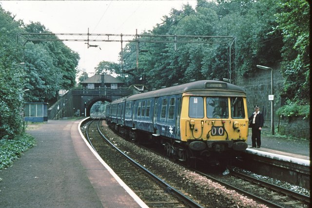
The British Rail Class 303 electric multiple units, also known as "Blue Train" units, were introduced in 1960 for the electrification of the North Clyde and the Cathcart Circle lines in Strathclyde. They were initially classified as AM3 units before the introduction of the TOPS classification system, and were the dominant EMU on the Glasgow suburban railway network for over 25 years before being progressively phased out by newer rolling stock. The final units were withdrawn from service in 2002. The fleet's lifespan was 42 years. The units were later used on the Inverclyde and Argyle lines of the Glasgow suburban railway network as various electrification schemes came to fruition. Description Ninety-one 3-car units were built by Pressed Steel at Linwood near Paisley, from 1959–1961, and they were introduced into service in 1960.Gillham (1988), Chapter 19: ''25 kV for Glasgow''. A further 19 near-identical Class 311 units were built in 1967 following the Inverclyde elect ... [...More Info...] [...Related Items...] OR: [Wikipedia] [Google] [Baidu] |
Glasgow Central Railway
The Glasgow Central Railway was a railway line built in Glasgow, Scotland by the Caledonian Railway, running in tunnel east to west through the city centre. It was opened in stages from 1894 and opened up new journey opportunities for passengers and enabled the Caledonian Railway to access docks and industrial locations on the north bank of the River Clyde. An intensive and popular train service was operated, but the long tunnel sections with frequent steam trains were smoky and heartily disliked. The network paralleled the North British Railway routes in the area, and after nationalisation of the railways the line declined and was closed in stages from 1959 to 1964. In 1979 the central part of the route was reopened as an electrically operated passenger railway, the ''Argyle Line''; this was greatly popular and enhanced connecting routes to west and east made this a valuable link through the city once more. The Argyle Line section is in heavy use today, but the other parts rema ... [...More Info...] [...Related Items...] OR: [Wikipedia] [Google] [Baidu] |
Stobcross Railway
The Stobcross Railway was a railway line in Glasgow, Scotland, built by the North British Railway to connect from Maryhill to the new dock being built at Stobcross; the dock became the Queen's Dock, opened in 1877. The line was opened first, in 1874, and gave the North British company access to the north bank of the River Clyde; there was a goods depot at Partick. As industry and housing developed further west the line became the stem of further branches, and in 1886 the sub-surface Glasgow City and District Railway connected through Queen Street Low Level to Stobcross. Queen's Dock closed in 1969 and freight use of the line was minimal, but part of the line has been electrified and most of it is in use in 2015 for passenger trains. History The Glasgow, Dumbarton and Helensburgh Railway The Glasgow, Dumbarton and Helensburgh Railway (GD&HR) was opened in 1858, running from the Edinburgh and Glasgow Railway (E&GR) at Cowlairs to Dumbarton where it joined an existing railwa ... [...More Info...] [...Related Items...] OR: [Wikipedia] [Google] [Baidu] |

.jpg)


.jpg)


