|
Puducherry (union Territory)
Puducherry, also known as Pondicherry, is a union territory of India, consisting of four small geographically unconnected districts. It was formed out of four territories of former French India, namely Puducherry district, Pondichéry (now Puducherry), Karaikal district, Karikal (Karaikal), Mahé district, Mahé and Yanaon (now Yanam district, Yanam), excluding Chandannagar (Chandernagore), and it is named after the largest district, Puducherry, which was also the capital of French India. Historically known as Pondicherry, the territory Renaming of cities in India, changed its official name to Puducherry on 1 October 2006. The Union Territory of Puducherry lies in the South India, southern part of the Indian Peninsula. The areas of Puducherry district and Karaikal district are bound by the state of Tamil Nadu, while Yanam district and Mahé district are enclosed by the states of Andhra Pradesh and Kerala, respectively. Puducherry is the 29th most populous of the 36 states and u ... [...More Info...] [...Related Items...] OR: [Wikipedia] [Google] [Baidu] |
Promenade Beach
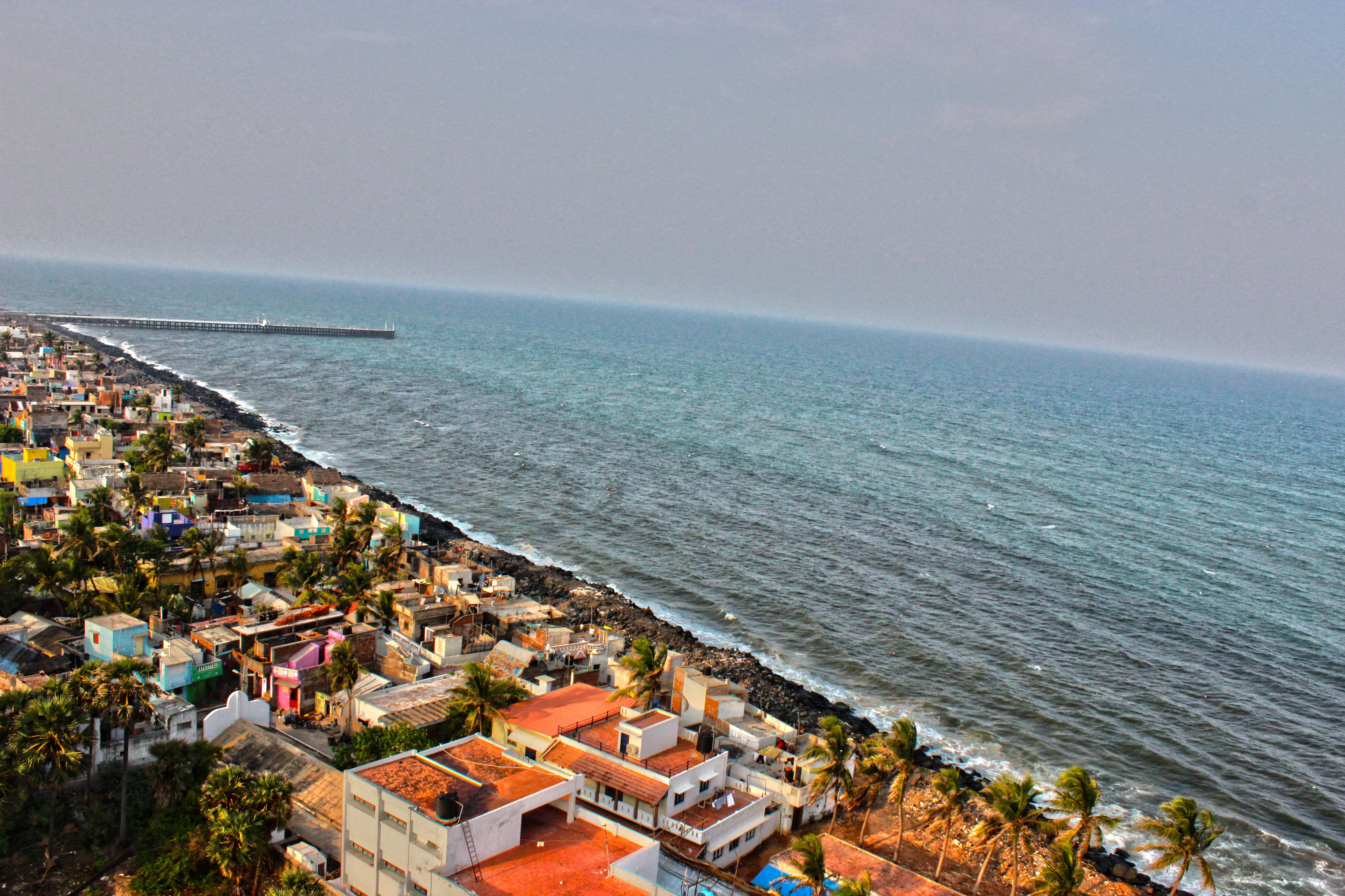
Rock Beach (or, known as, "Pondicherry Beach". French: Plage de la promenade) is the popular stretch of beachfront in the city of Puducherry (city), Puducherry, along the Bay of Bengal. It is a 1.2-kilometre-long stretch in Pondicherry, starts from War Memorial and end at Dupleix Park on the Goubert Avenue. Other attractions * French War Memorial (Puducherry), War Memorial * Chief Secretariat * Mahatma Gandhi statue * Dupleix Park Panoramas Gallery File:PondicherryFrenchWarMemorial.jpg, French War Memorial (Puducherry), French War Memorial File:Pondicherry, Promenade Beach, Rock Beach, India.jpg, Rock Beach/Promenade Beach File:Moon rise beach.jpg, Moon rise at Promenade beach File:Rock beach night harbor.jpg, Promenade beach at night showing harbor File:Gandhi statue poncherry 1.jpg, Gandhi statue at Promenade beach File:Pondicherry, Bay of Bengal, India.jpg, Harbor at Promenade beach File:Pondicherry Beach, India.jpg, Evening walk by the bay of Bengal in Pondicherry See ... [...More Info...] [...Related Items...] OR: [Wikipedia] [Google] [Baidu] |
Chandannagar
Chandannagar (), also known by its former names Chandannagore and Chandernagor (), is a city in the Hooghly district in the Indian state of West Bengal. It is headquarter of the Chandannagore subdivision and is a part of the area covered by Kolkata Metropolitan Development Authority (KMDA). Located on the western bank of Hooghly River, the city was one of the five settlements of French India. Indo-French architecture is seen in the colonial bungalows, most of which are in a dilapidated state. Cuisine Chandannagar is famous for its own popular Jolbhora Talsash Sondesh. Demographics As per 2011 Census of India Chandannagar had a total population of 166,867 of which 84,009 (50.3%) were males and 82,858 (49.7%) were females. The population below 6 years was 11,826. The total number of literates in Chandannagar was 139,005 (89.65% of the population over 6 years). Etymology The name Chandannagar is composed of two elements, of which the latter, ''nagar,'' means 'city' and ... [...More Info...] [...Related Items...] OR: [Wikipedia] [Google] [Baidu] |
Yanam District
Yanam district () (previously Yanaon, ()) is one of the four census districts of the Union Territory of Puducherry in India. Administratively it falls under the Puducherry district. Geography Yanam district occupies an area of , It is located south of Kakinada port on the north bank of Godavari river, slightly inland. It is bordered and surrounded by Konaseema district on South and Kakinada district on north (Districts of Andhra State) Revenue villages Apart from the town of Yanam itself, the following villages fall under the district's jurisdiction: * Agraharam * Darialatippa * Farampeta * Francetippa * Guerempeta * Kanakalapeta * Kurasampeta * Mettakur Demographics According to the 2011 census Yanam district has a population of 55,626, roughly equal to the island of Greenland. This gives it a ranking of 629th in India (out of a total of 640). The district has a population density of . Its population growth rate over the decade 2001-2011 was 77.15%. Yanam ha ... [...More Info...] [...Related Items...] OR: [Wikipedia] [Google] [Baidu] |
Yanaon
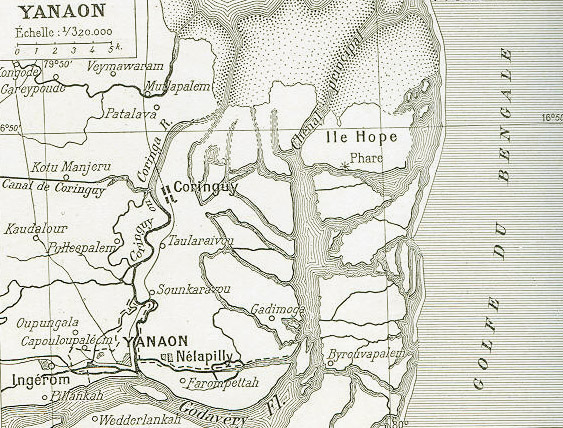
Yanaon (, , ) was one of the five principal settlements of French India between 1731 and 1954. It was referred to in British records as Yanam. Early years Reason for European interests The French in their earlier records does mention their interest in establishing trade in the Northern Circars, which lie in the coastal regions of the Hyderabad sultanate. The Northern circars are very important as they sway a big influence in the court of Deccan Subah. This Subah is indeed the most important among all other provinces of the Mughal empire in the Indian peninsula. The Mughal Empire considers Deccan as their principal power. In some old records, it was mentioned as ''Ayanaon, a big village in the Circar of Rajamindri, situated along the Ingiram river''. This French establishment very well flourished before the setback and failures of the French during the Seven Years' War. From this town and its surroundings, beautiful towels are manufactured. These towels are referred as guin� ... [...More Info...] [...Related Items...] OR: [Wikipedia] [Google] [Baidu] |
Mahé District
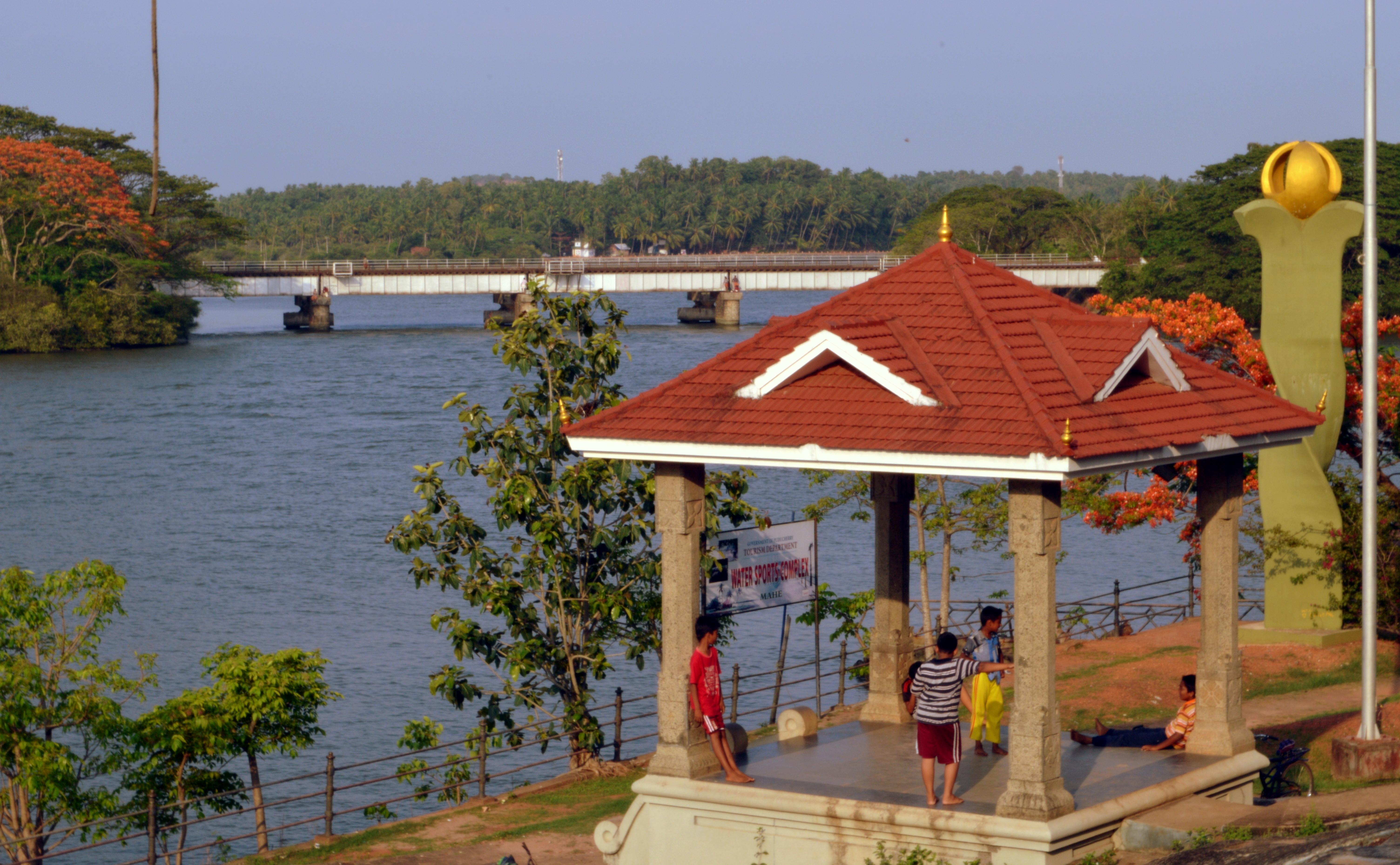
Mahé district () natively Mayyazhi () is one of the four census districts of the union territory of Puducherry, India. Administratively it falls under the Puducherry district. It consists of the whole of the Mahé region. Mahé is the smallest district of India in terms of land area. The total area of Mahé district is surrounded on three sides by Kannur District and one side by Kozhikode District. Geographically Mahé district is part of North Malabar region. It is the sixth least populous district in the country (out of 773). Geography Mahé district occupies an area of . Demographics According to the 2011 census Mahé district has a population of 41,816, roughly equal to the nation of Liechtenstein. This gives it a ranking of 635th in India (out of a total of 640). The district has a population density of . Its population growth rate over the decade 2001-2011 was 13.86%. Mahé has a sex ratio of 1,176 females for every 1,000 males, and a literacy rate of 98.35%. R ... [...More Info...] [...Related Items...] OR: [Wikipedia] [Google] [Baidu] |
Karaikal District
Karaikal district ( French: ''District de Karikal'') is one of the four districts of the Union Territory of Puducherry in India. Geography Karaikal district occupies an area of . Karaikal is a small coastal enclave of territory which was formerly part of French India. Together with the other former French enclaves of Pondicherry, Yanam, and Mahé, Karaikal forms the Union Territory of Puducherry. Karaikal is bounded on the North by Mayiladuthurai district, on the South by Nagapattinam district of Tamil Nadu state, on the west by Tiruvarur district (also belonging to Tamil Nadu), and on the East by the Bay of Bengal. Demographics According to the 2011 census Karaikal district has a population of 200,222, roughly equal to the nation of Samoa. This gives it a ranking of 589th in India (out of a total of 640). The district has a population density of . Its population growth rate over the decade 2001-2011 was 17.29%. Karaikal has a sex ratio of 1048 females for ev ... [...More Info...] [...Related Items...] OR: [Wikipedia] [Google] [Baidu] |
Puducherry District
The Puducherry District, also known by its former name Pondicherry district, is one of the four districts of the union territory of Puducherry in South India. The district occupies an area of , spread over 12 non-contiguous enclaves lying on or near the Bay of Bengal within a compact area in the state of Tamil Nadu. According to the 2011 census, the district has a population of 950,289. Administrative divisions For administrative purpose, the union territory of Puducherry is divided into eight taluks. Four of these, viz. Puducherry, Uzhavarkarai, Villianur and Bahour, together constitute Puducherry district. Among these four, only Uzhavarkarai taluk does not contain any rural area. The rural areas under the other three taluks are further divided commune panchayats (CP) or simply communes. Rural area of Puducherry taluk is covered by a single commune Ariyankuppam, whereas Villianur taluk has two communes, viz. Villianur and Mannadipet, and rural area of Bahour taluk c ... [...More Info...] [...Related Items...] OR: [Wikipedia] [Google] [Baidu] |
French India
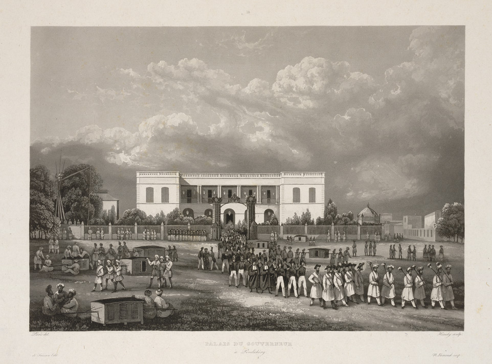
French India, formally the (), was a French colony comprising five geographically separated enclaves on the Indian subcontinent that had initially been factories of the French East India Company. They were ''de facto'' incorporated into the Republic of India in 1950 and 1954. The enclaves were , Karikal, Yanaon on the Coromandel Coast, Mahé on the Malabar Coast and Chandernagor in Bengal. The French also possessed several ('lodges', tiny subsidiary trading stations) inside other towns, but after 1816, the British denied all French claims to these, which were not reoccupied. By 1950, the total area measured , of which belonged to the territory of . In 1936, the population of the colony totalled 298,851 inhabitants, of which 63% (187,870) lived in the territory of Pondichéry. Background France was the last of the major European maritime powers of the 17th century to enter the East India trade. Six decades after the foundation of the English and Dutch East ... [...More Info...] [...Related Items...] OR: [Wikipedia] [Google] [Baidu] |
India
India, officially the Republic of India, is a country in South Asia. It is the List of countries and dependencies by area, seventh-largest country by area; the List of countries by population (United Nations), most populous country since 2023; and, since its independence in 1947, the world's most populous democracy. Bounded by the Indian Ocean on the south, the Arabian Sea on the southwest, and the Bay of Bengal on the southeast, it shares land borders with Pakistan to the west; China, Nepal, and Bhutan to the north; and Bangladesh and Myanmar to the east. In the Indian Ocean, India is near Sri Lanka and the Maldives; its Andaman and Nicobar Islands share a maritime border with Thailand, Myanmar, and Indonesia. Modern humans arrived on the Indian subcontinent from Africa no later than 55,000 years ago., "Y-Chromosome and Mt-DNA data support the colonization of South Asia by modern humans originating in Africa. ... Coalescence dates for most non-European populations averag ... [...More Info...] [...Related Items...] OR: [Wikipedia] [Google] [Baidu] |
Union Territory
Among the states and union territories of India, a Union Territory (UT) is a region that is directly governed by the Government of India, central government of India, as opposed to the states, which have their own State governments of India, state government systems. Unlike states, Union Territories do not have their own full-fledged government but are administered by a Lieutenant governor or Administrator appointed by the President of India. Union Territories are created for various reasons, including geographical importance, strategic necessity, or historical factors. These areas are under the control of the central government to ensure uniformity in governance across the country. Some Union Territories, such as Delhi (National Capital Territory) and Puducherry (union territory), Puducherry, have been granted special status and are allowed to have their own legislative assemblies, which can pass laws on certain matters, though the central government still retains significant ... [...More Info...] [...Related Items...] OR: [Wikipedia] [Google] [Baidu] |
The Hindu
''The Hindu'' is an Indian English-language daily newspaper owned by The Hindu Group, headquartered in Chennai, Tamil Nadu. It was founded as a weekly publication in 1878 by the Triplicane Six, becoming a daily in 1889. It is one of the Indian Newspaper of record, newspapers of record. , ''The Hindu'' is published from 21 locations across 11 states of India. ''The Hindu'' has been a family-owned newspaper since 1905, when it was purchased by S. Kasturi Ranga Iyengar from the original founders. It is now jointly owned by Iyengar's descendants, referred to as the "Kasturi family", who serve as the directors of the holding company. Except for a period of around two years, when Siddharth Varadarajan, S. Varadarajan held the editorship of the newspaper, senior editorial positions of the paper have always been held by members of the original Iyengar family or by those appointed by them under their direction. In June 2023, the former chairperson of the group, Malini Parthasarathy, w ... [...More Info...] [...Related Items...] OR: [Wikipedia] [Google] [Baidu] |


