|
Pristis Zijsron
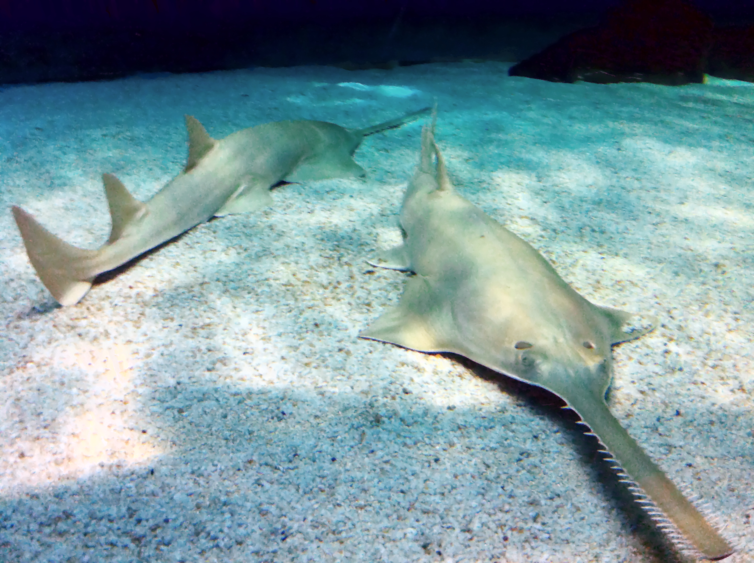
The longcomb sawfish, narrowsnout sawfish or green sawfish (''Pristis zijsron'') is a species of sawfish in the family Pristidae, found in tropical and subtropical waters of the Indo-West Pacific. It has declined drastically and is now considered a critically endangered species. Description The longcomb sawfish is possibly the largest species of sawfish, reaching a total length of up to , but rarely more than today. Its upperparts are greenish-brown to olive, while the underparts are whitish. A combination of characters are necessary to distinguish it from the other sawfish species: the longcomb sawfish has teeth to near the base of the rostrum or "saw" (unlike the knifetooth sawfish, ''Anoxypristis cuspidata''), 23–37 teeth on each side of the rostrum (18–24 in the dwarf sawfish, ''P. clavata'', 20–32 in smalltooth sawfish, ''P. pectinata'', and 14–24 in largetooth sawfish, ''P. pristis''), the teeth towards the tip of the rostrum are clearly closer to each other tha ... [...More Info...] [...Related Items...] OR: [Wikipedia] [Google] [Baidu] |
Pieter Bleeker
Pieter Bleeker (10 July 1819 – 24 January 1878) was a Dutch medical doctor, Ichthyology, ichthyologist, and Herpetology, herpetologist. He was famous for the ''Atlas Ichthyologique des Indes Orientales Néêrlandaises'', his monumental work on the fishes of East Asia published between 1862 and 1877. Life and work Bleeker was born on 10 July 1819 in Zaandam. He was employed as a medical officer in the Royal Netherlands East Indies Army from 1842 to 1860, (in French). stationed in the Dutch East Indies (now Indonesia). During that time, he did most of his ichthyology work, besides his duties in the army. He acquired many of his specimens from local fishermen, but he also built up an extended network of contacts who would send him specimens from various government outposts throughout the islands. During his time in Indonesia, he collected well over 12,000 specimens, many of which currently reside at the Naturalis Biodiversity Center in Leiden. Bleeker corresponded with Auguste Dum� ... [...More Info...] [...Related Items...] OR: [Wikipedia] [Google] [Baidu] |
Pectoral Fin
Fins are moving appendages protruding from the body of fish that interact with water to generate thrust and help the fish aquatic locomotion, swim. Apart from the tail or caudal fin, fish fins have no direct connection with the vertebral column, back bone and are supported only by muscles. Fish fins are distinctive anatomical features with varying structures among different clades: in ray-finned fish (Actinopterygii), fins are mainly composed of bone, bony spine (zoology), spines or ray (fish fin anatomy), rays covered by a thin stretch of fish scale, scaleless skin; in lobe-finned fish (Sarcopterygii) such as coelacanths and lungfish, fins are short rays based around a muscular central limb bud, bud supported by appendicular skeleton, jointed bones; in cartilaginous fish (Chondrichthyes) and jawless fish (Agnatha), fins are fleshy "flipper (anatomy), flippers" supported by a cartilaginous skeleton. Fins at different locations of the fish body serve different purposes, and are ... [...More Info...] [...Related Items...] OR: [Wikipedia] [Google] [Baidu] |
Estuarine
An estuary is a partially enclosed coastal body of brackish water with one or more rivers or streams flowing into it, and with a free connection to the open sea. Estuaries form a transition zone between river environments and maritime environments and are an example of an ecotone. Estuaries are subject both to marine influences such as tides, waves, and the influx of saline water, and to fluvial influences such as flows of freshwater and sediment. The mixing of seawater and freshwater provides high levels of nutrients both in the water column and in sediment, making estuaries among the most productive natural habitats in the world. Most existing estuaries formed during the Holocene epoch with the flooding of river-eroded or glacially scoured valleys when the sea level began to rise about 10,000–12,000 years ago. Estuaries are typically classified according to their geomorphological features or to water-circulation patterns. They can have many different names, such as bays, ... [...More Info...] [...Related Items...] OR: [Wikipedia] [Google] [Baidu] |
Mangrove
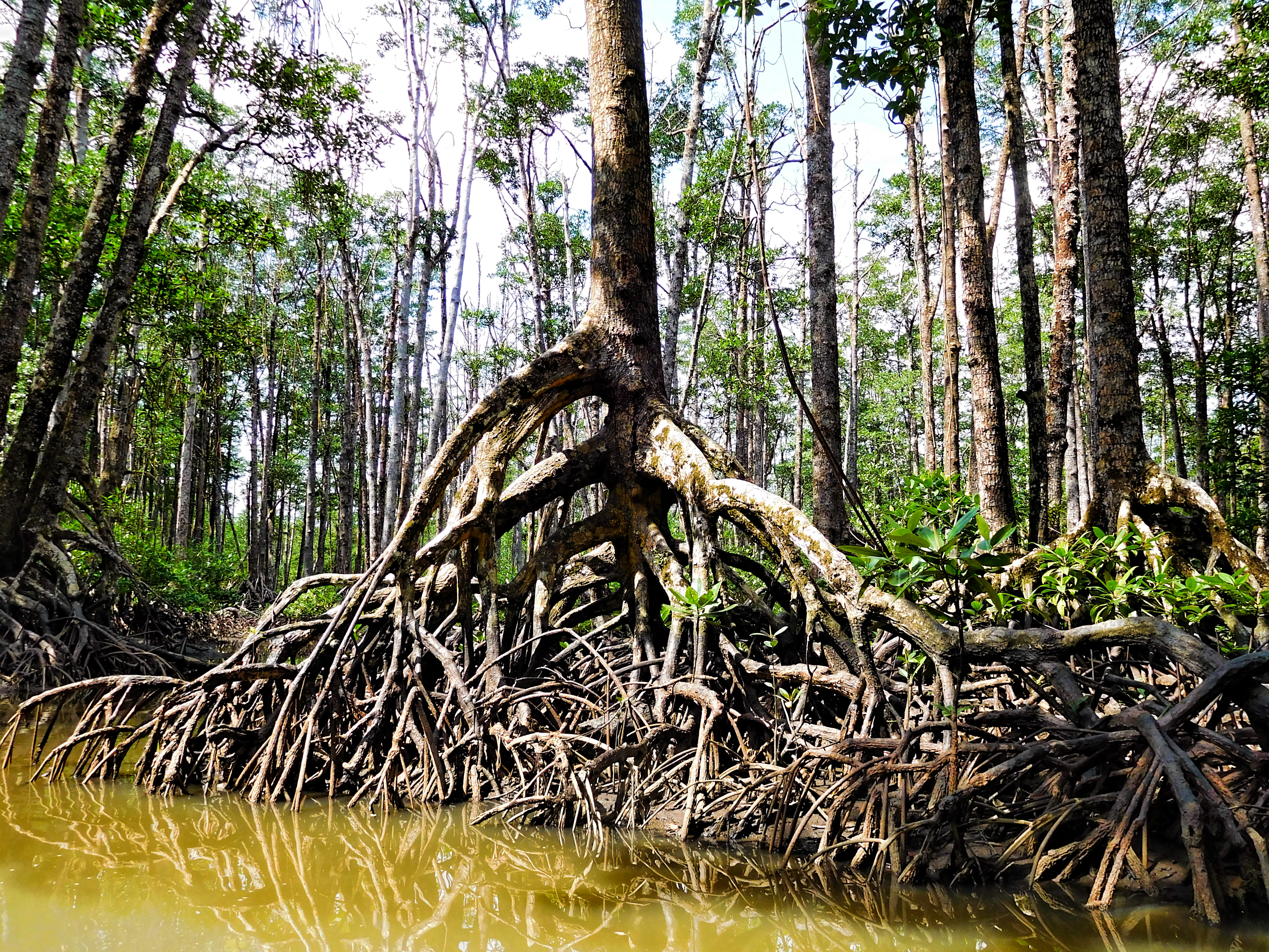
A mangrove is a shrub or tree that grows mainly in coastal saline water, saline or brackish water. Mangroves grow in an equatorial climate, typically along coastlines and tidal rivers. They have particular adaptations to take in extra oxygen and remove salt, allowing them to tolerate conditions that kill most plants. The term is also used for tropical coastal vegetation consisting of such species. Mangroves are taxonomically diverse due to convergent evolution in several plant families. They occur worldwide in the tropics and subtropics and even some temperate coastal areas, mainly between latitudes 30° N and 30° S, with the greatest mangrove area within 5° of the equator. Mangrove plant families first appeared during the Late Cretaceous to Paleocene epochs and became widely distributed in part due to the plate tectonics, movement of tectonic plates. The oldest known fossils of Nypa fruticans, mangrove palm date to 75 million years ago. Mangroves are salt-tolerant ... [...More Info...] [...Related Items...] OR: [Wikipedia] [Google] [Baidu] |
Jervis Bay
Jervis Bay () is a oceanic bay and village in the Jervis Bay Territory and on the South Coast (New South Wales), South Coast of New South Wales, Australia. A area of land around the southern headland of the bay, known as the Jervis Bay Territory, is not a part of the Australian Capital Territory (which it is administered by). The Territory includes the settlements of Jervis Bay Village and Wreck Bay Village. The Royal Australian Navy (RAN) base, , is in the Jervis Bay Territory between Jervis Bay Village and Greenpatch Point. History Archaeological finds at Burrill Lake, New South Wales, Burrill Lake, 55 kilometres south of Jervis Bay, provide evidence of Aboriginal occupation dating back 20,000 years. In the Dhurga language, spoken by local Aboriginal Australians, Aboriginal inhabitants, the bay was known as "Booderee", meaning "bay of plenty". Jervis Bay was sighted by Lieutenant (navy), Lieutenant James Cook aboard on 25 April 1770, two days after Saint George's Day, an ... [...More Info...] [...Related Items...] OR: [Wikipedia] [Google] [Baidu] |
Shark Bay
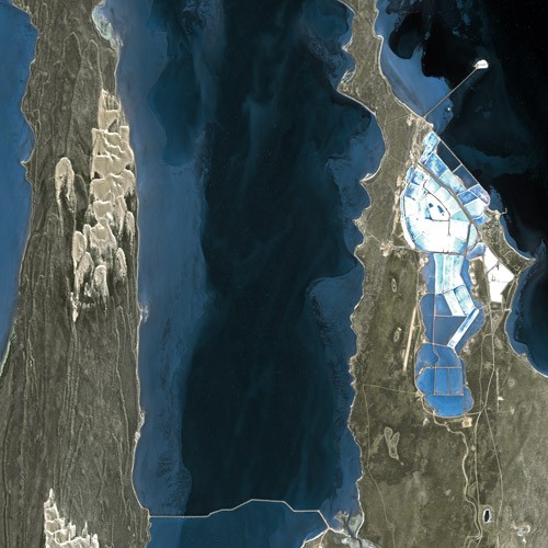
Shark Bay () is a World Heritage Site in the Gascoyne region of Western Australia. The area is located approximately north of Perth, on the westernmost point of the Australian continent. UNESCO's listing of Shark Bay as a World Heritage Site reads: The bay features Australia's most abundant marine ecosystems. It is a popular fishing spot. History The record of Indigenous Australians, Australian Aboriginal occupation of Shark Bay extends to years Before Present, BP. At that time most of the area was dry land, and rising sea levels flooded Shark Bay between BP and BP. A considerable number of Aboriginal midden sites have been found, especially on Peron Peninsula and Dirk Hartog Island, which provide evidence of some of the foods gathered from the waters and nearby land areas. An expedition led by Dirk Hartog happened upon the area in 1616, becoming the second group of Europeans known to have visited Australia, after the crew of ''Duyfken'' under Willem Janszoon had visi ... [...More Info...] [...Related Items...] OR: [Wikipedia] [Google] [Baidu] |
Southeast Asia
Southeast Asia is the geographical United Nations geoscheme for Asia#South-eastern Asia, southeastern region of Asia, consisting of the regions that are situated south of China, east of the Indian subcontinent, and northwest of the Mainland Australia, Australian mainland, which is part of Oceania. Southeast Asia is bordered to the north by East Asia, to the west by South Asia and the Bay of Bengal, to the east by Oceania and the Pacific Ocean, and to the south by Australia (continent), Australia and the Indian Ocean. Apart from the British Indian Ocean Territory and two out of Atolls of the Maldives, 26 atolls of the Maldives in South Asia, Maritime Southeast Asia is the only other subregion of Asia that lies partly within the Southern Hemisphere. Mainland Southeast Asia is entirely in the Northern Hemisphere. Timor-Leste and the southern portion of Indonesia are the parts of Southeast Asia that lie south of the equator. The region lies near the intersection of Plate tectonics, ... [...More Info...] [...Related Items...] OR: [Wikipedia] [Google] [Baidu] |
South China Sea
The South China Sea is a marginal sea of the Western Pacific Ocean. It is bounded in the north by South China, in the west by the Indochinese Peninsula, in the east by the islands of Taiwan island, Taiwan and northwestern Philippines (mainly Luzon, Mindoro and Palawan Island, Palawan), and in the south by Borneo, eastern Sumatra and the Bangka Belitung Islands, encompassing an area of around . It communicates with the East China Sea via the Taiwan Strait, the Philippine Sea via the Luzon Strait, the Sulu Sea via the straits around Palawan, the Java Sea via the Karimata Strait, Karimata and Bangka Straits and directly with Gulf of Thailand. The Gulf of Tonkin is part of the South China Sea. $3.4 trillion of the world's $16 trillion Maritime transport, maritime shipping passed through South China Sea in 2016. Oil and natural gas reserves have been found in the area. The Western Central Pacific accounted for 14% of world's commercial fishing in 2010. The South China Sea Islands, ... [...More Info...] [...Related Items...] OR: [Wikipedia] [Google] [Baidu] |
Persian Gulf
The Persian Gulf, sometimes called the Arabian Gulf, is a Mediterranean seas, mediterranean sea in West Asia. The body of water is an extension of the Arabian Sea and the larger Indian Ocean located between Iran and the Arabian Peninsula.United Nations Group of Experts on Geographical NameWorking Paper No. 61, 23rd Session, Vienna, 28 March – 4 April 2006. accessed 9 October 2010 It is connected to the Gulf of Oman in the east by the Strait of Hormuz. The river delta of the Shatt al-Arab forms the northwest shoreline. The Persian Gulf has many fishing grounds, extensive reefs (mostly rocky, but also Coral reef, coral), and abundant pearl oysters, however its ecology has been damaged by industrialization and oil spills. The Persian Gulf is in the Persian Gulf Basin, which is of Cenozoic origin and related to the subduction of the Arabian plate under the Zagros Mountains. The current flooding of the basin started 15,000 years ago due to sea level rise, rising sea levels of ... [...More Info...] [...Related Items...] OR: [Wikipedia] [Google] [Baidu] |
Red Sea
The Red Sea is a sea inlet of the Indian Ocean, lying between Africa and Asia. Its connection to the ocean is in the south, through the Bab-el-Mandeb Strait and the Gulf of Aden. To its north lie the Sinai Peninsula, the Gulf of Aqaba, and the Gulf of Suez—leading to the Suez Canal. It is underlain by the Red Sea Rift, which is part of the Great Rift Valley. The Red Sea has a surface area of roughly , is about long, and wide at its widest point. It has an average depth of , and in the central Suakin Trough, it reaches its maximum depth of . Approximately 40% of the Red Sea is quite shallow at less than deep and about 25% is less than deep. The extensive shallow shelves are noted for their marine life and corals. More than 1,000 invertebrate species and 200 types of soft and hard coral live in the sea. The Red Sea is the world's northernmost tropical sea and has been designated a Global 200 ecoregion. Extent The International Hydrographic Organization defines the limi ... [...More Info...] [...Related Items...] OR: [Wikipedia] [Google] [Baidu] |
Indo-Pacific
The Indo-Pacific is a vast biogeographic region of Earth. In a narrow sense, sometimes known as the Indo-West Pacific or Indo-Pacific Asia, it comprises the tropical waters of the Indian Ocean, the western and central Pacific Ocean, and the seas connecting the two. The term is especially useful in marine biology, ichthyology, and similar fields, since many marine habitats are continuously connected from Madagascar to Japan and Oceania, and a number of species occur over that range, but are not found in the Atlantic Ocean. As a distinct marine realm, the region has an exceptionally high species richness, with the world's highest species richness being found in at its heart in the Coral Triangle, and a remarkable gradient of decreasing species richness radiating outward in all directions. The region includes over 3,000 species of fish, compared with around 1,200 in the next richest marine region, the Western Atlantic, and around 500 species of reef building corals, compar ... [...More Info...] [...Related Items...] OR: [Wikipedia] [Google] [Baidu] |
Sawfish Genova2
Sawfish, also known as carpenter sharks, are a family of very large rays characterized by a long, narrow, flattened rostrum, or nose extension, lined with sharp transverse teeth, arranged in a way that resembles a saw. They are among the largest fish, with some species reaching lengths of about . They are found worldwide in tropical and subtropical regions in coastal marine and brackish estuarine waters, as well as freshwater rivers and lakes. All species are critically endangered. They should not be confused with sawsharks (order Pristiophoriformes) or the extinct sclerorhynchoids (order Rajiformes) which have a similar appearance, or swordfish (family Xiphiidae) which have a similar name but a very different appearance. Sawfishes are relatively slow breeders and the females give birth to live young. They feed on fish and invertebrates that are detected and captured with the use of their saw. They are generally harmless to humans, but can inflict serious injuries with the ... [...More Info...] [...Related Items...] OR: [Wikipedia] [Google] [Baidu] |


