|
Port-of-spain
Port of Spain ( ; Trinidadian and Tobagonian English, Trinidadian English: ''Port ah Spain'' ) is the capital and chief port of Trinidad and Tobago. With a municipal population of 49,867 (2017), an urban population of 81,142 and a transient daily population of 250,000, it is Trinidad and Tobago's third largest municipality, after Chaguanas and San Fernando, Trinidad and Tobago, San Fernando. Port of Spain is located on the Gulf of Paria, on the northwest coast of the island of Trinidad and is part of East–West Corridor, a larger conurbation stretching from Chaguaramas, Trinidad, Chaguaramas in the west to Arima in the east with an estimated population of 600,000. The city serves primarily as a retail and administrative centre and it has been the capital of the island since 1757. It is also an important financial services centre for the Caribbean [...More Info...] [...Related Items...] OR: [Wikipedia] [Google] [Baidu] |
Magnificent Seven (Port Of Spain)
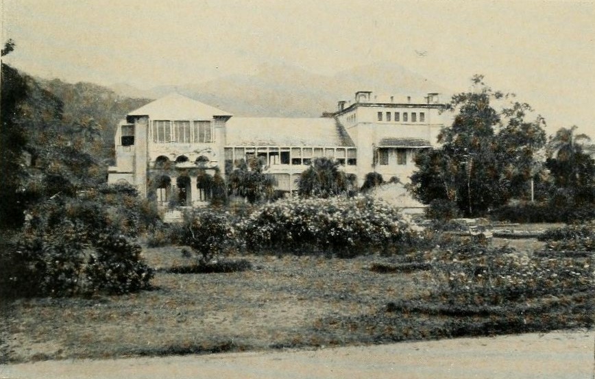
The Magnificent Seven is a group of seven mansions located west of the Queen's Park Savannah in northern Port of Spain, Trinidad and Tobago on Maraval Road in the St Clair neighborhood. They were built between 1902 and 1910 on land that was previously used as a government stock farm and are listed as heritage sites at the National Trust of Trinidad and Tobago. Stollmeyer's Castle was the first building in the neighborhood and took several years to complete, as was typical of the Magnificent Seven. The structures were designed in an array of architectural styles including French Colonial, Scottish baronial, Indian Empire, and Moorish Mediterranean styles—often blended with Caribbean architecture. Many have unusual elements, like the chiming clock and lighted clock tower of Queen's Royal College. Stollmeyer's Castle is said to be modeled after a wing of Balmoral Castle. Hayes Court, a French Colonial style building, has contemporary Scottish cast iron elements and traditional D ... [...More Info...] [...Related Items...] OR: [Wikipedia] [Google] [Baidu] |
Capital City
A capital city, or just capital, is the municipality holding primary status in a country, state (polity), state, province, department (administrative division), department, or other administrative division, subnational division, usually as its Seat of government, seat of the government. A capital is typically a city that physically encompasses the government's offices and meeting places; the status as capital is often designated by its law or constitution. In some jurisdictions, including several countries, different branches of government are in different settlements, sometimes meaning multiple official capitals. In some cases, a distinction is made between the official (constitutional) capital and the seat of government, which is in list of countries with multiple capitals, another place. English language, English-language media often use the name of the capital metonymy, metonymically to refer to the government sitting there. Thus, "London-Washington relations" is widely unde ... [...More Info...] [...Related Items...] OR: [Wikipedia] [Google] [Baidu] |
Chaguanas
The Borough of Chaguanas is the largest municipality (83,489 at the 2011 census) and fastest-growing – Afra Raymond, 29 July 2004. – ''Trinidad Guardian'', 1 October 1998 town in Trinidad and Tobago. Located in west-central Trinidad, south of Port of Spain, north of Couva and San Fernando, Trinidad and Tobago, San Fernando, and named after the indigenous tribe who originally settled there, it grew in size due to its proximity to the Woodford Lodge sugar refinery. It remained a minor town until the 1980s when it began to grow rapidly as it drew people for its bargain shopping and moderately priced housing. Its rapid growth has seen property values increase dramatically, however. Chag ... [...More Info...] [...Related Items...] OR: [Wikipedia] [Google] [Baidu] |
Carnival
Carnival (known as Shrovetide in certain localities) is a festive season that occurs at the close of the Christian pre-Lenten period, consisting of Quinquagesima or Shrove Sunday, Shrove Monday, and Shrove Tuesday or Mardi Gras. Carnival typically involves public party, celebrations, including events such as parades, public street party, street parties and other entertainments, combining some elements of a circus. Elaborate costumes and masks allow people to set aside their everyday individuality and experience a heightened sense of social unity.Bakhtin, Mikhail. 1984. ''Rabelais and his world''. Translated by H. Iswolsky. Bloomington: Indiana University Press. Original edition, ''Tvorchestvo Fransua Rable i narodnaia kul'tura srednevekov'ia i Renessansa'', 1965. Participants often indulge in excessive consumption of alcohol, meat, and other foods that will be forgone during upcoming Lent. Traditionally, butter, milk, and other animal products were not consumed "excessively", r ... [...More Info...] [...Related Items...] OR: [Wikipedia] [Google] [Baidu] |
Guyana
Guyana, officially the Co-operative Republic of Guyana, is a country on the northern coast of South America, part of the historic British West Indies. entry "Guyana" Georgetown, Guyana, Georgetown is the capital of Guyana and is also the country's largest city. Guyana is bordered by the Atlantic Ocean to the north, Brazil to the south and southwest, Venezuela to the west, and Suriname to the east. With a land area of , Guyana is the third-smallest sovereign state by area in mainland South America after Uruguay and Suriname, and is the List of South American countries by population, second-least populous sovereign state in South America after Suriname; it is also List of countries and dependencies by population density, one of the least densely populated countries on Earth. The official language of the country is English language, English, although a large part of the population is bilingual in English and the indigenous languages. It has a wide variety of natural habitats and ... [...More Info...] [...Related Items...] OR: [Wikipedia] [Google] [Baidu] |
Bauxite
Bauxite () is a sedimentary rock with a relatively high aluminium content. It is the world's main source of aluminium and gallium. Bauxite consists mostly of the aluminium minerals gibbsite (), boehmite (γ-AlO(OH)), and diaspore (α-AlO(OH)), Mixture, mixed with the two iron oxides goethite (FeO(OH)) and haematite (), the aluminium Clay minerals, clay mineral kaolinite () and small amounts of anatase () and ilmenite ( or ). Bauxite appears dull in Lustre (mineralogy), luster and is reddish-brown, white, or tan. In 1821, the French people, French geologist Pierre Berthier discovered bauxite near the village of Les Baux-de-Provence, Les Baux in Provence, southern France. Formation Numerous classification schemes have been proposed for bauxite but, , there was no consensus. Vadász (1951) distinguished Laterite, lateritic bauxites (silicate bauxites) from karst bauxite ores (carbonate bauxites): * The carbonate bauxites occur predominantly in Europe, Guyana, Suriname, and ... [...More Info...] [...Related Items...] OR: [Wikipedia] [Google] [Baidu] |
West Indies Federation
The West Indies Federation, also known as the West Indies, the Federation of the West Indies or the West Indian Federation, was a short-lived political union that existed from 3 January 1958 to 31 May 1962. Various islands in the Caribbean that were British West Indies, part of the British Empire, including Trinidad and Tobago, Barbados, Jamaica, and those on the British Leeward Islands, Leeward and British Windward Islands, Windward Islands, came together to form the Federation, with its capital in Port of Spain, Trinidad and Tobago. The expressed intention of the Federation was to create a political unit that would decolonization, become independent from Britain as a single state – possibly similar to Canada, the Federation of Australia, or the Federation of Rhodesia and Nyasaland. Before that could happen, the Federation collapsed due to internal political conflicts over how it would be governed or function viably. The formation of a West Indian Federation was encouraged b ... [...More Info...] [...Related Items...] OR: [Wikipedia] [Google] [Baidu] |
Piarco International Airport
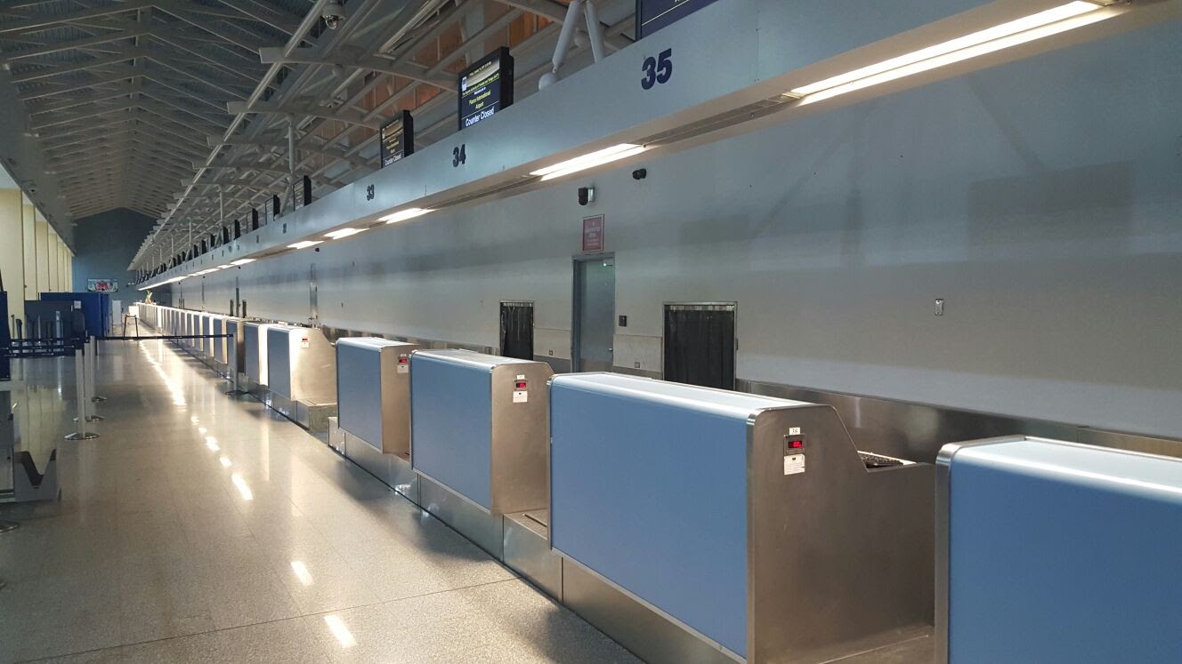
Piarco International Airport is an international airport serving the island of Trinidad and is one of two international airports in Trinidad and Tobago. The airport is east of Downtown Port of Spain, in the suburban town of Piarco. The airport is the primary hub and operating base for the country's national airline, as well as the Caribbean's largest airline, Caribbean Airlines. Piarco International Airport has direct scheduled service to destinations in the United States, Canada, Central America, South America and Europe. It is also a significant transit hub for the Southern Caribbean and serves as the primary connection point for many passengers travelling from Guyana. History The Piarco Airport opened on 8 January 1931, to serve Venezuela's ''Compagnie Generale Aeropostale''. Before this, the Queen's Park Savannah, the Mucurapo Field, and the Cocorite Docks (for flying boats) were used as airstrips to serve the island. In World War II the original airfield was used by the ... [...More Info...] [...Related Items...] OR: [Wikipedia] [Google] [Baidu] |
Caribbean
The Caribbean ( , ; ; ; ) is a region in the middle of the Americas centered around the Caribbean Sea in the Atlantic Ocean, North Atlantic Ocean, mostly overlapping with the West Indies. Bordered by North America to the north, Central America to the west, and South America to the south, it comprises numerous List of Caribbean islands, islands, cays, islets, reefs, and banks. It includes the Lucayan Archipelago, Greater Antilles, and Lesser Antilles of the West Indies; the Quintana Roo Municipalities of Quintana Roo#Municipalities, islands and Districts of Belize#List, Belizean List of islands of Belize, islands of the Yucatán Peninsula; and the Bay Islands Department#Islands, Bay Islands, Miskito Cays, Archipelago of San Andrés, Providencia and Santa Catalina, Archipelago of San Andrés, Providencia, and Santa Catalina, Corn Islands, and San Blas Islands of Central America. It also includes the coastal areas on the Mainland, continental mainland of the Americas bordering the ... [...More Info...] [...Related Items...] OR: [Wikipedia] [Google] [Baidu] |
Financial Services
Financial services are service (economics), economic services tied to finance provided by financial institutions. Financial services encompass a broad range of tertiary sector of the economy, service sector activities, especially as concerns financial management and consumer finance. The finance industry in its most common sense concerns commercial banks that provide market liquidity, derivative (finance), risk instruments, and broker, brokerage for large public company, public companies and multinational corporations at a macroeconomics, macroeconomic scale that impacts domestic politics and foreign relations. The extragovernmental power and scale of the finance industry remains an ongoing controversy in many industrialized Western economies, as seen in the American Occupy Wall Street civil protest movement of 2011. Styles of financial institution include credit union, bank, savings and loan association, trust company, building society, brokerage firm, payment processor, many ty ... [...More Info...] [...Related Items...] OR: [Wikipedia] [Google] [Baidu] |
Arima
Arima, officially The Royal Chartered Borough of Arima is the easternmost and second largest in area of the three boroughs of Trinidad and Tobago. It is geographically adjacent to Sangre Grande and Arouca at the south central foothills of the Northern Range. To the south is the Caroni–Arena Dam. Coterminous with Town of Arima since 1888, the borough of Arima is the fourth-largest municipality in population in the country (after Port of Spain, Chaguanas and San Fernando). The census estimated it had 33,606 residents in 2011. In 1887, the town petitioned Queen Victoria for municipal status as part of the celebration for the Golden Jubilee of Queen Victoria. This was granted in the following year, and Arima became a Royal Borough on 1 August 1888. Historically the third-largest town of Trinidad and Tobago, Arima is fourth since Chaguanas became the largest town in the country. History Contrary to the belief that the city is named after the Arawak word for "water", roote ... [...More Info...] [...Related Items...] OR: [Wikipedia] [Google] [Baidu] |


