|
New Jersey Meadowlands
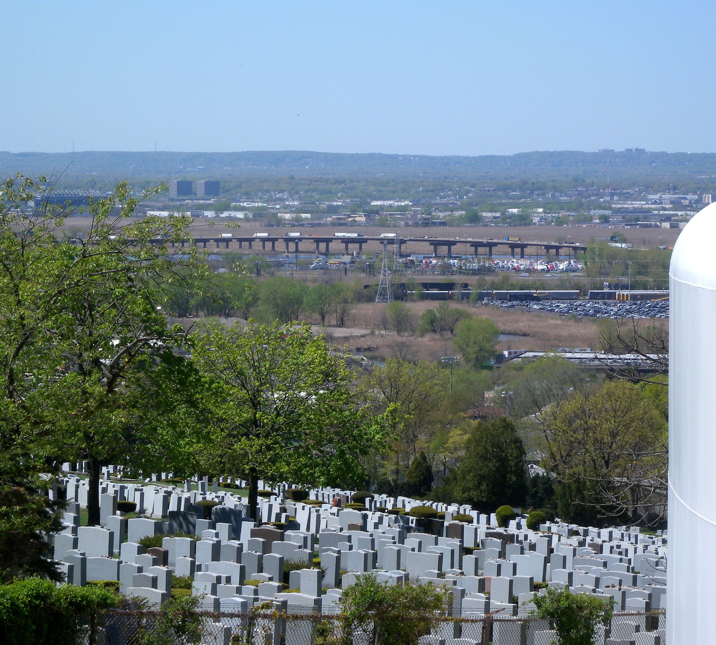
New Jersey Meadowlands, also known as the Hackensack Meadowlands after the primary river flowing through it, is a general name for the large ecosystem of wetlands in northeastern New Jersey in the United States, a few miles to the west of New York City. In the 20th century, much of the Meadowlands area was urbanized, and it became known for being the site of large landfills and decades of environmental abuse. A variety of projects are underway to restore and conserve the remaining ecological resources in the Meadowlands. Geography The Meadowlands stretch mainly along the terminus of the Hackensack and Passaic Rivers as they flow into Newark Bay; tributaries of the Hackensack include Mill Creek, Berrys Creek, and Overpeck Creek. The Meadowlands consist of roughly 8,400 acres (34 km2) of open, undeveloped space in addition to developed areas that had been part of the natural wetlands which were heavily developed by H. Bert Mack and M. Bolero in the 1960s. [...More Info...] [...Related Items...] OR: [Wikipedia] [Google] [Baidu] |
Overpeck Creek
Overpeck Creek is a tributary of the Hackensack River, approximately long, in Bergen County in northeastern New Jersey in the United States. The lower broad mouth of the creek is part of the extended tidal estuary of the lower Hackensack and of the adjacent wetland region known as the New Jersey Meadowlands. The upper creek flows through suburban communities west of New York City. The creek rises in Tenafly, on the west side of the Palisades, approximately from the Hudson River. It flows south-southwest through Englewood, past Teaneck, Leonia, and Palisades Park, where it flows past the Overpeck County Park. It joins the Hackensack on the south side of Ridgefield Park and the east side of Little Ferry. In colonial times, the creek was called "Tantaqua" and was the site of a Hackensack village. An attempted European settlement, Achter Col, in 1642 was aborted after Lenape retaliations for the Pavonia Massacre. Later 17th and 18th century settlements were collectively k ... [...More Info...] [...Related Items...] OR: [Wikipedia] [Google] [Baidu] |
Teaneck, New Jersey
Teaneck () is a Township (New Jersey), township in Bergen County, New Jersey, Bergen County, in the U.S. state of New Jersey. It is a bedroom community in the New York metropolitan area. As of the 2010 United States census, 2010 U.S. census, the township's population was 39,776, reflecting an increase of 516 (+1.3%) from the 39,260 counted in the 2000 United States census, 2000 census. As of 2010, it was the second-most populous among the 70 municipalities in Bergen County, behind Hackensack, New Jersey, Hackensack, which had a population of 43,010. Teaneck was created on February 19, 1895, by an act of the New Jersey Legislature from portions of Englewood Township, New Jersey, Englewood Township and Ridgefield Township, New Jersey, Ridgefield Township, both of which are now defunct (despite existing municipalities with similar names), along with portions of Bogota, New Jersey, Bogota and Leonia, New Jersey, Leonia.Snyder, John P''The Story of New Jersey's Civil Boundaries: ... [...More Info...] [...Related Items...] OR: [Wikipedia] [Google] [Baidu] |
South Hackensack, New Jersey
South Hackensack is a township in Bergen County, New Jersey, United States. As of the 2010 United States Census, the township's population was 2,378, reflecting an increase of 129 (+5.7%) from the 2,249 counted in the 2000 Census, which had in turn increased by 143 (+6.8%) from the 2,106 counted in the 1990 Census. South Hackensack was formed as a township by an act of the New Jersey Legislature on November 15, 1935, replacing Lodi Township, based on the results of a referendum held November 5, 1935, which passed by a margin of 309 to 15.Snyder, John P''The Story of New Jersey's Civil Boundaries: 1606-1968'' Bureau of Geology and Topography; Trenton, New Jersey; 1969. p. 87. Accessed February 5, 2012.Staff ''The New York Times'', November 7, 1935. Accessed October 8, 2019. "As the name indicates, South Hackensack is directly south of Hackensack, the county seat of Bergen County." The township's name derives from its location relative to Hackensack. Geography According to th ... [...More Info...] [...Related Items...] OR: [Wikipedia] [Google] [Baidu] |
Ridgefield, New Jersey
} Ridgefield is a borough in Bergen County, New Jersey, United States. As of the 2010 United States Census, the borough's population was 11,032,DP-1 - Profile of General Population and Housing Characteristics: 2010 for Ridgefield borough, Bergen County, New Jersey , . Accessed March 13, 2013. [...More Info...] [...Related Items...] OR: [Wikipedia] [Google] [Baidu] |
Moonachie, New Jersey
Moonachie (; ) is a borough in Bergen County, New Jersey, in the Hackensack River watershed. As of the 2010 United States Census, the borough's population was 2,708,DP-1 - Profile of General Population and Housing Characteristics: 2010 for Moonachie borough, Bergen County, New Jersey , . Accessed March 10, 2013. [...More Info...] [...Related Items...] OR: [Wikipedia] [Google] [Baidu] |
North Bergen, New Jersey
North Bergen is a township in the northern part of Hudson County, New Jersey, United States. As of the 2020 U.S. census, the township had a total population of 63,361. The township was founded in 1843. It was much diminished in territory by a series of secessions. Situated on the Hudson Palisades, it is one of the hilliest municipalities in the United States. Like neighboring North Hudson communities, North Bergen is among those places in the nation with the highest population density and a majority Hispanic population. History Colonial era At the time of European colonization the area was the territory of Hackensack tribe of the Lenape Native Americans, who maintained a settlement, Espatingh, on the west side of the hills and where a Dutch trading post was established after the Peach Tree War. In 1658, Peter Stuyvesant, then Director-General of New Netherland, repurchased from them the area now encompassed by the municipalities of Hudson County east of the Hackensack Ri ... [...More Info...] [...Related Items...] OR: [Wikipedia] [Google] [Baidu] |
Carlstadt, New Jersey
Carlstadt is a borough in Bergen County, New Jersey, United States. As of the 2010 United States Census, the borough's population was 6,127,DP-1 - Profile of General Population and Housing Characteristics: 2010 for Carlstadt borough, Bergen County, New Jersey . Accessed May 31, 2012. [...More Info...] [...Related Items...] OR: [Wikipedia] [Google] [Baidu] |
East Rutherford, New Jersey
East Rutherford is a borough in Bergen County, New Jersey, United States. As of the 2020 U.S. census, the borough's population was 10,022, reflecting an increase of 1,109 (+12.4%) from the 8,913 counted in the 2010 census.DP-1 - Profile of General Population and Housing Characteristics: 2010 for East Rutherford borough, Bergen County, New Jersey . Accessed July 29, 2012. [...More Info...] [...Related Items...] OR: [Wikipedia] [Google] [Baidu] |
Rutherford, New Jersey
Rutherford is a borough in Bergen County, New Jersey, United States. As of the 2020 United States Census, the borough's population was 18,834. Rutherford was formed as a borough by an act of the New Jersey Legislature on September 21, 1881, from portions of Union Township, based on the results of a referendum held on the previous day.Snyder, John P''The Story of New Jersey's Civil Boundaries: 1606-1968'' Bureau of Geology and Topography; Trenton, New Jersey; 1969. p. 86. Accessed February 2, 2012. The borough was named for John Rutherfurd, a U.S. Senator who owned land in the area. Rutherford has been called the "Borough of Trees" and "The First Borough of Bergen County", and is known as well for its pedestrian-focused downtown area adjacent to the borough's Bergen Line (New Jersey Transit) railway station. History The ridge above the New Jersey Meadowlands upon which Rutherford sits was settled by Lenape Native Americans long before the arrival of Walling Van Winkle in 1 ... [...More Info...] [...Related Items...] OR: [Wikipedia] [Google] [Baidu] |
Lyndhurst, New Jersey
Lyndhurst is a township in Bergen County, New Jersey, United States. As of the 2010 United States Census, the township's population was 20,554, reflecting an increase of 1,171 (+6.0%) from the 19,383 counted in the 2000 Census, which had in turn increased by 1,121 (+6.1%) from the 18,262 counted in the 1990 Census. History On February 22, 1840, Hudson County was formed by an Act of the New Jersey Legislature. The newly created county was created from territories that had been Bergen Township since 1691, as well as and from the southern portion of Lodi Township. The portion of Lodi Township taken at this time formed the new Harrison Township in Hudson County. The border between the newly created Harrison Township in Hudson County and the portion of Lodi Township remaining in Bergen County was the New Barbadoes Turnpike, which is now called Paterson Plank Road. Some of the residents of the northern portion of Harrison Township requested to be returned to Bergen County. On Feb ... [...More Info...] [...Related Items...] OR: [Wikipedia] [Google] [Baidu] |
Secaucus, New Jersey
Secaucus ( ) is a town in Hudson County, New Jersey, United States. As of the 2010 United States census, the town's population was 16,264,DP-1 – Profile of General Population and Housing Characteristics: 2010 for Secaucus town, Hudson County, New Jersey , . Accessed December 25, 2011. [...More Info...] [...Related Items...] OR: [Wikipedia] [Google] [Baidu] |


