|
Mount Holyoke Range State Park
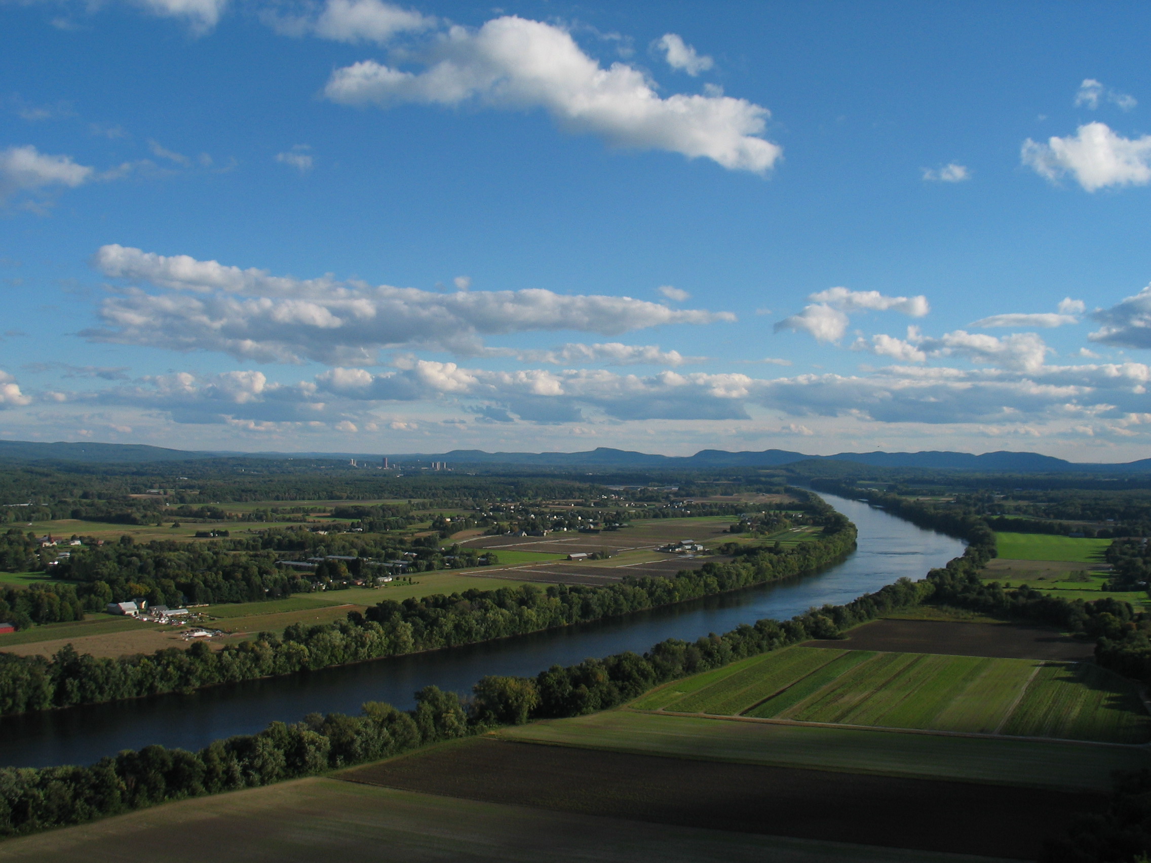
Mount Holyoke Range State Park is a state-owned, public recreation area encompassing the eastern half of the Holyoke Range in the Pioneer Valley region of Massachusetts. The state park is adjacent to J. A. Skinner State Park, which occupies the western half of the Holyoke Range. Both are managed by the Massachusetts Department of Conservation and Recreation. History According to the Massachusetts Department of Conservation & Recreation (DCR), the Mount Holyoke Range State Park grew out of "a long-standing desire by the public and the Commonwealth to protect the range," and the state had been acquiring land in the area since 1940. Starting in 1975, the DCR made more focused efforts to acquire land or easements to create the park." Activities and amenities Park trails are used for hiking, horseback riding, and cross-country skiing. Trails include sections of the long-distance Metacomet-Monadnock and Robert Frost trails. A visitors center is located near "The Notch" on Route 116 ... [...More Info...] [...Related Items...] OR: [Wikipedia] [Google] [Baidu] |
Amherst, Massachusetts
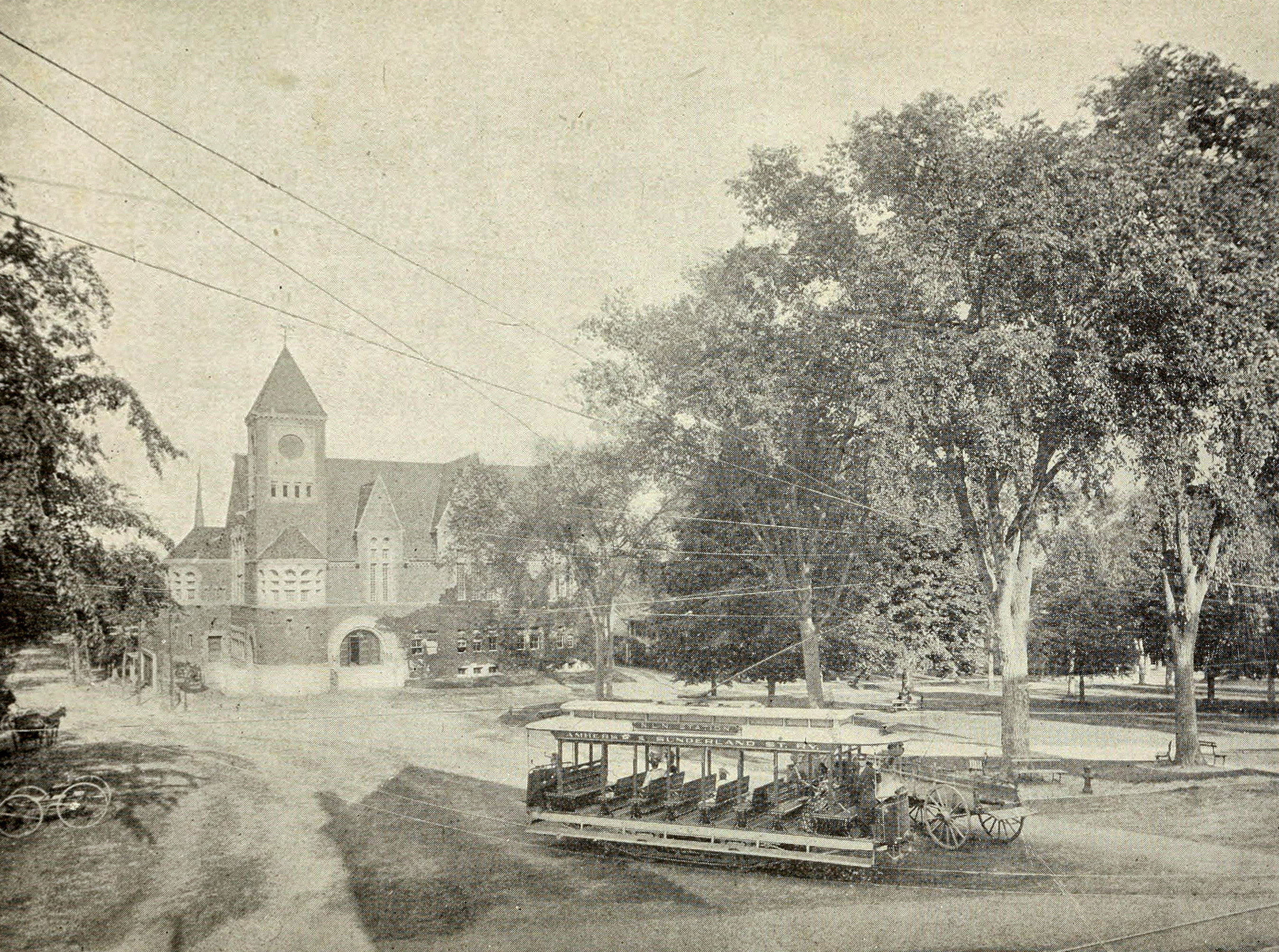
Amherst () is a New England town, town in Hampshire County, Massachusetts, United States, in the Connecticut River valley. As of the 2020 census, the population was 39,263, making it the highest populated municipality in Hampshire County (although the county seat is Northampton, Massachusetts, Northampton). The town is home to Amherst College, Hampshire College, and the University of Massachusetts Amherst, three of the Five College Consortium, Five Colleges. The name of the town is pronounced without the ''h'' ("AM-erst") by natives and long-time residents, giving rise to the local saying, "only the 'h' is silent", in reference both to the pronunciation and to the town's politically active populace. Amherst has three census-designated places: Amherst Center, Massachusetts, Amherst Center, North Amherst, Massachusetts, North Amherst, and South Amherst, Massachusetts, South Amherst. Amherst is part of the Springfield, Massachusetts Springfield metropolitan area, Massachusetts, Metr ... [...More Info...] [...Related Items...] OR: [Wikipedia] [Google] [Baidu] |
Granby, Massachusetts
Granby is a town in Hampshire County, Massachusetts, United States. The population was 6,110 at the 2020 census. It is part of the Springfield, Massachusetts Metropolitan Statistical Area. The census-designated place of Granby corresponds to the main village of Granby in the center of the town. History Granby was once part of Hadley, as were other towns. Granby was first settled in 1727 and was officially incorporated in 1768. The town is named in honor of John Manners, Marquess of Granby, a hero of the Seven Years' War. Granby was originally part of the Hadley Equivalent Lands, and then part of South Hadley, before being incorporated on June 11, 1768. Old Hadley was first settled in 1659 by people from Hartford and Wethersfield, Connecticut. These settlers left Connecticut because of religious differences within their communities. John Pynchon was commissioned to buy wilderness land for their new community. Pynchon purchased the land from three Native American chiefs: Chick ... [...More Info...] [...Related Items...] OR: [Wikipedia] [Google] [Baidu] |
Hampshire County, Massachusetts
Hampshire County is a historical and judicial county located in the U.S. state of Massachusetts. Following the dissolution of the county government in 1999, county affairs were managed by the Hampshire Council of Governments, which itself ceased operations in 2019, due to a "fundamentally flawed, unsustainable operational model". As of the 2020 census, the population was 162,308. Its most populous municipality is Amherst, its largest town in terms of landmass is Belchertown, and its traditional county seat is Northampton. The county is named after the county Hampshire, in England. Hampshire County is part of the Springfield, MA Metropolitan Statistical Area. Together with Hampden County, Hampshire County municipalities belong to the Pioneer Valley Planning Commission. History Hampshire County was constituted in 1662 from previously unorganized territory comprising the entire western part of Massachusetts Bay Colony. It included the original towns of Springfield, Northampt ... [...More Info...] [...Related Items...] OR: [Wikipedia] [Google] [Baidu] |
United States
The United States of America (U.S.A. or USA), commonly known as the United States (U.S. or US) or America, is a country primarily located in North America. It consists of 50 states, a federal district, five major unincorporated territories, nine Minor Outlying Islands, and 326 Indian reservations. The United States is also in free association with three Pacific Island sovereign states: the Federated States of Micronesia, the Marshall Islands, and the Republic of Palau. It is the world's third-largest country by both land and total area. It shares land borders with Canada to its north and with Mexico to its south and has maritime borders with the Bahamas, Cuba, Russia, and other nations. With a population of over 333 million, it is the most populous country in the Americas and the third most populous in the world. The national capital of the United States is Washington, D.C. and its most populous city and principal financial center is New York City. Paleo-Americ ... [...More Info...] [...Related Items...] OR: [Wikipedia] [Google] [Baidu] |
Massachusetts Department Of Conservation And Recreation
The Department of Conservation and Recreation (DCR) is a state agency of the Commonwealth of Massachusetts, situated in the Executive Office of Energy and Environmental Affairs. It is best known for its parks and parkways. The DCR's mission is "To protect, promote and enhance our common wealth of natural, cultural and recreational resources for the well-being of all." The agency is the largest landowner in Massachusetts. History and structure The Department of Conservation and Recreation was formed in 2003 under Governor Mitt Romney, when the former Metropolitan District Commission (MDC) and Department of Environmental Management (DEM) were merged to form the DCR. The DCR is under the general management of the Commissioner of the DCR. The general administration divisions; Human Resources Division, the Financial Division, and External and Legislative Affairs, report directly to the Commissioner. DCR is responsible for the stewardship of its lands, from general maintenance—suc ... [...More Info...] [...Related Items...] OR: [Wikipedia] [Google] [Baidu] |
Recreation
Recreation is an activity of leisure, leisure being discretionary time. The "need to do something for recreation" is an essential element of human biology and psychology. Recreational activities are often done for enjoyment, amusement, or pleasure and are considered to be "fun". Etymology The term ''recreation'' appears to have been used in English first in the late 14th century, first in the sense of "refreshment or curing of a sick person", and derived turn from Latin (''re'': "again", ''creare'': "to create, bring forth, beget"). Prerequisites to leisure People spend their time on activities of daily living, work, sleep, social duties and leisure, the latter time being free from prior commitments to physiologic or social needs, a prerequisite of recreation. Leisure has increased with increased longevity and, for many, with decreased hours spent for physical and economic survival, yet others argue that time pressure has increased for modern people, as they are committed to too ... [...More Info...] [...Related Items...] OR: [Wikipedia] [Google] [Baidu] |
Holyoke Range
The Holyoke Range or Mount Holyoke Range is a traprock mountain range located in the Connecticut River Valley of Massachusetts. It is a sub-range of the narrow, linear Metacomet Ridge that extends from Long Island Sound near New Haven, Connecticut north through the Connecticut River Valley of Massachusetts to the Vermont border. A popular hiking destination, the range is known for its anomalous east–west orientation, high ledges and its scenic character. It is also notable for its unique microclimate ecosystems and rare plant communities, as well as significant historic sites, such as the Mount Holyoke Summit House and the Horse Caves.Farnsworth, Elizabeth J"Metacomet-Mattabesett Trail Natural Resource Assessment." (2004). PDF file. Retrieved November 20, 2007. Retrieved December 10, 2007 Holyoke Range vs. Mount Holyoke Range Both ...[...More Info...] [...Related Items...] OR: [Wikipedia] [Google] [Baidu] |
Pioneer Valley
The Pioneer Valley is the colloquial and promotional name for the portion of the Connecticut River Valley that is in Massachusetts in the United States. It is generally taken to comprise the three counties of Hampden, Hampshire, and Franklin. The lower Pioneer Valley corresponds to the Springfield, Massachusetts metropolitan area, the region's urban center, and the seat of Hampden County. The upper Pioneer Valley region includes the smaller cities of Northampton and Greenfield, the county seats of Hampshire and Franklin counties, respectively. Historically the northern part of the Valley was an agricultural region, known for growing Connecticut shade tobacco and other specialty crops like Hadley asparagus; however, since the late 19th century its economy has become increasingly a knowledge economy, due to the prominence of the Five Colleges in Hampshire County. Similarly the Springfield- Chicopee-Holyoke economies transformed from volume producers of goods such as pa ... [...More Info...] [...Related Items...] OR: [Wikipedia] [Google] [Baidu] |
Massachusetts
Massachusetts (Massachusett language, Massachusett: ''Muhsachuweesut [Massachusett writing systems, məhswatʃəwiːsət],'' English: , ), officially the Commonwealth of Massachusetts, is the most populous U.S. state, state in the New England region of the Northeastern United States. It borders on the Atlantic Ocean and Gulf of Maine to the east, Connecticut and Rhode Island to the south, New Hampshire and Vermont to the north, and New York (state), New York to the west. The state's capital and List of municipalities in Massachusetts, most populous city, as well as its cultural and financial center, is Boston. Massachusetts is also home to the urban area, urban core of Greater Boston, the largest metropolitan area in New England and a region profoundly influential upon American History of the United States, history, academia, and the Economy of the United States, research economy. Originally dependent on agriculture, fishing, and trade. Massachusetts was transformed into a manuf ... [...More Info...] [...Related Items...] OR: [Wikipedia] [Google] [Baidu] |
State Park
State parks are parks or other protected areas managed at the sub-national level within those nations which use "state" as a political subdivision. State parks are typically established by a state to preserve a location on account of its natural beauty, historic interest, or recreational potential. There are state parks under the administration of the government of each U.S. state, some of the political divisions of Mexico#States, Mexican states, and in Brazil. The term is also used in the Australian states of template:state parks of Victoria, Victoria and state parks of New South Wales, New South Wales. The equivalent term used in Canada, Argentina, South Africa, and Belgium, is provincial park. Similar systems of local government maintained parks exist in other countries, but the terminology varies. State parks are thus similar to national parks, but under state rather than federal administration. Similarly, local government entities below state level may maintain parks, e.g., r ... [...More Info...] [...Related Items...] OR: [Wikipedia] [Google] [Baidu] |
Metacomet-Monadnock Trail
The Metacomet-Monadnock Trail (M&M Trail) is a hiking trail that traverses the Metacomet Ridge of the Pioneer Valley region of Massachusetts and the central uplands of Massachusetts and southern New Hampshire. Although less than from Boston and other large population centers, the trail is considered remarkably rural and scenic and includes many areas of unique ecologic, historic, and geologic interest. Notable features include waterfalls, dramatic cliff faces, exposed mountain summits, woodlands, swamps, lakes, river floodplain, farmland, significant historic sites, and the summits of Mount Monadnock, Mount Tom and Mount Holyoke.''The Metacomet-Monadnock Trail Guide,'' 10th edition. (2005). Amherst, Massachusetts: Appalachian Mountain Club. The Metacomet-Monadnock Trail is maintained largely through the efforts of the Berkshire Chapter of the Appalachian Mountain Club (AMC). Much of the trail (but not all) is a portion of the New England National Scenic Trail. Trail descriptio ... [...More Info...] [...Related Items...] OR: [Wikipedia] [Google] [Baidu] |
Robert Frost Trail (Massachusetts)
The Robert Frost Trail is a long footpath that passes through the eastern Connecticut River Valley of Massachusetts. The trail runs from the Connecticut River in South Hadley, Massachusetts to Ruggles Pond in Wendell State Forest, through both Hampshire and Franklin County and includes a number of scenic features such as the Holyoke Range, Mount Orient, Puffer's Pond, and Mount Toby.''A Guide to the Robert Frost Trail'' (2004). Amherst, Massachusetts: Amherst Conservation Department. The trail is named after the poet Robert Frost, who lived and taught in the area from 1916 to 1938. Trail description Although only 47 miles long, the Robert Frost Trail takes in a diverse patchwork of habitats, terrain, and scenery. The trail traverses trap rock Metacomet Ridge with its microclimate ecosystems; wetland habitat; ponds; farmland; deep ravines; wooded ledges; river banks; reservoirs; historic mill ponds; and dense forests. One segment of the trail follows a narrow greenway that s ... [...More Info...] [...Related Items...] OR: [Wikipedia] [Google] [Baidu] |


