|
Molaoi
Molaoi ( el, Μολάοι) is a town and a former municipality in Laconia, Peloponnese, Greece. Since the 2011 local government reform it is part of the municipality Monemvasia, of which it is the seat and a municipal unit. The municipal unit has an area of 193.167 km2. The population in 2011 was 4,980, of which 2,534 lived in the town itself. History The name of the village derived from the Latin word Mola (mill). Mola was mentioned for first time in the Treaty of Sapienza (1209). The current name Molaoi was mentioned during 15th century. During late medieval and early Ottoman era, Molaoi remained a small village, overshadowed by nearby Monemvasia. Molaoi was destroyed during the Orlov Revolt. Many inhabitants of Kandila bearing the name "Antonakos" ( el, Αντωνάκος) migrated to Koldere, near Magnesia ( ad Sipylum), where they arrived in 1777. The village was destroyed again by Ibrahim in 1825, during the Greek War of Independence. After Greek independence was achiev ... [...More Info...] [...Related Items...] OR: [Wikipedia] [Google] [Baidu] |
Laconia
Laconia or Lakonia ( el, Λακωνία, , ) is a historical and administrative region of Greece located on the southeastern part of the Peloponnese peninsula. Its administrative capital is Sparta. The word '' laconic''—to speak in a blunt, concise way—is derived from the name of this region, a reference to the ancient Spartans who were renowned for their verbal austerity and blunt, often pithy remarks. Geography Laconia is bordered by Messenia to the west and Arcadia to the north and is surrounded by the Myrtoan Sea to the east and by the Laconian Gulf and the Mediterranean Sea to the south. It encompasses Cape Malea and Cape Tainaron and a large part of the Mani Peninsula. The Mani Peninsula is in the west region of Laconia. The islands of Kythira and Antikythera lie to the south, but they administratively belong to the Attica regional unit of islands. The island, Elafonisos, situated between the Laconian mainland and Kythira, is part of Laconia. The Eurotas is ... [...More Info...] [...Related Items...] OR: [Wikipedia] [Google] [Baidu] |
Monemvasia
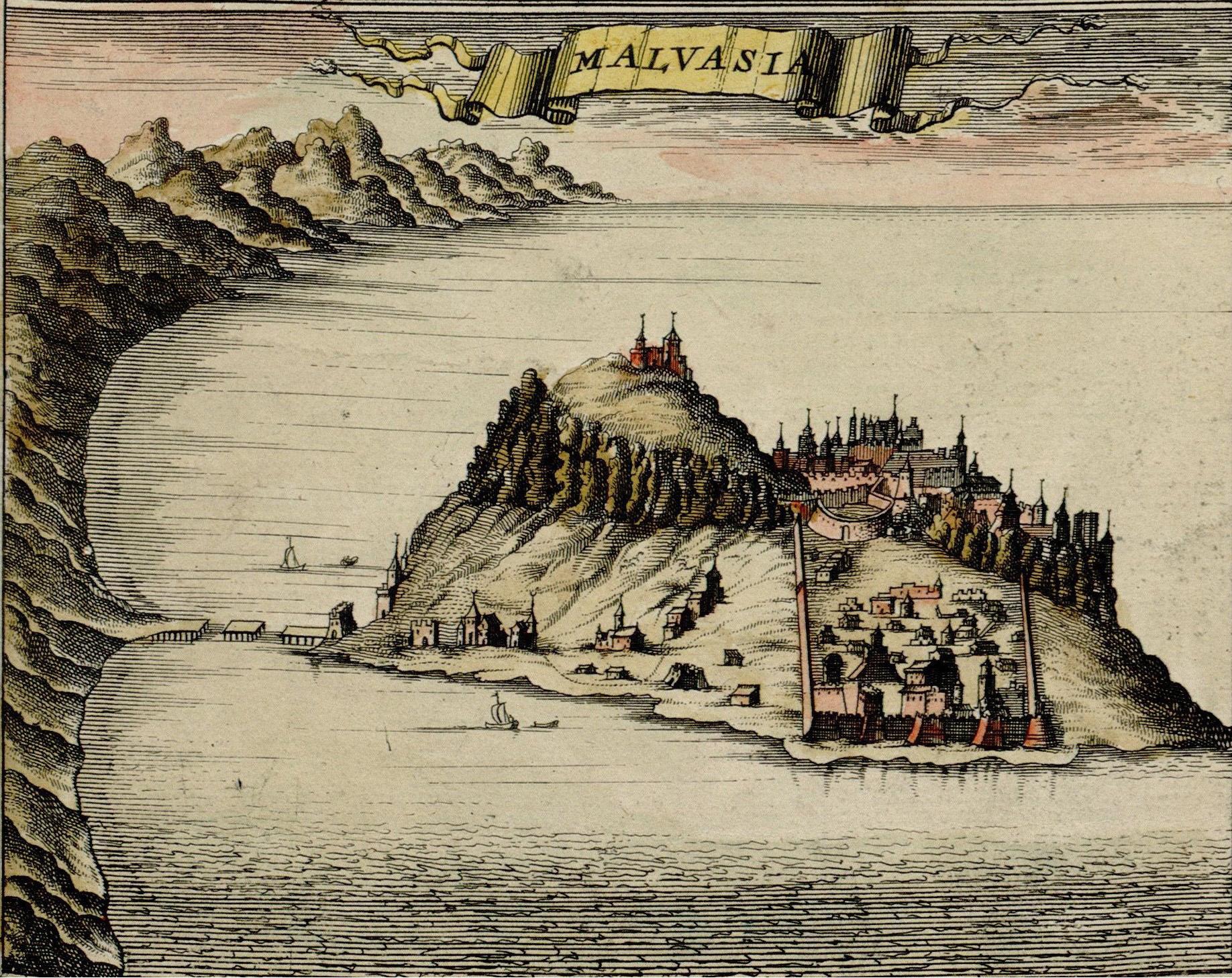
Monemvasia ( el, Μονεμβασιά, Μονεμβασία, or ) is a town and municipality in Laconia, Greece. The town is located on a small island off the east coast of the Peloponnese, surrounded by the Myrtoan Sea. The island is connected to the mainland by a short causeway in length. Its area consists mostly of a large plateau some above sea level, up to wide and long. Founded in the sixth century, and thus one of the oldest continually-inhabited fortified towns in Europe, the town is the site of a once-powerful medieval fortress, and was at one point one of the most important commercial centres in the Eastern Mediterranean. The town's walls and many Byzantine churches remain as testaments to the town's history. Today, the seat of the municipality of Monemvasia is the town of Molaoi. Etymology The town's name derives from two Greek words, (, 'single') and ''emvasis'' (, 'approach'), together meaning "city of the single approach, or entrance". Its Italian form, ''Mal ... [...More Info...] [...Related Items...] OR: [Wikipedia] [Google] [Baidu] |
Peloponnese (region)
The Peloponnese Region ( el, Περιφέρεια Πελοποννήσου, translit=Periféria Peloponnísou, ) is a region in southern Greece. It borders Western Greece to the north and Attica to the north-east. The region has an area of about . It covers most of the Peloponnese peninsula, except for the northwestern subregions of Achaea and Elis which belong to Western Greece and a small portion of the Argolid peninsula that is part of Attica. Administration The Peloponnese Region was established in the 1987 administrative reform. With the 2011 Kallikratis plan, its powers and authority were redefined and extended. Along with the Western Greece and Ionian Islands regions, it is supervised by the Decentralized Administration of Peloponnese, Western Greece and the Ionian Islands based at Patras. The region is based at Tripoli and is divided into five regional units (pre-Kallikratis prefectures), * Arcadia, * Argolis, * Corinthia, * Laconia and * Messenia, ... [...More Info...] [...Related Items...] OR: [Wikipedia] [Google] [Baidu] |
Communities And Municipalities Of Greece
The municipalities of Greece ( el, δήμοι, translit=dímoi ) are the lowest level of government within the organizational structure of the state. As of 2021, there are 332 municipalities, further divided into 1036 municipal units and 6136 communities. Thirteen administrative regions form the second-level unit of government. The regions consist of 74 regional units, which mostly correspond to the old prefectures. Regional units are then divided into municipalities. The new municipalities may be subdivided into municipal units (δημοτικές ενότητες, ''dimotikés enótites''), consisting of the pre-Kallikratis municipalities. These were further subdivided into municipal communities (δημοτικές κοινότητες, ''dimotikés koinótites'') and local communities (τοπικές κοινότητες, ''topikés koinótites'') according to population, but are simply named communities (κοινότητες, ''koinótites'') since the entry into force of t ... [...More Info...] [...Related Items...] OR: [Wikipedia] [Google] [Baidu] |
Greece
Greece,, or , romanized: ', officially the Hellenic Republic, is a country in Southeast Europe. It is situated on the southern tip of the Balkans, and is located at the crossroads of Europe, Asia, and Africa. Greece shares land borders with Albania to the northwest, North Macedonia and Bulgaria to the north, and Turkey to the northeast. The Aegean Sea lies to the east of the mainland, the Ionian Sea to the west, and the Sea of Crete and the Mediterranean Sea to the south. Greece has the longest coastline on the Mediterranean Basin, featuring thousands of islands. The country consists of nine traditional geographic regions, and has a population of approximately 10.4 million. Athens is the nation's capital and largest city, followed by Thessaloniki and Patras. Greece is considered the cradle of Western civilization, being the birthplace of democracy, Western philosophy, Western literature, historiography, political science, major scientific and mathematica ... [...More Info...] [...Related Items...] OR: [Wikipedia] [Google] [Baidu] |
Government Gazette (Greece)
The ''Government Gazette'' ( el, Εφημερίς της Κυβερνήσεως, translit=Efimeris tis Kyverniseos, translit-std=ISO, lit=Government Gazette) is the official journal of the Government of Greece which lists all laws passed in a set time period ratified by Cabinet and President. It was first issued in 1833. Until 1835, during the regency on behalf of King Otto, the gazette was bilingual in Greek and German. No law in Greece is valid until is published in this journal. Foundations, duties and rights of juridical persons should be published in this journal. The printed issues of the Government Gazette are sold by the National Printing House of Greece. They can also be searched and downloaded from the official site of the House. An issue of the gazette is called "Government Gazette Issue" (, ''ΦΕΚ'', ''FEK''), Each issue is separated into volumes called «Τεύχος» with distinct roles. References Publications established in 1833 Newspapers published i ... [...More Info...] [...Related Items...] OR: [Wikipedia] [Google] [Baidu] |
Treaty Of Sapienza
The Treaty of Sapienza was concluded in June 1209 between the Republic of Venice and the newly established Principality of Achaea, under Prince Geoffrey I of Villehardouin, concerning the partition of the Peloponnese (Morea) peninsula, conquered following the Fourth Crusade. By its terms, Venice, which had been accorded most of the Peloponnese in the ''Partitio Romaniae'', recognized Villehardouin in possession of the entire peninsula except for the two forts of Methoni, Messenia, Modon and Koroni, Coron, which came under Venetian control, and secured commercial and tax privileges in the Principality. The text of the treaty is also a valuable primary source for the early history of the Principality of Achaea. Background Following the Siege of Constantinople (1204), capture of Constantinople and the dissolution of the Byzantine Empire by the Fourth Crusade in 1204, the victorious Crusaders partitioned the Byzantine territories among them. The treaty of partition, the ''Partitio Roma ... [...More Info...] [...Related Items...] OR: [Wikipedia] [Google] [Baidu] |
Ottoman Greece
Most of the areas which today are within modern Greece's borders were at some point in the past part of the Ottoman Empire. This period of Ottoman rule in Greece, lasting from the mid-15th century until the successful Greek War of Independence that broke out in 1821 and the proclamation of the First Hellenic Republic in 1822 (preceded by the creation of the autonomous Septinsular Republic in 1800), is known in Greek as ''Tourkokratia'' ( el, Τουρκοκρατία, "Turkish rule"; en, "Turkocracy"). Some regions, however, like the Ionian islands, various temporary Venetian possessions of the Stato da Mar, or Mani peninsula in Peloponnese did not become part of the Ottoman administration, although the latter was under Ottoman suzerainty. The Eastern Roman Empire, the remnant of the ancient Roman Empire which ruled most of the Greek-speaking world for over 1100 years, had been fatally weakened since the sacking of Constantinople by the Latin Crusaders in 1204. The Ottoman ... [...More Info...] [...Related Items...] OR: [Wikipedia] [Google] [Baidu] |
Manisa
Manisa (), historically known as Magnesia, is a city in Turkey's Aegean Region and the administrative seat of Manisa Province. Modern Manisa is a booming center of industry and services, advantaged by its closeness to the international port city and the regional metropolitan center of İzmir and by its fertile hinterland rich in quantity and variety of agricultural production. In fact, İzmir's proximity also adds a particular dimension to all aspects of life's pace in Manisa in the form of a dense traffic of daily commuters between the two cities, separated as they are by a half-hour drive served by a fine six-lane highway nevertheless requiring attention at all times due to its curves and the rapid ascent (sea-level to more than 500 meters at Sabuncubeli Pass) across Mount Sipylus's mythic scenery. The historic part of Manisa spreads out from a forested valley in the immediate slopes of Sipylus mountainside, along Çaybaşı Stream which flows next to Niobe's "Weeping Rock" ... [...More Info...] [...Related Items...] OR: [Wikipedia] [Google] [Baidu] |
Magnesia Ad Sipylum
Magnesia Sipylum ( el, Mαγνησία ἡ πρὸς Σιπύλῳ or ; modern Manisa, Turkey) was a city of Lydia, situated about 65 km northeast of Smyrna (now İzmir) on the river Hermus (now Gediz) at the foot of Mount Sipylus. The city should not be confused with its older neighbor, Magnesia on the Maeander, both founded by colonists from the Greek region of Magnesia. The first famous mention of the city is in 190 BC, when Antiochus the Great was defeated in the battle of Magnesia by the Roman consul Lucius Cornelius Scipio Asiaticus. It became a city of importance under Roman rule and, though nearly destroyed by an earthquake in the reign of Tiberius, was restored by that emperor and flourished through the Roman empire. It was an important regional centre through the Byzantine Empire, and during the 13th-century interregnum of the Empire of Nicea. Magnesia housed the Imperial mint, the Imperial treasury, and served as the functional capital of the empire until th ... [...More Info...] [...Related Items...] OR: [Wikipedia] [Google] [Baidu] |
Ibrahim Pasha Of Egypt
Ibrahim Pasha ( tr, Kavalalı İbrahim Paşa; ar, إبراهيم باشا ''Ibrāhīm Bāshā''; 1789 – 10 November 1848) was an Ottoman Albanian general in the Egyptian army and the eldest son of Muhammad Ali, the Wāli and unrecognised Khedive of Egypt and Sudan. He served as a general in the Egyptian army that his father established during his reign, taking his first command of Egyptian forces when he was merely a teenager. In the final year of his life, he succeeded his still-living father as ruler of Egypt and Sudan, owing to the latter's ill health. His rule also extended over the other dominions that his father had brought under Egyptian rule, namely Syria, Hejaz, Morea, Thasos, and Crete. Ibrahim pre-deceased his father, dying 10 November 1848, only four months after acceding to the throne. Upon his father's death the following year, the Egyptian throne passed to Ibrahim's nephew (son of Muhammad Ali's second oldest son), Abbas. Ibrahim remains one of the most celeb ... [...More Info...] [...Related Items...] OR: [Wikipedia] [Google] [Baidu] |


