|
Milwaukee Metropolitan Area
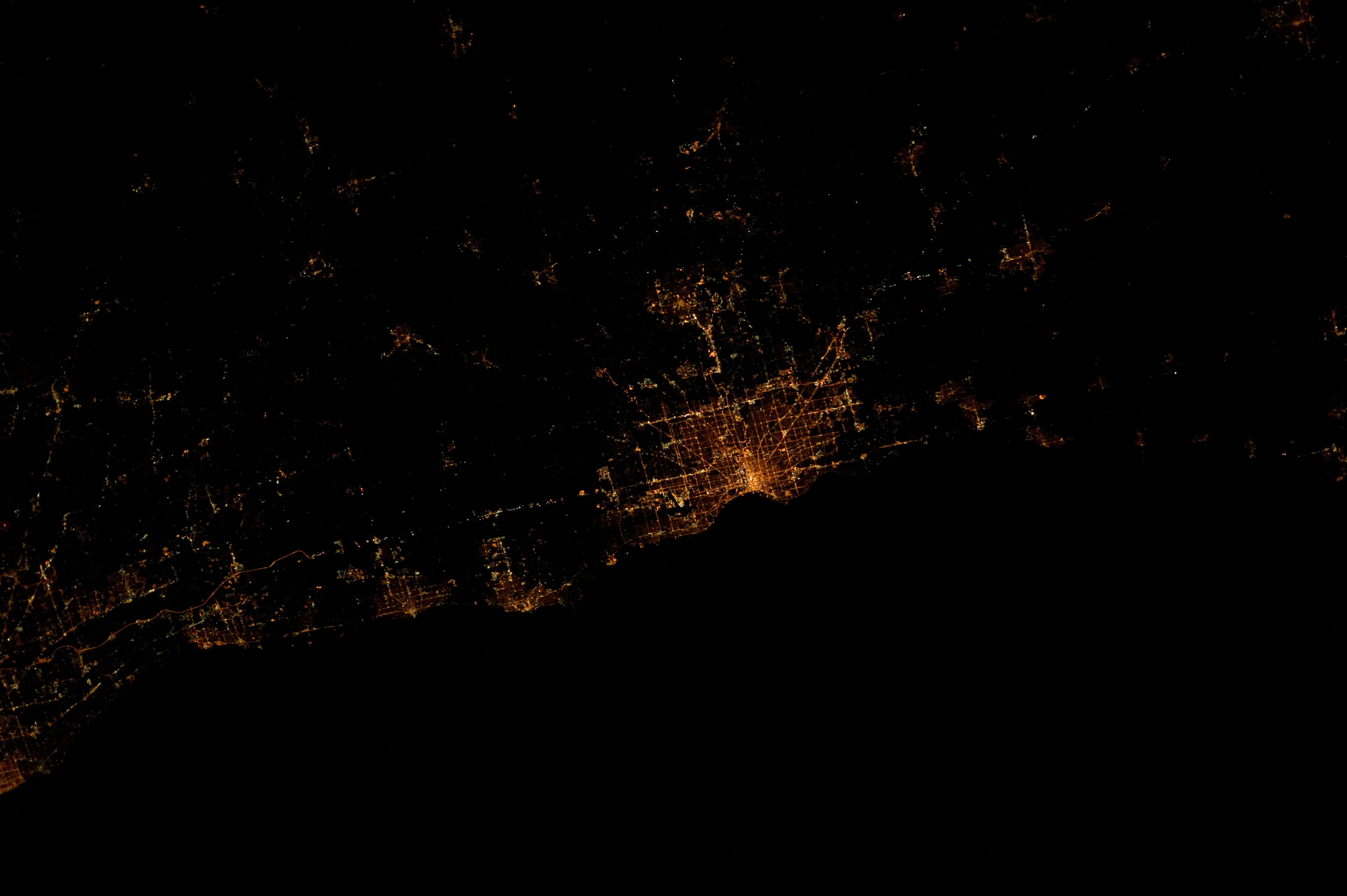
The Milwaukee metropolitan area (also known as Metro Milwaukee or Greater Milwaukee) is a major metropolitan area located in Southeastern Wisconsin, consisting of the city of Milwaukee and the surrounding area. There are several definitions of the area, including the Milwaukee–Waukesha–West Allis metropolitan area and the Milwaukee–Racine–Waukesha combined statistical area. It is the largest metropolitan area in Wisconsin, and the 39th largest metropolitan area in the United States. Definitions Metropolitan area The U.S. Census Bureau defines the Milwaukee Metropolitan area as containing four counties in southeastern Wisconsin: Milwaukee and the three WOW counties: Ozaukee, Washington, and Waukesha. The Metropolitan population of Milwaukee was 1,575,179 in the Census Bureau's 2019 estimate, making it the 39th largest in the United States. The city of Milwaukee is the hub of the metropolitan area. The eastern parts of Racine County, eastern parts of ... [...More Info...] [...Related Items...] OR: [Wikipedia] [Google] [Baidu] |
Metropolitan Area
A metropolitan area or metro is a region that consists of a densely populated urban area, urban agglomeration and its surrounding territories sharing Industry (economics), industries, commercial areas, Transport infrastructure, transport network, infrastructures and housing. A metro area usually comprises multiple Principal city, principal cities, jurisdictions and Municipality, municipalities: Neighbourhood, neighborhoods, townships, boroughs, City, cities, towns, exurbs, suburbs, County, counties, districts, as well as even State (polity), states and nations like the eurodistricts. As social, economic and political institutions have changed, metropolitan areas have become key economic and political regions. Metropolitan areas typically include Satellite city, satellite cities, towns and intervening rural areas that are socioeconomically tied to the Principal city, principal cities or urban core, often measured by commuting patterns. Metropolitan areas are sometimes anchored ... [...More Info...] [...Related Items...] OR: [Wikipedia] [Google] [Baidu] |
Shorewood, Wisconsin
Shorewood is a village in Milwaukee County, Wisconsin, United States. The population was 13,859 at the 2020 census. History In the early 19th century when the first European American settlers arrived, the Shorewood area was controlled by Native Americans, including the Menominee, Potawatomi, and Sauk people. The United States Federal Government acquired the land from the Menominee people in 1832 through the '' Treaty of Washington''. The land was organized as part of the Town of Milwaukee in 1835, and when settlers arrived in the mid-1830s, they found the area to be heavily forested. They built two sawmills on the east bank of the Milwaukee River, and the unincorporated community around the sawmills was known as Mechanicsville. However, the mills' success was short-lived; both closed during the Panic of 1837. Thomas Bare, the area's first permanent white settler, arrived in 1841 and purchased ninety acres of farmland east of the Milwaukee River. Around 1850, another uninco ... [...More Info...] [...Related Items...] OR: [Wikipedia] [Google] [Baidu] |
Jefferson County, Wisconsin
Jefferson County is a county in the U.S. state of Wisconsin. As of the 2020 census, the population was 84,900. Its county seat is Jefferson. Jefferson County comprises the Watertown- Fort Atkinson, WI Micropolitan Statistical Area, which is also included in the Milwaukee-Racine- Waukesha, WI Combined Statistical Area. History Jefferson County was created in 1836 as part of Wisconsin Territory and was organized in 1839. Jefferson County was founded by "Yankee" settlers from New England. It was named after Jefferson County, New York, where some of the original settlers came from. The town of Watertown, Wisconsin, was named after Watertown, New York, in Jefferson County, New York. Geography According to the U.S. Census Bureau, the county has an area of , of which is land and (4.5%) is water. Major highways Railroads *Canadian Pacific *Union Pacific *Wisconsin and Southern Railroad Buses * List of intercity bus stops in Wisconsin Airports * Watertown Municipal Airp ... [...More Info...] [...Related Items...] OR: [Wikipedia] [Google] [Baidu] |
Dodge County, Wisconsin
Dodge County is a county located in the U.S. state of Wisconsin. As of the 2020 census, the population was 89,396. Its county seat is Juneau. The county was created from the Wisconsin Territory in 1836 and organized in 1844. Dodge County comprises the Beaver Dam, WI Micropolitan Statistical Area, which is included in the Milwaukee- Racine- Waukesha, WI Combined Statistical Area. Geography According to the U.S. Census Bureau, the county has a total area of , of which is land and (3.5%) is water. The 6,718 acre Beaver Dam Lake and the 2,713 acre Fox Lake are found within the county. Adjacent counties * Fond du Lac County – northeast * Washington County – east * Waukesha County – southeast * Jefferson County – south * Dane County – southwest * Columbia County – west * Green Lake County – northwest National protected area * Horicon National Wildlife Refuge (part) Climate Demographics 2020 census As of the census of 2020, the population was 89,396 ... [...More Info...] [...Related Items...] OR: [Wikipedia] [Google] [Baidu] |
Racine County, Wisconsin
Racine County (, sometimes also ) is a county in southeastern Wisconsin. As of the 2020 census, its population was 197,727, making it Wisconsin's fifth-most populous county. Its county seat is Racine. The county was founded in 1836, then a part of the Wisconsin Territory. Racine County comprises the Racine metropolitan statistical area. This area is part of the Milwaukee-Racine-Waukesha combined statistical area. According to the U.S. Census Bureau, the county has an area of , of which is land and (58%) is water. The county's unemployment rate was 5.6% in June 2021. History The Potawatomi people occupied the area of Racine County until European settlement. The Wisconsin Territory legislature established Racine County in 1836, separating it from Milwaukee County. Racine County originally extended to Wisconsin's southern border and encompassed the land that is now Kenosha County, Wisconsin. Kenosha County was created as a separate entity in 1850. Geography * Milwaukee Co ... [...More Info...] [...Related Items...] OR: [Wikipedia] [Google] [Baidu] |
Metropolitan Statistical Area
In the United States, a metropolitan statistical area (MSA) is a geographical region with a relatively high population density at its core and close economic ties throughout the area. Such regions are neither legally incorporated as a city or town would be, nor are they legal administrative divisions like counties or separate entities such as states; because of this, the precise definition of any given metropolitan area can vary with the source. The statistical criteria for a standard metropolitan area were defined in 1949 and redefined as metropolitan statistical area in 1983. A typical metropolitan area is centered on a single large city that wields substantial influence over the region (e.g., New York City or Chicago). However, some metropolitan areas contain more than one large city with no single municipality holding a substantially dominant position (e.g., Dallas–Fort Worth metroplex, Virginia Beach–Norfolk–Newport News (Hampton Roads), Riverside–San B ... [...More Info...] [...Related Items...] OR: [Wikipedia] [Google] [Baidu] |
Combined Statistical Area
Combined statistical area (CSA) is a United States Office of Management and Budget (OMB) term for a combination of adjacent metropolitan (MSA) and micropolitan statistical areas (µSA) across the 50 US states and the territory of Puerto Rico that can demonstrate economic or social linkage. CSAs were first designated in 2003. The OMB defines a CSA as consisting of various combinations of adjacent metropolitan and micropolitan areas with economic ties measured by commuting patterns. These areas that combine retain their own designations as metropolitan or micropolitan statistical areas within the larger combined statistical area. The primary distinguishing factor between a CSA and an MSA/µSA is that the social and economic ties between the individual MSAs/µSAs within a CSA are at lower levels than between the counties within an MSA. CSAs represent multiple metropolitan or micropolitan areas that have an employment interchange of at least 15%. CSAs often represent regions wi ... [...More Info...] [...Related Items...] OR: [Wikipedia] [Google] [Baidu] |
Fox Cities
The Fox Cities of Northeastern Wisconsin are the cities, towns and villages along the Fox River as it flows from Lake Winnebago northward into Green Bay. The Fox Cities communities, as defined by its Chamber of Commerce and Convention and Visitors Bureau, include: * Calumet County * Outagamie County * Winnebago County * The cities of Appleton (pop. 74,526), Kaukauna (16,246), Menasha (18,268), Neenah (26,062), and Oshkosh (67,004). * The villages of Combined Locks (pop. 3,588), Fox Crossing (19,029), Harrison (11,532), Hortonville (2,767), Kimberly (6,803), Little Chute (11,564), Sherwood (2,985), and Greenville (10,309) * The towns of Buchanan (pop. 6,755), Clayton (3,951), Freedom (5,842), Grand Chute (20,919), Greenville, Kaukauna (1,238), Neenah (3,237), Vandenbroek (1,474). Major points of interest include the Fox Cities Exhibition Center, Community First Champion Center, Fox Cities Performing Arts Center, High Cliff State Park, and Neuroscience Group Fi ... [...More Info...] [...Related Items...] OR: [Wikipedia] [Google] [Baidu] |
Chicago
(''City in a Garden''); I Will , image_map = , map_caption = Interactive Map of Chicago , coordinates = , coordinates_footnotes = , subdivision_type = Country , subdivision_name = United States , subdivision_type1 = State , subdivision_type2 = Counties , subdivision_name1 = Illinois , subdivision_name2 = Cook and DuPage , established_title = Settled , established_date = , established_title2 = Incorporated (city) , established_date2 = , founder = Jean Baptiste Point du Sable , government_type = Mayor–council , governing_body = Chicago City Council , leader_title = Mayor , leader_name = Lori Lightfoot ( D) , leader_title1 = City Clerk , leader_name1 = Anna Valencia ( D) , unit_pref = Imperial , area_footnotes = , area_total ... [...More Info...] [...Related Items...] OR: [Wikipedia] [Google] [Baidu] |
Madison, Wisconsin
Madison is the county seat of Dane County and the capital city of the U.S. state of Wisconsin. As of the 2020 census the population was 269,840, making it the second-largest city in Wisconsin by population, after Milwaukee, and the 80th-largest in the U.S. The city forms the core of the Madison Metropolitan Area which includes Dane County and neighboring Iowa, Green, and Columbia counties for a population of 680,796. Madison is named for American Founding Father and President James Madison. The city is located on the traditional land of the Ho-Chunk, and the Madison area is known as ''Dejope'', meaning "four lakes", or ''Taychopera'', meaning "land of the four lakes", in the Ho-Chunk language. Located on an isthmus and lands surrounding four lakes—Lake Mendota, Lake Monona, Lake Kegonsa and Lake Waubesa—the city is home to the University of Wisconsin–Madison, the Wisconsin State Capitol, the Overture Center for the Arts, and the Henry Vilas Zoo. Madison is ho ... [...More Info...] [...Related Items...] OR: [Wikipedia] [Google] [Baidu] |
West Allis, Wisconsin
West Allis is a city in Milwaukee County, Wisconsin, United States. A suburb of Milwaukee, it is part of the Milwaukee metropolitan area. The population was 60,325 at the 2020 census. History The name West Allis derives from Edward P. Allis, whose Edward P. Allis Company was a large Milwaukee-area manufacturing firm in the late 19th century. In 1901, the Allis company became Allis-Chalmers, and in 1902 built a large new manufacturing plant west of its existing plant. The locale in which the new plant was constructed was at the time called North Greenfield, and prior to the 1880s had been called Honey Creek. With the building of the western Allis plant, the area was incorporated as the Village of West Allis, and it became the City of West Allis in 1906. With the presence of Allis-Chalmers, the largest manufacturer in the area, West Allis became the largest suburb of Milwaukee in the early 20th century. After that, West Allis grew quickly. Between 1910 and 1930, its population g ... [...More Info...] [...Related Items...] OR: [Wikipedia] [Google] [Baidu] |


