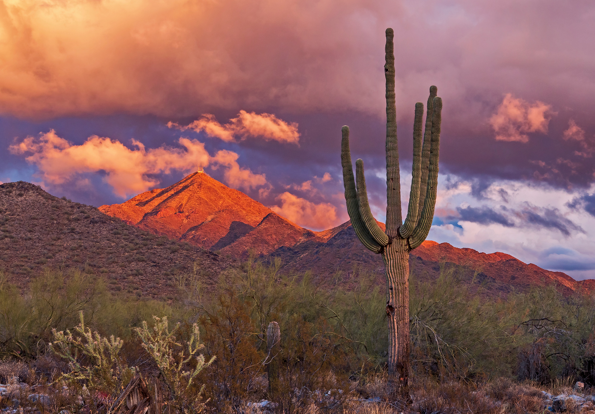
McDowell Mountains
   HOME
*


picture info

McDowell Mountains
The McDowell Mountain Range (Yavapai: Wi:kajasa) is located about twenty miles north-east of downtown Phoenix, Arizona, and may be seen from most places throughout the city. The range is composed of miocene deposits left nearly five million years ago. The McDowells share borders with the cities of Fountain Hills, Scottsdale, and Maricopa County. The city of Scottsdale has made its share of the McDowells a preserve, and has set up a wide trail network in partnership with the McDowell Sonoran Conservancy. The McDowell Sonoran Conservancy was established in 1991. The highest peak in the McDowells is East End, at . This mountain range also serves as a sacred marker to the Yavapai people The Yavapai are a Native American tribe in Arizona. Historically, the Yavapai – literally “people of the sun” (from ''Enyaava'' “sun” + ''Paay'' “people”) – were divided into four geographical bands who identified as separate, i .... The boundaries of the range are generally defin ...
[...More Info...]      
[...Related Items...]     OR:     [Wikipedia]   [Google]   [Baidu]  


Parkinsonia
''Parkinsonia'' , also ''Cercidium'' , is a genus of flowering plants in the pea family, Fabaceae. It contains about 12 species that are native to semi-desert regions of Africa and the Americas. The name of the genus honors English apothecary and botanist John Parkinson (1567–1650). They are large shrubs or small trees growing to tall, dry season deciduous, with sparse, open, thorny crowns and green bark. The leaves are pinnate, sometimes bipinnate, with numerous small leaflets; they are only borne for a relatively short time after rains, with much of the photosynthesis carried out by the green twigs and branches. The flowers are symmetrical or nearly so, with five yellow or white petals. The fruit is a pod containing several seeds. Most American species are known by the common name of palo verde or paloverde, from the Spanish words meaning "green pole" or "green stick". This name is derived from its characteristic green trunk. The palo verde (not species-specific) is ...
[...More Info...]      
[...Related Items...]     OR:     [Wikipedia]   [Google]   [Baidu]  


picture info

Miocene
The Miocene ( ) is the first epoch (geology), geological epoch of the Neogene Period and extends from about (Ma). The Miocene was named by Scottish geologist Charles Lyell; the name comes from the Greek words (', "less") and (', "new") and means "less recent" because it has 18% fewer modern marine invertebrates than the Pliocene has. The Miocene is preceded by the Oligocene and is followed by the Pliocene. As Earth went from the Oligocene through the Miocene and into the Pliocene, the climate slowly cooled towards a series of ice ages. The Miocene boundaries are not marked by a single distinct global event but consist rather of regionally defined boundaries between the warmer Oligocene and the cooler Pliocene Epoch. During the Early Miocene, the Arabian Peninsula collided with Eurasia, severing the connection between the Mediterranean and Indian Ocean, and allowing a faunal interchange to occur between Eurasia and Africa, including the dispersal of proboscideans into Eurasia. ...
[...More Info...]      
[...Related Items...]     OR:     [Wikipedia]   [Google]   [Baidu]  


picture info

Mountain Ranges Of The Sonoran Desert
A mountain is an elevated portion of the Earth's crust, generally with steep sides that show significant exposed bedrock. Although definitions vary, a mountain may differ from a plateau in having a limited summit area, and is usually higher than a hill, typically rising at least 300 metres (1,000 feet) above the surrounding land. A few mountains are isolated summits, but most occur in mountain ranges. Mountains are formed through tectonic forces, erosion, or volcanism, which act on time scales of up to tens of millions of years. Once mountain building ceases, mountains are slowly leveled through the action of weathering, through slumping and other forms of mass wasting, as well as through erosion by rivers and glaciers. High elevations on mountains produce colder climates than at sea level at similar latitude. These colder climates strongly affect the ecosystems of mountains: different elevations have different plants and animals. Because of the less hospitable terrain an ...
[...More Info...]      
[...Related Items...]     OR:     [Wikipedia]   [Google]   [Baidu]  


McDowell Peak
McDowell Peak is located in the McDowell Mountains, to the northeast of Phoenix, Arizona. Its height is . McDowell Peak is located approximately half a mile north of the easily recognizable Thompson Peak, and shares a ridge with Drinkwater Peak. It is bordered on the south by Bell Pass A bell is a struck idiophone, directly struck idiophone percussion instrument. Most bells have the shape of a hollow cup that when struck vibrates in a single strong strike tone, with its sides forming an efficient resonator. The strike may be ..., and on the north by Windgate Pass. The peak is in Scottsdale's McDowell Sonoran Preserve, owned and operated by the city of Scottsdale. By local ordinances "all preserve users must remain on designated and posted trails..." As of August 2016, there were no trails to the summit of McDowell Peak meaning that access was restricted. References External links Hike Arizona – Hiking Trails Index {{Mountains of Arizona Mountains of Arizona Lan ...
[...More Info...]      
[...Related Items...]     OR:     [Wikipedia]   [Google]   [Baidu]  


Thompson Peak (Arizona)
Thompson Peak is located in the McDowell Mountains, the summit being to the northeast of Phoenix, Arizona. Its height is . Thompson Peak has amateur and Maricopa County government radio towers on the summit, accessible via a service road from Fountain Hills Fountain Hills is a town in Maricopa County, Arizona, United States. Known for its impressive fountain, once the tallest in the world, it borders the Fort McDowell Yavapai Nation, Salt River Pima-Maricopa Indian Community, and Scottsdale. The .... References External links "Thompson Peak - MSP, AZ" HikeArizona.com. * {{Mountains of Arizona Landforms of Maricopa County, Arizona Mountains of Arizona Mountains of Maricopa County, Arizona ...
[...More Info...]      
[...Related Items...]     OR:     [Wikipedia]   [Google]   [Baidu]  


picture info

Yavapai People
The Yavapai are a Native American tribe in Arizona. Historically, the Yavapai – literally “people of the sun” (from ''Enyaava'' “sun” + ''Paay'' “people”) – were divided into four geographical bands who identified as separate, independent peoples: the Ɖulv G’paaya, or Western Yavapai; the Yaavpe', or Northwestern Yavapai; the Gwev G’paaya, or Southeastern Yavapai; and the Wiipukpaa, or Northeastern Yavapai – Verde Valley Yavapai. Another Yavapai band, which no longer exists, was the Mađqwarrpaa or "Desert People." Its people are believed to have mixed with the Mojave and Quechan peoples. The Yavapai have much in common with their linguistic relatives to the north, the Havasupai and the Hualapai. Often the Yavapai were mistaken as Apache by American settlers, who referred to them as "Mohave-Apache," "Yuma-Apache," or "Tonto-Apache". Before the 1860s, when settlers began exploring for gold in the area, the Yavapai occupied an area of approximately 20,0 ...
[...More Info...]      
[...Related Items...]     OR:     [Wikipedia]   [Google]   [Baidu]  


East End (Arizona)
East End is a mountain located at the northeastern end of the McDowell Mountains and about north northeast of Scottsdale, Arizona. Its summit is the highest point in the range, at . The mountain is mostly covered in rocky boulders, and is the site of the ancient Marcus Landslide Marcus, Markus, Márkus or Mărcuș may refer to: * Marcus (name), a masculine given name * Marcus (praenomen), a Roman personal name Places * Marcus, a main belt asteroid, also known as (369088) Marcus 2008 GG44 * Mărcuş, a village in Dobârl .... References External links East End Summitpost.org. McDowell Sonoran Conservancy East End Trail, McDowell Mountains Preserve Hike Arizona. {{Mountains of Arizona Landforms of Maricopa County, Arizona Mountains of Arizona Mountains of Maricopa County, Arizona ...
[...More Info...]      
[...Related Items...]     OR:     [Wikipedia]   [Google]   [Baidu]  


McDowell Sonoran Conservancy
The McDowell Sonoran Conservancy (The Conservancy) is an independent non-profit 501(c)(3) conservation organization. Its published mission is to “champion the sustainability of the McDowell Sonoran Preserve (The Preserve) for the benefit of this and future generations. As stewards, we connect the community to the Preserve through education, research, advocacy, partnerships and safe, respectful access.” The McDowell Sonoran Preserve is the largest urban preserve in the U.S. (List of urban parks by size), located within the city limits of Scottsdale, Arizona. It encompasses more than of upper Sonoran Desert, including large portions of the McDowell Mountains. The McDowell Sonoran Conservancy, in partnership with the City of Scottsdale, provides for stewardship of the land within the McDowell Sonoran Preserve. A small paid staff works with volunteers, known as stewards, from the McDowell Sonoran Conservancy to assist the city staff. These services and activities include a volun ...
[...More Info...]      
[...Related Items...]     OR:     [Wikipedia]   [Google]   [Baidu]  


Maricopa County
Maricopa County is in the south-central part of the U.S. state of Arizona. As of the 2020 census, the population was 4,420,568, making it the state's most populous county, and the fourth-most populous in the United States. It contains about 62% of Arizona's population, making Arizona one of the most centralized states in the nation. The county seat is Phoenix, the state capital and fifth-most populous city in the United States. Maricopa County is the central county of the Phoenix- Mesa-Chandler, AZ Metropolitan Statistical Area. The Office of Management and Budget renamed the metropolitan area in September 2018. Previously, it was the Phoenix-Mesa-Glendale metropolitan area, and in 2000, that was changed to Phoenix-Mesa-Scottsdale. Maricopa County was named after the Maricopa Native Americans. Five Native American Reservations are located in the county. The largest are the Salt River Pima-Maricopa Indian Community (east of Scottsdale) and the Gila River Indian Communit ...
[...More Info...]      
[...Related Items...]     OR:     [Wikipedia]   [Google]   [Baidu]  


picture info

Scottsdale, Arizona
, settlement_type = City , named_for = Winfield Scott , image_skyline = , image_seal = Seal of Scottsdale (Arizona).svg , image_blank_emblem = City of Scottsdale Script Logo.svg , nickname = "The West's Most Western Town" (official) , image_map = File:Maricopa County Arizona Incorporated and Unincorporated areas Scottsdale Highlighted 0465000.svg , mapsize = 200x200px , map_caption = Location in Maricopa County, Arizona , mapsize1 = , map_caption1 = , pushpin_map = USA Arizona Maricopa County#USA Arizona#USA , pushpin_label = Scottsdale , pushpin_map_caption = , coordinates = , subdivision_type = Country , subdivision_name = United States , subdivision_type1 = State , subdivision_name1 = Arizona , subdivision_type2 = County , subdivisio ...
[...More Info...]      
[...Related Items...]     OR:     [Wikipedia]   [Google]   [Baidu]  


picture info

Fountain Hills
Fountain Hills is a town in Maricopa County, Arizona, United States. Known for its impressive fountain, once the tallest in the world, it borders the Fort McDowell Yavapai Nation, Salt River Pima-Maricopa Indian Community, and Scottsdale. The population was 23,820 as of the 2020 census. Between the 1990 and 2000 censuses it was the eighth-fastest-growing place among cities and towns in Arizona. The median value of an owner-occupied housing during the period 2016-2020 was estimated at $402,100. History Before the development of Fountain Hills, the area was home to the Yavapai people, and petroglyphs can be found near the Dixie Mine in the northwest corner of the town along the mountains. In the early 20th century, the area that became Fountain Hills and the McDowell Mountain Regional Park was part of the Pemberton Ranch, later renamed the P-Bar Ranch. Fountain Hills High School is built on the site of one of the P-Bar Ranch's buildings, and a plaque stands in the parking l ...
[...More Info...]      
[...Related Items...]     OR:     [Wikipedia]   [Google]   [Baidu]  


picture info

Phoenix, Arizona
Phoenix ( ; nv, Hoozdo; es, Fénix or , yuf-x-wal, Banyà:nyuwá) is the capital and most populous city of the U.S. state of Arizona, with 1,608,139 residents as of 2020. It is the fifth-most populous city in the United States, and the only U.S. state capital with a population of more than one million residents. Phoenix is the anchor of the Phoenix metropolitan area, also known as the Valley of the Sun, which in turn is part of the Salt River Valley. The metropolitan area is the 11th largest by population in the United States, with approximately 4.85 million people . Phoenix, the seat of Maricopa County, has the largest area of all cities in Arizona, with an area of , and is also the 11th largest city by area in the United States. It is the largest metropolitan area, both by population and size, of the Arizona Sun Corridor megaregion. Phoenix was settled in 1867 as an agricultural community near the confluence of the Salt and Gila Rivers and was incorporated as a ci ...
[...More Info...]      
[...Related Items...]     OR:     [Wikipedia]   [Google]   [Baidu]