|
Mali–Senegal Border
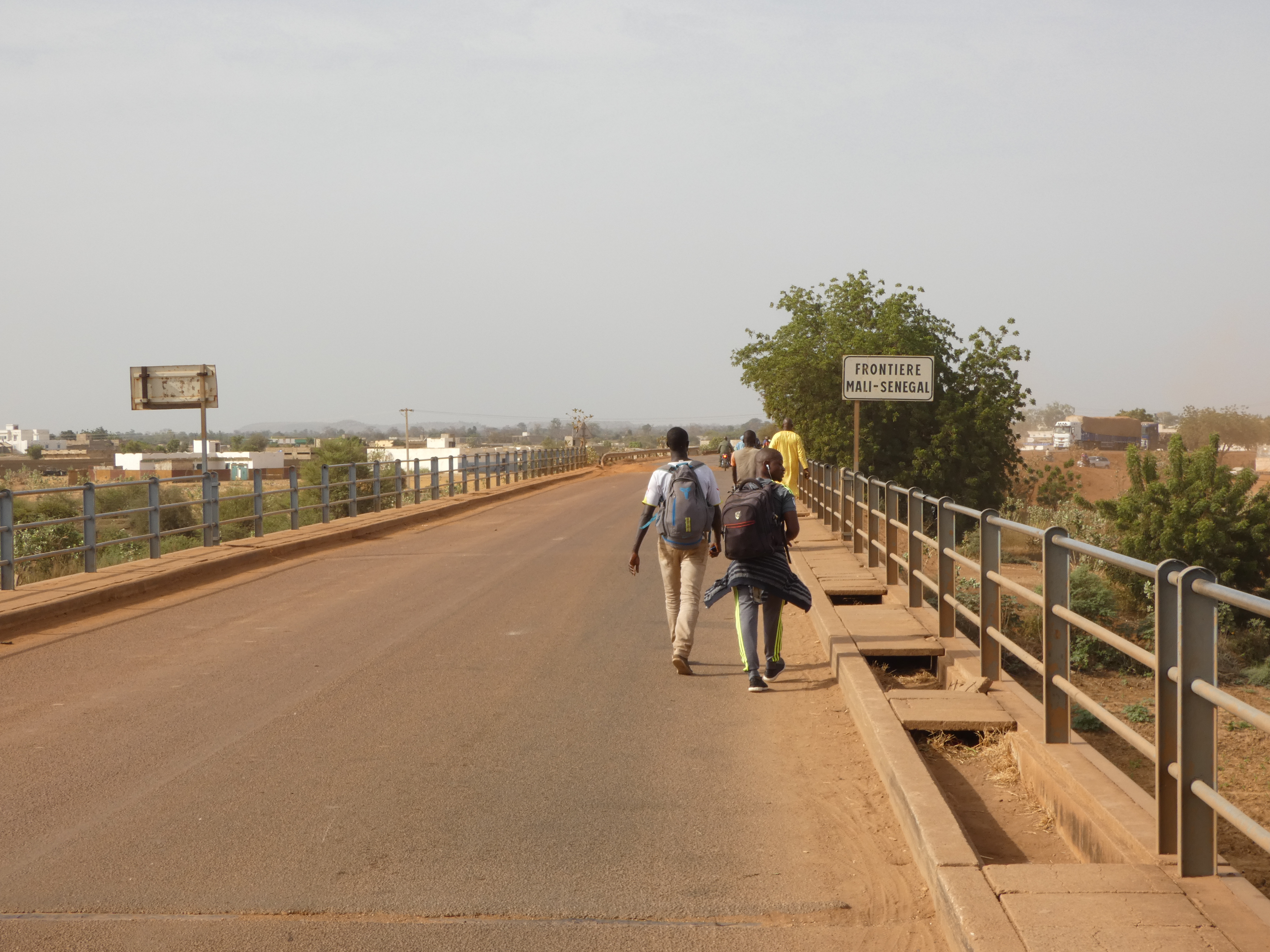
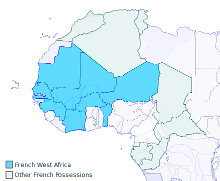
The Mali–Senegal border is 489 km (304 m) in length and runs from the tripoint with Mauritania in the north to the tripoint with Guinea in the south. Description The border begins in the north at the tripoint with Mauritania at the confluence of the Senegal River and Falémé River. It then follows the latter for some distance southwards, before proceeding overland for a stretch, before rejoining the Falémé, which it then follows down to the tripoint with Guinea. History France had begun settling on the coast of modern Senegal in the 17th century, gradually extending their rule further inland during the mid-1800s onward. The areas east of the Falémé river (i.e. roughly modern Mali, Burkina Faso and Niger) were originally under Senegalese administration as Upper Senegal, but were split off as French Sudan in 1893. Both Senegal and French Sudan later became constituent of the federal colony of French West Africa (''Afrique occidentale française'', abbreviated AOF). ... [...More Info...] [...Related Items...] OR: [Wikipedia] [Google] [Baidu] |
Second World War
World War II or the Second World War, often abbreviated as WWII or WW2, was a world war that lasted from 1939 to 1945. It involved the vast majority of the world's countries—including all of the great powers—forming two opposing military alliances: the Allies and the Axis powers. World War II was a total war that directly involved more than 100 million personnel from more than 30 countries. The major participants in the war threw their entire economic, industrial, and scientific capabilities behind the war effort, blurring the distinction between civilian and military resources. Aircraft played a major role in the conflict, enabling the strategic bombing of population centres and deploying the only two nuclear weapons ever used in war. World War II was by far the deadliest conflict in human history; it resulted in 70 to 85 million fatalities, mostly among civilians. Tens of millions died due to genocides (including the Holocaust), starvat ... [...More Info...] [...Related Items...] OR: [Wikipedia] [Google] [Baidu] |
Borders Of Mali
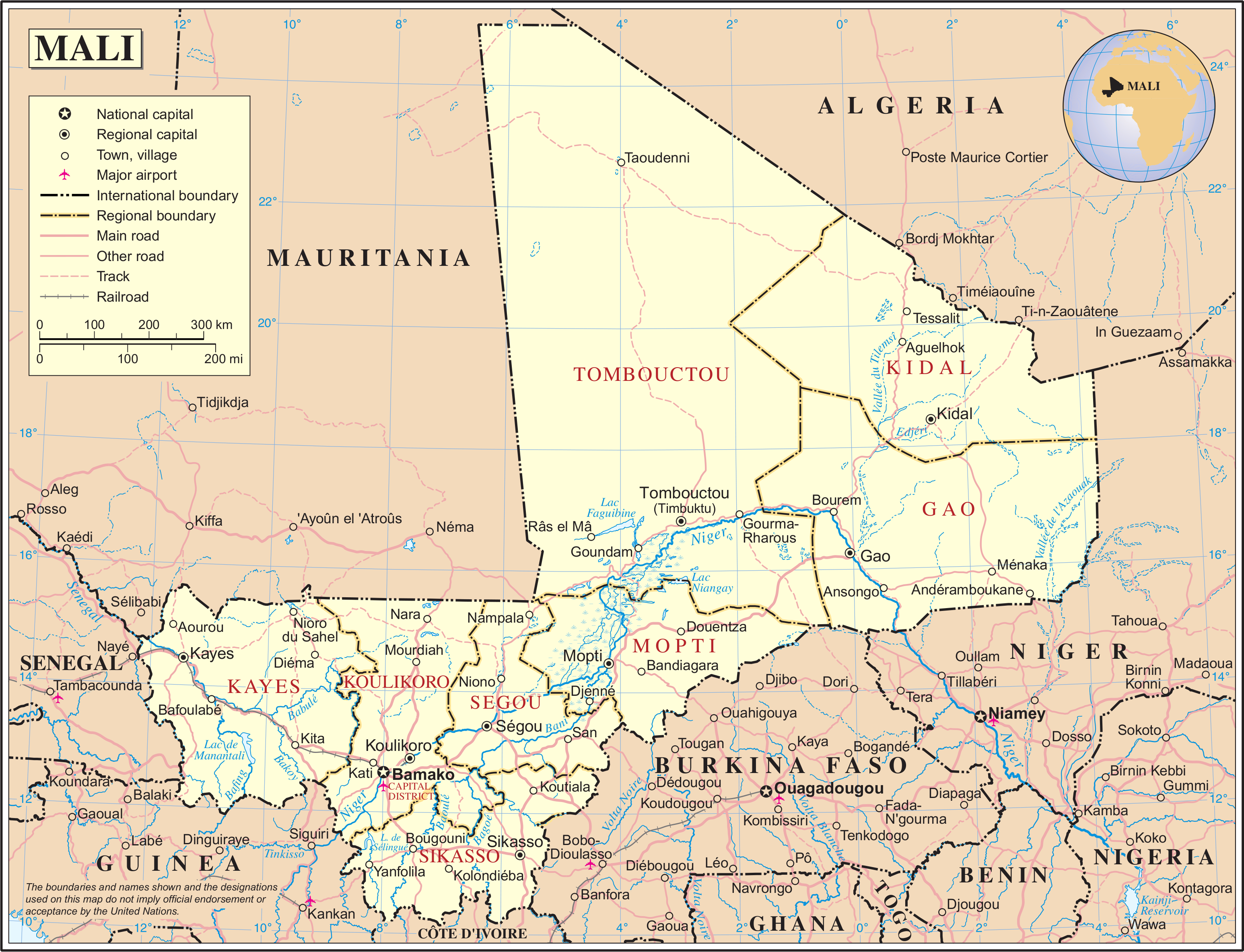
Mali is a landlocked nation in West Africa, located southwest of Algeria, extending south-west from the southern Sahara Desert through the Sahel to the Sudanian savanna zone. Mali's size is 1,240,192 square kilometers. Desert or semi-desert covers about 65 percent of Mali's total area (1,240,192 square kilometers). The Niger River creates a large and fertile inland delta as it arcs northeast through Mali from Guinea before turning south and eventually emptying into the Gulf of Guinea. The territory encompasses three natural zones: the southern cultivated Sudanese zone, central semi-desert Sahelian zone, and northern desert Saharan zone. The terrain is primarily savanna in the south and flat to rolling plains or high plateau (200–500 meters in elevation) in the north. There are rugged hills in the northeast, with elevations of up to 1,000 meters. The Niger (with 1,693 kilometers in Mali) and Senegal are Mali's two largest rivers. The Niger is generally described as Mali's ... [...More Info...] [...Related Items...] OR: [Wikipedia] [Google] [Baidu] |
Mali–Senegal Border
The Mali–Senegal border is 489 km (304 m) in length and runs from the tripoint with Mauritania in the north to the tripoint with Guinea in the south. Description The border begins in the north at the tripoint with Mauritania at the confluence of the Senegal River and Falémé River. It then follows the latter for some distance southwards, before proceeding overland for a stretch, before rejoining the Falémé, which it then follows down to the tripoint with Guinea. History France had begun settling on the coast of modern Senegal in the 17th century, gradually extending their rule further inland during the mid-1800s onward. The areas east of the Falémé river (i.e. roughly modern Mali, Burkina Faso and Niger) were originally under Senegalese administration as Upper Senegal, but were split off as French Sudan in 1893. Both Senegal and French Sudan later became constituent of the federal colony of French West Africa (''Afrique occidentale française'', abbreviated AOF). ... [...More Info...] [...Related Items...] OR: [Wikipedia] [Google] [Baidu] |
Kidira
Kidira is a town and commune in Tambacounda Region of eastern Senegal, lying near the Malian border. Its population in 2013 was about 10,000. Transport It is an important transport hub and lies on the N1 and N2 roads, the Dakar – Bamako railway and the Falémé River The Falémé River is a river in West Africa. The Falémé arises in northern Guinea and flows in a north-northeast direction to Mali, forming a short portion of the border between Guinea and Senegal. It turns north and then forms a portion of th .... See also * Railway stations in Senegal References Populated places in Tambacounda Region Mali–Senegal border crossings Communes of Senegal {{Senegal-geo-stub ... [...More Info...] [...Related Items...] OR: [Wikipedia] [Google] [Baidu] |
Kéniéba
Kéniéba is a rural commune, small town and seat of Kéniéba Cercle in Mali's Kayes Region, near the Mali–Senegal border. As well as the main town, the commune includes 26 other villages.. In the 2009 census the commune had a population of 39,557. Kéniéba is located in the gold-rich region of Bambouk. Climate Twin towns Kéniéba is twinned with the following towns: * Tonopah, Nevada, United States The United States of America (U.S.A. or USA), commonly known as the United States (U.S. or US) or America, is a country primarily located in North America. It consists of 50 states, a federal district, five major unincorporated territori ... References External links *. Communes of Kayes Region {{Kayes-geo-stub ... [...More Info...] [...Related Items...] OR: [Wikipedia] [Google] [Baidu] |
Diboli
Diboli is a small town and principal settlement of the commune of Falémé in the Cercle of Kayes in the Kayes Region of south-western Mali.. It is located just from the Mali–Senegal border. Its nearest big town is Kidira, across the border in Senegal Senegal,; Wolof: ''Senegaal''; Pulaar: 𞤅𞤫𞤲𞤫𞤺𞤢𞥄𞤤𞤭 (Senegaali); Arabic: السنغال ''As-Sinighal'') officially the Republic of Senegal,; Wolof: ''Réewum Senegaal''; Pulaar : 𞤈𞤫𞤲𞤣𞤢𞥄𞤲𞤣𞤭 .... References Populated places in Kayes Region {{Kayes-geo-stub ... [...More Info...] [...Related Items...] OR: [Wikipedia] [Google] [Baidu] |
Fégui
Fégui is a town and urban commune in the Cercle of Kayes in the Kayes Region of south-western Mali. The town lies on the bank of the Falémé River that marks the boundary between Mali and Senegal Senegal,; Wolof: ''Senegaal''; Pulaar: 𞤅𞤫𞤲𞤫𞤺𞤢𞥄𞤤𞤭 (Senegaali); Arabic: السنغال ''As-Sinighal'') officially the Republic of Senegal,; Wolof: ''Réewum Senegaal''; Pulaar : 𞤈𞤫𞤲𞤣𞤢𞥄𞤲𞤣𞤭 .... In 2009 the commune had a population of 5,494. References External links *. Communes of Kayes Region {{Kayes-geo-stub ... [...More Info...] [...Related Items...] OR: [Wikipedia] [Google] [Baidu] |
Mali Federation
The Mali Federation ( ar, اتحاد مالي) was a federation in West Africa linking the French colonies of Senegal and the Sudanese Republic (or French Sudan) for two months in 1960. It was founded on 4 April 1959 as a territory with self-rule within the French Community and became independent after negotiations with France on 20 June 1960. Two months later, on 19 August 1960, the Sudanese Republic leaders in the Mali Federation mobilized the army, and Senegal leaders in the federation retaliated by mobilizing the gendarmerie (national police); this resulted in a tense stand-off, and led to the withdrawal from the federation by Senegal the next day. The Sudanese Republic officials resisted this dissolution, cut off diplomatic relations with Senegal, and defiantly changed the name of their country to Mali. For the brief existence of the Mali Federation, the premier was Modibo Keïta, who would later become the first President of Mali, and its government was based in Dakar, the ... [...More Info...] [...Related Items...] OR: [Wikipedia] [Google] [Baidu] |
French Community
The French Community (1958–1960; french: Communauté française) was the constitutional organization set up in 1958 between France and its remaining African colonies, then in the process of decolonization. It replaced the French Union, which had reorganized the colonial empire in 1946. While the Community remained formally in existence until 1995, when the French Parliament officially abolished it, it had effectively ceased to exist and function by the end of 1960, by which time all the African members had declared their independence and left it. The Community had a short lifespan because, while the African members did not refuse it, they refrained from giving it real life. Under the appearance of equality, the constitution of the Community restricted the sovereignty of the twelve new African states, and reaffirmed the preeminence of France, by placing in the ''domaine commun'' (exercised in common) critical functions such as foreign affairs, defence, the currency, economic ... [...More Info...] [...Related Items...] OR: [Wikipedia] [Google] [Baidu] |


