|
Manicaragua
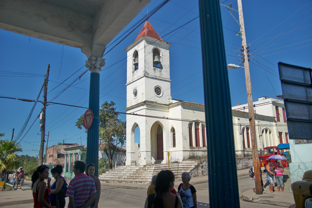
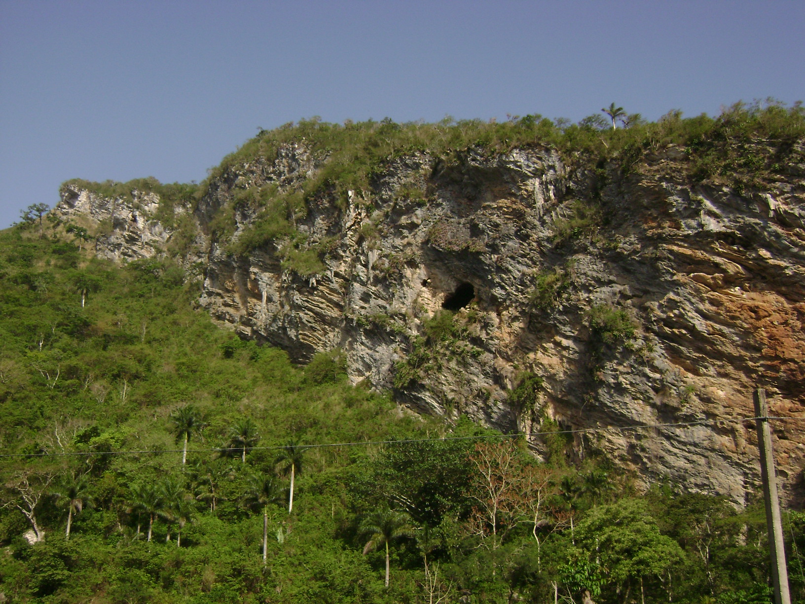
Manicaragua () is a municipality and mountain town in the Villa Clara Province of Cuba. It is located in the Escambray Mountains at the southern part of Villa Clara, bordering the provinces of Cienfuegos to the west and Sancti Spíritus to the east. History The area was originally settled by the Siboney, a Taíno people native of Cuba. Some toponyms of settlements included in the municipality (as Manicaragua, Mataguá, Jibacoa etc.) have an Arawak origin. ( EcuRed) Geography The municipality includes the town proper (with circa 23,000 inhabitants in 2003) and several villages as Arroyo Seco, El Mango, El Salto del Ha ...[...More Info...] [...Related Items...] OR: [Wikipedia] [Google] [Baidu] |
Jibacoa (Manicaragua)
Jibacoa is a Cuban village and ''consejo popular'' ("people's council", i.e. hamlet) of the municipality of Manicaragua, in Villa Clara Province. As of 2004, it had a population of 3,101; and the council's administrative territory covers an area of 78.5 km².Jibacoa on EcuRed History The village was founded in 1961, soon after the . Its toponyms, as well as other included in the municipality (as Manicaragua, , etc.) have an |
Mataguá
Mataguá is a Cuban village and ''consejo popular'' ("people's council", i.e. hamlet) of the municipality of Manicaragua, in Villa Clara Province. With a population of ca. 10,000, it is the most populated village in the municipality after Manicaragua. History Founded in 1868 as a farm estate owned by a Spanish man named Jacinto Rivero, it was sold some years later to Susano Rodríguez, that changed the aboriginal name of Mataguá to ''Palma Sola''. The property was transferred in 1904 to the brothers Pablo and Belisario Millar Vila. The new owners changed the name of the estate, which returned to be the aboriginal one. The village was connected to the mains in 1927, and had a train station on a no longer active line. During the Cuban Revolution, Mataguá was taken by the revolutionaries on 22 December 1958, one week before the Battle of Santa Clara, by a group led by the commander Raúl Nieves. Geography Located 11 km in north of Manicaragua and 27 in south of the city of San ... [...More Info...] [...Related Items...] OR: [Wikipedia] [Google] [Baidu] |
El Salto Del Hanabanilla
El Salto del Hanabanilla, also known as Hanabanilla, is a Cuban village and ''consejo popular'' ("people's council", i.e. hamlet) of the municipality of Manicaragua, Villa Clara Province.El Salto del Hanabanilla on EcuRed As of 2014 the town has 137 homes making up a total of 436 inhabitants. Is a mountain resort famous for the homonym lake. History El Salto del Hanabanilla was originally settled by Taino people; so far 35 aboriginal villages have been discovered around this area. After the |
Villa Clara Province
Villa Clara is one of the provinces of Cuba. It is located in the central region of the island bordering with the Atlantic at north, Matanzas Province by west, Sancti Spiritus Province by east, and Cienfuegos Province on the South. Villa Clara shares with Cienfuegos and Sancti Spiritus on the south the Escambray Mountain Range. Its main cities are Santa Clara (the capital), Remedios, Sagua La Grande, Camajuani, Caibarién, Ranchuelo, Placetas, and Manicaragua. History Prior to 1976, the current provinces of Cienfuegos, Sancti Spíritus, and Villa Clara were all part of the now obsolete province of Las Villas, but Villa Clara is still referred some times just as "Las Villas" using the shorter old name. Santa Clara was the capital of historical Las Villas and still capital of Villa Clara province. That old name itself, Spanish for "The Cities", refers to the four original 16th and 17th-century cities founded in this vast territory: San Juan de los Remedios, Sanct ... [...More Info...] [...Related Items...] OR: [Wikipedia] [Google] [Baidu] |
Hanabanilla Lake
El Salto del Hanabanilla, also known as Hanabanilla, is a Cuban village and ''consejo popular'' ("people's council", i.e. hamlet) of the municipality of Manicaragua, Villa Clara Province.El Salto del Hanabanilla on EcuRed As of 2014 the town has 137 homes making up a total of 436 inhabitants. Is a mountain resort famous for the homonym lake. History El Salto del Hanabanilla was originally settled by Taino people; so far 35 aboriginal villages have been discovered around this area. After the |
Güinía De Miranda
Güinía de Miranda, sometimes shortened as ''Güinía'', is a Cuban village and ''consejo popular'' ("people's council", i.e. hamlet) of the municipality of Manicaragua, in Villa Clara Province. It has a population of circa 3,000 and the council's administrative territory covers an area of 114.2 km². History Founded in 1536, at the end of the 16th century it was an estate depending from Sancti Spíritus. In 1862 Güinía was made up of 50 buildings and had a population of 300.Güinía de Miranda on EcuRed Until 1976, it was part of the municipality of Fomento. Geography Güinía de Miranda is a hilltown surrounded by the |
Cumanayagua
Cumanayagua () is a municipality and town in the Cienfuegos Province of Cuba. It is located in a valley near the Guamuhaya Mountains (usually these mountains are referred as Escambray Mountains, east of Cienfuegos, the provincial capital. History Cumanayagua was inhabited by Cuban Taíno indigenous people when the Spanish arrived to the island.Cumanayagua on EcuRed Though the meaning of the name is uncertain, is known it comes from Taino origin. Some scholars believe it means ''"The place filled with flowers of Royal Palms"'' other believe it could mean ''"The place of Cuma and Anayagua"'', Cuma was the aboriginal chief ruler of the region, and Anayagua his ... [...More Info...] [...Related Items...] OR: [Wikipedia] [Google] [Baidu] |
Fomento
Fomento is a town and municipality in the Sancti Spíritus Province of Cuba. It was founded in 1864. Geography The municipality is divided into the barrios of Fomento (municipal seat) and the village of Jíquimas. Until 1976 the villages of Juan Bravo and Güinía de Miranda were part of Fomento, when they passed in the new province of Villa Clara, as part of the municipality of Manicaragua. Demographics In 2004, the municipality of Fomento had a population of 33,528. With a total area of , it has a population density of . Personalities MLB All-Star Kendrys Morales was born in Fomento but spent the majority of his formative years in Havana. See also *Municipalities of Cuba *List of cities in Cuba This is a list of cities in Cuba with at least 20,000 inhabitants, listed in descending order. Population data refers to city proper and not to the whole municipality, because they include large rural areas with several villages. All figu ... References External links ' ... [...More Info...] [...Related Items...] OR: [Wikipedia] [Google] [Baidu] |
Placetas
Placetas () is a city in the Villa Clara Province in the center of Cuba; before the change in the country's government in 1959 the province was called Las Villas. The town is also known as ''La Villa de los Laureles'' because of its wild laurel trees. Placetas is also a ''municipio'', one of 13 subdivisions of the Villa Clara Province. Cuba's geographical center, Guaracabulla, is located in this municipality. History Placetas was founded on September 9, 1861 mainly due to the sugar production industry. Nowadays, the main produce of the area is tobacco. The main contribution to its foundation came from Jose Martinez-Fortun y Erles, a Spanish Marques and former colonel in the Spanish Army. The town is located on the Carretera Central road, which cuts through the town. The town's position on this road has allowed it to serve as a stop for many travellers. Placetas has grown considerably over the years, being declared a town in 1881 and a city in 1925. In 1879 it was established a ... [...More Info...] [...Related Items...] OR: [Wikipedia] [Google] [Baidu] |
Santa Clara, Cuba
Santa Clara is the capital city of the Cuban province of Villa Clara. It is centrally located in the province and Cuba. Santa Clara is the fifth-most populous Cuban city, with a population of nearly 250,000. History Santa Clara was founded by 175 people on July 15, 1689. 138 of them represented two large families already living in the area, who owned land next to the new city. The other 37 came from seven other families and included a priest and governor, all originating in the coastal city of San Juan de los Remedios. The population of Remedios had to choose between leaving their city, constantly being besieged by pirates, or staying. While most decided to stay, 37 people traveled south to the interior. On June 1, 1689, they arrived at a hill, joining two other families already present at the site. According to tradition, a mass was celebrated under a tamarind tree and Santa Clara was founded. Since then, the place under the tree has been known as ''Loma del Carmen'' ( ... [...More Info...] [...Related Items...] OR: [Wikipedia] [Google] [Baidu] |
Juan Ramón Valdés Gómez
Juan Ramón Valdés Gómez (born 1968 in Manicaragua, Cuba), also called "Yiki", is a modern Cuban artist, known for his paintings. His paintings are representative of 20th-century vanguardia artists who rejected the academic conventions of Cuba's national art academy. His work is influenced by Cubism Cubism is an early-20th-century avant-garde art movement that revolutionized European painting and sculpture, and inspired related movements in music, literature and architecture. In Cubist artwork, objects are analyzed, broken up and reassemble ... and Modernist Primitivism themes from Cuba. He attended the Instituto Superior de Arte in Havana. He has earned numerous awards and his work has been exhibited extensively throughout Cuba as well as in North America and Europe. This includes notable exhibits such as "Borders Crossroads" (Galleria Villa Manuela, Havana City - 2006), "Tribute to the 110th Birthday of Wifredo Lam" (Sagua la grande, Villa Clara, Cuba - 2012), "That's Cu ... [...More Info...] [...Related Items...] OR: [Wikipedia] [Google] [Baidu] |
Municipalities Of Cuba
The provinces of Cuba are divided into 168 municipalities or ''municipios''. They were defined by Cuban Law Number 1304 of July 3, 1976Fifth United Nations Conference on the Standardization of Geographical Names, Vol. II, published by the United Nations, New York, 1991 and reformed in 2010 with the abrogation of the municipality of Varadero and the creation of two new provinces: Artemisa and Mayabeque in place of former La Habana Province. Summary The municipalities are listed below, by province: List of municipalities Municipal maps The maps below show the municipal subdivision of each province, in yellow, within Cuba. Each provincial capital is shown in red. Artemisa (Cuban municipal map).png, Artemisa Camagüey (Cuban municipal map).png, Camagüey Ciego de Ávila (Cuban municipal map).png, Ciego de Ávila Cienfuegos (Cuban municipal map).png, Cienfuegos Bayamo (Cuban municipal map).png, Granma Guantánamo (Cuban municipal map).png, Guantánamo Havana (Cuban mu ... [...More Info...] [...Related Items...] OR: [Wikipedia] [Google] [Baidu] |


