|
Liberty Street (Manhattan)
Liberty Street is a street in New York City that stretches east-west from the middle of Lower Manhattan almost to the East River. It borders such sites as 28 Liberty Street, the Federal Reserve Bank of New York Building, Liberty Tower (Manhattan), Liberty Tower, the Chamber of Commerce Building (Manhattan), Chamber of Commerce Building 140 Broadway, One Liberty Plaza, Zuccotti Park, Liberty Plaza Park, the World Trade Center (2001–present), World Trade Center, Brookfield Place (New York City), Brookfield Place, Gateway Plaza, Liberty Park (Manhattan), Liberty Park, and the North Cove Marina. A FDNY Firehouse, Engine Company 10 and Ladder Company 10, is located at 124 Liberty Street, directly across from the World Trade Center. History Before the American Revolution, Liberty Street was known as Crown Street, which consisted of the present Liberty Street as well as the present Maiden Lane (Manhattan), Maiden Lane between Liberty and Pearl Streets. Its name was changed to Libert ... [...More Info...] [...Related Items...] OR: [Wikipedia] [Google] [Baidu] |
Detroit Photographic Company (0620)
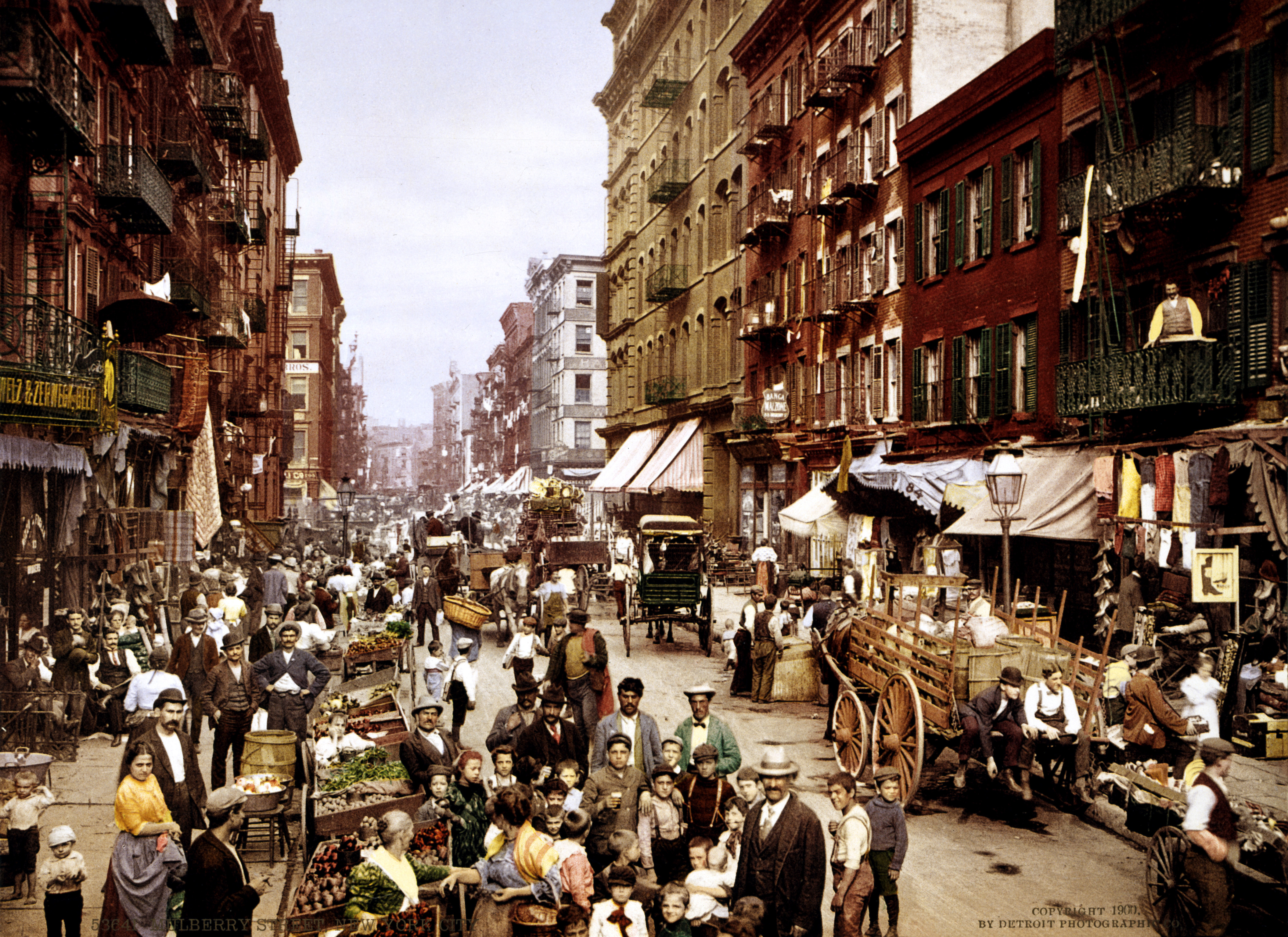
The Detroit Publishing Company was an American photography, photographic publishing firm best known for its large assortment of photochrom color postcards. History The Detroit Publishing Company was started by publisher William A. Livingstone and photographer Edwin H. Husher in the late 19th century as the Detroit Photographic Company, it later became The Detroit Photochrom Company, and it was not until 1905 that the company called itself the Detroit Publishing Company. The company acquired rights to a color printing process developed by Hans Jakob Schmid of Orell Fussli & Company of Switzerland called Photochrom. Photochrom allowed for the company to mass market postcards and other materials in color. The Detroit Publishing Company started to market this in 1907 under the name "photostint". By the time of World War I, the company faced declining sales both due to the war economy and the competition from cheaper, more advanced printing methods. The company declared bankruptcy in ... [...More Info...] [...Related Items...] OR: [Wikipedia] [Google] [Baidu] |
Engine Company 10 And Ladder Company 10
Firehouse, Engine Company 10 and Ladder Company 10, is a New York City Fire Department (FDNY) fire station, located at 124 Liberty Street across from the World Trade Center site and the National September 11 Memorial & Museum in the Financial District neighborhood of Manhattan, New York City. It is known for being the first fire station to respond to the Terrorist Attacks at the World Trade Center on September 11, 2001.'' History Engine Company 10 was established on September 8, 1865, initially situated at 28 Beaver Street. Over the years, it underwent several relocations, first moving to 8 Stone Street in April 1867 and eventually settling at 124 Liberty Street on June 11, 1980. Similarly, Ladder Company 10 was founded on October 20, 1865, starting at 28 Ann Street and housed for a time at 193 Fulton Street alongside Engine Co. No. 29 before eventually moving to Liberty Street on July 1, 1984. The Ten House is unique among the 220 FDNY firehouses as it is one of only two ... [...More Info...] [...Related Items...] OR: [Wikipedia] [Google] [Baidu] |
World Trade Center Site
The World Trade Center site, often referred to as " Ground Zero" or "the Pile" immediately after the September 11 attacks, is a 14.6-acre (5.9 ha) area in Lower Manhattan in New York City. The site is bounded by Vesey Street to the north, the West Side Highway to the west, Liberty Street to the south, and Church Street to the east. The Port Authority of New York and New Jersey (PANYNJ) owns the site's land (except for 7 World Trade Center). The original World Trade Center complex stood on the site until it was destroyed in the September 11 attacks. The Port Authority, Silverstein Properties, and the Lower Manhattan Development Corporation (LMDC) have overseen the reconstruction of the site as part of the new World Trade Center, following a master plan by Studio Daniel Libeskind. Developer Larry Silverstein holds the lease to retail and office space in four of the site's buildings. Before the World Trade Center The western portion of the World Trade Center site ... [...More Info...] [...Related Items...] OR: [Wikipedia] [Google] [Baidu] |
Deutsche Bank Building
The Deutsche Bank Building (formerly Bankers Trust Plaza) was a 39-story office building located at 130 Liberty Street in Manhattan, New York City, adjacent to the World Trade Center site. The building opened in 1974 and closed following the September 11 attacks in 2001, due to contamination that spread from the collapse of the South Tower. The structure was designed by Shreve, Lamb & Harmon, which also designed the Empire State Building. The building was purchased by Deutsche Bank when it acquired Bankers Trust in 1998. It was part of the skyline of Lower Manhattan, and was demolished between 2007 and 2011. 5 World Trade Center will eventually replace the building, expanding the ground space on which the World Trade Center stands, as this land was not part of the original World Trade Center. September 11th The collapse of the South Tower during the September 11 attacks tore a 24-story gash into the facade of the building, knocked out a load-bearing column, and destroyed ... [...More Info...] [...Related Items...] OR: [Wikipedia] [Google] [Baidu] |
2 World Trade Center (1971–2001)
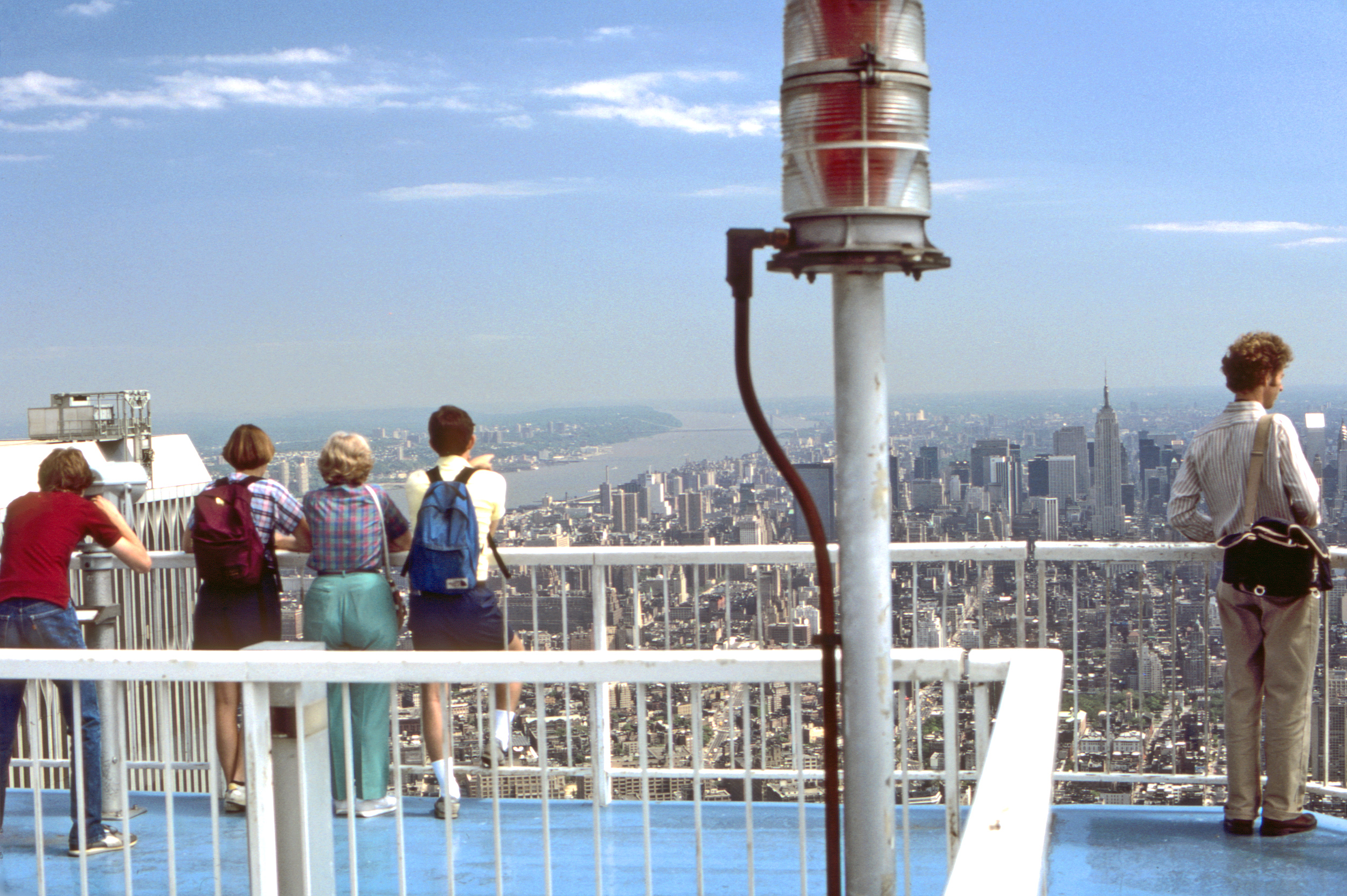
The original Two World Trade Center (also known as the South Tower, Tower 2, Building Two, or 2 WTC) was one of the Twin Towers in the original World Trade Center (1973–2001), World Trade Center Complex in New York City. The Tower was completed and opened in 1973 at a height of to the roof, distinguishable from its twin, the 1 World Trade Center (1971–2001), North Tower (1 World Trade Center), by the absence of a television antenna. On the 107th floor of this building was a popular tourist attraction called "World Trade Center (1973–2001)#Top of the World observation deck, Top of the World Trade Center Observatories," and on the roof was an outdoor observation deck accessible to the public and a disused helipad at the center. The address of this building was 2 World Trade Center, with the WTC complex having its own ZIP code of 10048 (ZIP code), 10048. The South Tower was destroyed along with the North Tower in the September 11 attacks. At 9:03 a.m, seventeen minutes after ... [...More Info...] [...Related Items...] OR: [Wikipedia] [Google] [Baidu] |
September 11 Attacks
The September 11 attacks, also known as 9/11, were four coordinated Islamist terrorist suicide attacks by al-Qaeda against the United States in 2001. Nineteen terrorists hijacked four commercial airliners, crashing the first two into the Twin Towers of the World Trade Center in New York City and the third into the Pentagon (headquarters of the U.S. Department of Defense) in Arlington County, Virginia. The fourth plane crashed in a rural Pennsylvania field during a passenger revolt. The attacks killed 2,977 people, making it the deadliest terrorist attack in history. In response to the attacks, the United States waged the global war on terror over multiple decades to eliminate hostile groups deemed terrorist organizations, as well as the foreign governments purported to support them. Ringleader Mohamed Atta flew American Airlines Flight 11 into the North Tower of the World Trade Center complex at 8:46 a.m. Seventeen minutes later at 9:03 a.m., United Airlines Flig ... [...More Info...] [...Related Items...] OR: [Wikipedia] [Google] [Baidu] |
World Trade Center (1973–2001)
The original World Trade Center (WTC) was a complex of seven buildings in the Financial District, Manhattan, Financial District of Lower Manhattan in New York City. Built primarily between 1966 and 1975, it was dedicated on April 4, 1973, and was collapse of the World Trade Center, destroyed during the September 11 attacks in 2001. At the time of their completion, the 110-story-tall Twin Towers, including the original 1 World Trade Center (1970–2001), 1 World Trade Center (the North Tower) at , and 2 World Trade Center (1971–2001), 2 World Trade Center (the South Tower) at , were the History of the world's tallest buildings#Skyscrapers: tallest buildings since 1908, tallest buildings in the world; they were also the List of tallest twin buildings and structures, tallest twin skyscrapers in the world until 1996, when the Petronas Towers opened in Kuala Lumpur, Malaysia. Other buildings in the complex included the Marriott World Trade Center (3 WTC), 4 World Trade Center (197 ... [...More Info...] [...Related Items...] OR: [Wikipedia] [Google] [Baidu] |
West Side Highway
The Joe DiMaggio Highway, commonly called the West Side Highway and formerly the Miller Highway, is a mostly surface section of New York State Route 9A (NY 9A), running from 72nd Street (Manhattan), West 72nd Street along the Hudson River to the southern tip of Manhattan in New York City. It replaced the West Side Elevated Highway, built between 1929 and 1951, was shut down in 1973 due to neglect and lack of maintenance, and was dismantled by 1989. North of 72nd Street, the roadway continues as the Henry Hudson Parkway. The current highway was complete by 2001, but required reconstruction after the September 11 attacks that year, when the collapse of the World Trade Center caused debris to fall onto the surrounding areas, damaging the highway. It uses the surface streets that existed before the elevated highway was built: West Street, Eleventh Avenue (Manhattan), Eleventh Avenue and Twelfth Avenue. A short section of Twelfth Avenue still runs between 125th and 138th ... [...More Info...] [...Related Items...] OR: [Wikipedia] [Google] [Baidu] |
Church Street (Manhattan)
Church Street and Trinity Place form a single northbound roadway in Lower Manhattan, New York City. Its northern end is at Canal Street and its southern end is at Morris Street, where Trinity Place merges with Greenwich Street. The dividing point is Liberty Street. Description Trinity Place branches off Greenwich Street at Morris Street, running uptown to the northeast, passing west of Trinity Church, the Trinity and United States Realty Buildings, and Zuccotti Park. At Liberty Street it becomes Church Street, which forms the eastern boundary of the World Trade Center to Vesey Street. At Franklin Street, a few blocks south of Canal Street, Avenue of the Americas (Sixth Avenue) branches off. Trinity Place, Church Street, and Avenue of the Americas form a continuous northbound through-route from Lower Manhattan to Central Park. Church Street is named after Trinity Church, a historic Gothic-style parish church on Broadway at Wall Street. Extended in 1784, Church Street ... [...More Info...] [...Related Items...] OR: [Wikipedia] [Google] [Baidu] |
Jersey City
Jersey City is the List of municipalities in New Jersey, second-most populousTable1. New Jersey Counties and Most Populous Cities and Townships: 2020 and 2010 Censuses New Jersey Department of Labor and Workforce Development. Accessed December 1, 2022. city (New Jersey), city in the U.S. state of New Jersey, after Newark, New Jersey, Newark.The Counties and Most Populous Cities and Townships in 2010 in New Jersey: 2000 and 2010 , United States ... [...More Info...] [...Related Items...] OR: [Wikipedia] [Google] [Baidu] |
Communipaw Terminal
The Central Railroad of New Jersey Terminal, also known as Communipaw Terminal and Jersey City Terminal, was the Central Railroad of New Jersey's waterfront passenger terminal in Jersey City, New Jersey. The terminal was built in 1889, replacing an earlier one that had been in use since 1864. It operated until April 30, 1967. It also serviced the Central Railroad of New Jersey-operated Reading Railroad, the Baltimore and Ohio Railroad, and the Lehigh Valley Railroad during various periods in its 78 years of operation. The terminal was one of five passenger railroad terminals that lined the Hudson Waterfront during the 19th and 20th centuries, the others being Weehawken, Hoboken, Pavonia and Exchange Place, with Hoboken being the only station that is still in use, as of 2024. The headhouse was renovated and incorporated into Liberty State Park. The station has been listed on the New Jersey Register of Historic Places and National Register of Historic Places since Septemb ... [...More Info...] [...Related Items...] OR: [Wikipedia] [Google] [Baidu] |
North River (Hudson River)
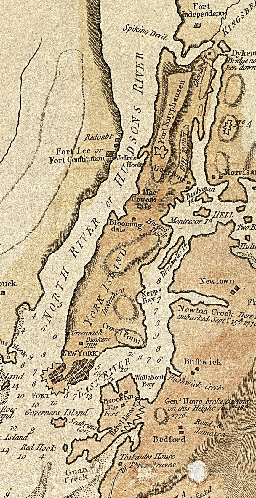
North River () is an alternative name for the southernmost portion of the Hudson River in the vicinity of New York City and Gateway Region, northeastern New Jersey in the United States. History Name In the early 17th century, the entire watercourse was named the North River (Dutch: Noort Rivier") by the Dutch colonial empire; by the early 18th century, the term fell out of general use for most of the river's 300+ mile course. The name remains in limited use among local mariners and others and on some nautical charts and maps. The term is also used to describe infrastructure on and under the river, including the North River piers, North River Tunnels, and Riverbank State Park. The origin of the name North River is generally attributed to the Dutch. In describing the major rivers in the New Netherland colony, they called the present-day Hudson River the "North River", the present-day Connecticut River the "Fresh River", and the Delaware River the "South River". Another theory ... [...More Info...] [...Related Items...] OR: [Wikipedia] [Google] [Baidu] |


