|
Kettla Ness
Kettla Ness, Kettlaness or just Kettla is a tied island and headland in Shetland. It is connected by the tombolo Minn beach (Banna Minn), to the south end of West Burra, part of the Scalloway Islands. The headland itself is conspicuous and circa 160 feet high. The island is accessible to walkers via Minn beach and is now uninhabitated. It is principally used for Sheep farming and pasture. History The former settlements of Minn, Gossigarth and Point of Guide lie on the north-west part of the island. The ruined village was principally abandoned following the Highland Clearances in the 19th century although some occupation continued into the early 20th century. There are several other instances of prehistoric activity on the island, primarily at Minn, including several 3rd-1st millennium BC house, cairns, burnt mounds, cists, crop marks and other structures. Several of these are located in the Bight of the Sandy Geos, an area on the eastern side of Kettla Ness. Iron-age pottery fr ... [...More Info...] [...Related Items...] OR: [Wikipedia] [Google] [Baidu] |
West Burra
West Burra is one of the Scalloway Islands, a subgroup of the Shetland Islands in Scotland. It is connected by bridge to East Burra. With an area of , it is the eleventh-largest of the Shetland Islands. Geography The nearby south-facing sandy beach at Meal is a popular place on a warm day. At the south end of West Burra is Kettla Ness, with impressive cliff scenery; it is linked to the main island by a shingle and sand tombolo which also provides another attractive sandy beach. At Duncansclett, a traditional thatched cottage has recently been restored for use by the local history group; the building featured in the BBC television series, ''Restoration'' in 2003. West Burra is linked to the Shetland Mainland via Trondra by a series of bridges. Settlements Hamnavoe (an extremely common Shetland name) is the main settlement, and there is also Bridge End, so called because it is near the bridge to East Burra. History The form used in the ''Orkneyinga saga'' is "Barrey ... [...More Info...] [...Related Items...] OR: [Wikipedia] [Google] [Baidu] |
Scalloway Islands
The Scalloway Islands are in Shetland opposite Scalloway on south west of the Mainland. They form a mini-archipelago and include: * Burra (two islands linked by bridge to each other and Trondra) ** East Burra (with Houss Ness) ** West Burra (with Kettla Ness) ** South Havra ** Little Havra ** Papa – belongs to Civil parish of Lerwick ** West Head of Papa (tidal) The aforementioned islands were all part of the ancient civil parish of Burra, which was merged with Lerwick in 1891. They are shown on coloured maps as part of Lerwick. Retrieved June 18, 2017 * /Hildesay – belongs to Civil parish of Tingwall * [...More Info...] [...Related Items...] OR: [Wikipedia] [Google] [Baidu] |
Shetland
Shetland (until 1975 spelled Zetland), also called the Shetland Islands, is an archipelago in Scotland lying between Orkney, the Faroe Islands, and Norway, marking the northernmost region of the United Kingdom. The islands lie about to the northeast of Orkney, from mainland Scotland and west of Norway. They form part of the border between the Atlantic Ocean to the west and the North Sea to the east. The island's area is and the population totalled in . The islands comprise the Shetland (Scottish Parliament constituency), Shetland constituency of the Scottish Parliament. The islands' administrative centre, largest settlement and only burgh is Lerwick, which has been the capital of Shetland since 1708, before which time the capital was Scalloway. Due to its location it is accessible only by ferry or flight with an airport located in Sumburgh as well as a port and emergency airstrip in Lerwick. The archipelago has an oceanic climate, complex geology, rugged coastline, and m ... [...More Info...] [...Related Items...] OR: [Wikipedia] [Google] [Baidu] |
Tied Island
A tied island or land-tied island is a landform consisting of an island that is connected to the mainland or another island only by a tombolo, which is a spit of beach materials connected to land at both ends. St Ninian's Isle in the Shetland Islands off the north coast of Scotland is an example: it was once an island but is now linked to the mainland. Other examples include Maury Island, Washington in Puget Sound, Coronado, California, and Nahant, Massachusetts in the United States; Paraguana Peninsula in Venezuela; Barrenjoey, New South Wales and Wedge Island, Western Australia; Paratutae Island in New Zealand; Mount Hakodate in Japan, Howth Head in Ireland; Davaar Island, Campbeltown, Scotland; Chefoo island in Yantai, China; and Cheung Chau in Hong Kong. The Isle of Portland, in England, is also described as a tied island, but geographers now believe that Chesil Beach, which connects the island to the mainland, is a barrier beach that has moved eastwards, ra ... [...More Info...] [...Related Items...] OR: [Wikipedia] [Google] [Baidu] |
Tombolo
A tombolo is a sandy or shingle isthmus. It is a deposition landform by which an island becomes attached to the mainland by a narrow piece of land such as a spit or bar. Once attached, the island is then known as a tied island. The word ''tombolo'' is from the Italian ', meaning 'pillow' or 'cushion', and sometimes translated incorrectly as '' ayre'' (an ayre is a shingle beach of any kind). Several islands tied together by bars which rise above the water level are called a tombolo cluster. Two or more tombolos may form an enclosure (called a lagoon) that can eventually fill with sediment. Formation The shoreline moves toward the island (or detached breakwater) owing to the accretion of sand in the lee of the island, where wave energy and longshore drift are reduced and therefore deposition of sand occurs. Wave diffraction and refraction True tombolos are formed by wave refraction and diffraction. As waves near an island, they are slowed by the shallow water surroundi ... [...More Info...] [...Related Items...] OR: [Wikipedia] [Google] [Baidu] |
Sheep Farming
Sheep farming or sheep husbandry is the raising and breeding of domestic sheep. It is a branch of animal husbandry. Sheep are raised principally for their meat (lamb and mutton), milk (sheep's milk), and fiber (wool). They also yield sheepskin and parchment. Sheep can be raised in a range of temperate climates, including arid zones near the equator and other torrid zones. Farmers build fences, housing, shearing sheds, and other facilities on their property, such as for water, feed, transport, and pest control. Most farms are managed so sheep can graze pastures, sometimes under the control of a shepherd or sheep dog. Farmers can select from various breeds suitable for their region and market conditions. When the farmer sees that a ewe (female adult) is showing signs of heat or estrus, they can organise for mating with males. Newborn lambs are typically subjected to lamb marking, which involves tail docking, mulesing, earmarking, and males may be castrated. Sheep producti ... [...More Info...] [...Related Items...] OR: [Wikipedia] [Google] [Baidu] |
Highland Clearances
The Highland Clearances ( , the "eviction of the Gaels") were the evictions of a significant number of tenants in the Scottish Highlands and Islands, mostly in two phases from 1750 to 1860. The first phase resulted from Scottish Agricultural Revolution, agricultural improvement, driven by the need for landlords to increase their income – many had substantial debts, with actual or potential bankruptcy being a large part of the story of the clearances. This involved the enclosure of the Open-field system, open fields managed on the run rig system and shared grazing. These were usually replaced with large-scale Pastoral farming, pastoral farms on which much higher rents were paid. The displaced tenants were expected to be employed in industries such as fishing, quarrying, or Kelp#Uses, kelp harvesting and processing. Their reduction in status from farmer to Croft (land), crofter was one of the causes of resentment. The second phase involved overcrowded crofting communities from ... [...More Info...] [...Related Items...] OR: [Wikipedia] [Google] [Baidu] |
Watermills
A watermill or water mill is a mill that uses hydropower. It is a structure that uses a water wheel or water turbine to drive a mechanical process such as milling (grinding), rolling, or hammering. Such processes are needed in the production of many material goods, including flour, lumber, paper, textiles, and many metal products. These watermills may comprise gristmills, sawmills, paper mills, textile mills, hammermills, trip hammering mills, rolling mills, and wire drawing mills. One major way to classify watermills is by wheel orientation (vertical or horizontal), one powered by a vertical waterwheel through a gear mechanism, and the other equipped with a horizontal waterwheel without such a mechanism. The former type can be further subdivided, depending on where the water hits the wheel paddles, into undershot, overshot, breastshot and pitchback (backshot or reverse shot) waterwheel mills. Another way to classify water mills is by an essential trait about their location: ... [...More Info...] [...Related Items...] OR: [Wikipedia] [Google] [Baidu] |
Inlet At Kettla Ness - Geograph
An inlet is a typically long and narrow indentation of a shoreline such as a small arm, cove, bay, sound, fjord, lagoon or marsh, that leads to an enclosed larger body of water such as a lake, estuary, gulf or marginal sea. Overview In marine geography, the term "inlet" usually refers to either the actual channel between an enclosed bay and the open ocean and is often called an "entrance", or a significant recession in the shore of a sea, lake or large river. A certain kind of inlet created by past glaciation is a fjord, typically but not always in mountainous coastlines and also in montane lakes. Multi-arm complexes of large inlets or fjords may be called sounds, e.g., Puget Sound, Howe Sound, Karmsund (''sund'' is Scandinavian for "sound"). Some fjord-type inlets are called canals, e.g., Portland Canal, Lynn Canal, Hood Canal, and some are channels, e.g., Dean Channel and Douglas Channel. Tidal amplitude, wave intensity, and wave direction are all factors that ... [...More Info...] [...Related Items...] OR: [Wikipedia] [Google] [Baidu] |
Armeria Maritima
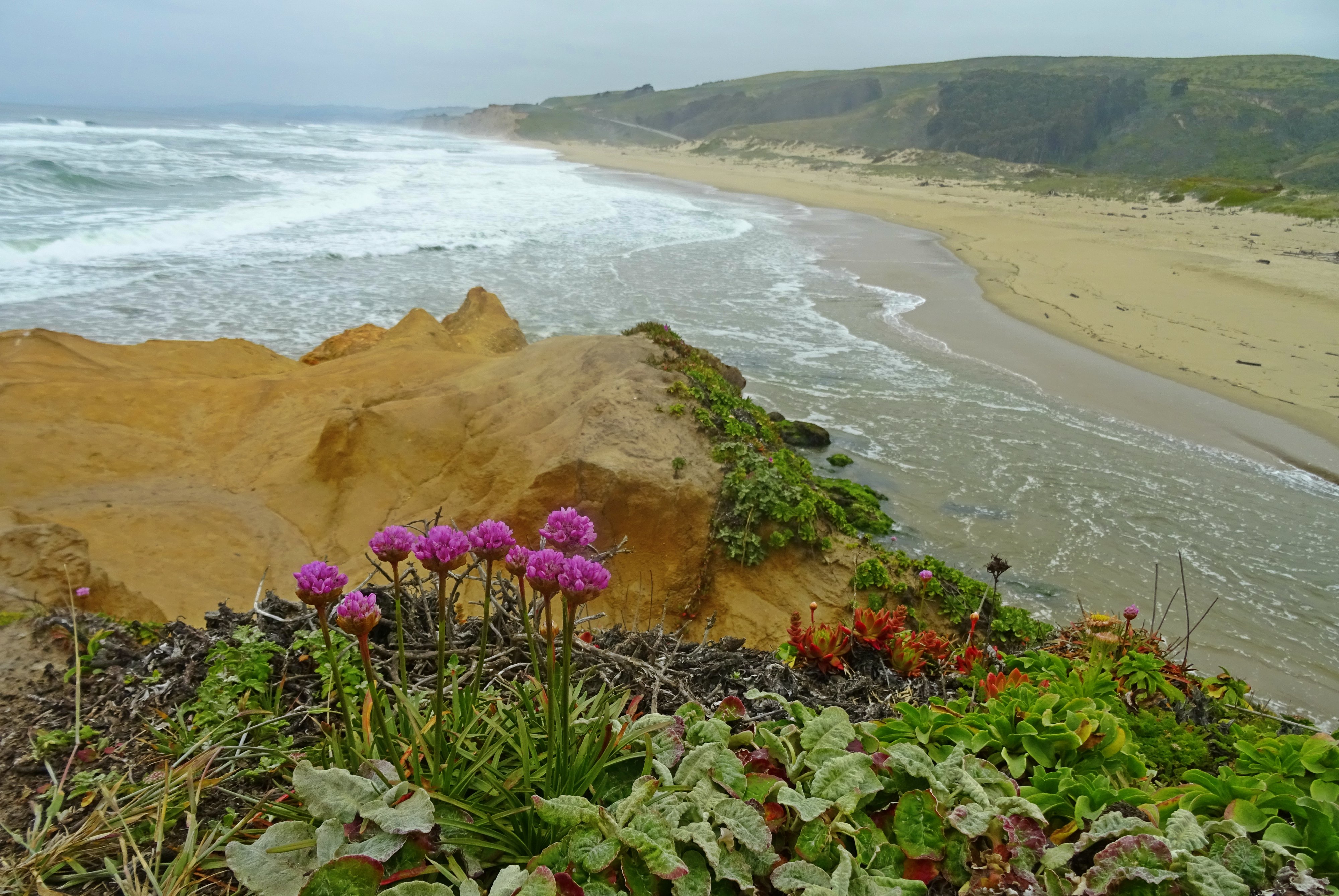
''Armeria maritima'', the thrift, sea thrift or sea pink, is a species of flowering plant in the family Plumbaginaceae. It is a compact evergreen perennial which grows in low clumps and sends up long stems that support globes of bright pink flowers. In some cases purple, white or red flowers also occur. It is a popular garden flower and has been distributed worldwide as a garden and cut flower. It does well in gardens designed as xeriscapes or rock gardens. The Latin specific epithet ''maritima'' means pertaining to the sea or coastal. Subspecies 12 subspecies are accepted. * ''Armeria maritima'' subsp. ''azorica'' – Azores *''Armeria maritima'' subsp. ''barcensis'' – central Romania (near Brasov) *''Armeria maritima'' subsp. ''bottendorfensis'' – central Germany (Bottendorfer Hügel) * ''Armeria maritima'' subsp. ''californica'' – California Seapink – west coast of North America from Vancouver Island to California *''Armeria maritima'' subsp. ''elongata'' – Ta ... [...More Info...] [...Related Items...] OR: [Wikipedia] [Google] [Baidu] |
Stack (geology)
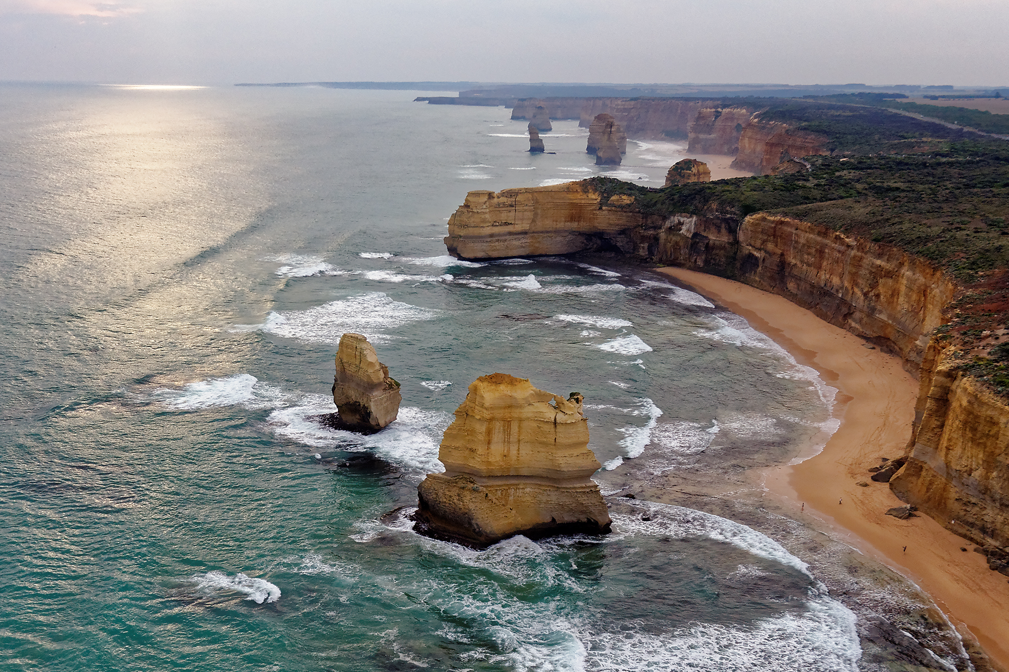
A stack or sea stack is a geological landform consisting of a steep and often vertical column or columns of rock in the sea near a coast, formed by wave erosion. Stacks are formed over time by wind and water, processes of coastal geomorphology. britannica.com They are formed when part of a is eroded by hydraulic action, which is the force of the sea or water crashing against the rock. The force of the water weakens cracks in the headland, causing them to later collapse, forming free-standing stacks and ... [...More Info...] [...Related Items...] OR: [Wikipedia] [Google] [Baidu] |


