|
Jefferson County, Montana
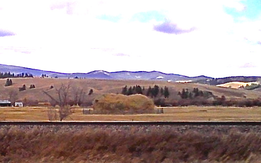
Jefferson County is a county in Montana, United States. As of the 2020 census, the population was 12,085. Its county seat is Boulder. The county was created in 1865 and named for President Thomas Jefferson. Jefferson County is part of the Helena, MT Micropolitan Statistical Area. Geography According to the United States Census Bureau, the county has a total area of , of which is land and (0.2%) is water. Major highways * Interstate 15 * Interstate 90 * U.S. Highway 12 * U.S. Highway 287 * Montana Highway 2 * Montana Highway 41 * Montana Highway 55 * Montana Highway 69 Adjacent counties * Lewis and Clark County - north * Broadwater County - east * Gallatin County - southeast * Madison County - south * Silver Bow County - west * Deer Lodge County - west * Powell County - northwest National protected areas * Deerlodge National Forest (part) * Helena National Forest (part) Politics Demographics 2000 census As of the 2 ... [...More Info...] [...Related Items...] OR: [Wikipedia] [Google] [Baidu] |
Jefferson County Courthouse (Boulder, Montana)
Jefferson County Courthouse is a site on the National Register of Historic Places located in Boulder, Montana. It was added to the Register on August 6, 1980. The building was authorized with a $40,000 bond issue in 1888 and was completed in 1889. The architect selected to design the building was John Paulsen, a German immigrant. The contractor was J.S. McKenzie. The design was a two-story Richardsonian Romanesque style built with local granite and locally manufactured brick, with a square tower with an octagonal spire and two turrets. Design elements drawn from the Middle Ages In the history of Europe, the Middle Ages or medieval period lasted approximately from the late 5th to the late 15th centuries, similar to the post-classical period of global history. It began with the fall of the Western Roman Empire a ... included gargoyles on each corner of the building, just under the eaves. The interior of the building has extensive carved woodwork. Today is one of t ... [...More Info...] [...Related Items...] OR: [Wikipedia] [Google] [Baidu] |
Montana Highway 2
Montana Highway 2 (MT 2) is a state highway in the southern part of the U.S. state of Montana. It extends from Interstate 15 (I-15) and I-90 in Butte to I-90 in Three Forks. Previously, this roadway was a part of U.S. Route 10 (US 10). Route description MT 2 begins in Butte at an interchange with I-15 and I-90, which travel concurrently through the city. The highway heads south and then southeast through rural Silver Bow and Jefferson Counties. It travels through Whitehall Whitehall is a road and area in the City of Westminster, Central London. The road forms the first part of the A3212 road from Trafalgar Square to Chelsea. It is the main thoroughfare running south from Trafalgar Square towards Parliament Sq ... and Cardwell. As it nears Three Forks, MT 2 meets US 287 and the two highways travel concurrently for approximately . Just west of Three Forks, MT 2 splits away from US 287 and then enters the city. ... [...More Info...] [...Related Items...] OR: [Wikipedia] [Google] [Baidu] |
Powell County, Montana
Powell County is a county in the U.S. state of Montana. As of the 2020 census, the population was 6,946. Its county seat is Deer Lodge. Geography According to the United States Census Bureau, the county has a total area of , of which is land and (0.3%) is water. Major highways * Interstate 90 * U.S. Route 10 (Former) * U.S. Route 12 * Montana Highway 141 * Montana Highway 200 Adjacent counties * Flathead County - north * Lewis and Clark County - east * Jefferson County - southeast * Deer Lodge County - south * Granite County - southwest * Missoula County - west National protected areas * Beaverhead-Deerlodge National Forest (part) * Flathead National Forest (part) * Grant-Kohrs Ranch National Historic Site * Helena National Forest (part) * Lolo National Forest (part) * Bob Marshall Wilderness Area (part) * Scapegoat Wilderness Area (part) Demographics 2000 census As of the 2000 United States census, there were 7,180 people, 2,422 households, and 1, ... [...More Info...] [...Related Items...] OR: [Wikipedia] [Google] [Baidu] |
Deer Lodge County, Montana
Deer Lodge County is a County (United States), county in the U.S. state of Montana. As of the 2020 United States census, 2020 census, the population was 9,421. It forms a consolidated city-county government with its county seat of Anaconda, Montana, Anaconda. The county was established in 1865. History Deer Lodge was one of the original 9 Montana counties, as constituted with the establishment of Montana Territory in 1864. The original county included what are now Silver Bow County (separated in 1881), Deer Lodge County, Granite County (separated in 1893) and Powell County (separated in 1901). Geography According to the United States Census Bureau, the county has an area of , of which is land and (0.6%) is water. It is the second-smallest county in Montana by area. The county has a wealth of natural amenities, such as the Anaconda Mountain Range, Georgetown Lake, and the Mount Haggin wildlife management area (Montana's largest at 54,000 acres). Major highways * Interstat ... [...More Info...] [...Related Items...] OR: [Wikipedia] [Google] [Baidu] |
Silver Bow County, Montana
Silver Bow County is a county in the U.S. state Montana. As of the 2020 census, the population was 35,133. Its county seat is Butte. In 1977, the city and county governments consolidated to form the single entity of Butte-Silver Bow. Additionally, the town of Walkerville is a separate municipality from Butte and is within the county. Silver Bow County comprises the Butte-Silver Bow, MT Micropolitan Statistical Area. Geography According to the United States Census Bureau, the county has an area of , of which is land and (0.08%) is water. It is Montana's smallest county by area. Major highways * Interstate 15 * Interstate 90 * Interstate 115 * U.S. Highway 10 (Former) * U.S. Highway 91 * Montana Highway 2 * Montana Highway 41 * Montana Highway 43 * Montana Highway 55 Adjacent counties * Deer Lodge County - northwest * Jefferson County - east * Madison County - south * Beaverhead County - southwest National protected areas * Beaverhead National Forest (part) ... [...More Info...] [...Related Items...] OR: [Wikipedia] [Google] [Baidu] |
Madison County, Montana
Madison County is a County (United States), county in the U.S. state of Montana. As of the 2020 United States census, 2020 census, the population was 8,623. Its county seat is Virginia City, Montana, Virginia City. The county was founded in 1865; at the time it was part of the Montana Territory. Geography According to the United States Census Bureau, the county has an area of , of which is land and (0.4%) is water. Major highways * Interstate 15 in Montana, Interstate 15 * Former U.S. Highway 91 * U.S. Route 287#Montana, U.S. Highway 287 * Montana Highway 41 * Montana Highway 84 * Montana Highway 87 * Montana Highway 55 * Montana Highway 287 Adjacent counties * Beaverhead County, Montana, Beaverhead County - southwest * Silver Bow County, Montana, Silver Bow County - northwest * Jefferson County, Montana, Jefferson County - north * Gallatin County, Montana, Gallatin County - east * Fremont County, Idaho - south National protected areas * Beaverhead National Fores ... [...More Info...] [...Related Items...] OR: [Wikipedia] [Google] [Baidu] |
Gallatin County, Montana
Gallatin County is located in the U.S. state of Montana. With its county seat in Bozeman, it is the second-most populous county in Montana, with a population of 118,960 in the 2020 Census. The county's prominent geographical features are the Bridger mountains in the north, and the Gallatin mountains and Gallatin River in the south, named by Meriwether Lewis in 1805 for Albert Gallatin, the United States Treasury Secretary who formulated the Lewis and Clark Expedition. At the southern end of the county, West Yellowstone's entrance into Yellowstone National Park accounts for around half of all park visitors. Big Sky Resort, one of the largest ski resorts in the United States, lies in Gallatin and neighboring Madison counties, midway between Bozeman and West Yellowstone. History During the territorial era, a small patch of land known as "Lost Dakota" existed as a remote exclave of Dakota Territory until it was transferred to Gallatin County, Montana Territory, in 1873. Geogr ... [...More Info...] [...Related Items...] OR: [Wikipedia] [Google] [Baidu] |
Broadwater County, Montana
Broadwater County is a county in the U.S. state of Montana. As of the 2020 census, the population was 6,774. Its county seat is Townsend. The county was named for Charles Arthur Broadwater, a noted Montana railroad, real estate, and banking magnate. History The Lewis and Clark Expedition traveled through what is now Broadwater County as they traced the Missouri River. Gold was discovered in the Big Belt Mountains in 1864 which brought several mining towns. In 1881 the Northern Pacific Railway included a stop in what is now Townsend. Geography According to the United States Census Bureau, the county has a total area of , of which is land and (3.7%) is water. The boundaries of the county are roughly formed by the Big Belt Mountains to the east and north, the Elkhorn Mountains to the west, and the Horseshoe Hills to the south. Broadwater County is perhaps best known as the home of Canyon Ferry Lake, the third largest body of water in Montana. The lake provides essential i ... [...More Info...] [...Related Items...] OR: [Wikipedia] [Google] [Baidu] |
Lewis And Clark County, Montana
Lewis and Clark County is a county located in the U.S. state of Montana. As of the 2020 census, the population was 70,973. Its county seat is Helena, the state capital. The numerical designation for Lewis and Clark County (used in the issuance of the state's license plates) is 5. The county was established on June 2, 1865 as one of the nine original counties of the Territory of Montana named Edgerton County in honor of Sidney Edgerton, first Governor of the Territory of Montana, and was renamed Lewis and Clark County on March 1, 1868 in honor of explorers Meriwether Lewis and William Clark. Lewis and Clark County is part of the Helena, Montana Micropolitan Statistical Area. Geography According to the United States Census Bureau, the county has a total area of , of which is land and (1.1%) is water. Major highways * * * * * * * * Adjacent counties * Teton County - north * Cascade County - east * Meagher County - east * Broadwater County - southeast * Jeffer ... [...More Info...] [...Related Items...] OR: [Wikipedia] [Google] [Baidu] |
Montana Highway 69
Montana Highway 69 (MT 69) is a route running northerly from an intersection with MT 55 in the community of Whitehall. The highway extends approximately to an intersection with Interstate 15 (I-15) at the northern edge of the town of Boulder. Most of the route follows the Boulder River valley, a scenic and relatively unspoiled rural landscape. Route description MT 69 begins at MT 55 at Whitehall. Concurrent with MT 2, it runs parallel to I-90, before intersecting it, and proceeding northward. An intersection with Boulder Cutoff Road is not far off. It reaches an intersection with Wilson Park Road before continuing northward, and intersecting Dunn Canyon Road. Dunn lane intersects from the east, and shortly after, MT 69 intersects with Lower Valley Road. Thereafter, it intersects Quintana Lane before intersecting several minor roads. Through a scenic and rural area, MT 69 proceeds north as ''South Main Street'' as it enters Boulder. MT 69 en ... [...More Info...] [...Related Items...] OR: [Wikipedia] [Google] [Baidu] |
Montana Highway 55
Highway 55 (MT 55) in the U.S. State of Montana is a route running in a northerly direction from an intersection with MT 41 about north of the small town of Silver Star. The highway extends approximately to an interchange with Interstate 90 (I-90) at the north edge of the town of Whitehall. The route traverses largely agricultural land in the Jefferson River valley. Route description Highway 55 begins at MT 41, north of Silver Star. Concurrent with Montana Highway 287, it intersects Cut Across Road. An intersection with Waterloo Road is not far off as Highway 55 proceeds northward. From the west intersects Jack Rabbit Lane, before intersecting Fish Creek Road. It intersects Airport Lane before intersecting Cape Lane. After intersecting several small roads, Highway 55 ends at I-90 at Whitehall. History Before receiving its current designation, Highway 55 was designated as part of Montana Highway 287. A small segment of Highway 55 in Whitehall was a former alignment of U.S. R ... [...More Info...] [...Related Items...] OR: [Wikipedia] [Google] [Baidu] |


