|
Hypsugo Alaschanicus
The Alashanian pipistrelle (''Hypsugo alaschanicus'') is a species of bat in the family Vespertilionidae. It is found in China, South Korea, Mongolia, Japan, and Russia. It is assessed as Least-concern species, least-concern by the International Union for Conservation of Nature, IUCN. Taxonomy This species was first described by Nikolay Alekseyevich Bobrinski in 1926. The genus ''Hypsugo'' was previously considered to be within ''Pipistrellus'', but is now considered distinct. This species was previously considered to be a subspecies of ''Savi's pipistrelle, H. savii'', but is now considered a full species. The taxonomic status of the Korean population of ''H. alaschanicus'' is unclear, with it sometimes being considered as a subspecies, and it being considered as a distinct species called ''H. coreensis'' by other authors. Biology The pipistrelle is likely an open forager. It is an insectivore. The bat echolocates at a frequency of around 35 kHz. Habitat and distributio ... [...More Info...] [...Related Items...] OR: [Wikipedia] [Google] [Baidu] |
Nikolay Alekseyevich Bobrinski
Professor Count Nikolay Alekseyevich Bobrinski (10 March 1890 – 27 December 1964) was a Russian zoologist and biogeographer. He was a student of Mikhail Menzbier, M.A. Menzbier and was especially interested in the zoogeography of mammals. He published several influential textbooks including one on zoogeography. Biography Bobrinski was born in Moscow into the aristocratic Russian family of Bobrinsky, Bobrinski, Bobrinsky or Bobrinskoy (Бобринские). His father was Count Alexei Alekseevich Bobrinsky (descended from an illegitimate son of Catherine the Great and Count Grigory Orlov) and his mother Varvara was daughter of Nikolai Alexandrovich Lvov. He was mostly taken care of by English governesses and he went to the Polivanov Gymnasium. He however graduated as an external student at the Tula gymnasium where he became interested in natural sciences. He was sent to Europe along with Aleksandr Kots, Alexander Kots. In 1908 he went to Moscow University and worked under M. A ... [...More Info...] [...Related Items...] OR: [Wikipedia] [Google] [Baidu] |
Henan
Henan; alternatively Honan is a province in Central China. Henan is home to many heritage sites, including Yinxu, the ruins of the final capital of the Shang dynasty () and the Shaolin Temple. Four of the historical capitals of China, Luoyang, Anyang, Kaifeng and Zhengzhou, are in Henan. While the province's name means 'south of the river', approximately a quarter of the province lies north of the Yellow River. With an area of , Henan covers a large part of the fertile and densely populated North China Plain. Its neighboring provinces are Shaanxi, Shanxi, Hebei, Shandong, Anhui, and Hubei. Henan is China's third-most populous province and the most populous among inland provinces, with a population of over 99 million as of 2020. It is also the world's seventh-most populous administrative division; if it were a country by itself, Henan would be the 17th-most populous in the world, behind Egypt and Vietnam. People from Henan often suffer from regional discrimination ... [...More Info...] [...Related Items...] OR: [Wikipedia] [Google] [Baidu] |
IUCN Red List
The International Union for Conservation of Nature (IUCN) Red List of Threatened Species, also known as the IUCN Red List or Red Data Book, founded in 1964, is an inventory of the global conservation status and extinction risk of biological species. A series of Regional Red Lists, which assess the risk of extinction to species within a political management unit, are also produced by countries and organizations. The goals of the Red List are to provide scientifically based information on the status of species and subspecies at a global level, to draw attention to the magnitude and importance of threatened biodiversity, to influence national and international policy and decision-making, and to provide information to guide actions to conserve biological diversity. Major species assessors include BirdLife International, the Institute of Zoology (the research division of the Zoological Society of London), the World Conservation Monitoring Centre, and many Specialist Groups w ... [...More Info...] [...Related Items...] OR: [Wikipedia] [Google] [Baidu] |
Primoriye
Primorsky Krai, informally known as Primorye, is a federal subject (a krai) of Russia, part of the Far Eastern Federal District in the Russian Far East. The city of Vladivostok on the southern coast of the krai is its administrative center, and the second largest city in the Russian Far East, behind Khabarovsk in the neighbouring Khabarovsk Krai. Primorsky Krai has the largest economy among the federal subjects in the Russian Far East, and a population of 1,845,165 as of the 2021 Census. The krai has Russia's only border with North Korea, along the Tumen River in Khasansky District in the southwestern corner of the krai. Peter the Great Gulf, the largest gulf in the Sea of Japan, is on the south coast. The territory of the krai was historically part of Manchuria. It was ceded to the Russian Empire by Qing China in 1860 as part of a region known as Outer Manchuria, forming most of the territory of Primorskaya Oblast. As a result, China permanently lost its coastline w ... [...More Info...] [...Related Items...] OR: [Wikipedia] [Google] [Baidu] |
Korean Peninsula
Korea is a peninsular region in East Asia consisting of the Korean Peninsula, Jeju Island, and smaller islands. Since the end of World War II in 1945, it has been politically divided at or near the 38th parallel between North Korea (Democratic People's Republic of Korea; DPRK) and South Korea (Republic of Korea; ROK). Both countries proclaimed independence in 1948, and the two countries fought the Korean War from 1950 to 1953. The region is bordered by China to the north and Russia to the northeast, across the Amnok (Yalu) and Duman (Tumen) rivers, and is separated from Japan to the southeast by the Korea Strait. Known human habitation of the Korean peninsula dates to 40,000 BC. The kingdom of Gojoseon, which according to tradition was founded in 2333 BC, fell to the Han dynasty in 108 BC. It was followed by the Three Kingdoms period, in which Korea was divided into Goguryeo, Baekje, and Silla. In 668 AD, Silla conquered Baekje and Goguryeo with the aid of the Tang dy ... [...More Info...] [...Related Items...] OR: [Wikipedia] [Google] [Baidu] |
Aomori Prefecture
is a Prefectures of Japan, prefecture of Japan in the Tōhoku region. The prefecture's capital, largest city, and namesake is the city of Aomori (city), Aomori. Aomori is the northernmost prefecture on Japan's main island, Honshu, and is bordered by the Pacific Ocean to the east, Iwate Prefecture to the southeast, Akita Prefecture to the southwest, the Sea of Japan to the west, and Hokkaido across the Tsugaru Strait to the north. Aomori Prefecture is the List of Japanese prefectures by area, 8th-largest prefecture, with an area of , and the List of Japanese prefectures by population, 31st-most populous prefecture, with more than 1.18 million people. Approximately 45 percent of Aomori Prefecture's residents live in its two Core cities of Japan, core cities, Aomori and Hachinohe, which lie on coastal plains. The majority of the prefecture is covered in forested mountain ranges, with population centers occupying valleys and plains. Aomori is the third-most populous prefecture i ... [...More Info...] [...Related Items...] OR: [Wikipedia] [Google] [Baidu] |
Hokkaido
is the list of islands of Japan by area, second-largest island of Japan and comprises the largest and northernmost prefectures of Japan, prefecture, making up its own list of regions of Japan, region. The Tsugaru Strait separates Hokkaidō from Honshu; the two islands are connected by railway via the Seikan Tunnel. The largest city on Hokkaido is its capital, Sapporo, which is also its only cities designated by government ordinance of Japan, ordinance-designated city. Sakhalin lies about to the north of Hokkaidō, and to the east and northeast are the Kuril Islands, which are administered by Russia, though the four most southerly are Kuril Islands dispute, claimed by Japan. The position of the island on the northern end of the archipelago results in a colder climate, with the island seeing significant snowfall each winter. Despite the harsher climate, it serves as an agricultural breadbasket for many crops. Hokkaido was formerly known as ''Ezo'', ''Yezo'', ''Yeso'', or ''Yes ... [...More Info...] [...Related Items...] OR: [Wikipedia] [Google] [Baidu] |
Hebei
Hebei is a Provinces of China, province in North China. It is China's List of Chinese administrative divisions by population, sixth-most populous province, with a population of over 75 million people. Shijiazhuang is the capital city. It borders Shanxi to the west, Henan to the south, Shandong and Liaoning to the east, and Inner Mongolia to the north; in addition, Hebei entirely surrounds the direct-administered municipalities of Beijing and Tianjin on land. Its population is 96% Han Chinese, 3% Manchu people, Manchu, 0.8% Hui people, Hui, and 0.3% Mongols in China, Mongol. Varieties of Chinese spoken include Jilu Mandarin, the Beijing dialect of Mandarin, and Jin Chinese. During the Spring and Autumn period, Spring and Autumn and Warring States periods (771–226 BC), the region was ruled by the states of Yan (state), Yan and Zhao (state), Zhao. During the Yuan dynasty (1271–1368), the region was called Zhongshu Sheng, Zhongshu. It was called North Zhili during the ... [...More Info...] [...Related Items...] OR: [Wikipedia] [Google] [Baidu] |
Beijing
Beijing, Chinese postal romanization, previously romanized as Peking, is the capital city of China. With more than 22 million residents, it is the world's List of national capitals by population, most populous national capital city as well as China's List of cities in China by population, second largest city by urban area after Shanghai. It is located in North China, Northern China, and is governed as a Direct-administered municipalities of China, municipality under the direct administration of the Government of the People's Republic of China, State Council with List of administrative divisions of Beijing, 16 urban, suburban, and rural districts.Figures based on 2006 statistics published in 2007 National Statistical Yearbook of China and available online at archive. Retrieved 21 April 2009. Beijing is mostly surrounded by Hebei Province and neighbors Tianjin to the southeast; together, the three divisions form the Jing-Jin-Ji, Jing-Jin-Ji cluster. Beijing is a global city and ... [...More Info...] [...Related Items...] OR: [Wikipedia] [Google] [Baidu] |
Heilongjiang
Heilongjiang is a province in northeast China. It is the northernmost and easternmost province of the country and contains China's northernmost point (in Mohe City along the Amur) and easternmost point (at the confluence of the Amur and Ussuri rivers). The province is bordered by Jilin to the south and Inner Mongolia to the west. It also shares a border with Russia ( Amur Oblast, Jewish Autonomous Oblast, Khabarovsk Krai, Primorsky Krai and Zabaykalsky Krai) to the north and east. The capital and the largest city of the province is Harbin. Among Chinese provincial-level administrative divisions, Heilongjiang is the sixth-largest by total area, the 20th-most populous, and the second-poorest by GDP per capita after only Gansu province. The province takes its name from the Amur river which marks the border between the People's Republic of China and Russia. Heilongjiang has significant agricultural production, and raw materials, such as timber, oil, and coal. Etymology ... [...More Info...] [...Related Items...] OR: [Wikipedia] [Google] [Baidu] |
Jilin
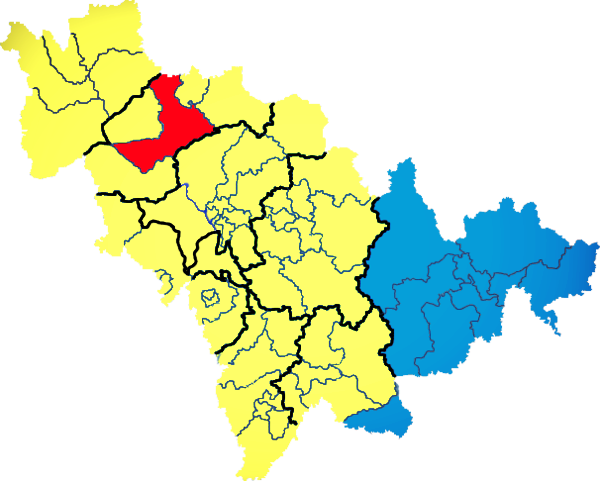
) , image_skyline = Changbaishan Tianchi from western rim.jpg , image_alt = , image_caption = View of Heaven Lake , image_map = Jilin in China (+all claims hatched).svg , mapsize = 275px , map_alt = Map showing the location of Jilin Province , map_caption = Map showing the location of Jilin Province , coordinates = , subdivision_type = Country , subdivision_name = China , named_for = from ''girin ula'', a Manchu language, Manchu phrase meaning "along the river" , seat_type = Capital , seat = , seat1_type = , seat1 = , parts_type = Divisions , parts_style = para , p1 = 9 Prefectures of China, prefectures , p2 = 60 Counties of China, counties , p3 = 1006 Townships of China, townships , government_type = Provinces of China, Province , governing_body = Jilin Provinci ... [...More Info...] [...Related Items...] OR: [Wikipedia] [Google] [Baidu] |


