|
Gumbinnen (region)
Regierungsbezirk Gumbinnen () was a ''Regierungsbezirk'', or government region, of the Prussian province of East Prussia from 1808 until 1945. The regional capital was Gumbinnen (Gusev). History In 1808 during the Napoleonic Wars, East Prussia was divided into the ''Regierungsbezirke'' of Gumbinnen, comprising the eastern parts of the former Duchy of Prussia, and Königsberg. On November 1, 1905, the southern districts of the two regions were separated to create Regierungsbezirk Allenstein. The districts of Johannisburg, Lötzen, Lyck and Sensburg were transferred from Regierungsbezirk Gumbinnen to Regierungsbezirk Allenstein. Regierungsbezirk Gumbinnen was dissolved in 1945 when East Prussia was partitioned between Poland and the Soviet Union after World War II according to the resolutions at the Potsdam Conference. Districts in 1937 As of December 31, 1937 Urban districts #Insterburg #Tilsit Rural districts # Angerburg (Węgorzewo today, Węgobork between 1945–1946) #Darkeh ... [...More Info...] [...Related Items...] OR: [Wikipedia] [Google] [Baidu] |
Regierungsbezirk
A ' () means "governmental district" and is a type of administrative division in Germany. Four of sixteen ' ( states of Germany) are split into '. Beneath these are rural and urban districts. Saxony has ' (directorate districts) with more responsibilities shifted from the state parliament. The cities of Bremen, Hamburg and Berlin – the city states – have a different system. ' serve as regional mid-level local government units in four of Germany's sixteen federal states: Baden-Württemberg, Bavaria, Hesse and North Rhine-Westphalia. Each of the nineteen ' features a non-legislative governing body called a ' (governing presidium) or ' (district government) headed by a '' Regierungspräsident'' (governing president), concerned mostly with administrative decisions on a local level for districts within its jurisdiction. Translations ' is a German term variously translated into English as "governmental district", "administrative district" or "province",Shapiro, Henry ... [...More Info...] [...Related Items...] OR: [Wikipedia] [Google] [Baidu] |
Kreis Angerburg
The Angerburg district was a Prussian district in East Prussia that was founded in 1818 and existed until 1945. It was located in the Masurian Lake District in Masuria. The town of Węgorzewo, Angerburg was the capital of the district. History Since the East Prussian district reform of 1752, most of the area of the Angerburg district belonged to what was then the Seehesten district. As part of the Prussian Reform Movement, Prussian administrative reforms, the “Ordinance for Improved Establishment of the Provincial Authorities” of April 30, 1815 resulted in a comprehensive district reform in all of East Prussia, as the districts established in 1752 were too large. On September 1, 1818, the new ''Angerburg district'' was formed from the northern part of the Seehesten district in Gumbinnen (region), Regierungsbezirk Gumbinnen. Since 1871, the province of Prussia (and thus also the district of Angerburg) belonged to the German Empire. After the province of Prussia was divided ... [...More Info...] [...Related Items...] OR: [Wikipedia] [Google] [Baidu] |
Nesterov
Nesterov (russian: Не́стеров), until 1938 known by its German name ( lt, Stalupėnai; pl, Stołupiany) and in 1938-1946 as Ebenrode, is a town and the administrative center of Nesterovsky District in Kaliningrad Oblast, Russia, located east of Kaliningrad, near the Russian-Lithuanian border on the railway connecting Kaliningrad Oblast with Moscow. Population figures: History In the Middle Ages, the area in Old Prussia had been settled by the Nadruvian tribe of the Baltic Prussians. It was conquered by the Teutonic Knights in about 1276 and incorporated into the State of the Teutonic Order. From the 15th century onwards, the Knights largely resettled the lands with Samogitian and Lithuanian colonists. Since 1466, it was part of the Kingdom of Poland as a fief held by the Teutonic Order. The settlement itself was first mentioned as ''Stallupoenen'', or ''Stallupönen'', in 1539, named after a nearby river called ''Stalupė'' in Lithuanian. At that time, with the s ... [...More Info...] [...Related Items...] OR: [Wikipedia] [Google] [Baidu] |
Stallupönen (district)
Nesterov (russian: Не́стеров), until 1938 known by its German name ( lt, Stalupėnai; pl, Stołupiany) and in 1938-1946 as Ebenrode, is a town and the administrative center of Nesterovsky District in Kaliningrad Oblast, Russia, located east of Kaliningrad, near the Russian-Lithuanian border on the railway connecting Kaliningrad Oblast with Moscow. Population figures: History In the Middle Ages, the area in Old Prussia had been settled by the Nadruvian tribe of the Baltic Prussians. It was conquered by the Teutonic Knights in about 1276 and incorporated into the State of the Teutonic Order. From the 15th century onwards, the Knights largely resettled the lands with Samogitian and Lithuanian colonists. Since 1466, it was part of the Kingdom of Poland as a fief held by the Teutonic Order. The settlement itself was first mentioned as ''Stallupoenen'', or ''Stallupönen'', in 1539, named after a nearby river called ''Stalupė'' in Lithuanian. At that time, with the s ... [...More Info...] [...Related Items...] OR: [Wikipedia] [Google] [Baidu] |
Dobrovolsk
Dobrovolsk (russian: Добровольск, lit. "Voluntary Town"; german: Pillkallen (1510-1938) or ' (1938-1947); lt, Pilkalnis; pl, Pilkały) is a village in Krasnoznamensky District of Kaliningrad Oblast, Russia. It has a population of 1,693 ( 2010). It is located in the historical region of Lithuania Minor. It lies approximately north of Nesterov and north-east of Gusev. History Russian sources give the date of the earliest record of the village as 1510, while the earliest surviving German language record dates from 1516 under the name ''Schlosbergk'', and slightly later the name ''Mühlenberg'' is also used. Nevertheless, it is believed that there was already a trading settlement in existence before this. The name Pillkallen first appears in the records in 1545 in connection with an inheritance dispute, and is thought to have originated with Lithuanian inhabitants derived from the Lithuanian language term ''pilkalnis'', meaning ''mound'' or '' castle mound''. In 1549 ... [...More Info...] [...Related Items...] OR: [Wikipedia] [Google] [Baidu] |
Pillkallen (district)
Dobrovolsk (russian: Добровольск, lit. "Voluntary Town"; german: Pillkallen (1510-1938) or ' (1938-1947); lt, Pilkalnis; pl, Pilkały) is a village in Krasnoznamensky District of Kaliningrad Oblast, Russia. It has a population of 1,693 (2010). It is located in the historical region of Lithuania Minor. It lies approximately north of Nesterov and north-east of Gusev. History Russian sources give the date of the earliest record of the village as 1510, while the earliest surviving German language record dates from 1516 under the name ''Schlosbergk'', and slightly later the name ''Mühlenberg'' is also used. Nevertheless, it is believed that there was already a trading settlement in existence before this. The name Pillkallen first appears in the records in 1545 in connection with an inheritance dispute, and is thought to have originated with Lithuanian inhabitants derived from the Lithuanian language term ''pilkalnis'', meaning ''mound'' or ''castle mound''. In 1549 a ... [...More Info...] [...Related Items...] OR: [Wikipedia] [Google] [Baidu] |
Slavsk
Slavsk (russian: link=no, Славск; german: Heinrichswalde; lt, Gastos; pl, Jędrzychowo) is a town and the administrative center of Slavsky District in the Kaliningrad Oblast, Russia, located northeast of Kaliningrad. Population figures: History The town was established in 1292. In 1454, King Casimir IV Jagiellon incorporated it to the Kingdom of Poland upon the request of the anti-Teutonic Prussian Confederation. After the subsequent Thirteen Years' War (1454–1466), it became a part of Poland as a fief held by the Teutonic Knights, and by Ducal Prussia afterwards. From 1701, it formed part of the Kingdom of Prussia, and in 1819 it became seat of the Prussian Elchniederung district. In 1871 it became part of Germany. In the late 19th century, it had a population of over 1,800, partially Lithuanian. According to German data 16,000 Lithuanians lived in the district in 1890 (29% of the population). Two annual fairs were held in the town in the late 19th century. Admin ... [...More Info...] [...Related Items...] OR: [Wikipedia] [Google] [Baidu] |
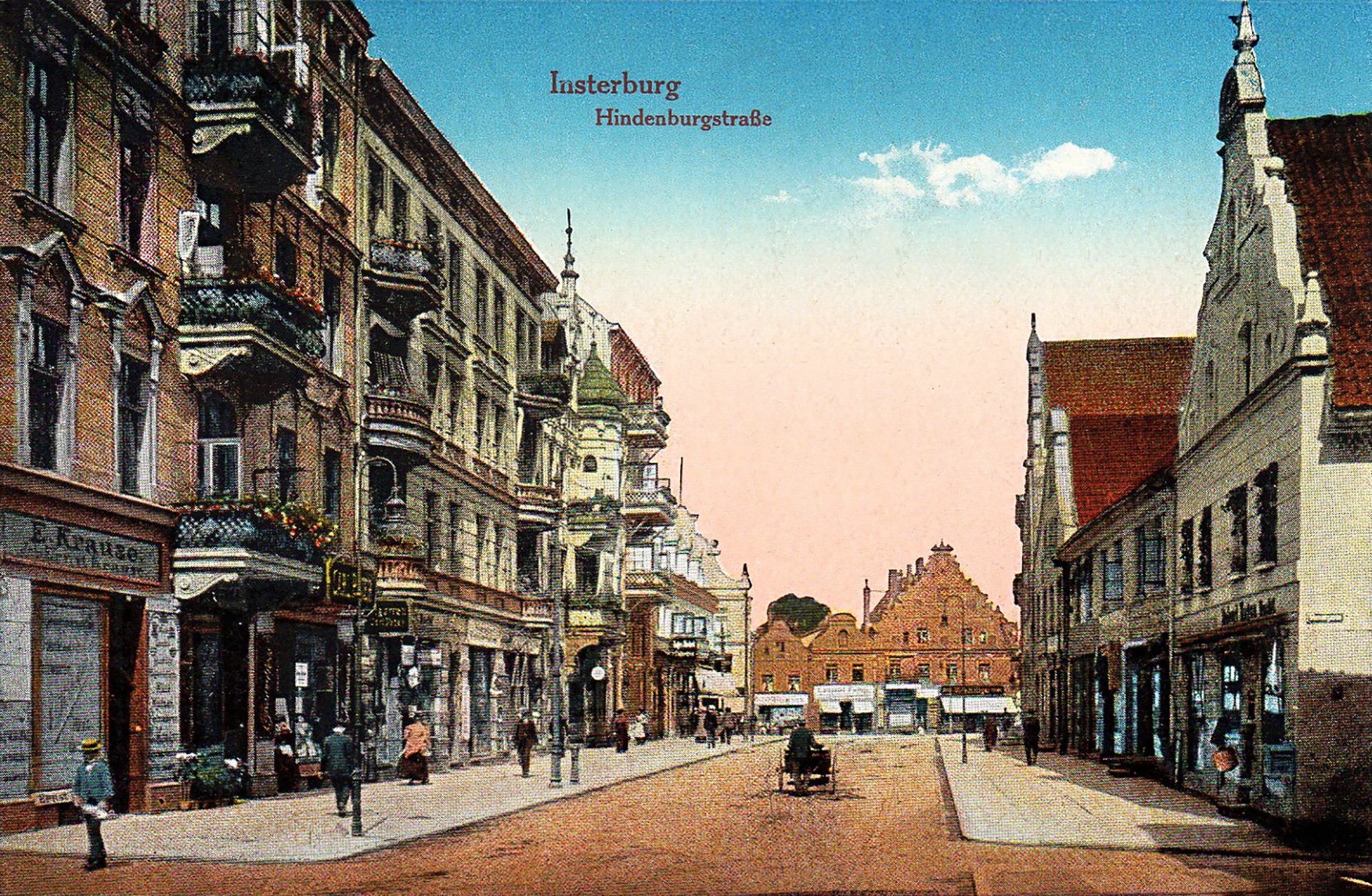
Insterburg (district)
Chernyakhovsk (russian: Черняхо́вск) – known prior to 1946 by its German name of (Old Prussian: Instrāpils, lt, Įsrutis; pl, Wystruć) – is a town in the Kaliningrad Oblast of Russia, where it is the administrative center of Chernyakhovsky District. Located at the confluence of the Instruch and Angrapa rivers, which unite to become the Pregolya river below Chernyakhovsk, the town had a population in 2017 of 36,423. History Chernyakhovsk was founded in 1336 by the Teutonic Knights on the site of a former Old Prussian fortification when Dietrich von Altenburg, the Grand Master of the Teutonic Knights, built a castle called ''Insterburg'' following the Prussian Crusade. During the Teutonic Knights' Northern Crusades campaign against the Grand Duchy of Lithuania, the town was devastated in 1376. The castle had been rebuilt as the seat of a Procurator and a settlement also named ''Insterburg'' grew up to serve it. In 1454, Polish King Casimir IV Jagiellon incorpor ... [...More Info...] [...Related Items...] OR: [Wikipedia] [Google] [Baidu] |
Gusevsky District
Gusevsky District (russian: Гу́севский райо́н) is an administrative district (raion), one of the administrative divisions of Kaliningrad Oblast, fifteen in Kaliningrad Oblast, Russia.Law #463 As a subdivisions of Russia#Municipal divisions, municipal division, it is incorporated as Gusevsky Urban Okrug.Law #230 It is located in the east of the oblast. The area of the district is . Its administrative center is the types of inhabited localities in Russia, town of Gusev, Kaliningrad Oblast, Gusev.Resolution #639 Population: 37,461 (Russian Census (2002), 2002 Census); In 1989, Gusev was administratively incorporated separately from the district, so the 1989 Census data do not include its population. The population of Gusev accounts for 76.1% of the district's total population. Geography The district is situated in the east of the oblast and is sparsely populated. The rivers in the district include the Pissa River, Pissa and the Angrapa River, Angrapa. The southern part ... [...More Info...] [...Related Items...] OR: [Wikipedia] [Google] [Baidu] |
Gołdap
Gołdap ( or variant ''Goldapp''; lt, Geldupė, Geldapė, Galdapė) is a town in northeastern Poland, in the region of Masuria, seat of Gołdap County in the Warmian-Masurian Voivodeship. It is located on the Gołdapa River, between the Szeskie Hills (''Szeski Garb'', ''Seesker Höhen'') and the Puszcza Romincka forest. It has a population of 15,600 (). History Beginnings Masurians began to settle the region in the 16th century while it was part of the Duchy of Prussia, a fief of the Kingdom of Poland. Systematic settlement began in 1565, while the town was officially founded by Caspar von Nostitz on May 15, 1570. Located at a profitable location on the crossing of several trade routes near the Prussian border with Lithuania, Gołdap grew rapidly. Its coat of arms depicts the House of Hohenzollern and Brandenburg, while the letter "S" stands for Sigismund II Augustus, King of Poland, who was the suzerain of the region. In 1656, during the Polish-Swedish War, Polish troops under ... [...More Info...] [...Related Items...] OR: [Wikipedia] [Google] [Baidu] |
Kreis Goldap
The Goldap district was a Prussian district in East Prussia that existed from 1818 to 1945. Its territory is now divided between the Polish Warmian-Masurian Voivodeship and the Russian Kaliningrad Oblast. History Kingdom of Prussia On 1 September 1818 the new ''Goldap district was'' formed in Regierungsbezirk Gumbinnen from parts of the old ''Insterburg'' ''district''. This included the parishes of Dubeningken, Gawaiten, Goldap, Grabowen, Gurnen, Mehlkehmen, Szirgupönen (from 1824) and Szittkehmen. The district office was in Goldap. On 1 February 1843 a major exchange of territory took place between the district of Goldap and the district of Stallupönen. The parish of Mehlkehmen was transferred from the district of Goldap to the district of Stallupönen, and in return, the parish of Tollmingkehmen was transferred from the district of Stallupönen to the district of Goldap. Germany Since 1871, the district belonged to the German Empire. After the province of Prus ... [...More Info...] [...Related Items...] OR: [Wikipedia] [Google] [Baidu] |


