|
Geophysical MASINT
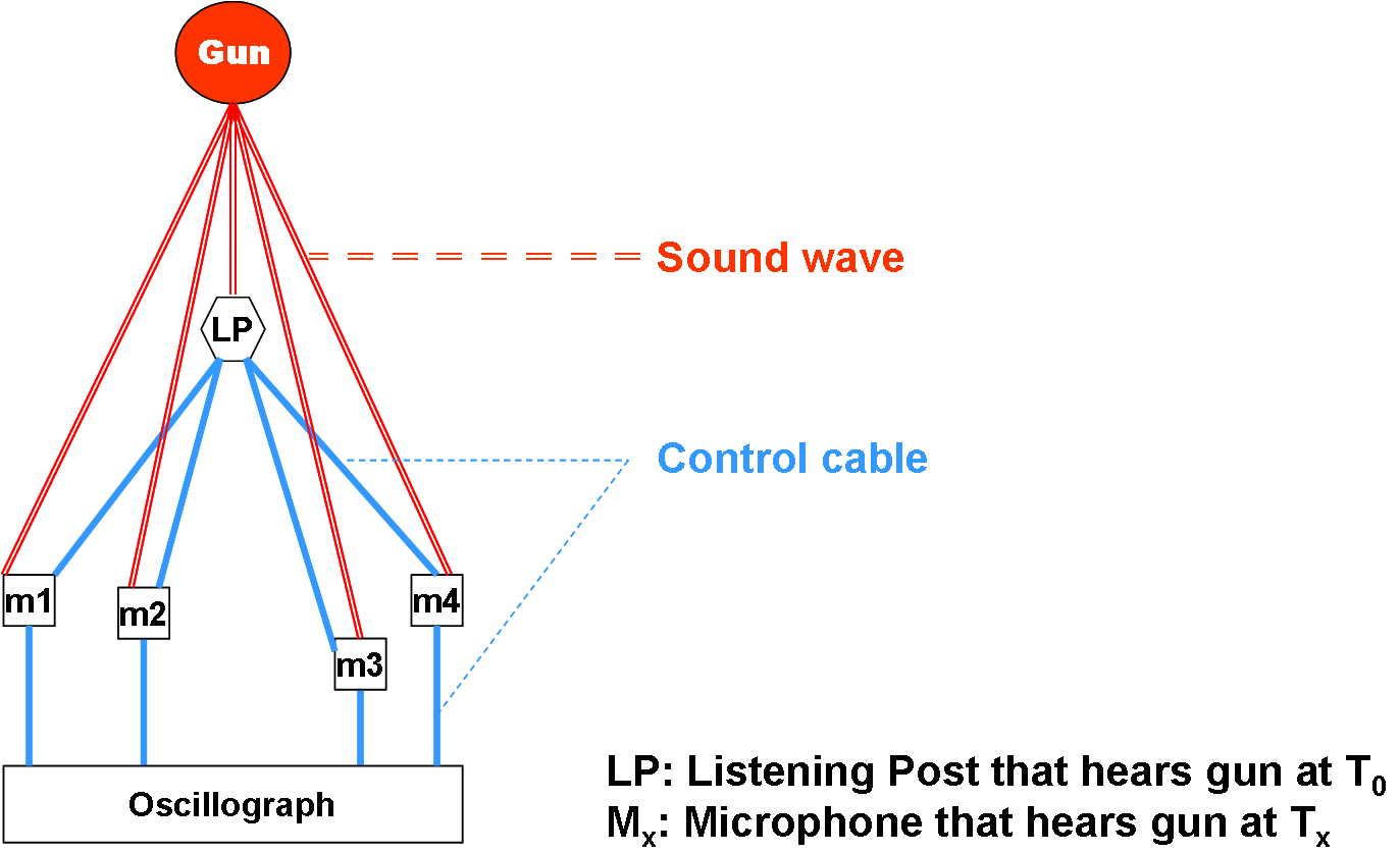
Geophysical MASINT is a branch of Measurement and Signature Intelligence (MASINT) that involves phenomena transmitted through the earth (ground, water, atmosphere) and manmade structures including emitted or reflected sounds, pressure waves, vibrations, and magnetic field or ionosphere disturbances. According to the United States Department of Defense, MASINT has technically derived intelligence (excluding traditional imagery IMINT and signals intelligence Signals intelligence, SIGINT) that – when collected, processed, and analyzed by dedicated MASINT systems – results in intelligence that detects, tracks, identifies or describes the signatures (distinctive characteristics) of fixed or dynamic target sources. MASINT was recognized as a formal intelligence discipline in 1986. Another way to describe MASINT is a "non-literal" discipline. It feeds on a target's unintended emissive by-products, the "trails" - the spectral, chemical or RF that an object leaves behind. These trails f ... [...More Info...] [...Related Items...] OR: [Wikipedia] [Google] [Baidu] [Amazon] |
Measurement And Signature Intelligence
Measurement and signature intelligence (MASINT) is a technical branch of intelligence gathering, which serves to detect, track, identify or describe the distinctive characteristics (signatures) of fixed or dynamic target sources. This often includes radar intelligence, acoustic intelligence, nuclear intelligence, and chemical and biological intelligence. MASINT is defined as scientific and technical intelligence derived from the analysis of data obtained from sensing instruments for the purpose of identifying any distinctive features associated with the source, emitter or sender, to facilitate the latter's measurement and identification. MASINT specialists themselves struggle with providing simple explanations of their field. One attempt calls it the "CSI" of the intelligence community, in imitation of the television series '' CSI: Crime Scene Investigation''. Another possible definition calls it "astronomy except for the direction of view." The allusion here is to observation ... [...More Info...] [...Related Items...] OR: [Wikipedia] [Google] [Baidu] [Amazon] |
Radar MASINT
Radar MASINT is a subdiscipline of measurement and signature intelligence (MASINT) and refers to intelligence gathering activities that bring together disparate elements that do not fit within the definitions of signals intelligence (SIGINT), imagery intelligence (IMINT), or human intelligence (HUMINT). According to the United States Department of Defense, MASINT is technically derived intelligence (excluding traditional imagery IMINT and signals intelligence) that – when collected, processed, and analyzed by dedicated MASINT systems – results in intelligence that detects, tracks, identifies, or describes the distinctive characteristics target sources. in the US MASINT was recognized as a formal intelligence discipline in 1986. As with many branches of MASINT, specific techniques may overlap with the six major conceptual disciplines of MASINT defined by the Center for MASINT Studies and Research, which divides MASINT into electro-optical, nuclear, geophysical, radar, materi ... [...More Info...] [...Related Items...] OR: [Wikipedia] [Google] [Baidu] [Amazon] |
Synthetic Aperture Sonar
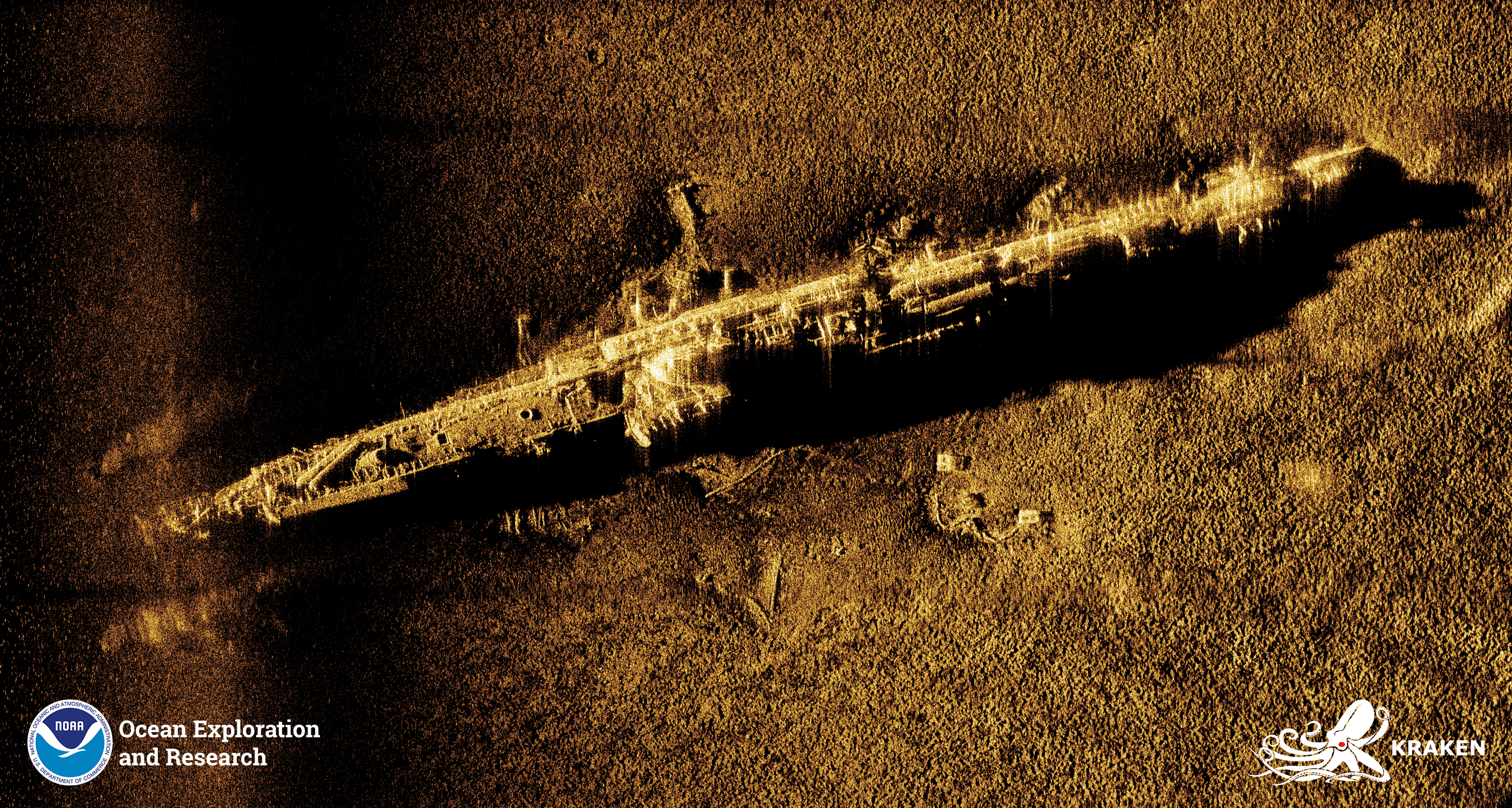
Synthetic-aperture sonar (SAS) is a form of sonar in which sophisticated post-processing of sonar data is used in ways closely analogous to synthetic-aperture radar. Synthetic-aperture sonars combine a number of acoustic pings to form an image with much higher along-track resolution than conventional sonars. The along-track resolution can approach half the length of one sonar element, though is downward limited by 1/4 wavelength. The principle of synthetic-aperture sonar is to move the sonar while illuminating the same spot on the sea floor with several pings. When moving along a straight line, those pings that have the image position within the beamwidth constitute the synthetic array. By coherent reorganization of the data from all the pings, a synthetic-aperture image is produced with improved along-track resolution. In contrast to conventional Sidescan sonar, side-scan sonar (SSS), SAS processing provides range-independent along-track resolution. At maximum range the resolutio ... [...More Info...] [...Related Items...] OR: [Wikipedia] [Google] [Baidu] [Amazon] |
Sonar
Sonar (sound navigation and ranging or sonic navigation and ranging) is a technique that uses sound propagation (usually underwater, as in submarine navigation) to navigate, measure distances ( ranging), communicate with or detect objects on or under the surface of the water, such as other vessels. "Sonar" can refer to one of two types of technology: ''passive'' sonar means listening for the sound made by vessels; ''active'' sonar means emitting pulses of sounds and listening for echoes. Sonar may be used as a means of acoustic location and of measurement of the echo characteristics of "targets" in the water. Acoustic location in air was used before the introduction of radar. Sonar may also be used for robot navigation, and sodar (an upward-looking in-air sonar) is used for atmospheric investigations. The term ''sonar'' is also used for the equipment used to generate and receive the sound. The acoustic frequencies used in sonar systems vary from very low ( infrasonic) to e ... [...More Info...] [...Related Items...] OR: [Wikipedia] [Google] [Baidu] [Amazon] |
Tactical Ground Ystems
Tactic(s) or Tactical may refer to: * Tactic (method), a conceptual action implemented as one or more specific tasks ** Military tactics, the disposition and maneuver of units on a particular sea or battlefield ** Chess tactics ** Political tactics * TACTIC (military program), a U.S. military research program conducted by DARPA Computer science * A ''tactic'' is a procedure for deriving terms in an interactive theorem prover Geography * Tactic, Guatemala, a municipality in the Alta Verapaz department Entertainment * Tactics, a dart game similar to cricket * "Tactics", a 1995 song by The Yellow Monkey * ''Tactics'' (album), a 1996 album by John Abercrombie * Tactics (band), an Australian band * ''Tactics'' (game), generally credited as the first board wargame * ''Tactics'' (manga), a Japanese manga series * ''Tactic'' (video game), a puzzle video game * Tactics (video games studio) is a Japanese software publishing company specializing in the publishing and distribut ... [...More Info...] [...Related Items...] OR: [Wikipedia] [Google] [Baidu] [Amazon] |
Operation Igloo White
Operation Igloo White was a covert United States joint military electronic warfare operation conducted from late January 1968 until February 1973, during the Vietnam War. These missions were carried out by the 553rd Reconnaissance Wing, a U.S. Air Force unit flying modified EC-121R Warning Star aircraft, and VO-67, a specialized U.S. Navy unit flying highly modified OP-2E Neptune aircraft. This state-of-the-art operation utilized electronic sensors, computers, and communications relay aircraft in an attempt to automate intelligence collection. The system would then assist in the direction of strike aircraft to their targets. The objective of those attacks was the logistical system of the People's Army of Vietnam (PAVN) that snaked through southeastern Laos and was known as the Ho Chi Minh Trail (the Truong Son Road to the North Vietnamese). Establishment of Igloo White The idea of a system to interdict North Vietnamese infiltration into South Vietnam had been proposed in ... [...More Info...] [...Related Items...] OR: [Wikipedia] [Google] [Baidu] [Amazon] |
SOSUS
Sound Surveillance System (SOSUS) was the original name for a submarine detection system based on passive sonar developed by the United States Navy to track Soviet Navy, Soviet submarines. The system's true nature was classified with the name and acronym SOSUS classified as well. The unclassified name ''Project Caesar'' was used to cover the installation of the system and a cover story developed regarding the shore stations, identified only as a Naval Facility (NAVFAC), being for oceanographic research. The name changed to Integrated Undersea Surveillance System (IUSS) in 1985, as the fixed bottom arrays were supplemented by the mobile Surveillance Towed Array Sensor System (SURTASS) and other new systems. The commands and personnel were covered by the "oceanographic" term until 1991 when the mission was declassified. As a result, the commands, Oceanographic System Atlantic and Oceanographic System Pacific became Undersea Surveillance Atlantic and Undersea Surveillance Pacific, a ... [...More Info...] [...Related Items...] OR: [Wikipedia] [Google] [Baidu] [Amazon] |
Lockheed P-3 Orion
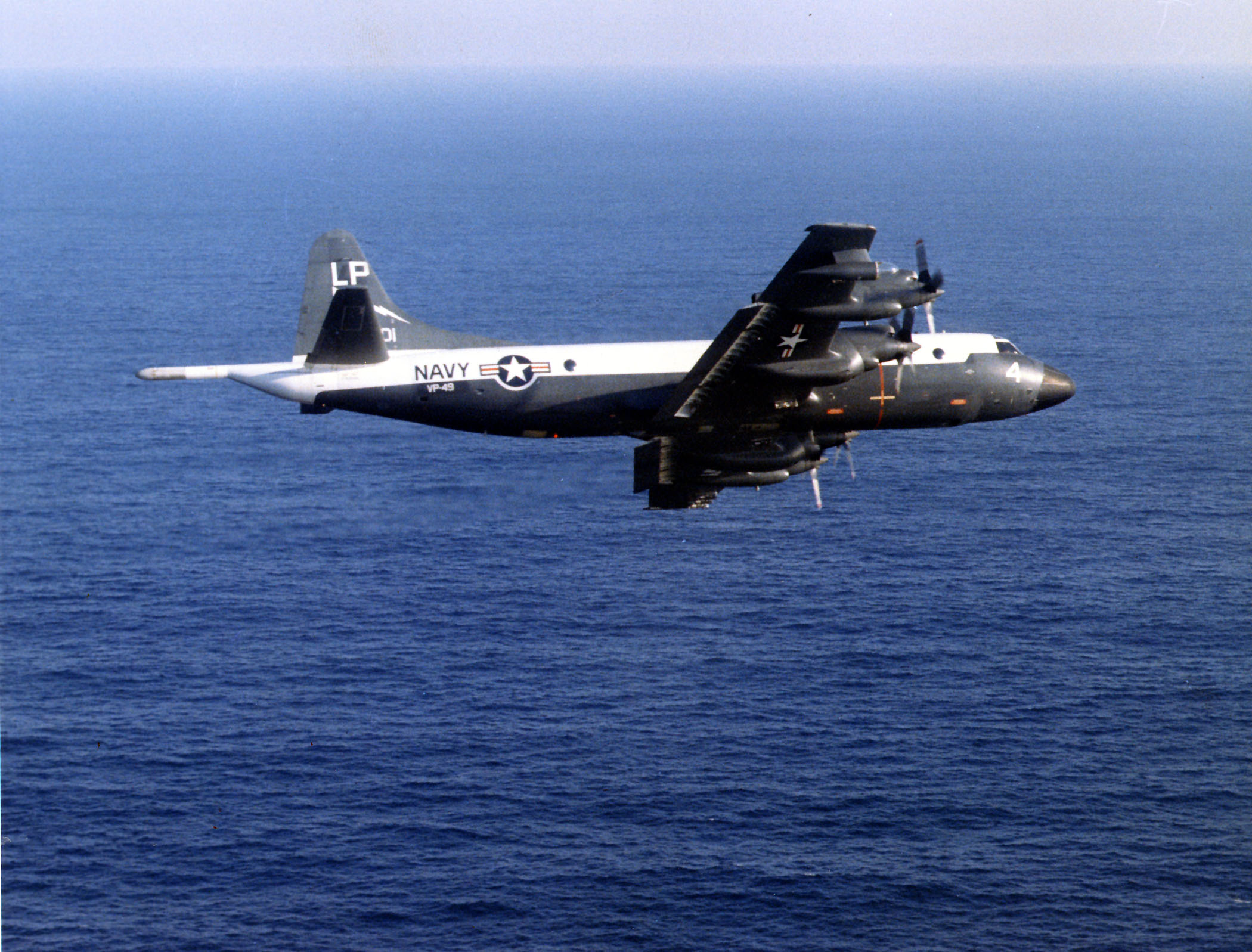
The Lockheed P-3 Orion is a four-engined, turboprop Anti-submarine warfare, anti-submarine and maritime patrol aircraft, maritime surveillance aircraft developed for the United States Navy and introduced in the 1960s. It is based on the Lockheed L-188 Electra, L-188 Electra commercial airliner by Lockheed Corporation, Lockheed; it is easily distinguished from the Electra by its distinctive tail stinger or "MAD" boom, used for the Magnetic anomaly detector, magnetic anomaly detection (MAD) of submarines. Over the years, the P-3 has seen numerous design developments, most notably in its electronics packages. Numerous navies and air forces around the world continue to use the type primarily for maritime patrol, reconnaissance, anti-surface warfare and anti-submarine warfare. A total of 757 P-3s have been built. In 2012, it joined the handful of military aircraft including the Boeing B-52 Stratofortress, Boeing KC-135 Stratotanker, and Lockheed C-130 Hercules that the United States m ... [...More Info...] [...Related Items...] OR: [Wikipedia] [Google] [Baidu] [Amazon] |
SURTASS
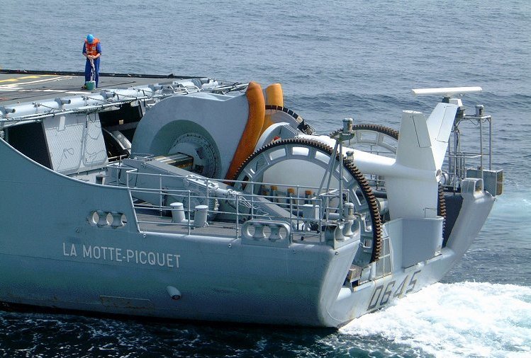
The AN/UQQ-2 Surveillance Towed Array Sensor System (SURTASS), colloquially referred to as the ship's "Tail", is a towed array sonar system of the United States Navy. SURTASS Twin-Line consists of either the long passive SURTASS array or the Twin-line array, consisting of two shorter passive arrays towed side by side. The Twin-line Engineering Development Model was installed on USNS ''Assertive'', and the first production model was installed on USNS ''Bold''. Neither ship still serve as SURTASS units. , SURTASS was deployed on the four ''Victorious''-class vessels and the (a small-waterplane-area twin hull (SWATH) vessel). In accordance with the Joint Electronics Type Designation System (JETDS), the "''AN/UQQ-2''" designation represents the second design of an Army-Navy electronic device for general utility sonar special combination equipment. The JETDS system also now is used to name all Department of Defense electronic systems. History SURTASS began as development program ... [...More Info...] [...Related Items...] OR: [Wikipedia] [Google] [Baidu] [Amazon] |
USNS Able (T-AGOS-20) Aft SURTASS Equipment
USNS ''Able'' (T-AGOS-20) is a ''Victorious''-class oceanographic survey ship in the service of the United States Navy's Military Sealift Command. Construction ''Able'' was laid down on 23 March 1989, at McDermott Shipyard, in Morgan City, Louisiana. Launched on 16 February 1991; sponsored by Mrs. Dorothy E. Thompson, wife of Rear Adm. William Thompson (Ret.); and placed in service with the Military Sealift Command (MSC) on 22 July 1992. ''Able'' is an MSC-crewed ocean surveillance ship that uses surveillance towed-array sensor system equipment to gather underwater acoustical data. The command operates the ship as part of its Special Mission Ships Program, using her to support the antisubmarine warfare mission of the commanders of the Atlantic and Pacific Fleets. In addition, ''Able'' carries electronic equipment to process and transmit that data via satellites to shore stations for evaluation. She is built on a small-waterplane, twin-hull design for greater stability at slow spe ... [...More Info...] [...Related Items...] OR: [Wikipedia] [Google] [Baidu] [Amazon] |
Sonobuoys
A sonobuoy (a portmanteau of sonar and buoy) is a small expendable sonar buoy dropped from aircraft or ships for anti-submarine warfare or underwater acoustic research. Sonobuoys are typically around in diameter and long. When floating on the water, sonobuoys have both a radio transmitter above the surface and hydrophone sensors underwater. Sonobuoys are mission-critical platforms for enhancing Undersea Domain Awareness (UDA), providing an effective means to detect, locate, and track submarines and other underwater threats. Playing a key role in anti-submarine warfare (ASW) and other naval operations, they support in maintaining naval security and in protecting naval carrier strike groups. Theory of operation Sonobuoys are ejected from aircraft in canisters and deploy upon water impact. An inflatable surface float with a radio transmitter remains on the surface for communication with the aircraft, while one or more hydrophone sensors and stabilizing equipment descend below th ... [...More Info...] [...Related Items...] OR: [Wikipedia] [Google] [Baidu] [Amazon] |
