|
European Hake
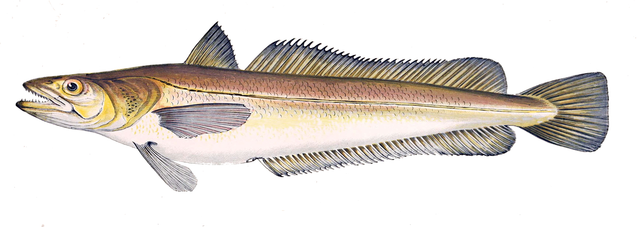
''Merluccius merluccius'', the European hake, is a merluccid hake of the genus ''Merluccius''. Other vernacular names include Cornish salmon and herring hake. It is a predatory species which was often netted alongside one of its favoured prey, the Atlantic herring, thus the latter common name. It is found in the eastern Atlantic from the Norway and Iceland south to Mauritania and into the Mediterranean Sea. It is an important species in European fisheries and is heavily exploited with some populations thought to be being fished unsustainably. Description ''Merluccius merluccius'' is a slim-bodied fish with a large head and large jaws on which are set a number of large curved teeth, the lower jaw has two rows of teeth and the upper jaw has one row. The inside of the mouth and the branchial cavity are black. The body is at its widest just behind its head. It has two dorsal fins; the first is triangular in shape, high with a short base, while the second is long, nearly the same le ... [...More Info...] [...Related Items...] OR: [Wikipedia] [Google] [Baidu] |
The IUCN Red List Of Threatened Species
The International Union for Conservation of Nature (IUCN) Red List of Threatened Species, also known as the IUCN Red List or Red Data Book, founded in 1964, is the world's most comprehensive inventory of the global conservation status of biological species. It uses a set of precise criteria to evaluate the extinction risk of thousands of species and subspecies. These criteria are relevant to all species and all regions of the world. With its strong scientific base, the IUCN Red List is recognized as the most authoritative guide to the status of biological diversity. A series of Regional Red Lists are produced by countries or organizations, which assess the risk of extinction to species within a political management unit. The aim of the IUCN Red List is to convey the urgency of conservation issues to the public and policy makers, as well as help the international community to reduce species extinction. According to IUCN the formally stated goals of the Red List are to provide scie ... [...More Info...] [...Related Items...] OR: [Wikipedia] [Google] [Baidu] |
Dorsal Fin
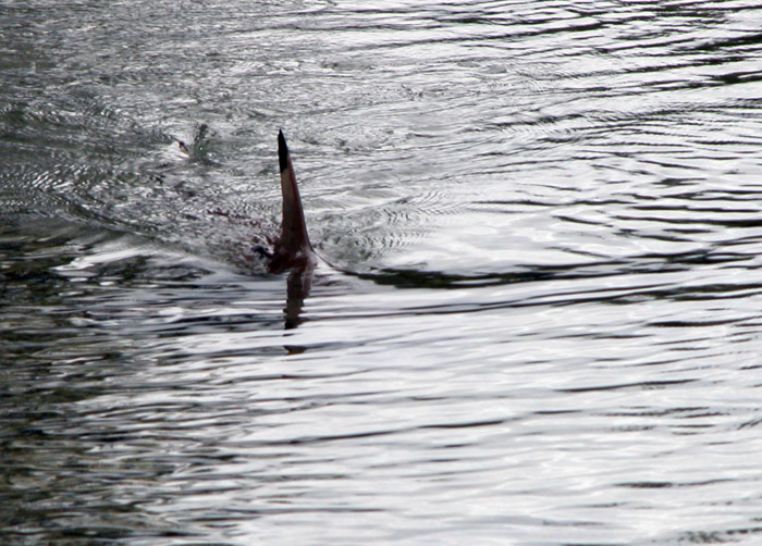
A dorsal fin is a fin located on the back of most marine and freshwater vertebrates within various taxa of the animal kingdom. Many species of animals possessing dorsal fins are not particularly closely related to each other, though through convergent evolution they have independently evolved external superficial fish-like body plans adapted to their marine environments, including most numerously fish, but also mammals such as cetaceans ( whales, dolphins, and porpoises), and even extinct ancient marine reptiles such as various known species of ichthyosaurs. Most species have only one dorsal fin, but some have two or three. Wildlife biologists often use the distinctive nicks and wear patterns which develop on the dorsal fins of large cetaceans to identify individuals in the field. The bony or cartilaginous bones that support the base of the dorsal fin in fish are called ''pterygiophores''. Functions The main purpose of the dorsal fin is to stabilize the animal against ro ... [...More Info...] [...Related Items...] OR: [Wikipedia] [Google] [Baidu] |
Adriatic Sea
The Adriatic Sea () is a body of water separating the Italian Peninsula from the Balkan Peninsula. The Adriatic is the northernmost arm of the Mediterranean Sea, extending from the Strait of Otranto (where it connects to the Ionian Sea) to the northwest and the Po Valley. The countries with coasts on the Adriatic are Albania, Bosnia and Herzegovina, Croatia, Italy, Montenegro, and Slovenia. The Adriatic contains more than 1,300 islands, mostly located along the Croatian part of its eastern coast. It is divided into three basins, the northern being the shallowest and the southern being the deepest, with a maximum depth of . The Otranto Sill, an underwater ridge, is located at the border between the Adriatic and Ionian Seas. The prevailing currents flow counterclockwise from the Strait of Otranto, along the eastern coast and back to the strait along the western (Italian) coast. Tidal movements in the Adriatic are slight, although larger amplitudes are known to occur occasi ... [...More Info...] [...Related Items...] OR: [Wikipedia] [Google] [Baidu] |
Scotland
Scotland (, ) is a Countries of the United Kingdom, country that is part of the United Kingdom. Covering the northern third of the island of Great Britain, mainland Scotland has a Anglo-Scottish border, border with England to the southeast and is otherwise surrounded by the Atlantic Ocean to the north and west, the North Sea to the northeast and east, and the Irish Sea to the south. It also contains more than 790 Islands of Scotland, islands, principally in the archipelagos of the Hebrides and the Northern Isles. Most of the population, including the capital Edinburgh, is concentrated in the Central Belt—the plain between the Scottish Highlands and the Southern Uplands—in the Scottish Lowlands. Scotland is divided into 32 Subdivisions of Scotland, administrative subdivisions or local authorities, known as council areas. Glasgow, Glasgow City is the largest council area in terms of population, with Highland (council area), Highland being the largest in terms of area. Limi ... [...More Info...] [...Related Items...] OR: [Wikipedia] [Google] [Baidu] |
Bay Of Biscay
The Bay of Biscay (), known in Spain as the Gulf of Biscay ( es, Golfo de Vizcaya, eu, Bizkaiko Golkoa), and in France and some border regions as the Gulf of Gascony (french: Golfe de Gascogne, oc, Golf de Gasconha, br, Pleg-mor Gwaskogn), is a gulf of the northeast Atlantic Ocean located south of the Celtic Sea. It lies along the western coast of France from Point Penmarc'h to the Spanish border, and the northern coast of Spain west to Cape Ortegal. The south area of the Bay of Biscay that washes over the northern coast of Spain is known locally as the Cantabrian Sea. The average depth is and the greatest depth is . Name The Bay of Biscay is named (for English speakers) after Biscay on the northern Spanish coast, probably standing for the western Basque districts (''Biscay'' up to the early 19th century). Its name in other languages is: * ast, Mar Cantábricu * eu, Bizkaiko golkoa * br, pleg-mor Gwaskogn * french: golfe de Gascogne (named after Gascony, France) * ... [...More Info...] [...Related Items...] OR: [Wikipedia] [Google] [Baidu] |
Kattegat
The Kattegat (; sv, Kattegatt ) is a sea area bounded by the Jutlandic peninsula in the west, the Danish Straits islands of Denmark and the Baltic Sea to the south and the provinces of Bohuslän, Västergötland, Halland and Skåne in Sweden in the east. The Baltic Sea drains into the Kattegat through the Danish Straits. The sea area is a continuation of the Skagerrak and may be seen as a bay of the North Sea, but in traditional Scandinavian usage, this is not the case. The Kattegat is a rather shallow sea and can be very difficult and dangerous to navigate because of the many sandy and stony reefs and tricky currents, which often shift. In modern times, artificial seabed channels have been dug, many reefs have been dredged by either sand pumping or stone fishing, and a well-developed light signaling network has been installed, to safeguard the very heavy international traffic of this small sea. There are several large cities and major ports in the Kattegat, including, in d ... [...More Info...] [...Related Items...] OR: [Wikipedia] [Google] [Baidu] |
Baltic Sea
The Baltic Sea is an arm of the Atlantic Ocean that is enclosed by Denmark, Estonia, Finland, Germany, Latvia, Lithuania, Poland, Russia, Sweden and the North and Central European Plain. The sea stretches from 53°N to 66°N latitude and from 10°E to 30°E longitude. A marginal sea of the Atlantic, with limited water exchange between the two water bodies, the Baltic Sea drains through the Danish Straits into the Kattegat by way of the Øresund, Great Belt and Little Belt. It includes the Gulf of Bothnia, the Bay of Bothnia, the Gulf of Finland, the Gulf of Riga and the Bay of Gdańsk. The " Baltic Proper" is bordered on its northern edge, at latitude 60°N, by Åland and the Gulf of Bothnia, on its northeastern edge by the Gulf of Finland, on its eastern edge by the Gulf of Riga, and in the west by the Swedish part of the southern Scandinavian Peninsula. The Baltic Sea is connected by artificial waterways to the White Sea via the White Sea–Baltic Canal and to t ... [...More Info...] [...Related Items...] OR: [Wikipedia] [Google] [Baidu] |
Black Sea
The Black Sea is a marginal mediterranean sea of the Atlantic Ocean lying between Europe and Asia, east of the Balkans, south of the East European Plain, west of the Caucasus, and north of Anatolia. It is bounded by Bulgaria, Georgia, Romania, Russia, Turkey, and Ukraine. The Black Sea is supplied by major rivers, principally the Danube, Dnieper, and Don. Consequently, while six countries have a coastline on the sea, its drainage basin includes parts of 24 countries in Europe. The Black Sea covers (not including the Sea of Azov), has a maximum depth of , and a volume of . Most of its coasts ascend rapidly. These rises are the Pontic Mountains to the south, bar the southwest-facing peninsulas, the Caucasus Mountains to the east, and the Crimean Mountains to the mid-north. In the west, the coast is generally small floodplains below foothills such as the Strandzha; Cape Emine, a dwindling of the east end of the Balkan Mountains; and the Dobruja Plateau considerably ... [...More Info...] [...Related Items...] OR: [Wikipedia] [Google] [Baidu] |
Straits Of Gibraltar
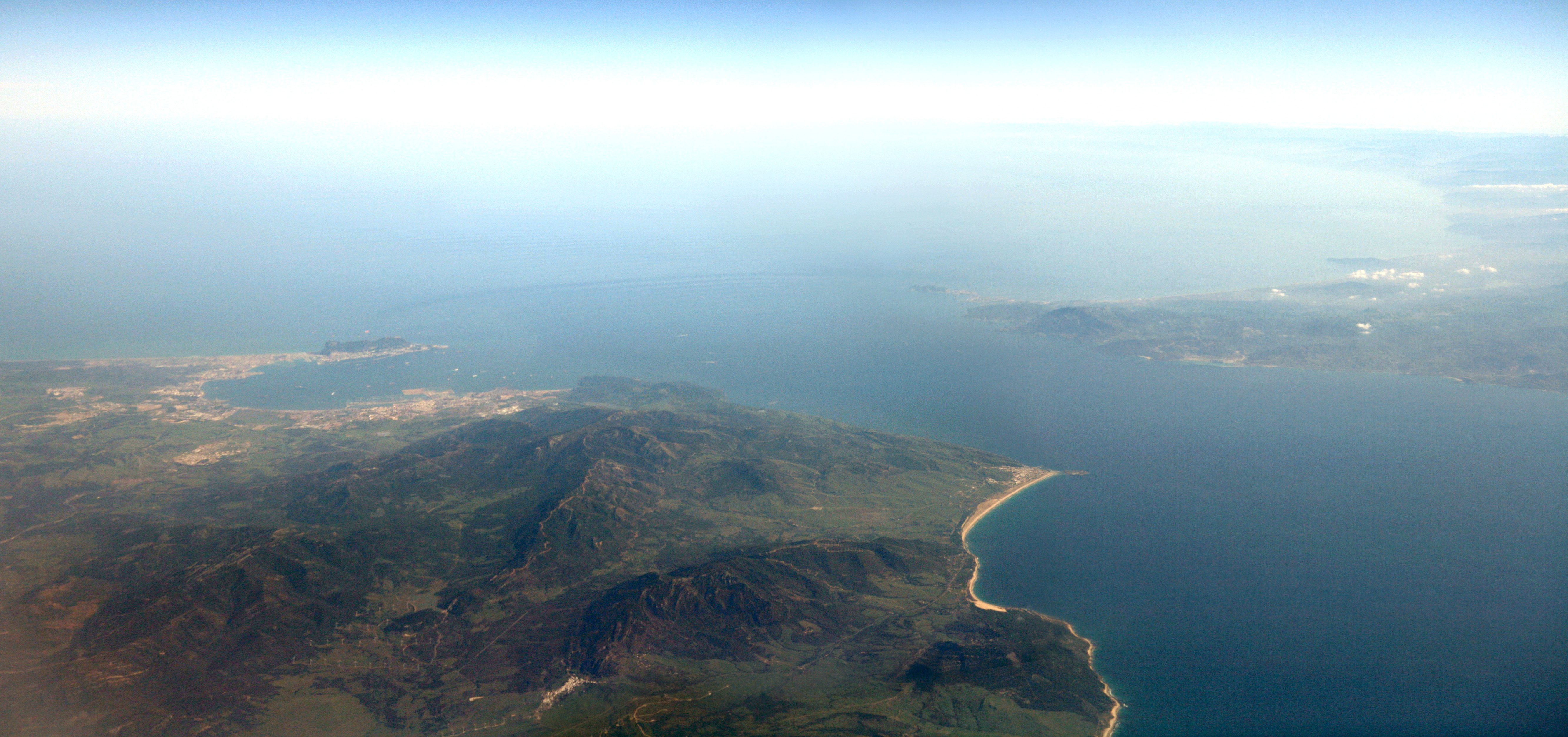
The Strait of Gibraltar ( ar, مضيق جبل طارق, Maḍīq Jabal Ṭāriq; es, Estrecho de Gibraltar, Archaism, Archaic: Pillars of Hercules), also known as the Straits of Gibraltar, is a narrow strait that connects the Atlantic Ocean to the Mediterranean Sea and separates the Iberian Peninsula in Europe from Morocco in Africa. The two continents are separated by of ocean at the Strait's narrowest point between Punta de Tarifa, Point Marroquí in Spain and Point Cires in Morocco. Ferries cross between the two continents every day in as little as 35 minutes. The Strait's depth ranges between which possibly interacted with the lower mean sea level of the last major glaciation 20,000 years ago when the level of the sea is believed to have been lower by . The strait lies in the territorial waters of Morocco, Spain, and the British overseas territory of Gibraltar. Under the United Nations Convention on the Law of the Sea, foreign vessels and aircraft have the freedom of navi ... [...More Info...] [...Related Items...] OR: [Wikipedia] [Google] [Baidu] |
Lateral Line
The lateral line, also called the lateral line organ (LLO), is a system of sensory organs found in fish, used to detect movement, vibration, and pressure gradients in the surrounding water. The sensory ability is achieved via modified epithelial cells, known as hair cells, which respond to displacement caused by motion and transduce these signals into electrical impulses via excitatory synapses. Lateral lines serve an important role in schooling behavior, predation, and orientation. Fish can use their lateral line system to follow the vortices produced by fleeing prey. Lateral lines are usually visible as faint lines of pores running lengthwise down each side, from the vicinity of the gill covers to the base of the tail. In some species, the receptive organs of the lateral line have been modified to function as electroreceptors, which are organs used to detect electrical impulses, and as such, these systems remain closely linked. Most amphibian larvae and some fully aquatic ... [...More Info...] [...Related Items...] OR: [Wikipedia] [Google] [Baidu] |
Caudal Fin
Fins are distinctive anatomical features composed of bony spines or rays protruding from the body of a fish. They are covered with skin and joined together either in a webbed fashion, as seen in most bony fish, or similar to a flipper, as seen in sharks. Apart from the tail or caudal fin, fish fins have no direct connection with the spine and are supported only by muscles. Their principal function is to help the fish swim. Fins located in different places on the fish serve different purposes such as moving forward, turning, keeping an upright position or stopping. Most fish use fins when swimming, flying fish use pectoral fins for gliding, and frogfish use them for crawling. Fins can also be used for other purposes; male sharks and mosquitofish use a modified fin to deliver sperm, thresher sharks use their caudal fin to stun prey, reef stonefish have spines in their dorsal fins that inject venom, anglerfish use the first spine of their dorsal fin like a fishing rod ... [...More Info...] [...Related Items...] OR: [Wikipedia] [Google] [Baidu] |
Food And Agriculture Organization
The Food and Agriculture Organization of the United Nations (FAO)french: link=no, Organisation des Nations unies pour l'alimentation et l'agriculture; it, Organizzazione delle Nazioni Unite per l'Alimentazione e l'Agricoltura is an international organization that leads international efforts to defeat hunger and improve nutrition and food security. Its Latin motto, ', translates to "let there be bread". It was founded on 16 October 1945. The FAO is composed of 195 members (including 194 countries and the European Union). Their headquarters is in Rome, Italy, and the FAO maintains regional and field offices around the world, operating in over 130 countries. It helps governments and development agencies coordinate their activities to improve and develop agriculture, forestry, fisheries, and land and water resources. It also conducts research, provides technical assistance to projects, operates educational and training programs, and collects data on agricultural output, pr ... [...More Info...] [...Related Items...] OR: [Wikipedia] [Google] [Baidu] |


.png)
