|
Elias Pym Fordham
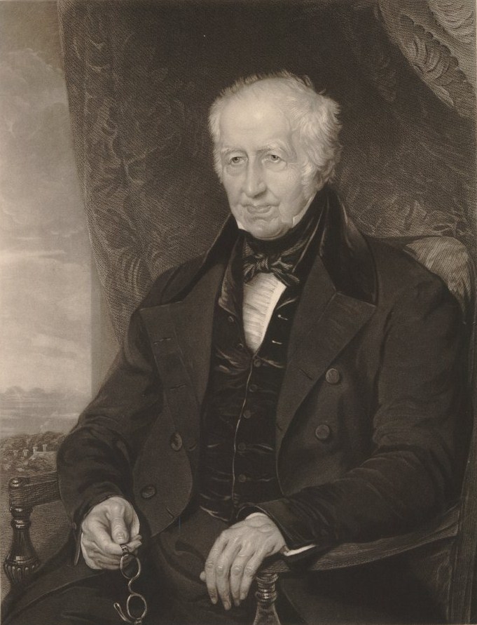
Elias Pym Fordham (1788-1850) was the original surveyor of Indianapolis. He was an English immigrant to the United States and author of an American travel memoir. Elias Pym Fordham was born in Royston, Hertfordshire, one of two sons and seven children to Elias Fordham (1762-1838) and his first wife Ann Clapton.Sheryl D. Vanderstel. "Elias Pym Fordham", in ''The Encyclopedia of Indianapolis'', 1994. The family background was of liberal nonconformism in Hertfordshire, exemplified by his uncle Edward King Fordham. He studied civil engineering under George Stephenson (a developer of the steam locomotive). Fordham immigrated to the US in 1817 with his sister Maria and travelled to Illinois where he purchased a tract of land in what was known as "the English Prairie", settled also by his first cousin George Flower (1788-1862), a founder of Albion, Illinois. In April 1821 he along with Alexander Ralston received joint appointments as surveyors of Indianapolis. Little else is known of For ... [...More Info...] [...Related Items...] OR: [Wikipedia] [Google] [Baidu] |
Indianapolis
Indianapolis (), colloquially known as Indy, is the state capital and most populous city of the U.S. state of Indiana and the seat of Marion County. According to the U.S. Census Bureau, the consolidated population of Indianapolis and Marion County was 977,203 in 2020. The " balance" population, which excludes semi-autonomous municipalities in Marion County, was 887,642. It is the 15th most populous city in the U.S., the third-most populous city in the Midwest, after Chicago and Columbus, Ohio, and the fourth-most populous state capital after Phoenix, Arizona, Austin, Texas, and Columbus. The Indianapolis metropolitan area is the 33rd most populous metropolitan statistical area in the U.S., with 2,111,040 residents. Its combined statistical area ranks 28th, with a population of 2,431,361. Indianapolis covers , making it the 18th largest city by land area in the U.S. Indigenous peoples inhabited the area dating to as early as 10,000 BC. In 1818, the Lenape relinquished ... [...More Info...] [...Related Items...] OR: [Wikipedia] [Google] [Baidu] |
Royston, Hertfordshire
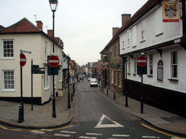
Royston is a town and civil parish in the District of North Hertfordshire and county of Hertfordshire in England. It is situated on the Greenwich Meridian, which brushes the town's eastern boundary, and at the northernmost apex of the county on the same latitude as towns such as Milton Keynes and Ipswich. It is about north of central London in a rural area. Before the boundary changes of the 1890s, the boundary between Hertfordshire and Cambridgeshire ran east–west through the centre of town along the middle of Melbourn Street. The town has a population of 15,781 as of 2011.Office for National Statistics : ''Census 2011 : Parish Headcounts : North Hertfordshire'' Retrieved 2013-03-18 History [...More Info...] [...Related Items...] OR: [Wikipedia] [Google] [Baidu] |
Hertfordshire
Hertfordshire ( or ; often abbreviated Herts) is one of the home counties in southern England. It borders Bedfordshire and Cambridgeshire to the north, Essex to the east, Greater London to the south, and Buckinghamshire to the west. For government statistical purposes, it forms part of the East of England region. Hertfordshire covers . It derives its name – via the name of the county town of Hertford – from a Hart (deer), hart (stag) and a Ford (crossing), ford, as represented on the county's coat of arms and on the Flag of Hertfordshire, flag. Hertfordshire County Council is based in Hertford, once the main market town and the current county town. The largest settlement is Watford. Since 1903 Letchworth has served as the prototype Garden city movement, garden city; Stevenage became the first town to expand under post-war Britain's New Towns Act 1946, New Towns Act of 1946. In 2013 Hertfordshire had a population of about 1,140,700, with Hemel Hempstead, Stevenage, Watford ... [...More Info...] [...Related Items...] OR: [Wikipedia] [Google] [Baidu] |
Edward King Fordham
Edward King Fordham (1750–1847) was an English banker and political reformer. Career and the Royston Bank The second son of Edward Fordham (1721–1778) of Therfield in Hertfordshire and his wife Mary Carter (1722–1798) he moved to Royston, the nearby town, while still a young man. In early life he worked as a woolcomber and stapler. He became prominent in business there, and a founder of the Royston Bank. The Royston Bank was set up in 1808, and traded under the name of Fordham, Flower & Co. In 1825 control passed within the Fordham family to John Edward Fordham (1799–1881), a nephew of Edward King Fordham, with John George Fordham (1780–1877), another nephew; John Edward ran the bank, then known as John Fordham & Co. The Royston Bank, then Fordham & Co., lost its independence in 1896 with the merger of a dozen banks to form Barclay & Co. The Fordhams as brewers The family concern was brewing. Peter Mathias considers the practical operation of duties on maltsters an ... [...More Info...] [...Related Items...] OR: [Wikipedia] [Google] [Baidu] |
George Stephenson
George Stephenson (9 June 1781 – 12 August 1848) was a British civil engineer and mechanical engineer. Renowned as the "Father of Railways", Stephenson was considered by the Victorians a great example of diligent application and thirst for improvement. Self-help advocate Samuel Smiles particularly praised his achievements. His chosen rail gauge, sometimes called "Stephenson gauge", was the basis for the standard gauge used by most of the world's railways. Pioneered by Stephenson, rail transport was one of the most important technological inventions of the 19th century and a key component of the Industrial Revolution. Built by George and his son Robert's company Robert Stephenson and Company, the ''Locomotion'' No. 1 was the first steam locomotive to carry passengers on a public rail line, the Stockton and Darlington Railway in 1825. George also built the first public inter-city railway line in the world to use locomotives, the Liverpool and Manchester Railway, which ... [...More Info...] [...Related Items...] OR: [Wikipedia] [Google] [Baidu] |
Steam Locomotive
A steam locomotive is a locomotive that provides the force to move itself and other vehicles by means of the expansion of steam. It is fuelled by burning combustible material (usually coal, oil or, rarely, wood) to heat water in the locomotive's boiler to the point where it becomes gaseous and its volume increases 1,700 times. Functionally, it is a steam engine on wheels. In most locomotives, the steam is admitted alternately to each end of its cylinders, in which pistons are mechanically connected to the locomotive's main wheels. Fuel and water supplies are usually carried with the locomotive, either on the locomotive itself or in a tender coupled to it. Variations in this general design include electrically-powered boilers, turbines in place of pistons, and using steam generated externally. Steam locomotives were first developed in the United Kingdom during the early 19th century and used for railway transport until the middle of the 20th century. Richard Trevithi ... [...More Info...] [...Related Items...] OR: [Wikipedia] [Google] [Baidu] |
Illinois
Illinois ( ) is a state in the Midwestern United States. Its largest metropolitan areas include the Chicago metropolitan area, and the Metro East section, of Greater St. Louis. Other smaller metropolitan areas include, Peoria and Rockford, as well Springfield, its capital. Of the fifty U.S. states, Illinois has the fifth-largest gross domestic product (GDP), the sixth-largest population, and the 25th-largest land area. Illinois has a highly diverse economy, with the global city of Chicago in the northeast, major industrial and agricultural hubs in the north and center, and natural resources such as coal, timber, and petroleum in the south. Owing to its central location and favorable geography, the state is a major transportation hub: the Port of Chicago has access to the Atlantic Ocean through the Great Lakes and Saint Lawrence Seaway and to the Gulf of Mexico from the Mississippi River via the Illinois Waterway. Additionally, the Mississippi, Ohio, and W ... [...More Info...] [...Related Items...] OR: [Wikipedia] [Google] [Baidu] |
Albion, Illinois
Albion is a city in and the county seat of Edwards County, Illinois, United States. The population was 1,971 at the 2020 census. The city was named "Albion" after an ancient and poetic reference to the island of Great Britain. Geography Albion is located south of the center of Edwards County at (38.377300, -88.061028). In it, Illinois Route 130 and Illinois Route 15 meet. Route 130 leads north to Olney and south to Grayville, while Route 15 leads east to Mount Carmel and west to Fairfield. According to the 2021 census gazetteer files, Albion has a total area of , of which (or 97.89%) is land and (or 2.11%) is water. A 3.8-magnitude earthquake occurred seven and a half miles outside of the city on September 19, 2017. Climate History Albion was laid out in 1818 as a utopian community and given the name Albion, a literary name for England. In 1821, the county seat of Edwards County was moved from Palmyra to Albion, eighteen miles to the west. However, residents ... [...More Info...] [...Related Items...] OR: [Wikipedia] [Google] [Baidu] |
Alexander Ralston
Alexander Ralston (1771 – January 5, 1827) was a Scottish surveyor who was one of two co-architects for the design of the city of Indianapolis, Indiana. He also helped to design Washington, D.C. Life Alexander Ralston was born in Scotland in 1771. In Britain he was an engineer working for the Baron of Roslin on his estate before immigrating to the United States after the American Revolution. An assistant to the French-American architect Pierre (Peter) Charles L'Enfant in 1791, Ralston helped L'Enfant lay out the city plan for Washington, D.C. (see L'Enfant Plan).(1) (2) Ralston came to Indiana sometime before 1815, leaving the east partly because of his involvement with Aaron Burr and the Burr conspiracy. He settled on a homestead in southern Indiana.* He was first hired in 1820 by Christopher Harrison, the state commissioner overseeing the survey of Indianapolis, and charged with helping to survey the city. With co-surveyor Elias Pym Fordham, Ralston's was later com ... [...More Info...] [...Related Items...] OR: [Wikipedia] [Google] [Baidu] |
Dover
Dover () is a town and major ferry port in Kent, South East England. It faces France across the Strait of Dover, the narrowest part of the English Channel at from Cap Gris Nez in France. It lies south-east of Canterbury and east of Maidstone. The town is the administrative centre of the Dover District and home of the Port of Dover. Archaeological finds have revealed that the area has always been a focus for peoples entering and leaving Britain. The name derives from the River Dour that flows through it. In recent times the town has undergone transformations with a high-speed rail link to London, new retail in town with St James' area opened in 2018, and a revamped promenade and beachfront. This followed in 2019, with a new 500m Pier to the west of the Harbour, and new Marina unveiled as part of a £330m investment in the area. It has also been a point of destination for many illegal migrant crossings during the English channel migrant crisis. The Port of Dover provides mu ... [...More Info...] [...Related Items...] OR: [Wikipedia] [Google] [Baidu] |
Capel-le-Ferne
__NOTOC__ Capel-le-Ferne is a village situated near Folkestone, Kent. Its name derives from the phrase "Chapel in the Ferns". It had a population in 2011 of 1,884. It is perched on top of the White Cliffs of Dover. Its foremost attraction is the Battle of Britain Memorial, opened by the Queen Mother on 9 July 1993 and dedicated to those who fought in the battle. The Memorial is built upon part of a former World War II coastal battery (No. 2 and No. 3 guns). The other part of the Coastal Battery is privately held and under restoration. The Channel Tunnel runs underneath the northernmost part of the village. The village is twinned with the commune of Oye-Plage in the Pas-de-Calais department in France, about 7 miles (12 km) east of Calais. Transport The B2011 New Dover road runs through the village between Folkestone and Dover. The A20 runs to the north and is used by freight and ferry traffic heading for Dover. Tourism The cliffs offer a spectacular walking opport ... [...More Info...] [...Related Items...] OR: [Wikipedia] [Google] [Baidu] |
1788 Births
Events January–March * January 1 – The first edition of ''The Times'', previously ''The Daily Universal Register'', is published in London. * January 2 – Georgia ratifies the United States Constitution, and becomes the fourth U.S. state under the new government. * January 9 – Connecticut ratifies the United States Constitution, and becomes the fifth U.S. state. * January 18 – The leading ship (armed tender HMS ''Supply'') in Captain Arthur Phillip's First Fleet arrives at Botany Bay, to colonise Australia. * January 22 – the Congress of the Confederation, effectively a caretaker government until the United States Constitution can be ratified by at least nine of the 13 states, elects Cyrus Griffin as its last president.''Harper's Encyclopaedia of United States History from 458 A. D. to 1909'', ed. by Benson John Lossing and, Woodrow Wilson (Harper & Brothers, 1910) p167 * January 24 – The La Perouse expedition in the ''Astrolabe'' and '' Boussole'' arrives ... [...More Info...] [...Related Items...] OR: [Wikipedia] [Google] [Baidu] |


