|
Districts Of Rwanda
The five provinces of Rwanda are divided into 30 districts (Kinyarwanda: ''uturere'', sing. ''akarere''). Each district is in turn divided into sectors (Kinyarwanda: ''imirenge'', sing. ''umurenge''), which are in turn divided into ''cells'' (Kinyarwanda: ''utugali'', sing. ''akagali''), which are in turn divided into ''villages'' (Kinyarwanda: ''imidugudu'', sing. ''umudugudu''). Prior to 2002, Rwanda was composed of prefectures, subprefectures (which were sometimes called "districts") and 154 communes (Kinyarwanda: ''imijyi'', sing. ''umujyi''). In 2002, communes were replaced by two kinds of divisions called districts and municipalities (Kinyarwanda: ''akarere'' and ''umujyi''). In 2006, the number of districts was reduced from 106 to 30. The districts are listed below, by province. Current list of districts by province Eastern Province # Bugesera # Gatsibo # Kayonza # Kirehe # Ngoma # Nyagatare # Rwamagana Kigali # Gasabo # Kicukiro # Nyarugenge Northern ... [...More Info...] [...Related Items...] OR: [Wikipedia] [Google] [Baidu] |
Gasabo District
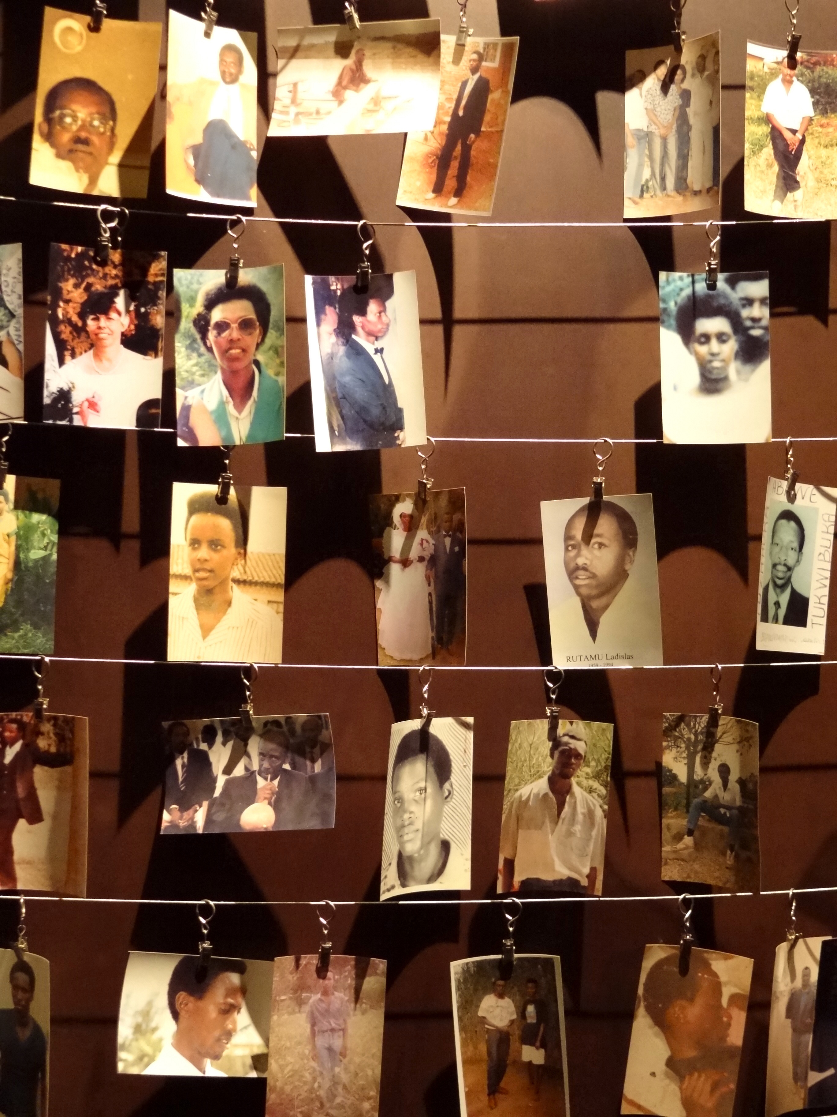
Gasabo is a district, (''akarere'') in Kigali city, the capital of Rwanda. The headquarter of Gasabo is located in Remera Sector. The district also includes large areas of the city itself, including Kacyiru, Kimironko, Remera, Nyarutarama and Kimihurura. The district is the location of the Gisozi Genocide Memorial Site, the burial place of approximately 300,000 victims of the 1994 Genocide against Tutsis . In addition to the cemetery, the memorial has a related genocide exhibition area and library and has plans to develop a teaching centre on the history of the genocide. History The original country of Rwanda, referred to as “the Rwanda of Gasabo” (u Rwanda rwa Gasabo), was a small territorial entity located in the present district of Gasabo, along the valley of Lake Muhazi, namely Nyabugogo. When the period of historical kings unfolded (“abami b’ibitekerezo”), Rwanda came under the reign of King Ruganzu Bwimba- The first king among series of historical kings who ... [...More Info...] [...Related Items...] OR: [Wikipedia] [Google] [Baidu] |
Muhanga District
Muhanga is a district (''akarere'') in Rwanda. Its administrative centre is located in the city of Muhanga (former Gitarama). Geography Muhanga Districtis one of the eight districts comprising the Southern Province. It is subdivided into twelve (12) sectors, sixty three (63) cells and three hundred and thirty one (331) villages (Imidugudu). The District covers an area of six hundred forty seven point seven square kilometers (647.7 km2) and, it is neighbouring the Districts of Gakenke in the North, Kamonyi in the East, Ruhango in the South and Ngororero in the West, Karongi District to the southwest and Ngororero District to the west Relief and climate One part of Muhanga District is located in the "central plateau" of the country with topography of hills type. With high and low peaks, this part constitutes one of the best elements of the central "plateau" of the country. The other part of the District is on the high mountains of the Nil-Congo; it has peaks prancing beyond ... [...More Info...] [...Related Items...] OR: [Wikipedia] [Google] [Baidu] |
Kamonyi District
Kamonyi is a district (''akarere'') in Southern Province, Rwanda. Its capital is Kamonyi, also sometimes known as Gihinga. Sectors Kamonyi district is divided into 12 sectors Sector may refer to: Places * Sector, West Virginia, U.S. Geometry * Circular sector, the portion of a disc enclosed by two radii and a circular arc * Hyperbolic sector, a region enclosed by two radii and a hyperbolic arc * Spherical sector, a p ... (''imirenge''): Gacurabwenge, Karama, Kayenzi, Kayumbu, Mugina, Musambira, Ngamba, Nyamiyaga, Nyarubaka, Rugalika, Rukoma and Runda. References * Inzego.doc— Province, District and Sector information from ''MINALOC'', the Rwanda ministry of local government. {{coord, 2, 00, S, 29, 54, E, display=title, region:RW_type:adm2nd_source:GNS-enwiki Southern Province, Rwanda Districts of Rwanda ... [...More Info...] [...Related Items...] OR: [Wikipedia] [Google] [Baidu] |
Huye District
Huye is one of the eight districts (''Akarere'') that make up Rwanda's Southern Province. It has a total surface area of 581.5 square Kilometers. It has thirteen sectors and 77 cells with a total of 508 umudugudus (villages) in total. The district has a population of 328,298, with an average of 581 inhabitants per square kilometer. The largest city in the province is Butare. Geography and education Huye borders with Nyanza district in the North, Gisagara in the east and south, Nyaruguru in the south west and Nyamagabe in the north west. The hilly landscape protrudes from east to west but develops into a steep hilly and mountainous area as one moves towards the west and north west. The western part of the district has tall undulating mountains, including the famous Huye mountain. The district has rainfall a distribution pattern of 1.200 mm and an average climate of 19 °C. Huye was previously home to the National University of Rwanda, the oldest university in the countr ... [...More Info...] [...Related Items...] OR: [Wikipedia] [Google] [Baidu] |
Gisagara District
Gisagara is a district (''akarere'') in Southern Province, Rwanda. Its headquarters is Ndora. Geography The district lies just to the East of Butare city, along the border with Burundi. Where of gisagara district office building ,sector, cell Gisagara district is divided into 13 sectors Sector may refer to: Places * Sector, West Virginia, U.S. Geometry * Circular sector, the portion of a disc enclosed by two radii and a circular arc * Hyperbolic sector, a region enclosed by two radii and a hyperbolic arc * Spherical sector, a p ... (''imirenge''): Gikonko, Gishubi, Kansi, Kibilizi, Kigembe, Mamba, Muganza, Mugombwa, Mukindo, Musha, Ndora, Nyanza and Save. Mugombwa refugee camp The Mugombwa refugee camp is home to over 7300 Congolese refugees. A Turi Kumwe Centre, housing "a Police post as well as migration and camp management offices" was opened in the camp in 2014. References * Inzego.doc— Province, District and Sector information from ''MINALOC'', the ... [...More Info...] [...Related Items...] OR: [Wikipedia] [Google] [Baidu] |
Rwanda SouthDists
Rwanda (; rw, u Rwanda ), officially the Republic of Rwanda, is a landlocked country in the Great Rift Valley of Central Africa, where the African Great Lakes region and Southeast Africa converge. Located a few degrees south of the Equator, Rwanda is bordered by Uganda, Tanzania, Burundi, and the Democratic Republic of the Congo. It is highly elevated, giving it the soubriquet "land of a thousand hills", with its geography dominated by mountains in the west and savanna to the southeast, with numerous lakes throughout the country. The climate is temperate to subtropical, with two rainy seasons and two dry seasons each year. Rwanda has a population of over 12.6 million living on of land, and is the most densely populated mainland African country; among countries larger than 10,000 km2, it is the fifth most densely populated country in the world. One million people live in the capital and largest city Kigali. Hunter-gatherers settled the territory in the Stone and ... [...More Info...] [...Related Items...] OR: [Wikipedia] [Google] [Baidu] |
Rulindo District
Rulindo is a district (''akarere'') in Northern Province, Rwanda. Its capital is Tare (also known as Bushoki). Geography The district lies roughly halfway between Kigali and Ruhengeri, and is very mountainous, containing Mount Kabuye. Its principal town, Tare (more commonly known as Nyirangarama), serves as a rest and refreshment stop for most long distance bus services between Kigali and Gisenyi and Goma. Economy Rulindo district is home to Agashya, Rwanda's leading manufacturer of passion fruit squash. Kinihira Sector is home to the Sorwathe Tea Factory. Sectors Rulindo district is divided into 17 sectors (''imirenge''): Base, Burega, Bushoki, Buyoga Buyoga is a town and sector in the Rulindo district of Northern Province, Rwanda Rwanda (; rw, u Rwanda ), officially the Republic of Rwanda, is a landlocked country in the Great Rift Valley of Central Africa, where the African Great ..., Cyinzuzi, Cyungo, Kinihira, Kisaro, Masoro, Rwanda, Masoro, Mb ... [...More Info...] [...Related Items...] OR: [Wikipedia] [Google] [Baidu] |
Musanze District
Musanze is a district in the Northern Province of Rwanda. Its capital city is Ruhengeri. Geography and tourism Musanze is Rwanda's most mountainous district, containing the largest part of the Volcanoes National Park, and its head office at Kinigi. Five of the eight volcanoes of the Virunga chain ( Karisimbi, Bisoke, Sabyinyo, Gahinga and Muhabura) are within the district boundaries. It is also in this district that most of Rwanda's mountain gorillas are found, making it the most popular tourist destination in the country. Sectors Musanze district is divided into 15 sectors (''imirenge''): Busogo, Cyuve, Gacaca, Gashaki Gashaki is a town and sector in the Musanze district of Northern Province, Rwanda Rwanda (; rw, u Rwanda ), officially the Republic of Rwanda, is a landlocked country in the Great Rift Valley of Central Africa, where the African Great ..., Gataraga, Kimonyi, Kinigi, Muhoza, Muko, Musanze, Nkotsi, Nyange, Remera, Rwaza and Shingiro. But Musa ... [...More Info...] [...Related Items...] OR: [Wikipedia] [Google] [Baidu] |
Gicumbi District
Gicumbi is a district (''akarere'') in Northern Province, Rwanda. Its capital is Byumba, which is also the provincial capital. Geography The district lies due-north of Kigali, straddling the major road from Kigali to Kampala. It is a hilly district. Sectors Gicumbi district is divided into 21 sectors Sector may refer to: Places * Sector, West Virginia, U.S. Geometry * Circular sector, the portion of a disc enclosed by two radii and a circular arc * Hyperbolic sector, a region enclosed by two radii and a hyperbolic arc * Spherical sector, a p ... (''imirenge''): Bukure, Bwisige, Byumba, Cyumba, Giti, Kaniga, Manyagiro, Miyove, Kageyo, Mukarange, Muko, Mutete, Nyamiyaga, Nyankenke II, Rubaya, Rukomo, Rushaki, Rutare, Ruvune, Rwamiko and Shangasha. Gihembe refugee camp Gihembe is camp of Congolese refugees located in Gicumbi District and is home to 12,904 residents. On 15 December 2014, Gihembe Refugee Camp in Gicumbi District received a visit from Howard G. Buffett, wh ... [...More Info...] [...Related Items...] OR: [Wikipedia] [Google] [Baidu] |
Gakenke District
Gakenke district is one among thirty district made of Rwanda . It's locate in Northern Province of this country (Rwanda). Its capital is Gakenke town. The district has started implementing a building plan with demarcation for land usage and public facilities. Sectors Gakenke district is divided into 19 sectors Sector may refer to: Places * Sector, West Virginia, U.S. Geometry * Circular sector, the portion of a disc enclosed by two radii and a circular arc * Hyperbolic sector, a region enclosed by two radii and a hyperbolic arc * Spherical sector, a p ... (): Busengo, Coko, Cyabingo, Gakenke, Gashenyi, Mugunga, Janja, Kamubuga, Karambo, Kivuruga, Mataba, Minazi, Muhondo, Muyongwe, Muzo, Nemba, Ruli, Rusasa and Rushashi. References * Inzego.doc— Province, District and Sector information from ''MINALOC'', the Rwanda ministry of local government. {{coord, 1, 42, S, 29, 47, E, display=title, region:RW_type:adm2nd_source:GNS-enwiki Northern Province, Rwanda Dist ... [...More Info...] [...Related Items...] OR: [Wikipedia] [Google] [Baidu] |
Burera District
Burera is a district (''Akarere'') in Northern Province, Rwanda. Its capital is Cyeru. Geography and tourism The district lies in the northern part of Rwanda, adjacent to the Ugandan border, and between the cities of Ruhengeri and Byumba. It is home to Lakes Burera and Ruhondo, and the Virunga Lodge hotel, which lies between them, commanding views of the lakes and the nearby Virunga mountains, making it one of Rwanda's tourist spots. The district also contains the Cyanika border post, gateway to Kisoro Kisoro is a town in the Western Region of Uganda. It is the chief town of Kisoro District and the site of the district headquarters. Location Kisoro is approximately , by road, west of Kabale, the largest city in the Kigezi sub-region. This is ... and southwestern Uganda. Burera district is known for its famous cancer hospital in Butaro sector and the only hospital in Burera district sponsored by Partners in Health. Sectors Burera district is divided into 17 sec ... [...More Info...] [...Related Items...] OR: [Wikipedia] [Google] [Baidu] |


