|
Wasatch Front
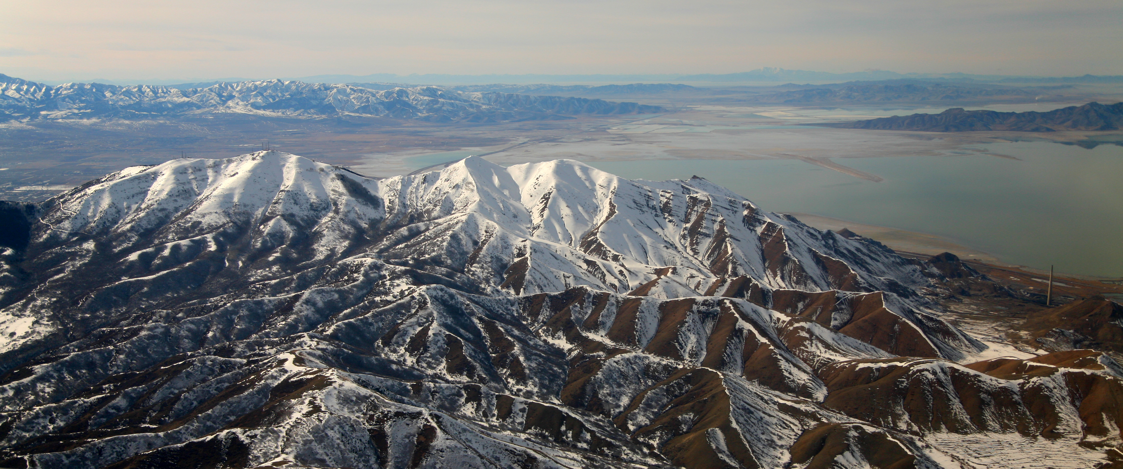
The Wasatch Front is a major metropolitan region in the north-central part of the U.S. state of Utah. It consists of a chain of contiguous cities and towns stretched along the Wasatch Range from Santaquin in the south to Pleasant View in the north, and containing the cities of Salt Lake City, Provo, Orem, Bountiful, Layton, and Ogden. Geography The Wasatch Front is long and narrow. To the east, the Wasatch Mountains rise abruptly several thousand feet above the valley floors, climbing to their highest elevation of at Mount Nebo (bordering southern Utah Valley). The area's western boundary is formed by Utah Lake in Utah County, the Oquirrh Mountains in Salt Lake County, and the Great Salt Lake in northwestern Salt Lake, Davis, Weber, and southeastern Box Elder county. Though most residents of the area live between Ogden and Provo (a distance of ), which includes Salt Lake City proper, the fullest built-out extent of the Wasatch Front is long and on average ... [...More Info...] [...Related Items...] OR: [Wikipedia] [Google] [Baidu] |
Region
In geography, regions, otherwise referred to as areas, zones, lands or territories, are portions of the Earth's surface that are broadly divided by physical characteristics (physical geography), human impact characteristics (human geography), and the interaction of humanity and the environment (environmental geography). Geographic regions and sub-regions are mostly described by their imprecisely defined, and sometimes transitory boundaries, except in human geography, where Jurisdiction (area), jurisdiction areas such as national borders are defined in law. More confined or well bounded portions are called ''locations'' or ''places''. Apart from the Earth, global continental regions, there are also hydrosphere, hydrospheric and atmosphere, atmospheric regions that cover the oceans, and discrete climates above the land mass, land and water mass, water masses of the planet. The land and water global regions are divided into subregions geographically bounded by large geological feature ... [...More Info...] [...Related Items...] OR: [Wikipedia] [Google] [Baidu] |
Oquirrh Mountains
The Oquirrh Mountains ( ) is a mountain range that runs north–south for approximately 30 miles (50 km) to form the west side of Utah's Salt Lake Valley, separating it from Tooele Valley. The range runs from northwestern Utah County–central & eastern Tooele County, UT, Tooele County, to the south shore of the Great Salt Lake. The highest elevation is Flat Top Mountain (Utah), Flat Top Mountain at 10,620 ft (3,237 m). The name Oquirrh was taken from the Goshute word meaning "wood sitting." The Oquirrh Mountains have been mined for gold, silver, lead, and most famously for copper, as home of the porphyry copper deposit at Bingham Canyon Mine, one of the world's largest open pit mines. As seen from Salt Lake City, the view of the mountain range is dominated by the displaced rock material (known as overburden) dug from the Kennecott mine. At the north end of the range is Kennecott's smelter complex, which refines ore concentrates from the mine into useful metals. Dar ... [...More Info...] [...Related Items...] OR: [Wikipedia] [Google] [Baidu] |
Utah Population Map
Utah is a landlocked state in the Mountain states, Mountain West subregion of the Western United States. It is one of the Four Corners states, sharing a border with Arizona, Colorado, and New Mexico. It also borders Wyoming to the northeast, Idaho to the north, and Nevada to the west. In comparison to all the U.S. states and territories, Utah, with a population of just over three million, is the List of U.S. states and territories by area, 13th largest by area, the List of U.S. states and territories by population, 30th most populous, and the List of U.S. states by population density, 11th least densely populated. Urban development is mostly concentrated in two regions: the Wasatch Front in the north-central part of the state, which includes the state capital, Salt Lake City, and is home to roughly two-thirds of the population; and Washington County, Utah, Washington County in the southwest, which has approximately 180,000 residents. Most of the western half of Utah lies in ... [...More Info...] [...Related Items...] OR: [Wikipedia] [Google] [Baidu] |


