|
Spatial Epidemiology
Spatial epidemiology is a subfield of epidemiology focused on the study of the spatial distribution of health outcomes; it is closely related to health geography. Specifically, spatial epidemiology is concerned with the description and examination of disease and its geographic variations. This is done in consideration of “demographic, environmental, behavioral, socioeconomic, genetic, and infections risk factors." Types of studies ;Disease Mapping: * Disease maps are visual representations of intricate geographic data that provide a quick overview of said information. Mainly used for explanatory purposes, disease maps can be presented to survey high-risk areas and to help policy and resource allocation in said areas. ;Geographic correlation studies * Geographic correlation studies attempt to study the geographical factors and their effects on geographically differentiated health outcomes. Measured on an ecologic scale, these factors include environmental variables (quality of ... [...More Info...] [...Related Items...] OR: [Wikipedia] [Google] [Baidu] |
Discipline (academia)
An academic discipline or academic field is a subdivision of knowledge that is taught and researched at the college or university level. Disciplines are defined (in part) and recognized by the academic journals in which research is published, and the learned societies and academic departments or faculties within colleges and universities to which their practitioners belong. Academic disciplines are conventionally divided into the humanities (including philosophy, language, art and cultural studies), the scientific disciplines (such as physics, chemistry, and biology); and the formal sciences like mathematics and computer science. The social sciences are sometimes considered a fourth category. It is also known as a ''field of study'', ''field of inquiry'', ''research field'' and ''branch of knowledge''. The different terms are used in different countries and fields. Individuals associated with academic disciplines are commonly referred to as ''experts'' or ''specialists''. Oth ... [...More Info...] [...Related Items...] OR: [Wikipedia] [Google] [Baidu] |
Modifiable Areal Unit Problem
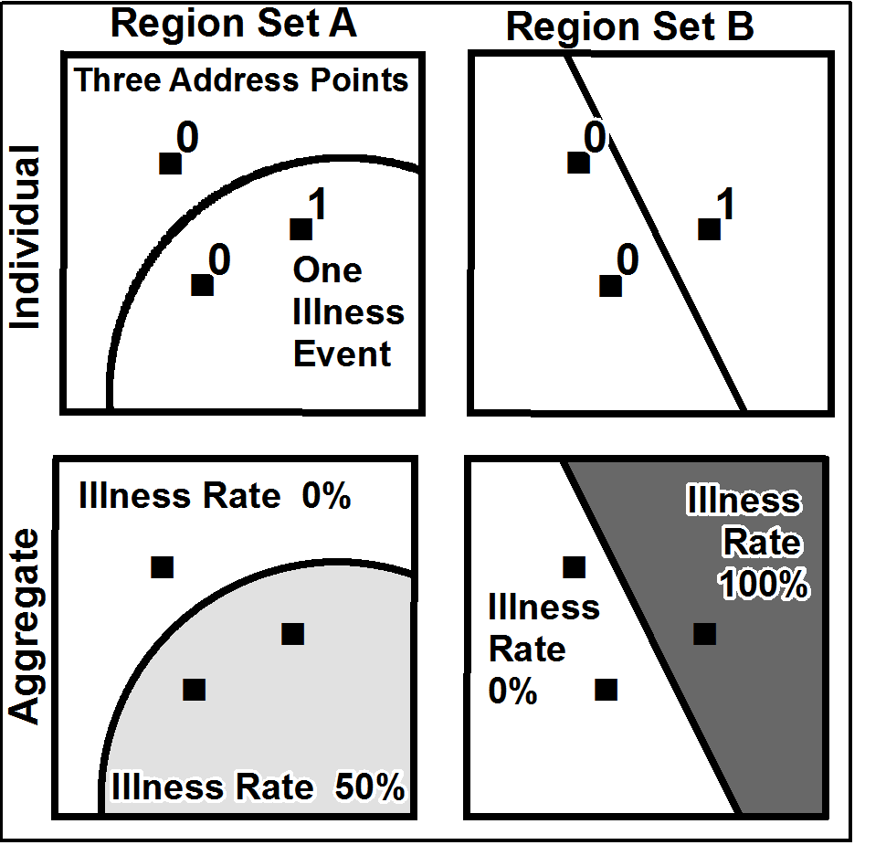
__NOTOC__ The modifiable areal unit problem (MAUP) is a source of statistical bias that can significantly impact the results of statistical hypothesis tests. MAUP affects results when point-based measures of spatial phenomena are Aggregate data, aggregated into spatial partitions or ''areal units'' (such as regions or districts) as in, for example, population density or illness rates. The resulting summary values (e.g., totals, rates, proportions, densities) are influenced by both the shape and Scale (geography), scale of the aggregation unit. For example, census data may be aggregated into county districts, census tracts, postcode areas, police precincts, or any other arbitrary spatial partition. Thus the results of data aggregation are dependent on the mapmaker's choice of which "modifiable areal unit" to use in their analysis. A census choropleth map calculating population density using state boundaries will yield radically different results from a map that calculates density ba ... [...More Info...] [...Related Items...] OR: [Wikipedia] [Google] [Baidu] |
