|
City Of Rockhampton
The City of Rockhampton was a local government area in the Central Queensland region of Queensland, Australia, encompassing most of the suburban area of the regional city of Rockhampton. The city covered an area of , and has existed as a local government entity in various forms from 1860 until 2008, when it amalgamated with several other councils in the surrounding area to become the Rockhampton Region. History The Borough of Rockhampton was proclaimed as Queensland's fourth municipality (after Borough of Brisbane, Borough of Ipswich and Borough of Toowoomba) on 13 December 1860 under the ''Municipalities Act 1858'', a piece of New South Wales legislation inherited by Queensland when it became a separate colony in 1859. It held its first election on 26 February 1861 and its inaugural meeting on 1 March 1861. The municipality had an area of located on the south bank of the Fitzroy River and had a population of about 600. In 1864, the council was divided into three wards— ... [...More Info...] [...Related Items...] OR: [Wikipedia] [Google] [Baidu] |
Queensland
Queensland ( , commonly abbreviated as Qld) is a States and territories of Australia, state in northeastern Australia, and is the second-largest and third-most populous state in Australia. It is bordered by the Northern Territory, South Australia and New South Wales to the west, south-west and south, respectively. To the east, Queensland is bordered by the Coral Sea and the Pacific Ocean; to the state's north is the Torres Strait, separating the Australian mainland from Papua New Guinea, and the Gulf of Carpentaria to the north-west. With an area of , Queensland is the world's List of country subdivisions by area, sixth-largest subnational entity; it List of countries and dependencies by area, is larger than all but 16 countries. Due to its size, Queensland's geographical features and climates are diverse, and include tropical rainforests, rivers, coral reefs, mountain ranges and white sandy beaches in its Tropical climate, tropical and Humid subtropical climate, sub-tropical c ... [...More Info...] [...Related Items...] OR: [Wikipedia] [Google] [Baidu] |
Mount Morgan, Queensland
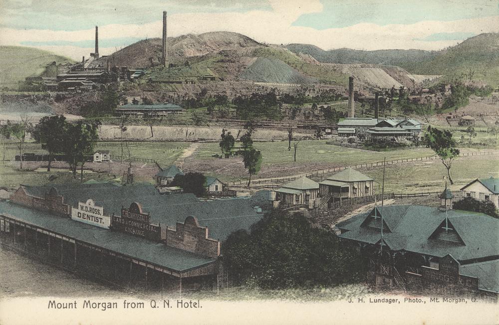
Mount Morgan is a rural town and locality in the Rockhampton Region, Queensland, Australia. The town was the administrative centre of the Mount Morgan Shire until March 2008, when it was amalgamated with neighbouring local government areas to form the Rockhampton Region. In the , the town of Mount Morgan had a population of 2,487 people, while the locality of Mount Morgan had a population of 2,018 people. Geography The town of Mount Morgan is situated on the Dee River, south of the city of Rockhampton, and is north of the state capital, Brisbane. The Burnett Highway passes through the town. There are a number of neighbourhoods within the locality: * Gordon Vale () * Kenbula (), located around the former Kenbula railway station * Talban (), located around the former Talban railway station The names ''Kenbula'' and ''Talban'' were both assigned by the Queensland Railway Department on 18 November 1911. Both are Aboriginal names, ''Kenbula'' meaning '' ironbark tree'' ... [...More Info...] [...Related Items...] OR: [Wikipedia] [Google] [Baidu] |
Shire Of Mount Morgan
The Shire of Mount Morgan was a local government area located in the Capricornia region of Central Queensland, Queensland, Australia, about south of the regional city of Rockhampton. The shire, roughly the region surrounding the former gold mining town of Mount Morgan, covered an area of , and existed as a local government entity from 1890 until 2008, when it amalgamated with several other councils to become the Rockhampton Region. History Mount Morgan came into being with the discovery of gold in the area in 1882. It was established as the Borough of Mount Morgan on 22 May 1890, becoming the Town of Mount Morgan on 31 March 1903 with the enactment of the ''Local Authorities Act 1902''. On 17 March 1909, the surrounding area, previously part of the Shire of Banana, was incorporated as the Shire of Calliungal, which had its offices in Mount Morgan. On 5 November 1931, the two merged to form the Shire of Mount Morgan. On 15 March 2008, under the ''Local Government (Reform Im ... [...More Info...] [...Related Items...] OR: [Wikipedia] [Google] [Baidu] |
Parliament Of Queensland
The Parliament of Queensland is the Unicameralism, unicameral legislature, legislative body of the States and territories of Australia, Australian state of Queensland. As provided under the Constitution of Queensland, the Parliament consists of Monarchy in Australia, the King, represented by the Governor of Queensland, and the Legislative Assembly of Queensland, Legislative Assembly. It has been the only unicameral state legislature in the country since the upper chamber, the Queensland Legislative Council, Legislative Council, was abolished in 1922. The Legislative Assembly sits in Parliament House, Brisbane, Parliament House in the state capital, Brisbane. The Queensland Parliament retains Plenary power, plenary legislative power over Queensland, however Commonwealth laws apply to the extent of any inconsistency. Some laws from the colonial era passed by the Parliament of New South Wales, New South Wales parliament and the Parliament of the United Kingdom, Imperial Parliament ... [...More Info...] [...Related Items...] OR: [Wikipedia] [Google] [Baidu] |
Parkhurst, Queensland
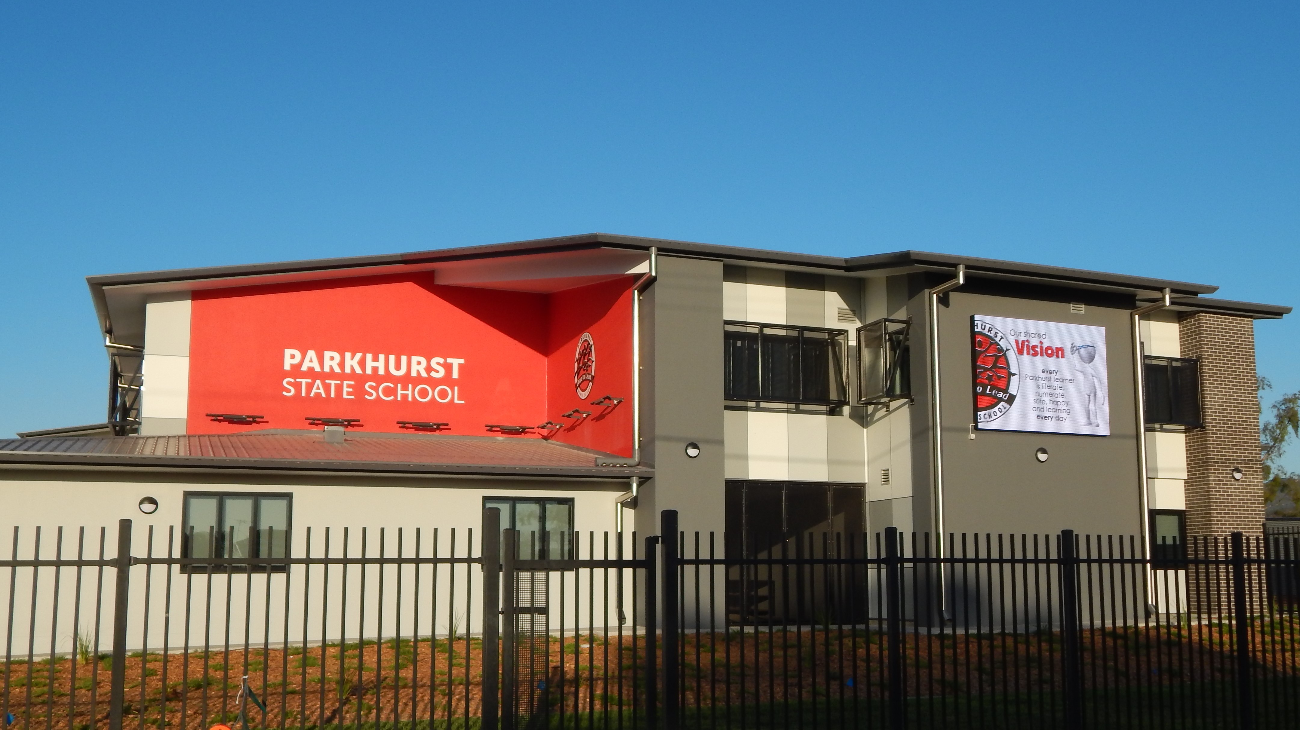
Parkhurst is a northern Suburbs and localities (Australia), suburb of Rockhampton, Queensland, Rockhampton in the Rockhampton Region, Queensland, Australia. In the , Parkhurst had a population of 3,043 people. Geography Parkhurst is bounded to the north by Ramsay Creek and to the west by Ramsay Creek and then the Fitzroy River (Queensland), Fitzroy River. To the south it is bounded by Limestone Creek (the creek, not the suburb) and by Rockhampton–Yeppoon Road (also known as the Yeppoon Road). A section of the Bruce Highway passes through the centre of the suburb from south to north, while the North Coast railway line, Queensland, North Coast railway line also passes through the suburb from south to north, to the west of the highway. The proposed Rockhampton Ring Road will pass through Parkhurst on its way to join the Bruce Highway' The Parkhurst Industrial Estate is in the south-west of the suburb, while the residential land is in the west near the river and in the north-eas ... [...More Info...] [...Related Items...] OR: [Wikipedia] [Google] [Baidu] |
Rockhampton And District Historical Society
Rockhampton is a city in the Rockhampton Region of Central Queensland, Australia. In the , the population of Rockhampton was 79,293. A common nickname for Rockhampton is "Rocky", and the demonym of Rockhampton is Rockhamptonite. The Scottish- Norwegian explorers Charles and William Archer came across the Toonooba River in 1853 and named it in-honour of Sir Charles FitzRoy; they also named many local landmarks after figures in Norse mythology, including the Berserker Range named after the Norse warrior " Baresark". The Archer brothers took-up a run near Gracemere in 1855, and more settlers arrived soon thereafter, enticed by the fertile valleys. The town of Rockhampton was proclaimed in 1858, and surveyed to a design that closely resembled the Hoddle Grid of Melbourne, and consisted of a grid of wide boulevards and laneways, which was uncommon for Queensland cities. Within a year, gold was found at Canoona, and led to the first North Australian gold rush. The Canoona gold ru ... [...More Info...] [...Related Items...] OR: [Wikipedia] [Google] [Baidu] |
Department Of Main Roads (Queensland)
Department may refer to: * Departmentalization, division of a larger organization into parts with specific responsibility Government and military *Department (administrative division), a geographical and administrative division within a country, for example: **Departments of Colombia, a grouping of municipalities **Departments of France, administrative divisions three levels below the national government **Departments of Honduras **Departments of Peru, name given to the subdivisions of Peru until 2002 **Departments of Uruguay *Department (United States Army), corps areas of the U.S. Army prior to World War I *Fire department, a public or private organization that provides emergency firefighting and rescue services *Ministry (government department), a specialized division of a government *Police department, a body empowered by the state to enforce the law *Ship's company#Command structure, Department (naval) administrative/functional sub-unit of a ship's company. Other uses *Depart ... [...More Info...] [...Related Items...] OR: [Wikipedia] [Google] [Baidu] |
Berserker, Queensland
Berserker ( ) is a suburb of Rockhampton in the Rockhampton Region, Queensland, Australia. It is situated about six kilometres north east of the central business district. In the , Berserker had a population of 7,020 people. Geography The eastern boundary is aligned with Frenchmans Creek and the western boundary follows Moores Creek. In the northeast of the suburb is the Stockland Rockhampton shopping centre. Swampy Lagoon is a waterhole (). History The suburb was named after the Berserker Range, which, in turn, was named by Rockhampton pioneer pastoralist Charles Archer after the Norse warrior " Baresark", who fought without armour in the Norwegian sagas. Although born in Scotland, the Archer family lived for many years in Larvik, Norway and members of the family moved between Queensland and Norway throughout their lives. St Mary's Catholic Primary School was opened in 1900 by the Sisters of Mercy but was initially known as the North Rockhampton Roman Catholic Scho ... [...More Info...] [...Related Items...] OR: [Wikipedia] [Google] [Baidu] |
North Rockhampton Borough Chambers
North Rockhampton Borough Chambers is a heritage-listed former town hall at 20 Bridge Street, Berserker, Rockhampton, Rockhampton Region, Queensland, Australia. It was designed by John William Wilson and built in 1885 by Messrs Burton and Smith. It was added to the Queensland Heritage Register on 27 September 2002. History The North Rockhampton Borough Chambers was constructed in 1885 by Messrs Burton and Smith to a design by Rockhampton architect, JW Wilson. The borough council remained in the building until 1919 when the Town of North Rockhampton was absorbed into the Town of Rockhampton. Since 1919, the building has been used by a number of groups, and from 1985, has been the home of the Rockhampton and District Historical Society. Rockhampton emerged as an important Queensland regional centre during the 1850s and 1860s. The Municipality of Rockhampton was proclaimed on 15 December 1860. Rockhampton's development took on a greater prominence after the discovery of the m ... [...More Info...] [...Related Items...] OR: [Wikipedia] [Google] [Baidu] |
Town Of North Rockhampton
The Town of North Rockhampton (formerly the Borough of North Rockhampton) was a local government area in Queensland, Australia. It existed from 1883 to 1919. History The Borough of Rockhampton was proclaimed as Queensland's fourth municipality (after Borough of Brisbane, Borough of Ipswich and Borough of Toowoomba) on 13 December 1860 under the ''Municipalities Act 1858'', a piece of New South Wales legislation inherited by Queensland when it became a separate colony in 1859. It held its first election on 26 February 1861 and its inaugural meeting on 1 March 1861. The municipality had an area of located on the south bank of the Fitzroy River and had a population of about 600. In 1864, the council was divided into three wards—Fitzroy, Archer and Leichhardt. It achieved a measure of autonomy in 1878 with the enactment of the ''Local Government Act''. On 11 November 1879, the Gogango Division was established as one of 74 divisions around Queensland under the ''Divisional ... [...More Info...] [...Related Items...] OR: [Wikipedia] [Google] [Baidu] |
City Of Townsville
The City of Townsville is a local government area (LGA) located in North Queensland, Australia. It encompasses the city of Townsville, together with the surrounding rural areas. To the south are the communities of Alligator Creek, Woodstock and Reid River, and to the north are Northern Beaches and Paluma. Also included is Magnetic Island. In June 2018 the area had a population of 194,072, and is the 28th-largest LGA in Australia. Townsville is considered to be the unofficial capital of North Queensland. In the , the City of Townsville had a population of 192,768 people. History Prior to 2008, the new City of Townsville was an entire area of two previous and distinct local government areas: * the former City of Townsville; * and the City of Thuringowa. The City of Townsville was first established as the Borough of Townsville under the ''Municipal Institutions Act 1864'' on 15 February 1866. The surrounding rural area, which was given the name Thuringowa Division, w ... [...More Info...] [...Related Items...] OR: [Wikipedia] [Google] [Baidu] |
Rockhampton Town Hall
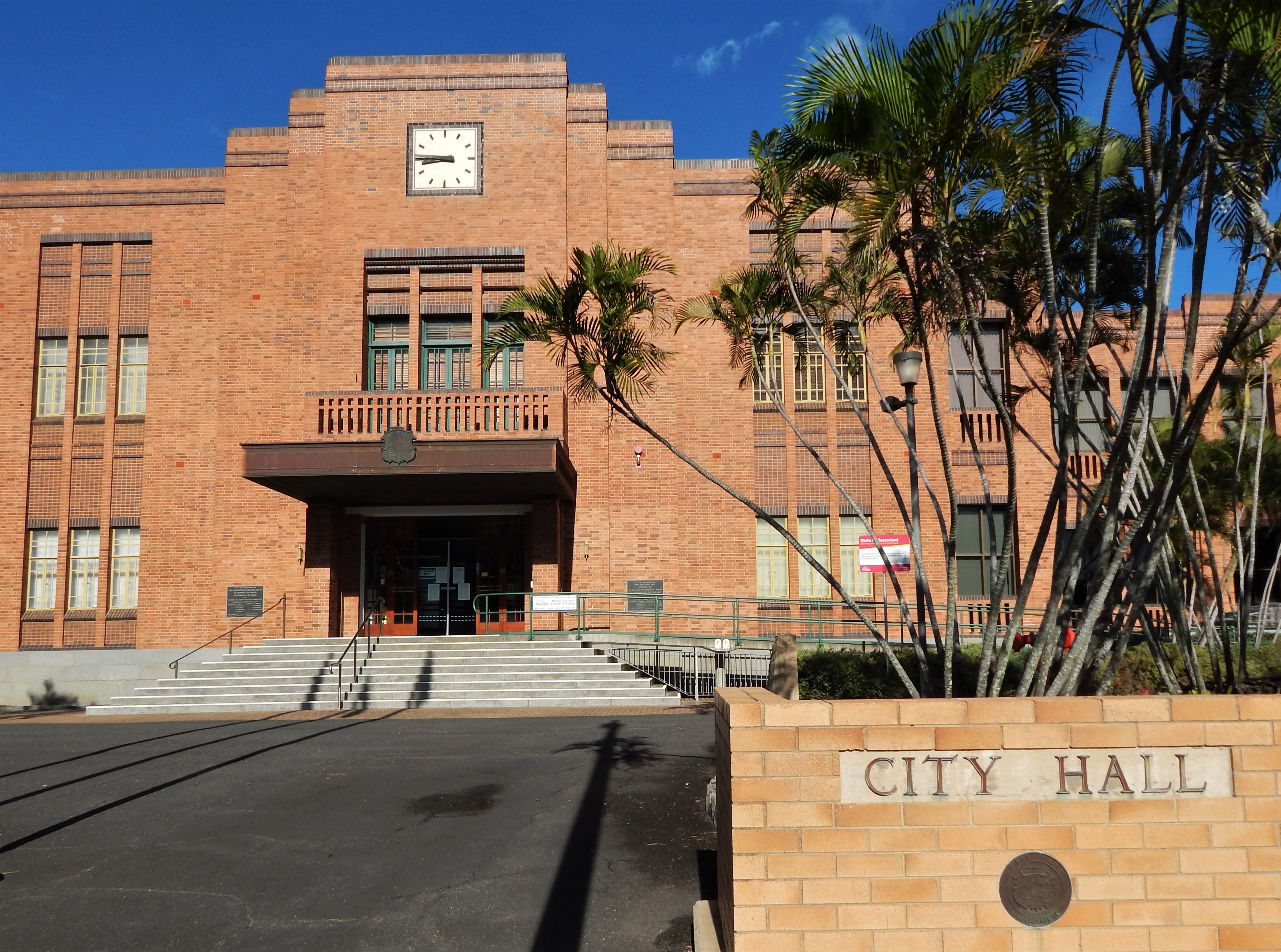
Rockhampton Town Hall is a heritage-listed town hall at 232 Bolsover Street, Rockhampton City, Queensland, Rockhampton City, Rockhampton, Queensland, Rockhampton, Rockhampton Region, Queensland, Australia. It was designed by Hockings & Palmer and built from 1939 to 1941 by John Hutchinson of Hutchinson Builders, J. Hutchinson & Sons (now Hutchinson Builders). It is also known as Rockhampton City Hall and Rockhampton Council Chambers. It was added to the Queensland Heritage Register on 29 April 2003. History Rockhampton emerged as an important Queensland regional centre during the 1850s and 1860s. This development took on especial prominence after the discovery of the mining wealth at Mount Morgan, Queensland, Mount Morgan in 1882. The additional affluence that flowed on for Rockhampton fuelled a rapid expansion of public and private buildings and residences throughout the City and surrounds. This building boom allowed for many grand places to be constructed, especially renown ... [...More Info...] [...Related Items...] OR: [Wikipedia] [Google] [Baidu] |


