|
Banff National Park
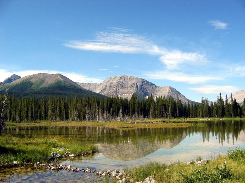
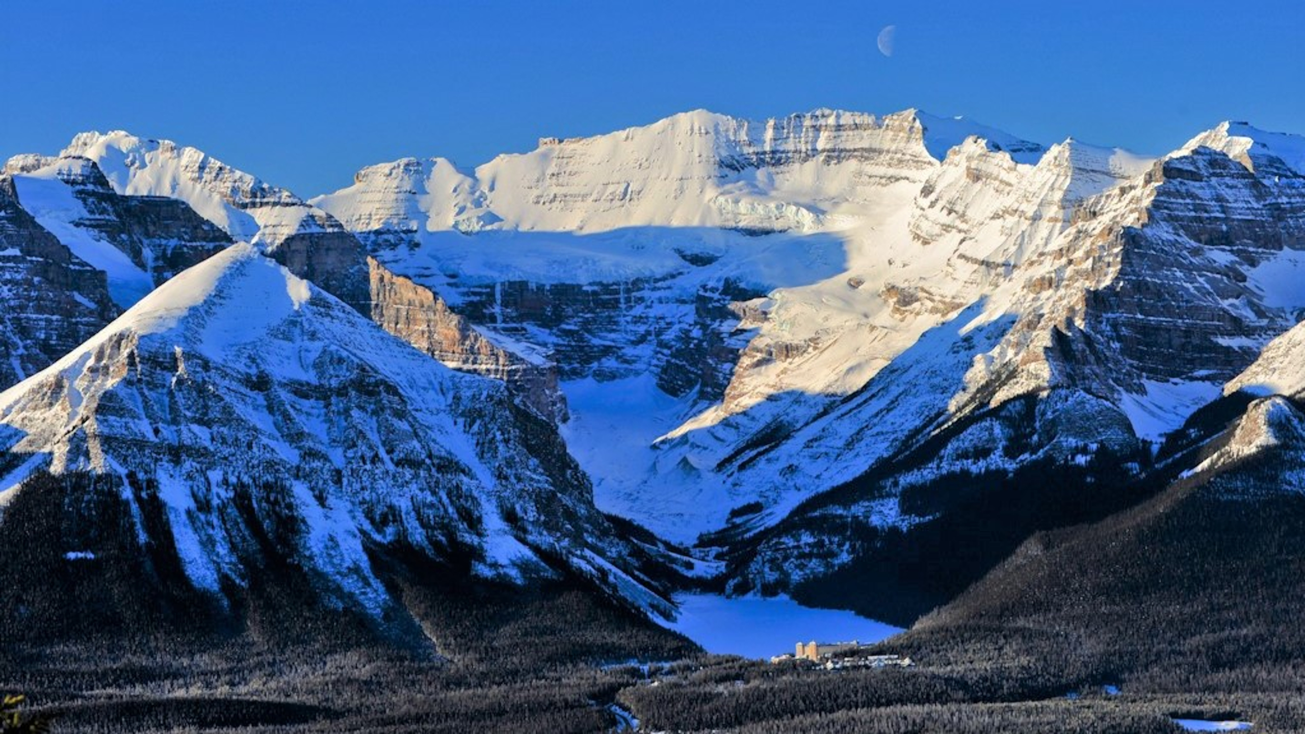
Banff National Park is Canada, Canada's first National Parks of Canada, national park, established in 1885 as Rocky Mountains Park. Located in Alberta's Rockies, Alberta's Rocky Mountains, west of Calgary, Banff encompasses of mountainous terrain, with many glaciers and ice fields, dense pinophyta, coniferous forest, and alpine landscapes. Provincial forests and Yoho National Park are neighbours to the west, while Kootenay National Park is located to the south and Kananaskis Country to the southeast. The main commercial centre of the park is the town of Banff, Alberta, Banff, in the Bow River valley. The Canadian Pacific Railway was instrumental in Banff's early years, building the Banff Springs Hotel and Chateau Lake Louise, and attracting tourists through extensive advertising. In the early 20th century, roads were built in Banff, at times by war internees from World War I, and through Great Depression-era public works projects. The Icefields Parkway extends from Lake Louis ... [...More Info...] [...Related Items...] OR: [Wikipedia] [Google] [Baidu] |
Moraine Lake
Moraine Lake is a snow and glacially fed alpine lake in Banff National Park, outside the village of Lake Louise, Alberta, Canada. It is situated in the Valley of the Ten Peaks, at an elevation of approximately . The lake has a surface area of . The lake, being fed almost completely by snow-melt and glacial-melt, does not reach its crest until middle to late June. When it is full, it reflects a distinctive shade of azure blue. The unique colour is due to the refraction of the blue end of the spectrum of sunlight off the rock sediment deposited in the lake on a continual basis in summer by the surrounding glaciers. The lake is completely created by nature and has not been dammed, drained, or otherwise altered by humans in any way, other than the visitor services which are strictly controlled by the National Park. The road to Moraine Lake is only open during the summer months (June-Sep). Since 2023, Parks Canada has closed it to personal vehicles year-round with only Park shu ... [...More Info...] [...Related Items...] OR: [Wikipedia] [Google] [Baidu] |
Kananaskis Country
Kananaskis Country (abbreviated: K-Country) is a multi-use area west of Calgary, Alberta, Canada in the Rocky Mountain Foothills, foothills and front ranges of the Canadian Rockies. Its western edge borders Banff National Park and the Alberta-British Columbia border. The area is named for the Kananaskis River, which was named by John Palliser in 1858 after a legendary Cree Native. Covering an area of approximately , Kananaskis Country was formed by the Alberta Government in 1978 to provide an assortment of land uses and designations. Land uses include resource extraction activities (such as forestry, cattle grazing, water, oil and gas), recreation, power generation, and residential communities. Land designations include public land and protected areas. History and administration The late 19th century and early 20th century saw the development of commercial use such as lumbering, hydroelectric developments, and coal mining in the eastern slopes of the Rockies, which included w ... [...More Info...] [...Related Items...] OR: [Wikipedia] [Google] [Baidu] |
Ecoregion
An ecoregion (ecological region) is an ecological and geographic area that exists on multiple different levels, defined by type, quality, and quantity of environmental resources. Ecoregions cover relatively large areas of land or water, and contain characteristic, geographically distinct assemblages of natural communities and species. The biodiversity of flora, fauna and ecosystems that characterise an ecoregion tends to be distinct from that of other ecoregions. In theory, biodiversity or conservation ecoregions are relatively large areas of land or water where the probability of encountering different species and communities at any given point remains relatively constant, within an acceptable range of variation (largely undefined at this point). Ecoregions are also known as "ecozones" ("ecological zones"), although that term may also refer to biogeographic realms. Three caveats are appropriate for all bio-geographic mapping approaches. Firstly, no single bio-geographic fram ... [...More Info...] [...Related Items...] OR: [Wikipedia] [Google] [Baidu] |
Subarctic Climate
The subarctic climate (also called subpolar climate, or boreal climate) is a continental climate with long, cold (often very cold) winters, and short, warm to cool summers. It is found on large landmasses, often away from the moderating effects of an ocean, generally at latitudes from 50°N to 70°N, poleward of the humid continental climates. Like other Class D climates, they are rare in the Southern Hemisphere, only found at some isolated highland elevations. Subarctic or boreal climates are the source regions for the cold air that affects temperate latitudes to the south in winter. These climates represent Köppen climate classification ''Dfc'', ''Dwc'', ''Dsc'', ''Dfd'', ''Dwd'' and ''Dsd''. Description This type of climate offers some of the most extreme seasonal temperature variations found on the planet: in winter, temperatures can drop to below and in summer, the temperature may exceed . However, the summers are short; no more than three months of the year (but at least on ... [...More Info...] [...Related Items...] OR: [Wikipedia] [Google] [Baidu] |
Trans-Canada Highway
The Trans-Canada Highway (Canadian French, French: ; abbreviated as the TCH or T-Can) is a transcontinental federal–provincial highway system that travels through all ten provinces of Canada, from the Pacific Ocean on the west coast to the Atlantic Ocean on the east coast. The main route spans across the country, one of the longest routes of its type in the world. The highway system is recognizable by its distinctive white-on-green maple leaf route shield, route markers, although there are small variations in the markers in some provinces. While by definition the Trans-Canada Highway is a highway ''system'' that has several parallel routes throughout most of the country, the term "Trans-Canada Highway" often refers to the main route that consists of Highway 1 (British Columbia, Alberta, Saskatchewan, and Manitoba), Highways 11 & 17/417 (Ontario), Autoroutes 40, 25, 20, 85 & 185 (Quebec), Highway 2 (New Brunswick), Highways 104 and 105 (Nova Scotia), and ... [...More Info...] [...Related Items...] OR: [Wikipedia] [Google] [Baidu] |
Jasper National Park
Jasper National Park, in Alberta, Canada, is the largest national park within Alberta's Rocky Mountains, spanning . It was established as Jasper Forest Park in 1907, renamed as a national park in 1930, and declared a UNESCO world heritage site in 1984. Its location is north of Banff National Park and west of Edmonton. The park contains the glaciers of the Columbia Icefield, springs, lakes, waterfalls and mountains. History First Nations The territory encompassed by what is now Jasper National Park has been inhabited since time immemorial by Nakoda, Cree, Secwépemc, and Dane-zaa peoples. Plainview projectile points have been found at the head of Jasper Lake, dating back to between 8000 and 7000 BCE. In the centuries between then and the establishment of the park, First Nations land use has fluctuated according to climatic variations over the long term, and according to cyclical patterns of ungulate population numbers, particularly elk, moose, mule deer, and occasion ... [...More Info...] [...Related Items...] OR: [Wikipedia] [Google] [Baidu] |
Icefields Parkway
Highway 93 is a north–south highway in Alberta, Canada. It is also known as the Banff-Windermere Parkway south of the Trans-Canada Highway ( Highway 1) and the Icefields Parkway north of the Trans-Canada Highway. It travels through Banff National Park and Jasper National Park and is maintained by Parks Canada for its entire length. It runs from the British Columbia border at Vermilion Pass in the south, where it becomes British Columbia Highway 93, to its terminus at the junction with the Yellowhead Highway ( Highway 16) at Jasper. The route takes its number from U.S. Route 93, which runs uninterrupted south to central Arizona, and was initially designated as '93' in 1959. Route description Banff-Windermere Highway The southern portion of the route is part of the Banff-Windermere Highway, a highway that travels from British Columbia Highway 95 at Radium Hot Springs, through Kootenay National Park and Vermilion Pass across the Continental Divide, to the junction ... [...More Info...] [...Related Items...] OR: [Wikipedia] [Google] [Baidu] |
The Canadian Encyclopedia
''The Canadian Encyclopedia'' (TCE; ) is the national encyclopedia of Canada, published online by the Toronto-based historical organization Historica Canada, with financial support by the federal Department of Canadian Heritage and Society of Composers, Authors and Music Publishers of Canada. Compiled by more than 5,000 scholars and specialists, the publication is a non-partisan, non-political initiative by a not-for-profit organization without political or governmental ties. First published in 1985, the consistently updated version has been available for free online in both Canadian English, English and Canadian French, French since 2001. The physical copy and website includes "articles on Canadian biographies and places, history, the Arts, as well as First Nations, science and Canadian innovation." , over 700,000 volumes of the print version of ''TCE'' have been sold and over 6 million people visit ''TCE'''s website yearly. The encyclopedia website consists of more than 25,000 ... [...More Info...] [...Related Items...] OR: [Wikipedia] [Google] [Baidu] |
Great Depression
The Great Depression was a severe global economic downturn from 1929 to 1939. The period was characterized by high rates of unemployment and poverty, drastic reductions in industrial production and international trade, and widespread bank and business failures around the world. The economic contagion began in 1929 in the United States, the largest economy in the world, with the devastating Wall Street stock market crash of October 1929 often considered the beginning of the Depression. Among the countries with the most unemployed were the U.S., the United Kingdom, and Weimar Republic, Germany. The Depression was preceded by a period of industrial growth and social development known as the "Roaring Twenties". Much of the profit generated by the boom was invested in speculation, such as on the stock market, contributing to growing Wealth inequality in the United States, wealth inequality. Banks were subject to laissez-faire, minimal regulation, resulting in loose lending and wides ... [...More Info...] [...Related Items...] OR: [Wikipedia] [Google] [Baidu] |
World War I
World War I or the First World War (28 July 1914 – 11 November 1918), also known as the Great War, was a World war, global conflict between two coalitions: the Allies of World War I, Allies (or Entente) and the Central Powers. Fighting took place mainly in European theatre of World War I, Europe and the Middle Eastern theatre of World War I, Middle East, as well as in parts of African theatre of World War I, Africa and the Asian and Pacific theatre of World War I, Asia-Pacific, and in Europe was characterised by trench warfare; the widespread use of Artillery of World War I, artillery, machine guns, and Chemical weapons in World War I, chemical weapons (gas); and the introductions of Tanks in World War I, tanks and Aviation in World War I, aircraft. World War I was one of the List of wars by death toll, deadliest conflicts in history, resulting in an estimated World War I casualties, 10 million military dead and more than 20 million wounded, plus some 10 million civilian de ... [...More Info...] [...Related Items...] OR: [Wikipedia] [Google] [Baidu] |
Chateau Lake Louise
The Fairmont Chateau Lake Louise is a Fairmont Hotels and Resorts, Fairmont hotel on the eastern shore of Lake Louise (Alberta), Lake Louise, near Banff, Alberta. The original hotel was gradually developed at the turn of the 20th century by the Canadian Pacific Railway and was thus "kin" to its predecessors, the Banff Springs Hotel and the Château Frontenac. The original wooden Rattenbury Wing was destroyed by fire on July 3, 1924, and was replaced by the Barott Wing a year later. The Painter Wing, built in 1913, remains the oldest existing part of the hotel. The Mount Temple Wing, opened in 2004, is the most recent wing and features modern function facilities; these include the Mount Temple Ballroom. History The hotel was first conceived by the railway at the end of the 19th century, as a vacation destination to lure moneyed travellers into taking trains and heading west. By the time airplanes and automobiles had displaced the trains, it had gained sufficient renown to have ... [...More Info...] [...Related Items...] OR: [Wikipedia] [Google] [Baidu] |
Banff Springs Hotel
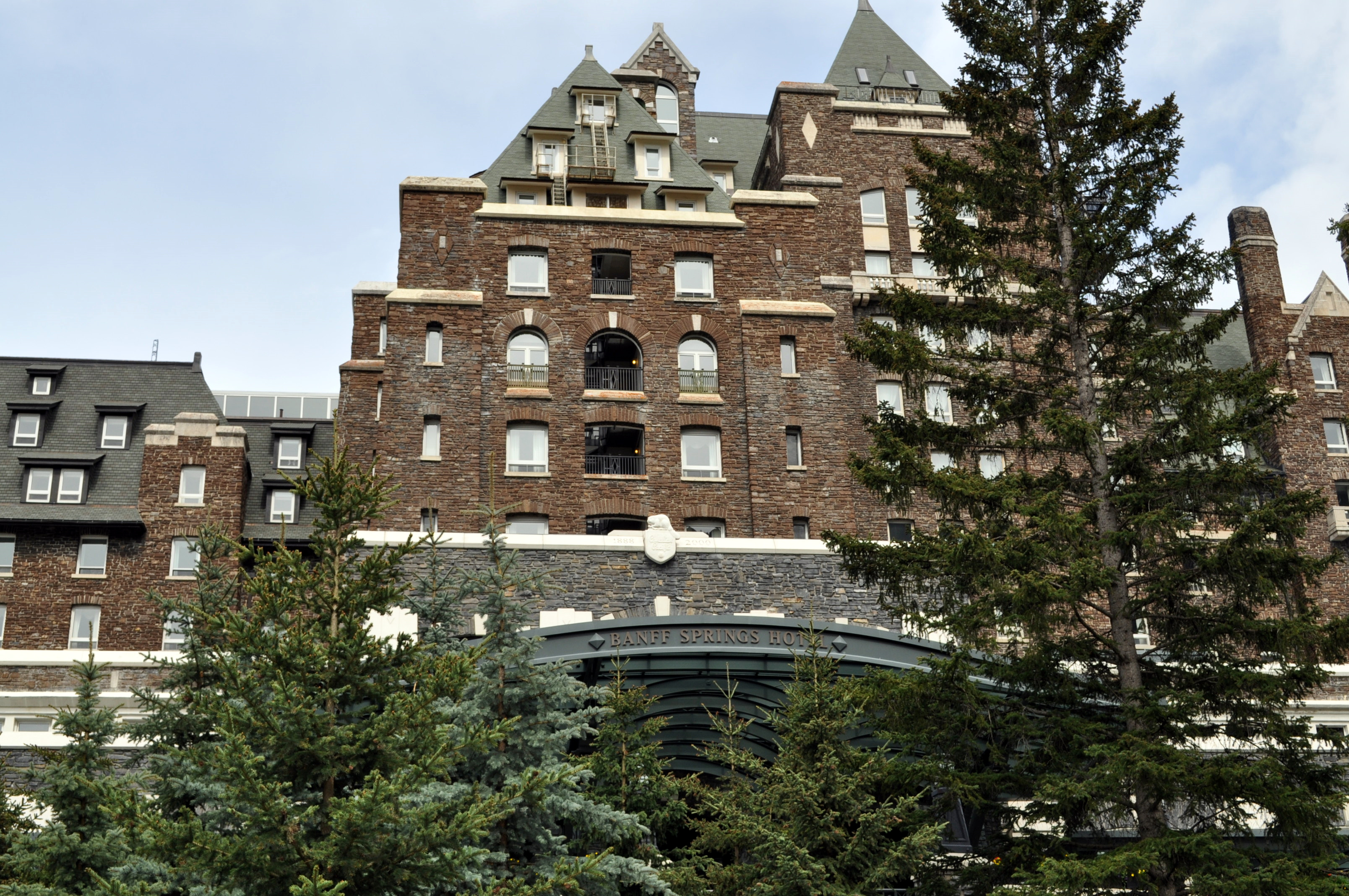
The Fairmont Banff Springs, formerly and commonly known as the Banff Springs Hotel, is a historic hotel in western Canada, located in Banff, Alberta. The entire town, including the hotel, is situated in Banff National Park, a national park managed by Parks Canada. At an elevation of above sea level, the hotel overlooks a valley towards Mount Rundle, both of which are situated within the Rocky Mountain mountain range. Opened in 1888 by the Canadian Pacific Railway, it is one of the earliest of Canada's grand railway hotels. The original five-storey wooden hotel was designed by Bruce Price and was able to accommodate 280 guests. With expansions, the original structure became the North Wing, which was eventually destroyed by fire in April 1926. The present hotel property is made up of several buildings, of which the main hotel consists of a 1914 eleven-storey center tower designed by Walter S. Painter, and a 1927 North Wing and a 1928 South Wing designed by John Orrock whi ... [...More Info...] [...Related Items...] OR: [Wikipedia] [Google] [Baidu] |


