|
Arctic Cordillera
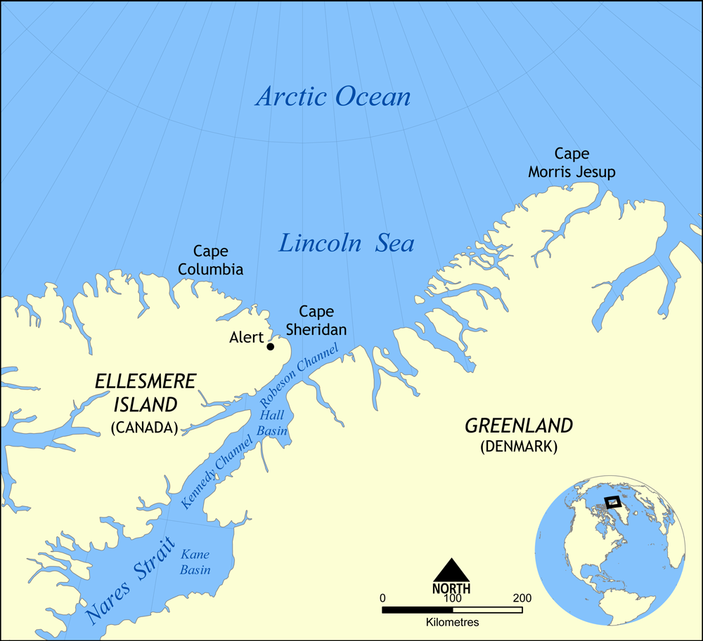
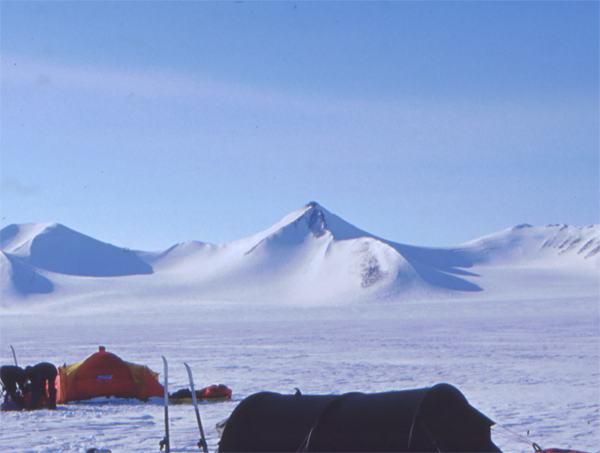
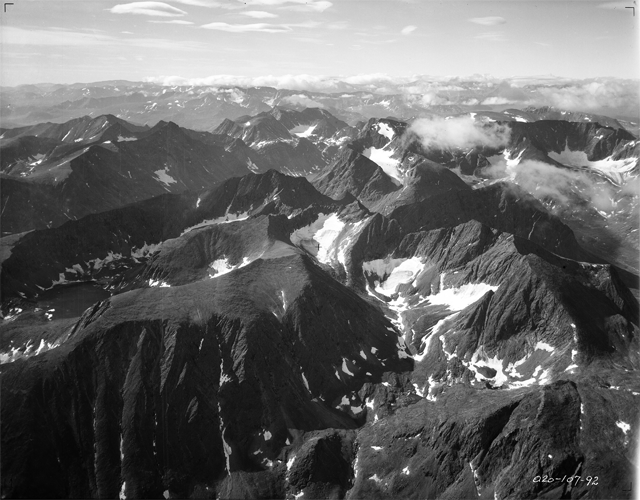
The Arctic Cordillera is a terrestrial ecozone in northern Canada characterized by a vast, deeply dissected chain of mountain ranges extending along the northeastern flank of the Canadian Arctic Archipelago from Ellesmere Island to the northeasternmost part of the Labrador Peninsula in northern Labrador and northern Quebec, Canada. It spans most of the eastern coast of Nunavut with high glaciated peaks rising through ice fields and some of Canada's largest ice caps, including the Penny Ice Cap on Baffin Island. It is bounded to the east by Baffin Bay, Davis Strait and the Labrador Sea while its northern portion is bounded by the Arctic Ocean. The geographic range is composed along the provinces of Labrador: including Eastern Baffin, Devon Island, Ellesmere, Bylot Island, the Torngat Mountains, and some parts of the Northeastern fringe. The landscape is dominated by massive polar icefields, alpine glaciers, inland fjords, and large bordering bodies of water, distinctive o ... [...More Info...] [...Related Items...] OR: [Wikipedia] [Google] [Baidu] |
Baffin Mountains
The Baffin Mountains are a mountain range running along the northeastern coast of Baffin Island and Bylot Island, Nunavut, Canada. The ice-capped mountains are part of the Arctic Cordillera and have some of the highest peaks of eastern North America, reaching a height of above sea level. While they are separated by bodies of water to make Baffin Island, they are closely related to the other mountain ranges that make the much larger Arctic Cordillera mountain range. Terrain The highest point is Mount Odin at while Mount Asgard (''Sivanitirutinguak'') at is perhaps the best known. The highest point in the northern Baffin Mountains is Qiajivik Mountain at . There are no trees in the Baffin Mountains because they are north of the Arctic tree line. Rocks that compose the Baffin Mountains are primarily deeply dissected granite, granitic rocks. They were covered with ice until about 1500 years ago, and vast parts of them are still ice-covered. Geology, Geologically, the Baffin Mountai ... [...More Info...] [...Related Items...] OR: [Wikipedia] [Google] [Baidu] |
Baffin Bay
Baffin Bay (Inuktitut: ''Saknirutiak Imanga''; ; ; ), located between Baffin Island and the west coast of Greenland, is defined by the International Hydrographic Organization as a marginal sea of the Arctic Ocean. It is sometimes considered a sea of the Atlantic Ocean, North Atlantic Ocean. It is connected to the Atlantic via Davis Strait and the Labrador Sea. The narrower Nares Strait connects Baffin Bay with the Arctic Ocean. The bay is not navigable most of the year because of the Arctic ice pack, ice cover and high density of Sea ice, floating ice and icebergs in the open areas. However, a polynya of about , known as the North Water Polynya, North Water, opens in summer on the north near Smith Sound. Most of the aquatic life of the bay is concentrated near that region. Extent The International Hydrographic Organization defines the limits of Baffin Bay as follows: History The area of the bay has been inhabited since BC. Around AD 1200, the initial Dorset culture ... [...More Info...] [...Related Items...] OR: [Wikipedia] [Google] [Baidu] |
Appalachian Mountains
The Appalachian Mountains, often called the Appalachians, are a mountain range in eastern to northeastern North America. The term "Appalachian" refers to several different regions associated with the mountain range, and its surrounding terrain. The general definition used is one followed by the United States Geological Survey and the Geological Survey of Canada to describe the respective countries' Physiographic region, physiographic regions. The U.S. uses the term Appalachian Highlands and Canada uses the term Appalachian Uplands; the Appalachian Mountains are not synonymous with the Appalachian Plateau, which is one of the provinces of the Appalachian Highlands. The Appalachian range runs from the Newfoundland (island), Island of Newfoundland in Canada, southwestward to Central Alabama in the United States; south of Newfoundland, it crosses the 96-square-mile (248.6 km2) archipelago of Saint Pierre and Miquelon, an overseas collectivity of France, meaning it is technica ... [...More Info...] [...Related Items...] OR: [Wikipedia] [Google] [Baidu] |
Western Canada
Western Canada, also referred to as the Western provinces, Canadian West, or Western provinces of Canada, and commonly known within Canada as the West, is a list of regions of Canada, Canadian region that includes the four western provinces and territories of Canada, provinces just north of the Canada–United States border namely (from west to east) British Columbia, Alberta, Saskatchewan and Manitoba. The people of the region are often referred to as "Western Canadians" or "Westerners", and though diverse from province to province are largely seen as being collectively distinct from other Canadians along cultural, linguistic, socioeconomic, geographic and political lines. They account for approximately 32% of Canada's total population. The region is further subdivided geographically and culturally between British Columbia, which is mostly on the western side of the Canadian Rockies and often referred to as the "British Columbia Coast, west coast", and the "Prairie Provinces" (c ... [...More Info...] [...Related Items...] OR: [Wikipedia] [Google] [Baidu] |
Western Cordillera (North America)
The North American Cordillera, sometimes also called the Western Cordillera of North America, the Western Cordillera, or the Pacific Cordillera, is the North American portion of the American Cordillera, the mountain chain system along the Pacific coast of the Americas. The North American Cordillera covers an extensive area of mountain ranges, intermontane basins, and plateaus in Western and Northwestern Canada, Western United States, and Mexico, including much of the territory west of the Great Plains. The precise boundaries of this cordillera and its subregions, as well as the names of its various features, may differ depending on the definitions in each country or jurisdiction, and also depending on the scientific field; this cordillera is a particularly prominent subject in the scientific field of physical geography.Melanie Ostopowich (2005) The Cordillera', Weigl Educational Publishers Limited, , pp. 6, 12, and 20: "The Cordillera is one of the seven geographic regions in Ca ... [...More Info...] [...Related Items...] OR: [Wikipedia] [Google] [Baidu] |
North America
North America is a continent in the Northern Hemisphere, Northern and Western Hemisphere, Western hemispheres. North America is bordered to the north by the Arctic Ocean, to the east by the Atlantic Ocean, to the southeast by South America and the Caribbean Sea, and to the south and west by the Pacific Ocean. The region includes Middle America (Americas), Middle America (comprising the Caribbean, Central America, and Mexico) and Northern America. North America covers an area of about , representing approximately 16.5% of Earth's land area and 4.8% of its total surface area. It is the third-largest continent by size after Asia and Africa, and the list of continents and continental subregions by population, fourth-largest continent by population after Asia, Africa, and Europe. , North America's population was estimated as over 592 million people in list of sovereign states and dependent territories in North America, 23 independent states, or about 7.5% of the world's popula ... [...More Info...] [...Related Items...] OR: [Wikipedia] [Google] [Baidu] |
Barbeau Peak
Barbeau Peak is a mountain in Qikiqtaaluk, Nunavut, Canada. Located on Ellesmere Island within Quttinirpaaq National Park, it is the highest mountain in Nunavut and the Canadian Arctic. The mountain was named in 1969 after Marius Barbeau, a Canadian anthropologist whose research into First Nations and Inuit cultures gained him international acclaim. Barbeau Peak is characterized by deep and long crevasses, razor thin ridges and highly variable and volatile weather. Barbeau Peak is the highest mountain within the British Empire Range as well as the Arctic Cordillera, as well as in all of eastern North America. Barbeau Peak was first climbed on 7 June 1967 by British geologist/glaciologist Geoffrey Hattersley-Smith as part of a joint Defence Research Board/Royal Air Force field party. The party both named the peak and determined its height. The second ascent was by an eight-man American team in June 1982 (Errington, Trafton AAC 1983) via the north ridge. Subsequent ascents were ... [...More Info...] [...Related Items...] OR: [Wikipedia] [Google] [Baidu] |
Permafrost
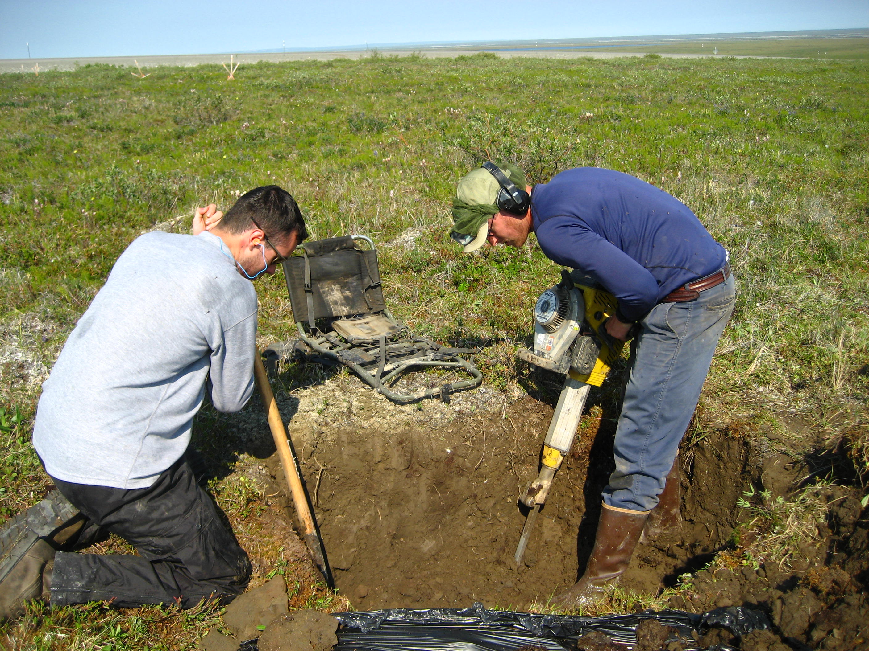
Permafrost () is soil or underwater sediment which continuously remains below for two years or more; the oldest permafrost has been continuously frozen for around 700,000 years. Whilst the shallowest permafrost has a vertical extent of below a meter (3 ft), the deepest is greater than . Similarly, the area of individual permafrost zones may be limited to narrow mountain summits or extend across vast Arctic regions. The ground beneath glaciers and ice sheets is not usually defined as permafrost, so on land, permafrost is generally located beneath a so-called active layer of soil which freezes and thaws depending on the season. Around 15% of the Northern Hemisphere or 11% of the global surface is underlain by permafrost, covering a total area of around . This includes large areas of Alaska, Canada, Greenland, and Siberia. It is also located in high mountain regions, with the Tibetan Plateau being a prominent example. Only a minority of permafrost exists in the Southern Hemi ... [...More Info...] [...Related Items...] OR: [Wikipedia] [Google] [Baidu] |
Inuit
Inuit (singular: Inuk) are a group of culturally and historically similar Indigenous peoples traditionally inhabiting the Arctic and Subarctic regions of North America and Russia, including Greenland, Labrador, Quebec, Nunavut, the Northwest Territories, Yukon (traditionally), Alaska, and the Chukotsky District of Chukotka Autonomous Okrug. The Inuit languages are part of the Eskaleut languages, also known as Inuit-Yupik-Unangan, and also as Eskimo–Aleut. Canadian Inuit live throughout most of Northern Canada in the territory of Nunavut, Nunavik in the northern third of Quebec, the Nunatsiavut in Labrador, and in various parts of the Northwest Territories and Yukon (traditionally), particularly around the Arctic Ocean, in the Inuvialuit Settlement Region. These areas are known, by Inuit Tapiriit Kanatami and the Government of Canada, as Inuit Nunangat. In Canada, sections 25 and 35 of the Constitution Act of 1982 classify Inuit as a distinctive group of Abo ... [...More Info...] [...Related Items...] OR: [Wikipedia] [Google] [Baidu] |
Torngat Mountains
The Torngat Mountains are a mountain range on the Labrador Peninsula at the northern tip of Newfoundland and Labrador and eastern Quebec. They are part of the Arctic Cordillera. The mountains form a peninsula that separates Ungava Bay from the Atlantic Ocean. Etymology The name ''Torngat'' is derived from an Inuktitut word meaning ''place of spirits'', sometimes interpreted as ''place of evil spirits''. Geography The Torngat Mountains have a substantial geographical extent. About 56% of the range is located in Quebec, 44% is in Labrador, and the remainder, less than 1%, is located on Killiniq Island in Nunavut. At least 2% of the mountain chain is under water, and poorly surveyed. The Torngat Mountains cover , including lowland areas and extend over from Cape Chidley in the north to Hebron Fjord in the south. The Torngat Mountains have the highest peaks of eastern continental Canada. The highest point is Mount Caubvick (also known as Mont D'Iberville) at . There are no tre ... [...More Info...] [...Related Items...] OR: [Wikipedia] [Google] [Baidu] |
Bylot Island
Bylot Island lies off the northern end of Baffin Island in Nunavut Territory, Canada. Eclipse Sound to the southeast and Navy Board Inlet to the southwest separate it from Baffin Island. Parry Channel lies to its northwest. At it is ranked 71st largest island in the world and Canada's 17th largest island. The island measures east to west and north to south and is one of the largest uninhabited islands in the world. While there are no permanent settlements on this Canadian Arctic island, Inuit from Pond Inlet and elsewhere regularly travel to Bylot Island. An Inuit seasonal hunting camp is located southwest of Cape Graham Moore. The island's mountains are part of the Byam Martin Mountains, which is part of the Baffin Mountains of the Arctic Cordillera. In addition to Angilaaq Mountain, Malik Mountain, Mount St. Hans, and Mount Thule are notable. Tay Bay is on the west coast. Vertical cliffs along the coastline are made up of Precambrian dolomite. There are numerou ... [...More Info...] [...Related Items...] OR: [Wikipedia] [Google] [Baidu] |
Devon Island
Devon Island (, ) is an island in Canada and the largest desert island, uninhabited island (no permanent residents) in the world. It is located in Baffin Bay, Qikiqtaaluk Region, Nunavut, Canada. It is one of the largest members of the Arctic Archipelago, the second-largest of the Queen Elizabeth Islands, Canada's List of Canadian islands by area, sixth-largest island, and the List of islands by area, 27th-largest island in the world. It has an area of (slightly smaller than Croatia). The bedrock is Precambrian gneiss and Paleozoic siltstones and shales. The highest point is the Devon Ice Cap at which is part of the Arctic Cordillera. Devon Island contains several small mountain ranges, such as the Treuter Mountains, Haddington Range and the Cunningham Mountains. The notable similarity of its surface to that of Mars has attracted interest from scientists. History and settlement Robert Bylot and William Baffin were the first Europeans to sight Devon Island in 1616. William Parr ... [...More Info...] [...Related Items...] OR: [Wikipedia] [Google] [Baidu] |

