|
Broxden Park And Ride
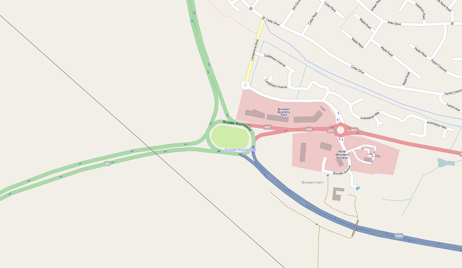
Broxden Junction (also known as Broxden Roundabout or Broxden Interchange) is one of the busier and more important road junctions in Scotland. It is located on the outskirts of Perth, and is one of the city's two major roundabouts – the other being Inveralmond Roundabout, where the A9 meets the A912 Dunkeld Road, to the north-northwest. The roundabout, oval in shape, is an important hub of the Scottish road network, a major junction on the A9 north–south route, and the UK's northernmost motorway junction, being junction 12 of the M90 motorway. Prior to Dunfermline's ascension to city status, all of the seven cities in Scotland were signposted from its exits. Broxden is an interchange for several local bus and long-distance coach services; it is the central point for the Megabus coach service in Scotland. There is a park and ride area with a bus service to Perth city centre. The roundabout was originally designed with the future intention of connecting the northbound ... [...More Info...] [...Related Items...] OR: [Wikipedia] [Google] [Baidu] |
Transport Scotland
Transport Scotland ( gd, Còmhdhail Alba) is the national transport agency of Scotland. It was established by the Transport (Scotland) Act 2005, and began operating on 1 January 2006 as an Executive Agency of the Scottish Government. Organisation Transport Scotland is an executive agency of the Scottish government that conducts transport projects, manages ScotRail, and also maintain all roads in Scotland, except motorways Directorates The agency is made up of eight directorates: Aviation, Maritime, Freight and Canals Used for transport links to its remote and island communities. It is responsible for: * project delivery, operational performance and policy development * aviation, ferries and canals * maritime interest including ports, harbours, and freight * looking after Scottish ministers’ interests in Glasgow Prestwick Airport, David MacBrayne, Caledonian Maritime Assets, Highlands and Islands Airports, and Scottish Canals Bus, Accessibility & Active Travel ... [...More Info...] [...Related Items...] OR: [Wikipedia] [Google] [Baidu] |
Megabus (United Kingdom)
Megabus is a long distance coach ( Intercity bus service) operator founded by Stagecoach, it commenced operating in August 2003, initially in the United Kingdom, and later expanding into continental Europe. Some services link with Megatrain services, also operated by Stagecoach. Fares use a yield management model, formerly starting at £1. In June 2016, Stagecoach Group sold all operations in the European mainland, as well as those services linking London with Europe, to German competitor Flixbus. Megabus serves as a contractor, so the sale resulted in no route changes for passengers.Stagecoach sells Megabus Europe to FlixBus ''Route One'' 29 June 2016 History [...More Info...] [...Related Items...] OR: [Wikipedia] [Google] [Baidu] |
River Dee, Aberdeenshire
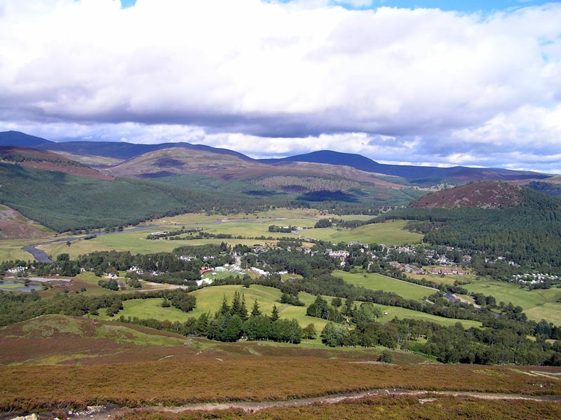
The River Dee ( gd, Uisge Dhè) is a river in Aberdeenshire, Scotland. It rises in the Cairngorms and flows through southern Aberdeenshire to reach the North Sea at Aberdeen. The area it passes through is known as Deeside, or Royal Deeside in the region between Braemar and Banchory because Queen Victoria came for a visit there in 1848 and greatly enjoyed herself. She and her husband, Prince Albert, built Balmoral Castle there which replaced an older castle. Deeside is a popular area for tourists, due to the combination of scenic beauty and historic and royal associations. It is part of the Cairngorms National Park, and the Deeside and Lochnagar National Scenic Area. The Dee is popular with anglers and is one of the most famous salmon fishing rivers in the world. The New Statistical Account of Scotland attributed the name Dee as having been used as early as the second century AD in the work of the Alexandrian geographer Claudius Ptolemy, as ''Δηοῦα'' (=Deva), meaning ... [...More Info...] [...Related Items...] OR: [Wikipedia] [Google] [Baidu] |
Braemar
Braemar is a village in Aberdeenshire, Scotland, around west of Aberdeen in the Highlands. It is the closest significantly-sized settlement to the upper course of the River Dee sitting at an elevation of . The Gaelic ''Bràigh Mhàrr'' properly refers to the area of upper Marr (as it literally means), i.e. the area of Marr to the west of Aboyne, the village itself being Castleton of Braemar (''Baile a' Chaisteil''). The village used to be known as ''Cinn Drochaid'' (bridge end); ''Baile a' Chaisteil'' referred to only the part of the village on the east bank of the river, the part on the west bank being known as ''Ach an Droighinn'' (thorn field). Geography Braemar is approached from the South on the A93 from Glen Clunie and the Cairnwell Pass and from the East also on the A93 from Deeside. Braemar can be approached on foot from the West through Glen Tilt, Glen Feshie, Glen Dee (by the Lairig Ghru), and Glen Derry (by the Lairig an Laoigh). Braemar is within a one- ... [...More Info...] [...Related Items...] OR: [Wikipedia] [Google] [Baidu] |
A82 Road
The A82 is a major road in Scotland that runs from Glasgow to Inverness via Fort William. It is one of the principal north-south routes in Scotland and is mostly a trunk road managed by Transport Scotland, who view it as an important link from the Central Belt to the Scottish Highlands and beyond. The road passes close to numerous landmarks, including; Loch Lomond, Rannoch Moor, Glen Coe, the Ballachulish Bridge, Ben Nevis, the Commando Memorial, Loch Ness, and Urquhart Castle. The route is derived in several places from the military roads constructed through the Highlands by General George Wade and Major William Caulfeild in the 18th century, along with later roads constructed by Thomas Telford in the 19th. The modern route is based on that designed by Telford, but with a number of improvements primarily dating from the 1920s and 30s. These include a diversion across Rannoch Moor, and another around Loch Leven which was subsequently replaced by the Ballachulish Bridg ... [...More Info...] [...Related Items...] OR: [Wikipedia] [Google] [Baidu] |
Loch Lomond
Loch Lomond (; gd, Loch Laomainn - 'Lake of the Elms'Richens, R. J. (1984) ''Elm'', Cambridge University Press.) is a freshwater Scottish loch which crosses the Highland Boundary Fault, often considered the boundary between the lowlands of Central Scotland and the Highlands.Tom Weir. ''The Scottish Lochs''. pp. 33-43. Published by Constable and Company, 1980. Traditionally forming part of the boundary between the counties of Stirlingshire and Dunbartonshire, Loch Lomond is split between the council areas of Stirling, Argyll and Bute and West Dunbartonshire. Its southern shores are about northwest of the centre of Glasgow, Scotland's largest city. The Loch forms part of the Loch Lomond and The Trossachs National Park which was established in 2002. Loch Lomond is long and between wide, with a surface area of . It is the largest lake in Great Britain by surface area; in the United Kingdom, it is surpassed only by Lough Neagh and Lough Erne in Northern Ireland. In the Bri ... [...More Info...] [...Related Items...] OR: [Wikipedia] [Google] [Baidu] |
A85 Road (Great Britain)
The A85 is a major road in Scotland. It runs east from Oban along the south bank of Loch Etive, through Lochawe and Tyndrum, Crianlarich, Lochearnhead, St Fillans and Crieff before passing through Perth, where it crosses the River Tay via Perth Bridge to Bridgend. Its name between Crieff and Perth is the Crieff Road. It then multiplexes with the A90 to the Swallow Roundabout before diverging to follow the Invergowrie Bypass, Riverside Avenue and Riverside Drive before terminating in Dundee city centre. The A90 road from Perth to Dundee was previously numbered A85; on opening of an upgraded A94 to Aberdeen the A90 number was continued across the Friarton Bridge (previously M85) and on to the A85 route, then from Swallow Roundabout to Aberdeen. The Perth-Dundee stretch was formerly part of the Euroroute system, of route E120 which ran in a circular route between Inverness, Aberdeen, Dundee and Perth. Between Tyndrum Tyndrum (; gd, Taigh an Droma) is a small villa ... [...More Info...] [...Related Items...] OR: [Wikipedia] [Google] [Baidu] |
Oban
Oban ( ; ' in Scottish Gaelic meaning ''The Little Bay'') is a resort town within the Argyll and Bute council area of Scotland. Despite its small size, it is the largest town between Helensburgh and Fort William. During the tourist season, the town can have a temporary population of up to over 24,000 people. Oban occupies a setting in the Firth of Lorn. The bay forms a near perfect horseshoe, protected by the island of Kerrera; and beyond Kerrera, the Isle of Mull. To the north, is the long low island of Lismore and the mountains of Morvern and Ardgour. Pre-history and archaeology Humans have used the site where Oban now stands since at least Mesolithic times, as evidenced by archaeological remains of cave dwellers found in the town. Just outside the town, stands Dunollie Castle, on a site that overlooks the main entrance to the bay and has been fortified since the Bronze Age. Just to the north of Oban, at Dunstaffnage, excavations in 2010, by Argyll Archaeology, in ... [...More Info...] [...Related Items...] OR: [Wikipedia] [Google] [Baidu] |
Crianlarich
Crianlarich (; gd, A' Chrìon Làraich) is a village in Stirling council area and in the registration county of Perthshire, Scotland, around north-east of the head of Loch Lomond. The village bills itself as "the gateway to the Highlands". Etymology The name ''Crianlarich'' is derived probably from the Gaelic meaning either "the wasted site" or "the aspen site" (c.f. Gaelic ''critheann'', "aspen"). Situation The village lies in the glen of Strath Fillan at the north western extent of the Trossachs, in the shadow of several Munro peaks, notably Ben More, but also Stob Binnein and Cruach Ardrain. Thus Crianlarich is very popular with hillwalkers. Also the village lies along the long-distance footpath, the West Highland Way. Its location makes Crianlarich a popular stop for tourists and there are a variety of types of overnight accommodation including guesthouses, B&Bs a SYHA Youth Hostel and a Best Western hotel. Transport connections Crianlarich has been a major cross ... [...More Info...] [...Related Items...] OR: [Wikipedia] [Google] [Baidu] |
Crieff
Crieff (; gd, Craoibh, meaning "tree") is a Scottish market town in Perth and Kinross on the A85 road between Perth and Crianlarich, and the A822 between Greenloaning and Aberfeldy. The A822 joins the A823 to Dunfermline. Crieff has become a hub for tourism, famous for whisky and its history of cattle droving. Attractions include the Caithness Glass Visitor Centre and Glenturret Distillery. The nearby Innerpeffray Library (founded about 1680) is Scotland's oldest lending library. St Mary's Chapel beside it dates from 1508. Both are open to the public: the library is run by a charitable trust; the chapel is in the care of Historic Scotland. History For a number of centuries Highlanders came south to Crieff to sell their black cattle, whose meat and hides were avidly sought by the growing urban populations in Lowland Scotland and the north of England. The town acted as a gathering point for the Michaelmas cattle sale held during the "October Tryst" each year, when the su ... [...More Info...] [...Related Items...] OR: [Wikipedia] [Google] [Baidu] |
Flyover (road)
An overpass (called an overbridge or flyover in the United Kingdom and some other Commonwealth countries) is a bridge, road, railway or similar structure that crosses over another road or railway. An ''overpass'' and ''underpass'' together form a grade separation. Stack interchanges are made up of several overpasses. History The world's first railroad flyover was constructed in 1843 by the London and Croydon Railway at Norwood Junction railway station to carry its atmospheric railway vehicles over the Brighton Main Line. Highway and road In North American usage, a ''flyover'' is a high-level overpass, built above main overpass lanes, or a bridge built over what had been an at-grade intersection. Traffic engineers usually refer to the latter as a '' grade separation''. A flyover may also be an extra ramp added to an existing interchange, either replacing an existing cloverleaf loop (or being built in place of one) with a higher, faster ramp that eventually bears left, but ... [...More Info...] [...Related Items...] OR: [Wikipedia] [Google] [Baidu] |
Inverness
Inverness (; from the gd, Inbhir Nis , meaning "Mouth of the River Ness"; sco, Innerness) is a city in the Scottish Highlands. It is the administrative centre for The Highland Council and is regarded as the capital of the Highlands. Historically it served as the county town of the county of Inverness-shire. Inverness lies near two important battle sites: the 11th-century battle of Blàr nam Fèinne against Norway which took place on the Aird, and the 18th century Battle of Culloden which took place on Culloden Moor. It is the northernmost city in the United Kingdom and lies within the Great Glen (Gleann Mòr) at its northeastern extremity where the River Ness enters the Beauly Firth. At the latest, a settlement was established by the 6th century with the first royal charter being granted by Dabíd mac Maíl Choluim (King David I) in the 12th century. Inverness and Inverness-shire are closely linked to various influential clans, including Clan Mackintosh, Clan Fraser an ... [...More Info...] [...Related Items...] OR: [Wikipedia] [Google] [Baidu] |


