|
A Line (Los Angeles Metro)
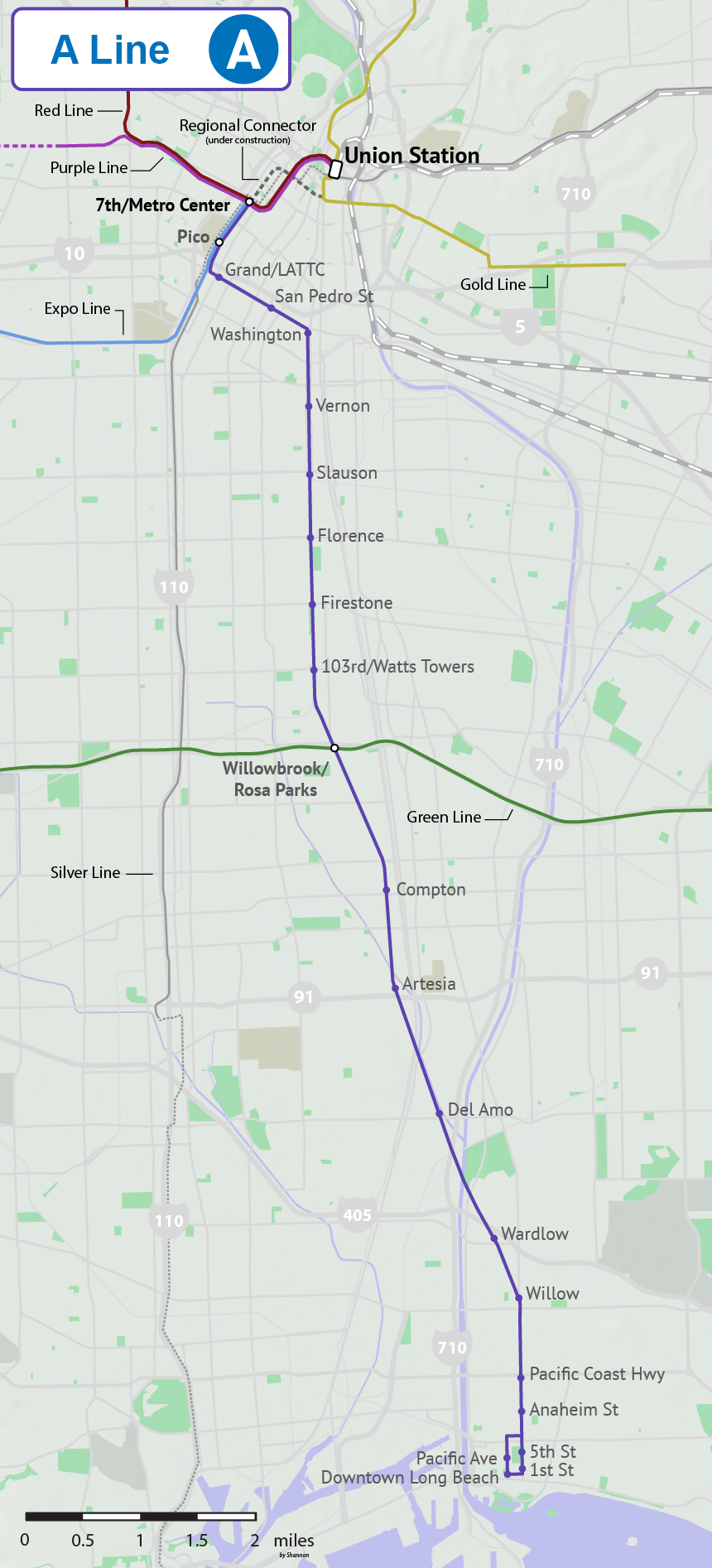
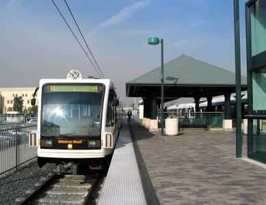
The A Line (formerly, from 1990-2019, and colloquially known as Blue Line) is a light rail line running north–south between Los Angeles and Long Beach, California, passing through Downtown Los Angeles, South Los Angeles, Watts, Willowbrook, Compton, Rancho Dominguez, and Long Beach in Los Angeles County. It is one of seven lines in the Metro Rail system. Opened in 1990, it is the system's oldest and third-busiest line with an estimated 22.38 million boardings per year . It is operated by the Los Angeles County Metropolitan Transportation Authority. The A Line passes near the cities of Vernon, Huntington Park, South Gate, Lynwood, and Carson. The famous Watts Towers art installation is visible from the train tracks near 103rd Street station. The under-construction Regional Connector will directly link this line to Union Station and into the San Gabriel Valley along the current route of the L Line, resulting in a longer A Line and the elimination of the L Line. Se ... [...More Info...] [...Related Items...] OR: [Wikipedia] [Google] [Baidu] |
Los Angeles County Metropolitan Transportation Authority
The Los Angeles County Metropolitan Transportation Authority (LACMTA), commonly branded as Metro, LA Metro, and L.A. Metro, is the state agency that plans, operates, and coordinates funding for most of the transportation system in Los Angeles County. The agency directly operates a large transit system that includes bus, light rail, heavy rail (subway), and bus rapid transit services; and provides funding for transit it does not operate, including Metrolink commuter rail, municipal bus operators and paratransit services. Metro also provides funding and directs planning for railroad and highway projects within Los Angeles County. In , the system had a total ridership of and had a ridership of per weekday as of . Background The Los Angeles County Metropolitan Transportation Authority was formed on February 1, 1993, from the merger of two rival agencies: the Southern California Rapid Transit District (SCRTD or more often, RTD) and the Los Angeles County Transportation Com ... [...More Info...] [...Related Items...] OR: [Wikipedia] [Google] [Baidu] |
South Gate, California
South Gate is the 19th largest city in Los Angeles County, California, United States, with . South Gate is located southeast of Downtown Los Angeles. It is part of the Gateway Cities region of southeastern Los Angeles County. The city was incorporated on January 20, 1923, and it became known as the "Azalea City" when it adopted the flower as its symbol in 1965. As of the 2020 census, the city had a population of 92,726. In 1990, South Gate was one of ten U.S. communities to receive the All-America City Award from the National Civic League. History Native Americans South Gate was in the traditional cultural territory of the Gabrielino. Gabrielino villages or archaeological sites are rumored to have existed at the South Gate Park and at the old City Hall site at the intersection of Post Street and Victoria Avenue. The village of Tajauta was located on the border of South Gate, Lynwood, and Watts. Land grants Among the early Spanish settlers was one of California's first ... [...More Info...] [...Related Items...] OR: [Wikipedia] [Google] [Baidu] |
Washington Boulevard (Los Angeles)
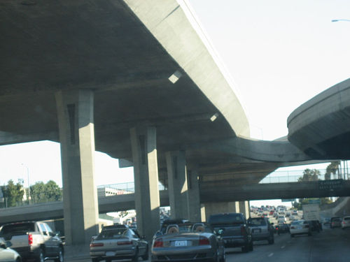
Washington Boulevard is an east-west arterial road in Los Angeles County, California spanning a total of 27.4 miles (44 km). Its western terminus is the Pacific Ocean just west of Pacific Avenue and straddling the border of the Venice Beach and Marina Peninsula neighborhoods of Los Angeles. The Boulevard extends eastbound to the city of Whittier, at Whittier Boulevard. It is south of Venice Boulevard for most of its length. At Wade Street, Washington Place is formed adjacent and parallel and lasts until just east of Sepulveda Boulevard, where it merges back into Washington Boulevard. Washington merges into Culver Boulevard briefly, but forms back into its own street at Canfield Avenue. Washington Boulevard, which is four lanes, primarily passes through locations in the mid-southern portion of Los Angeles County. The communities to the west include affluent areas such as Marina del Rey and Ladera Heights. Further east it passes between Crestview and Culver City and through ... [...More Info...] [...Related Items...] OR: [Wikipedia] [Google] [Baidu] |
Silver Line (Los Angeles Metro)
The J Line (formerly the Silver Line, sometimes listed as Line 910/950) is a bus rapid transit route that runs between El Monte, Downtown Los Angeles and Gardena, with some trips continuing to San Pedro. It is one of the two lines in the Metro Busway system operated by the Los Angeles County Metropolitan Transportation Authority (Metro). The J Line offers frequent, all-stops service along the El Monte Busway and the Harbor Transitway, two grade-separated transit facilities built into the Southern California freeway system. The line was created on December 13, 2009, as part of the conversion of the facilities from high-occupancy vehicle lanes into high-occupancy toll lanes (branded as Metro ExpressLanes) that allow solo drivers to pay a toll to use lanes. The tolls collected have been used to operate the J Line and refurbish the aged stations on the line. As J Line buses travel along the El Monte Busway and the Harbor Transitway they serve stations built into the center or ... [...More Info...] [...Related Items...] OR: [Wikipedia] [Google] [Baidu] |
E Line (Los Angeles Metro)
The E Line (formerly the Expo Line from 2012–2019) is a light rail line that runs between Downtown Los Angeles and Santa Monica. It is one of the seven lines in the Metro Rail system, and is operated by the Los Angeles County Metropolitan Transportation Authority (Metro). The line opened in 2012. The E Line largely follows the right-of-way of the former Pacific Electric Santa Monica Air Line. Passenger service ended in 1953; freight-only service ended by March 1988. Several E Line stations are built in the same location as Air Line stations, although no original station structures have been reused. Originally named the Expo Line after Exposition Boulevard, along which it runs for most of its route, the line was renamed the E Line in late 2019, while retaining the aqua-colored line and icons used to designate it on maps. When the Regional Connector is complete in 2022, the current E Line will be joined with the Eastside portion of the L Line to create an extended E Line, ... [...More Info...] [...Related Items...] OR: [Wikipedia] [Google] [Baidu] |
Downtown Long Beach
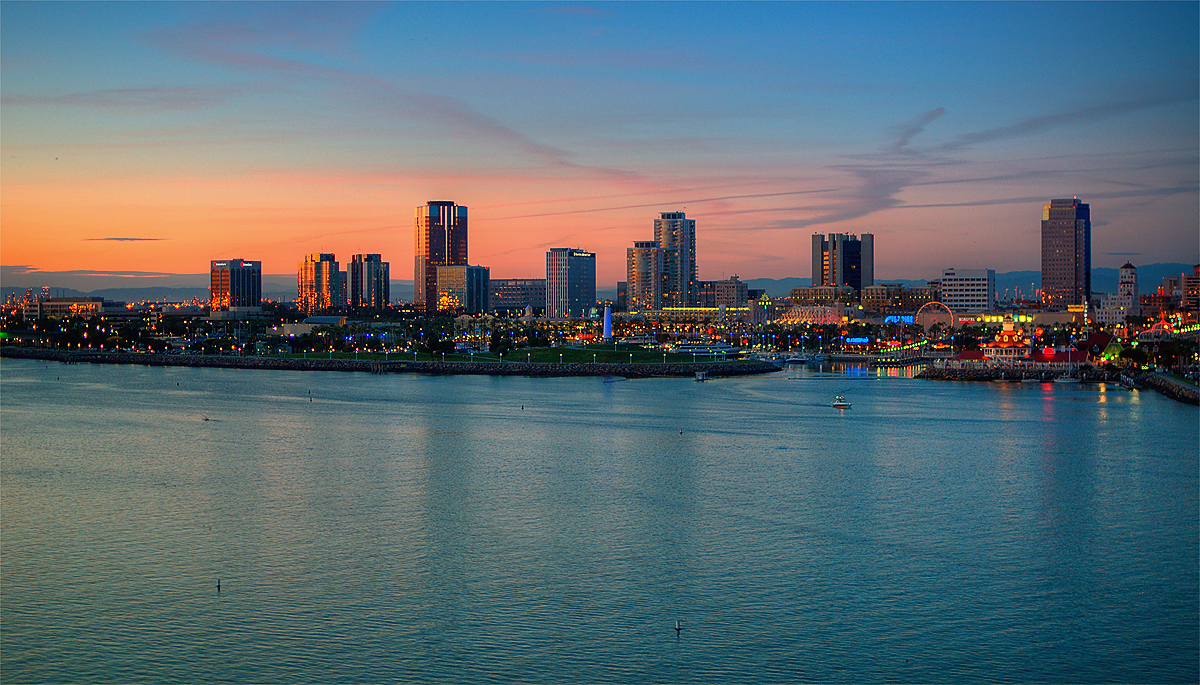
Downtown Long Beach is the heart of Long Beach, California, United States, and is the location for most of the city's major tourist attractions and municipal services. It is also the location for numerous businesses. There are many hotels and restaurants in the area that serve locals, tourists, and convention visitors. Location Downtown Long Beach is bounded by the Los Angeles River to the west, and Ocean Boulevard to the south (south of Ocean is considered the "Downtown Shoreline," a separate area). Alamitos Avenue roughly delimits downtown to the east, although the City's actual downtown zoning extends a few blocks east of Alamitos. Similarly, downtown effectively ends around 7th Street to the north, but the City's downtown zoning carries as far north as Anaheim Street between Pacific Avenue and Long Beach Boulevard, and up to 10th Street east of that. The greater downtown area includes the neighborhoods of the East Village Arts District, the West End, North Pine, ... [...More Info...] [...Related Items...] OR: [Wikipedia] [Google] [Baidu] |
Los Angeles Blue Line Route
LOS, or Los, or LoS may refer to: Science and technology * Length of stay, the duration of a single episode of hospitalisation * Level of service, a measure used by traffic engineers * Level of significance, a measure of statistical significance * Line-of-sight (other) * LineageOS, a free and open-source operating system for smartphones and tablet computers * Loss of signal ** Fading **End of pass (spaceflight) * Loss of significance, undesirable effect in calculations using floating-point arithmetic Medicine and biology * Lipooligosaccharide, a bacterial lipopolysaccharide with a low-molecular-weight * Lower oesophageal sphincter Arts and entertainment * '' The Land of Stories'', a series of children's novels by Chris Colfer * Los, or the Crimson King, a character in Stephen King's novels * Los (band), a British indie rock band from 2008 to 2011 * Los (Blake), a character in William Blake's poetry * Los (rapper) (born 1982), stage name of American rapper Carlo ... [...More Info...] [...Related Items...] OR: [Wikipedia] [Google] [Baidu] |
L Line (Los Angeles Metro)
The L Line (formerly the Gold Line before 2020) is a light rail line running from Azusa to East Los Angeles via Downtown Los Angeles serving several attractions, including Little Tokyo, Union Station, the Southwest Museum, Chinatown, and the shops of Old Pasadena. The line, one of seven in the Metro Rail system, entered service in 2003 and is operated by the Los Angeles County Metropolitan Transportation Authority (Metro). The L Line serves 26 stations (including two underground stations). In October 2020, the line was broken into two disconnected segments with the closure of the Little Tokyo/Arts District station in preparation for the opening of the Regional Connector tunnel in Spring 2023. At that point, the L Line will cease to exist as a distinct line within the system, with the northern half serving as an extension to the A Line and the southern half serving as an extension to the E Line. Bus shuttles currently connect the two portions of the line. Service descripti ... [...More Info...] [...Related Items...] OR: [Wikipedia] [Google] [Baidu] |
San Gabriel Valley
The San Gabriel Valley ( es, Valle de San Gabriel) is one of the principal valleys of Southern California, lying immediately to the east of the eastern city limits of the city of Los Angeles, and occupying the vast majority of the eastern part of Los Angeles County, California. Surrounding features include: * San Gabriel Mountains on the north, * San Rafael Hills to the west, with Los Angeles Basin beyond, * Crescenta Valley to the northwest, * Puente Hills to the south, with the coastal plain of Orange County, California, Orange County beyond, * Chino Hills and San Jose Hills to the east, with the Pomona Valley and Inland Empire (CA), Inland Empire beyond. * The city limits of Los Angeles bordering its western edge. The San Gabriel valley derives its name from the San Gabriel River (California), San Gabriel River that flows southward through the center of the valley, which itself was named for the Spanish Mission San Gabriel Arcángel originally built in the Whittier Narrows i ... [...More Info...] [...Related Items...] OR: [Wikipedia] [Google] [Baidu] |
Union Station (Los Angeles)
Los Angeles Union Station is the main train station, railway station in Los Angeles, California, and the largest railroad passenger terminal in the Western United States. It opened in May 1939 as the Los Angeles Union Passenger Terminal, replacing La Grande Station and Central Station, Los Angeles, Central Station. Approved in a controversial ballot measure in 1926 and built in the 1930s, it served to consolidate rail services from the Union Pacific, Atchison, Topeka and Santa Fe Railway, Santa Fe, and Southern Pacific Transportation Company, Southern Pacific Railroads into one terminal station. Conceived on a grand scale, Union Station became known as the "Last of the Great Railway Stations" built in the United States. The structure combines Art Deco, Mission Revival Style architecture, Mission Revival, and Streamline Moderne style. It was placed on the National Register of Historic Places in 1980. Today, the station is a major transportation hub for Southern California, servin ... [...More Info...] [...Related Items...] OR: [Wikipedia] [Google] [Baidu] |
Regional Connector Transit Corridor
In geography, regions, otherwise referred to as zones, lands or territories, are areas that are broadly divided by physical characteristics (physical geography), human impact characteristics (human geography), and the interaction of humanity and the environment (environmental geography). Geographic regions and sub-regions are mostly described by their imprecisely defined, and sometimes transitory boundaries, except in human geography, where jurisdiction areas such as national borders are defined in law. Apart from the global continental regions, there are also hydrospheric and atmospheric regions that cover the oceans, and discrete climates above the land and water masses of the planet. The land and water global regions are divided into subregions geographically bounded by large geological features that influence large-scale ecologies, such as plains and features. As a way of describing spatial areas, the concept of regions is important and widely used among the many branches of ... [...More Info...] [...Related Items...] OR: [Wikipedia] [Google] [Baidu] |
103rd Street/Watts Towers Station
103rd Street/Watts Towers station is an at-grade light rail station on the A Line of the Los Angeles Metro Rail system. The station is located alongside the Union Pacific freight railroad's Wilmington Subdivision (the historic route of the Pacific Electric Railway), at its intersection with 103rd Street, after which the station is named, along with the nearby landmark Watts Towers in the Watts neighborhood of Los Angeles, California. It is adjacent to the Watts Station, which historically served the Watts, Long Beach, and San Pedro lines of the Pacific Electric Railway. Service Station layout Hours and frequency Connections , the following connections are available: *Los Angeles Metro Bus: *LADOT DASH: Watts Notable places nearby The station is within walking distance of the following notable places: * Good Shepherd Convalescent Hospital * Jordan High School * Jordan Downs * Verbum Dei High School * Watts Senior Center * Watts Station — former Pacific E ... [...More Info...] [...Related Items...] OR: [Wikipedia] [Google] [Baidu] |


